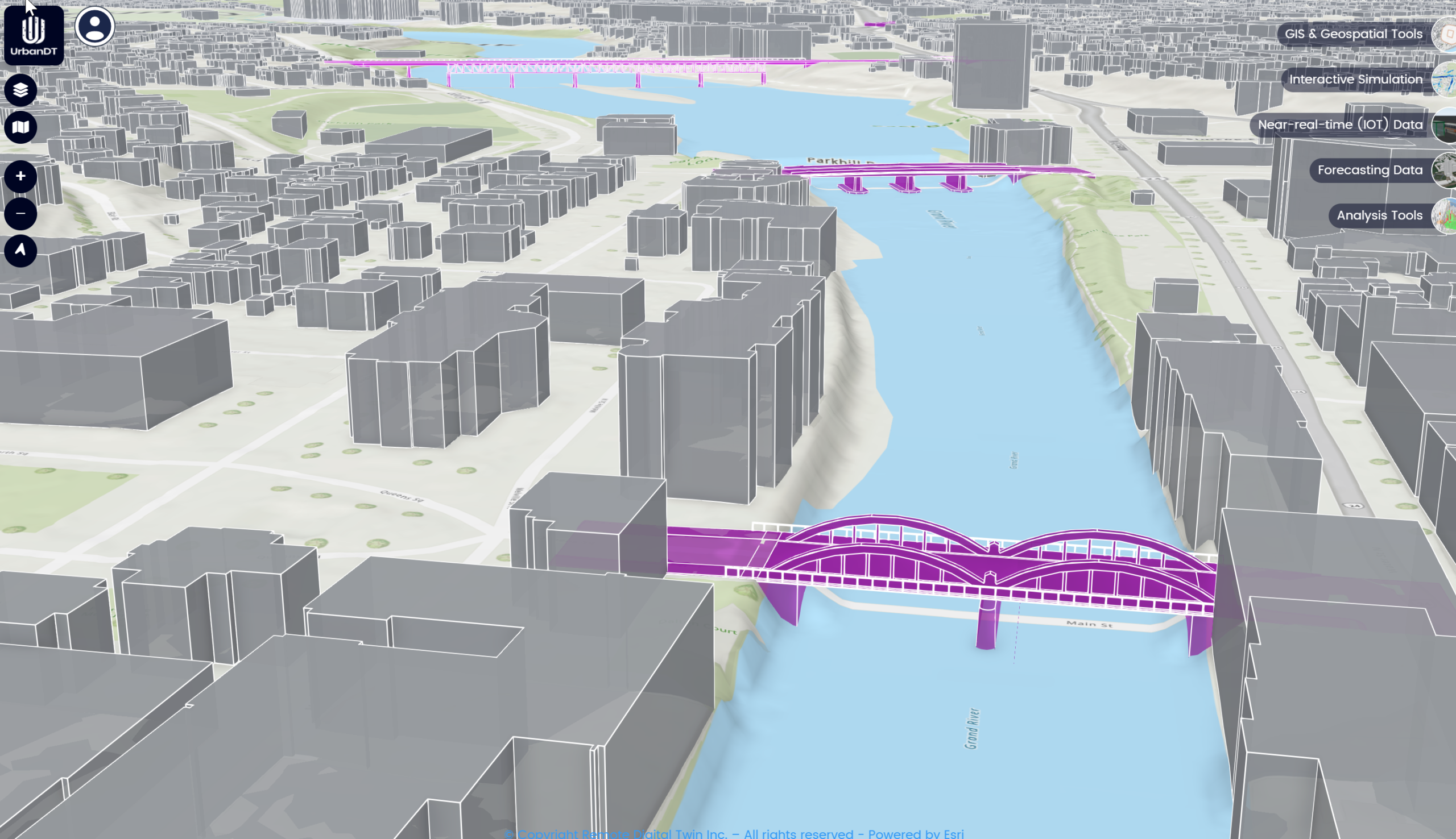
3D Bridge
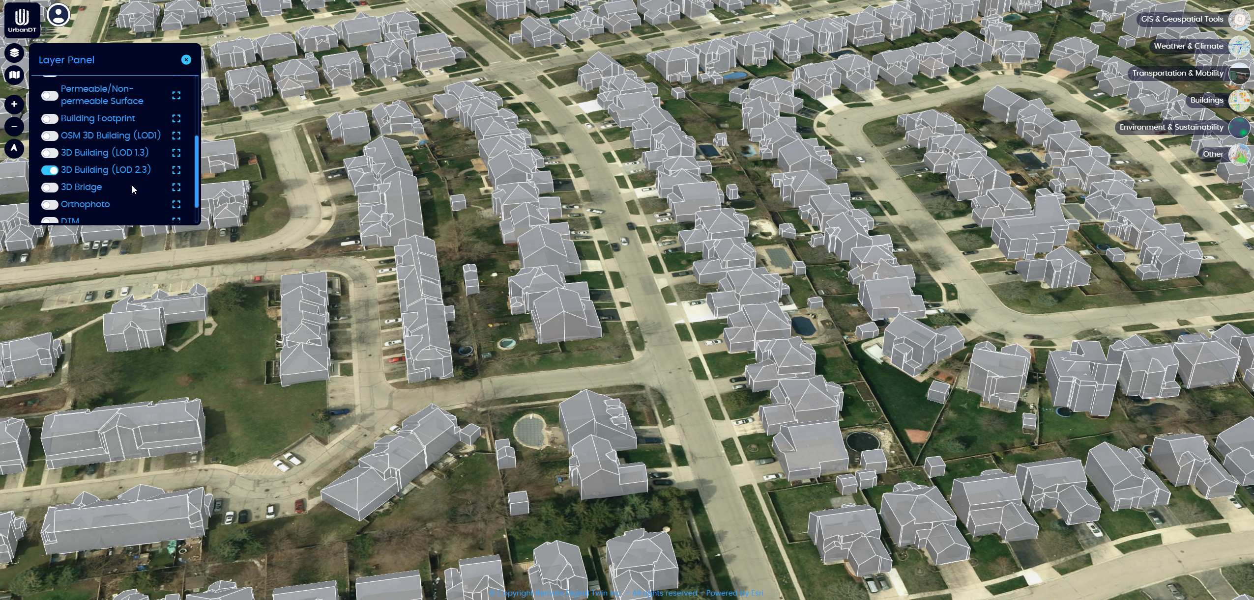
3D Building LOD2
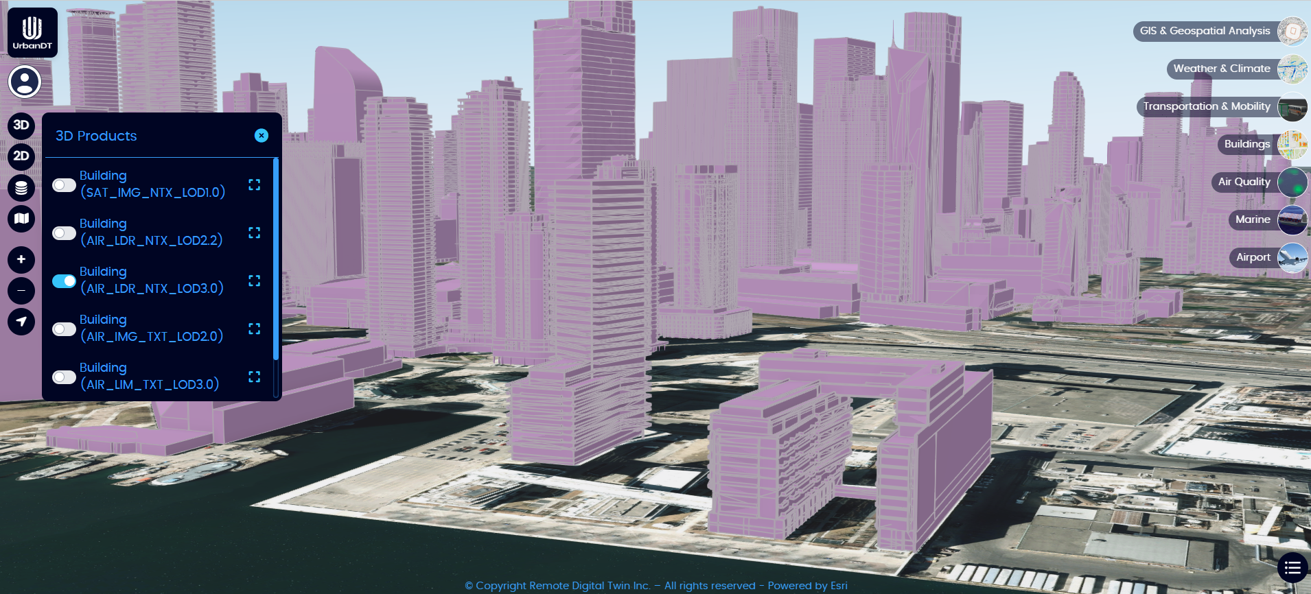
3D Building LOD3
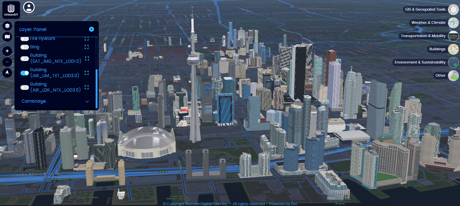
Textured 3D Building LOD3
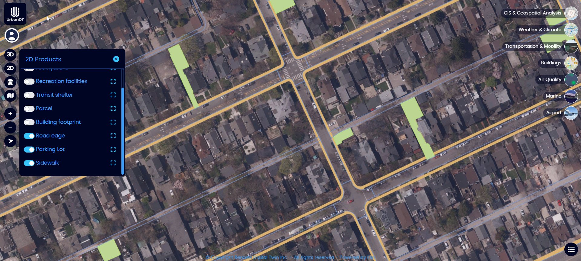
Road Edge, Parking Lot & Side Walk
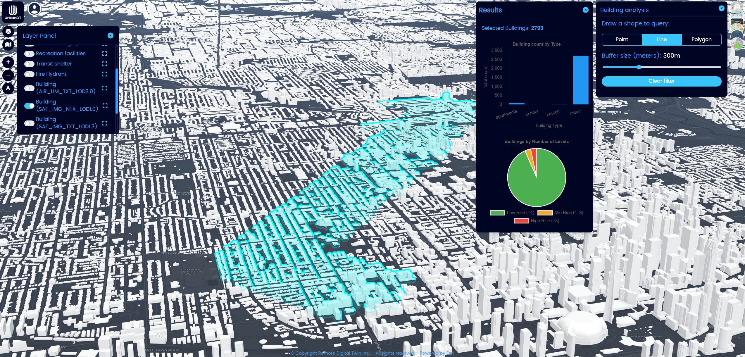
Building Analysis
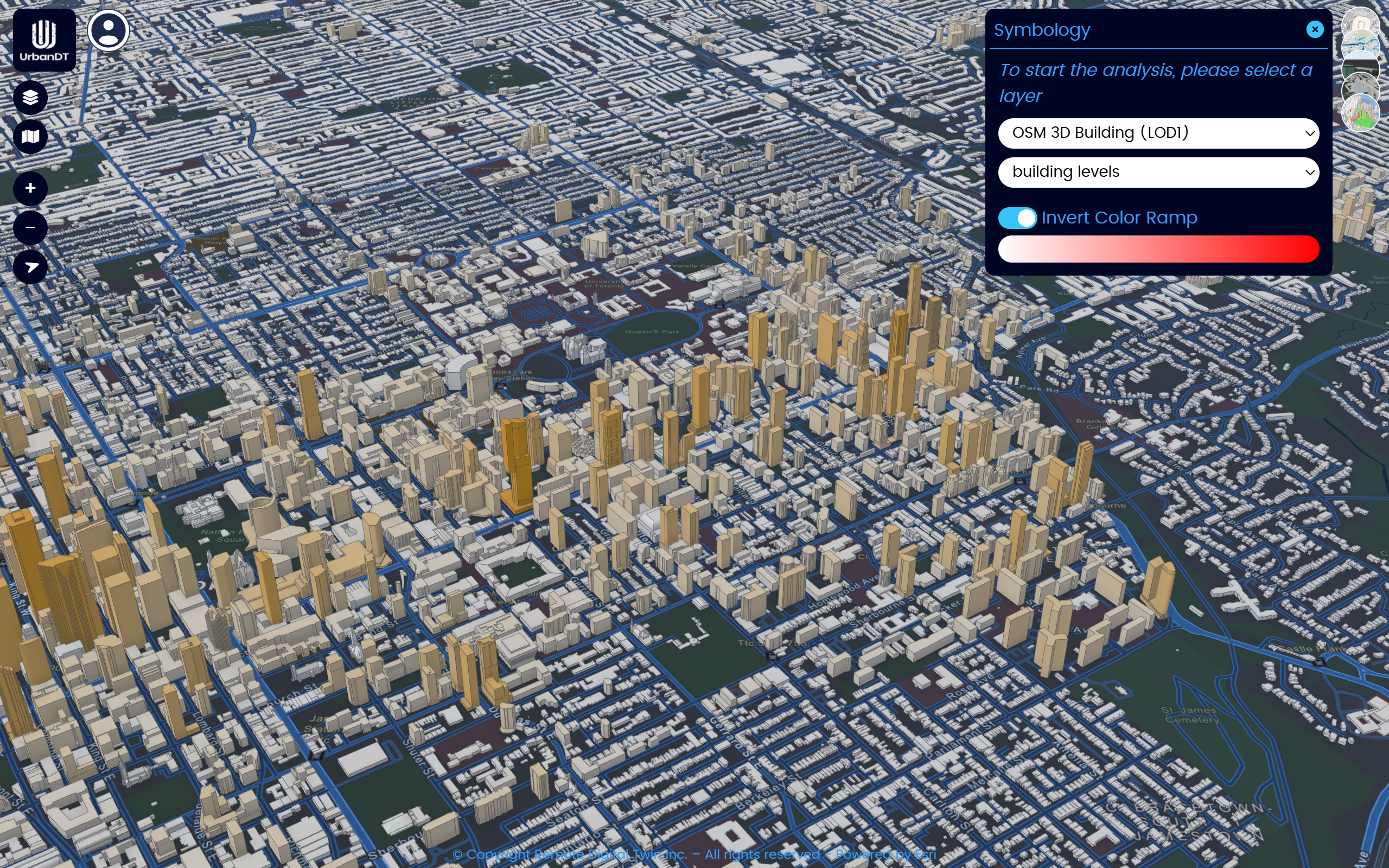
Building Classification
Building Shadow Analysis
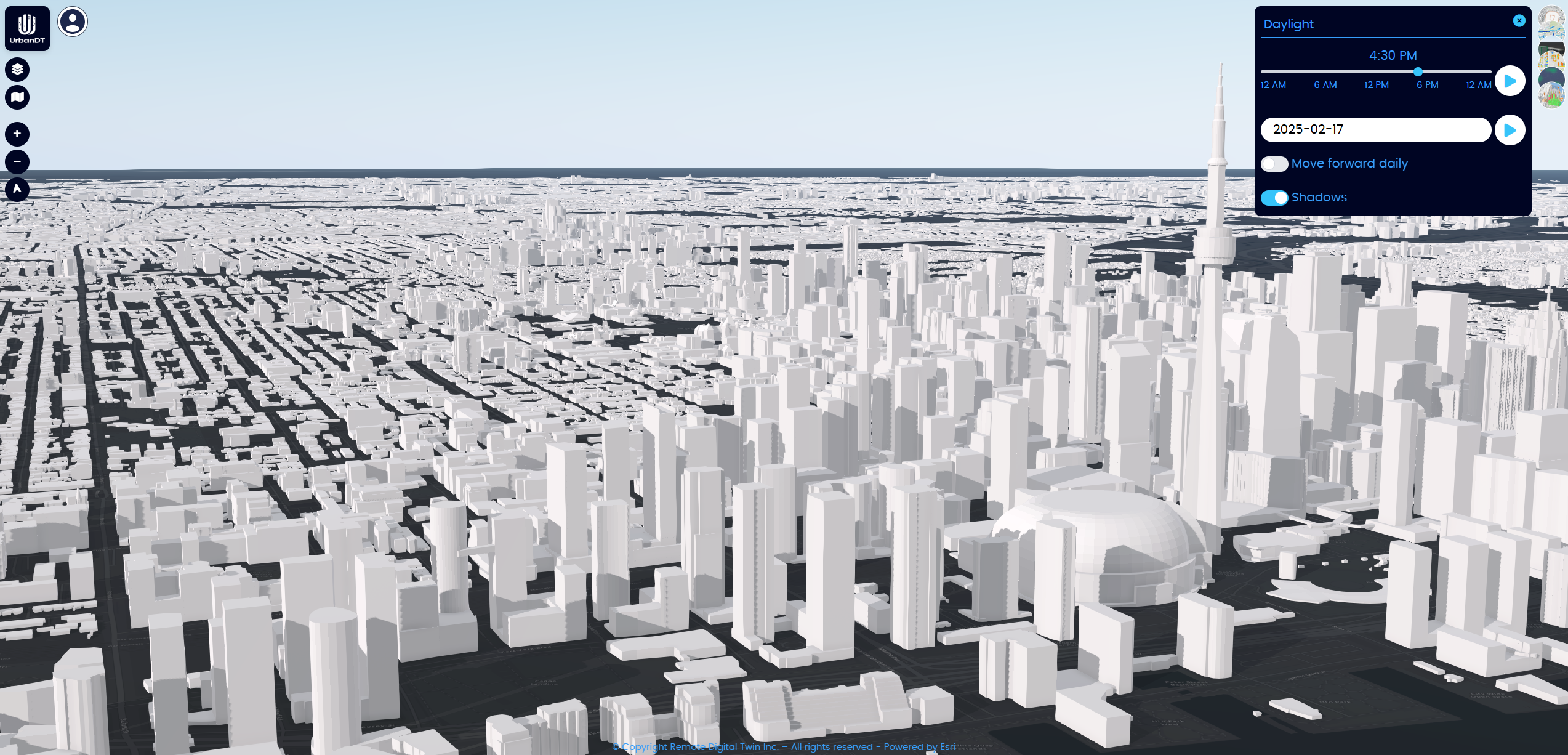
Daylight Analytics
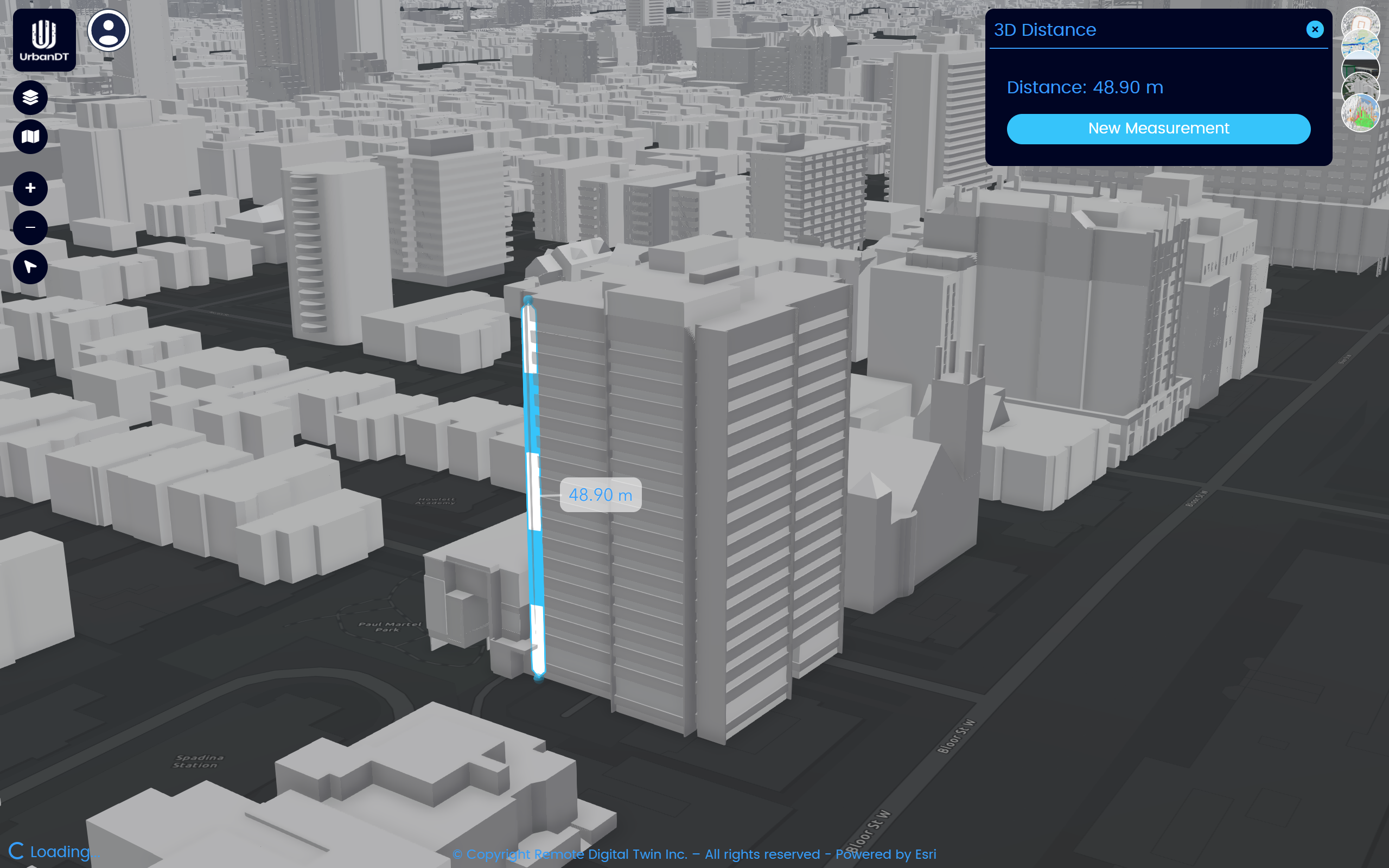
Distance Measurement
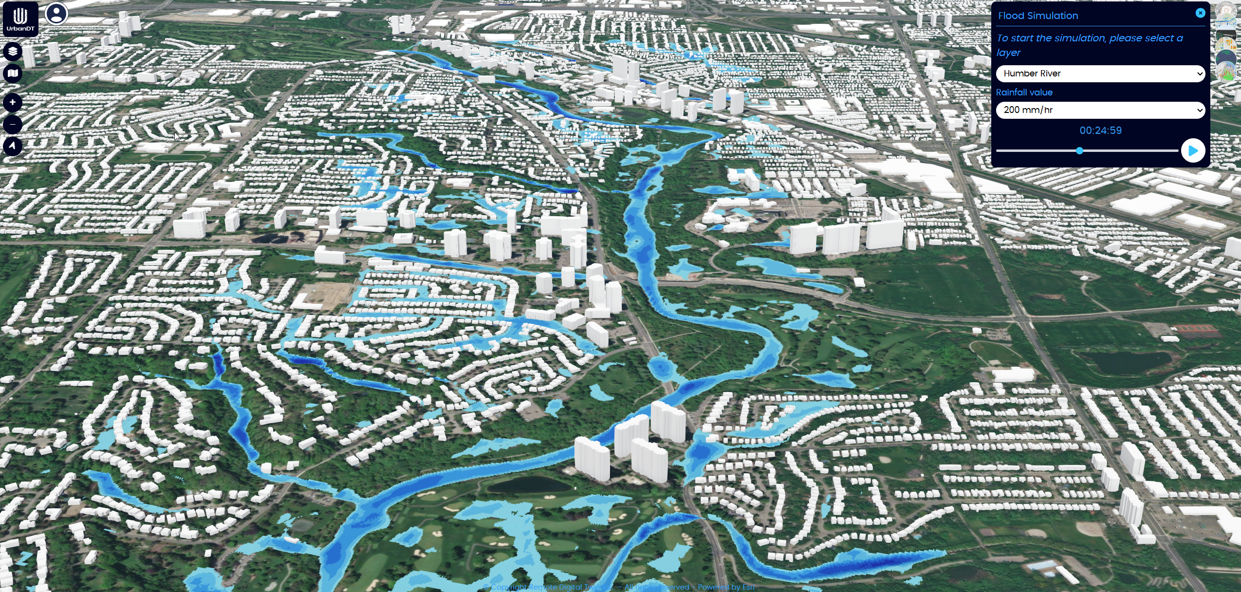
Flood Risk Simulation
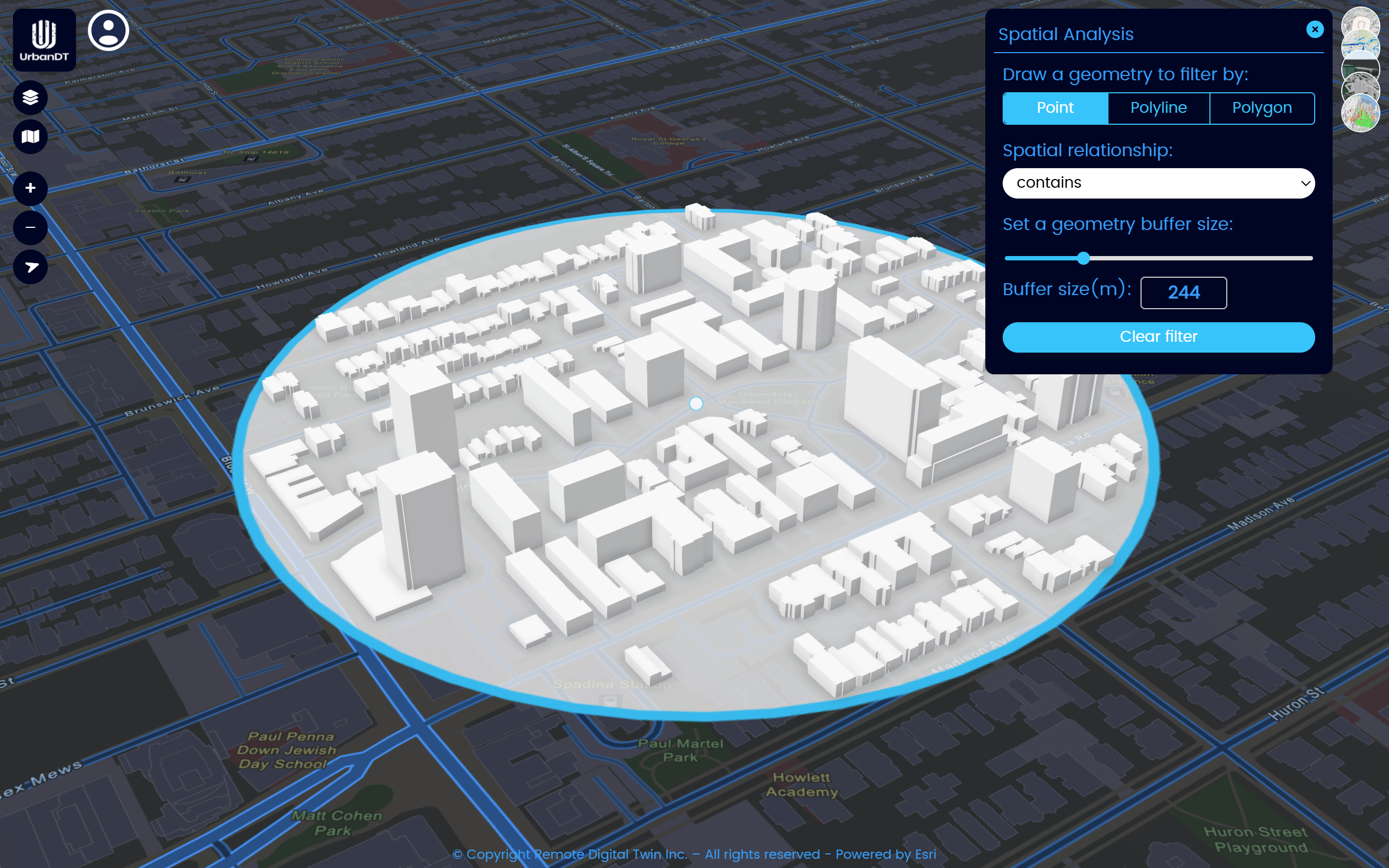
Geospatial Analytics
IoT Sensors
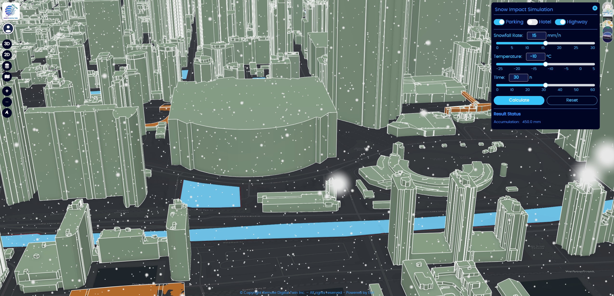
Snow Removal Simulation
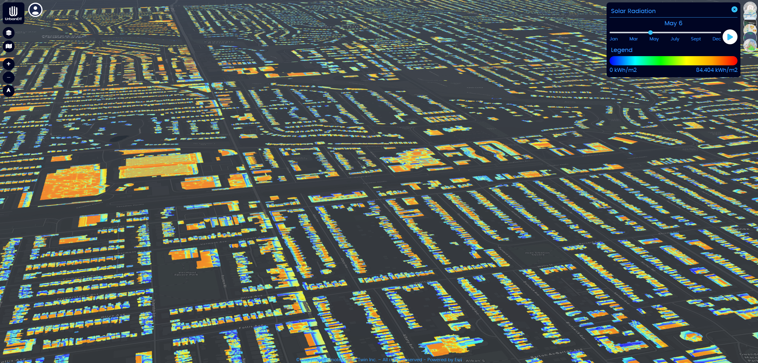
Solar Panel Potential
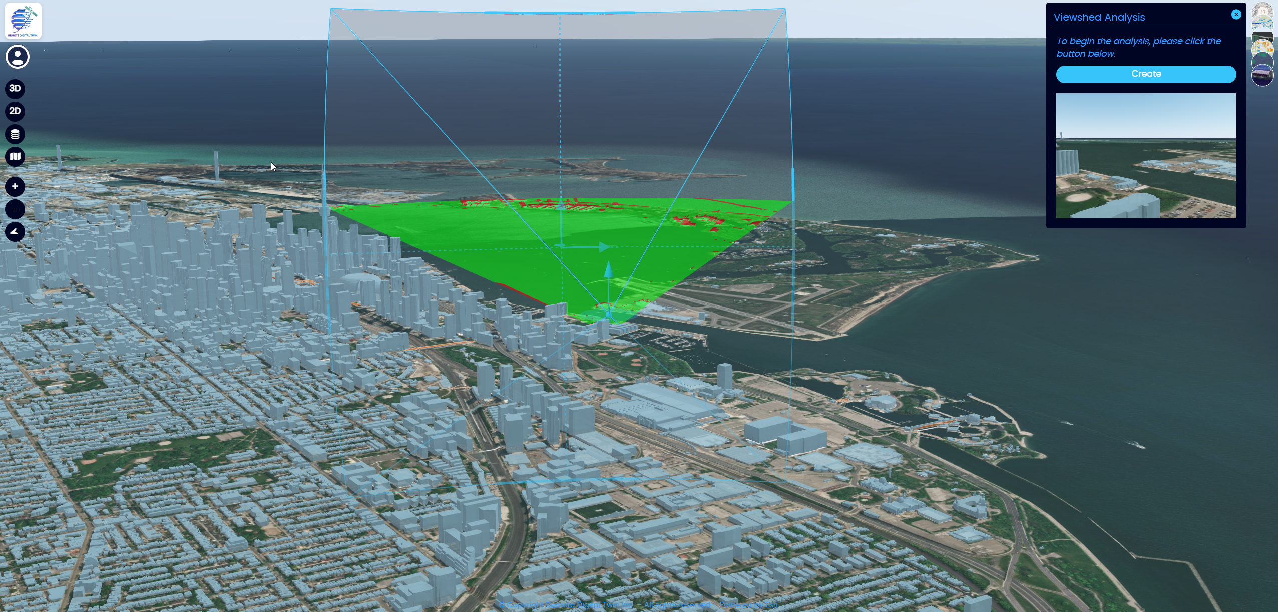
Viewshed Analysis
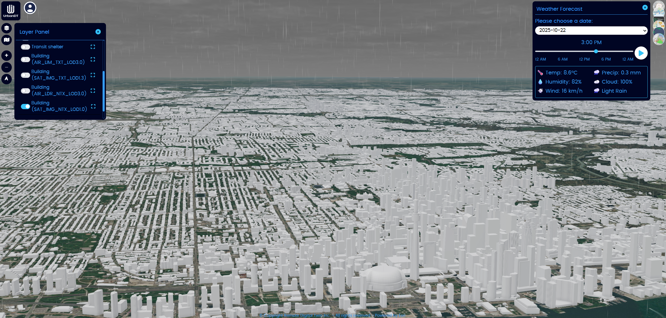
Weather Forecasting
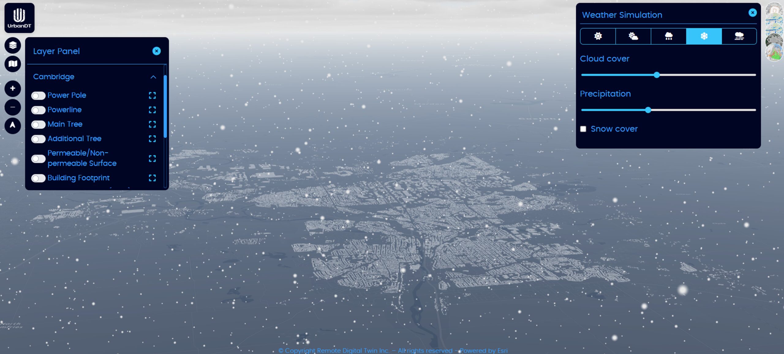
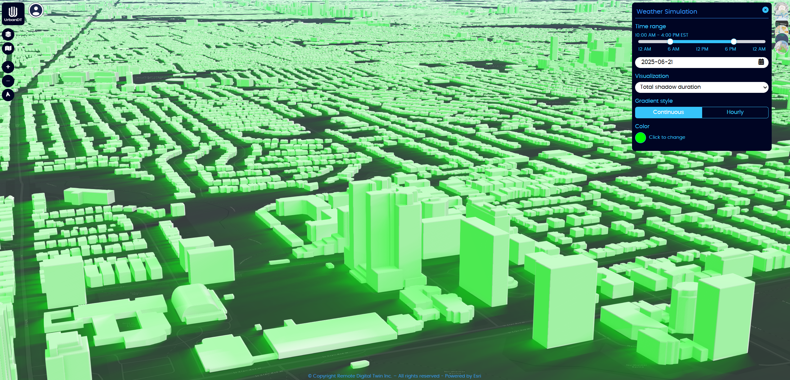
Weather Simulation
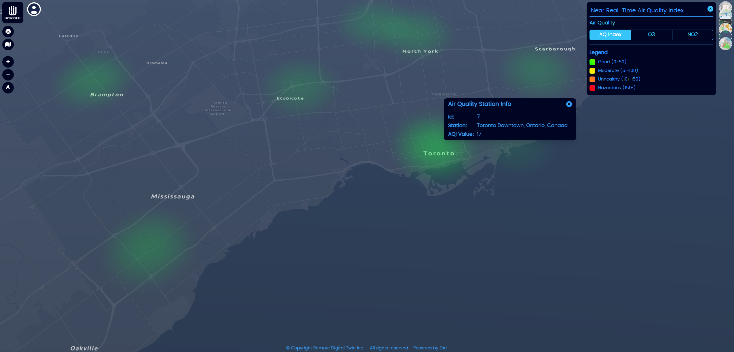
Near-Real-Time Air Quality Data
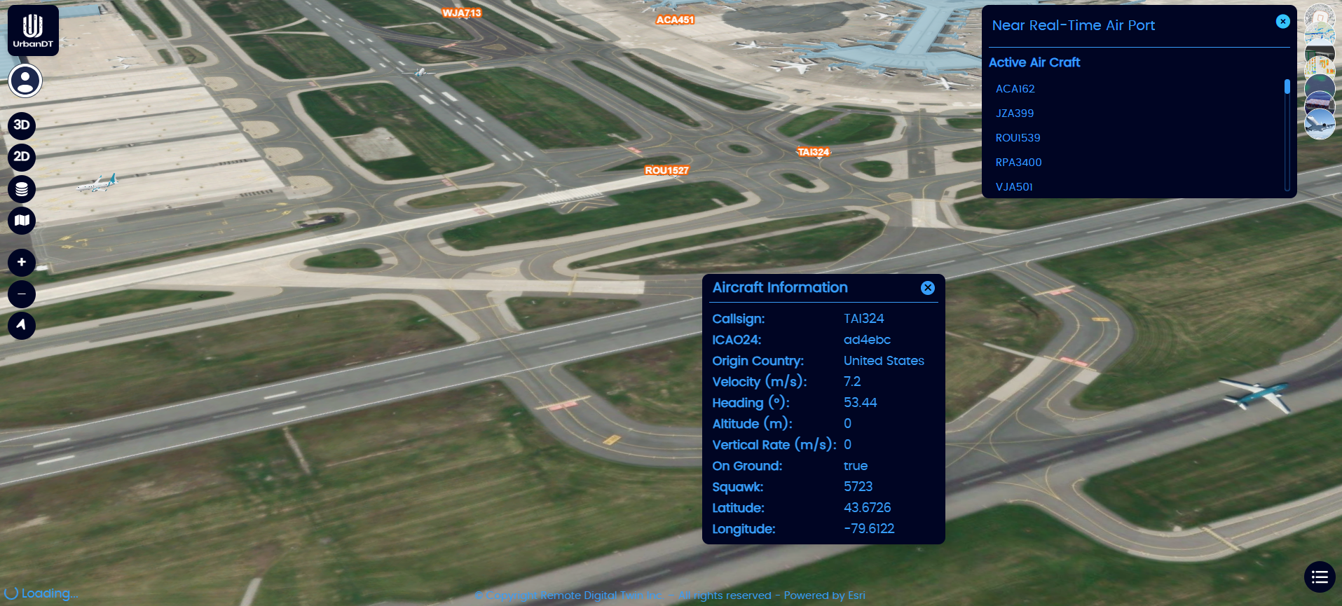
Near-Real-Time Airport Data
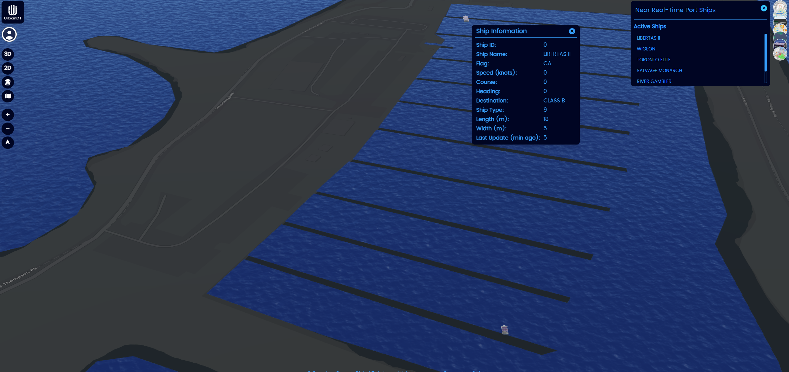
Near-Real-Time Ship Data
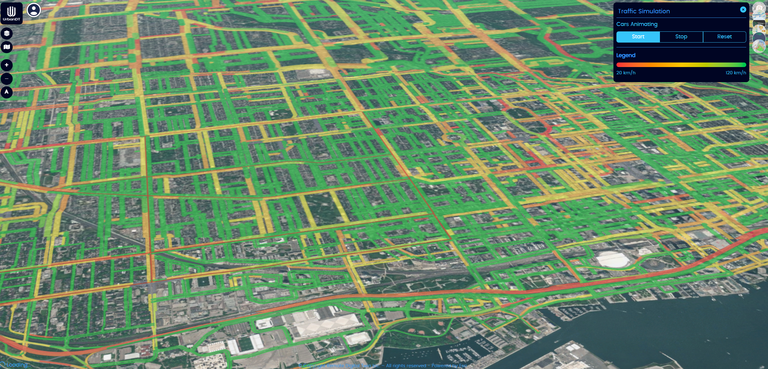
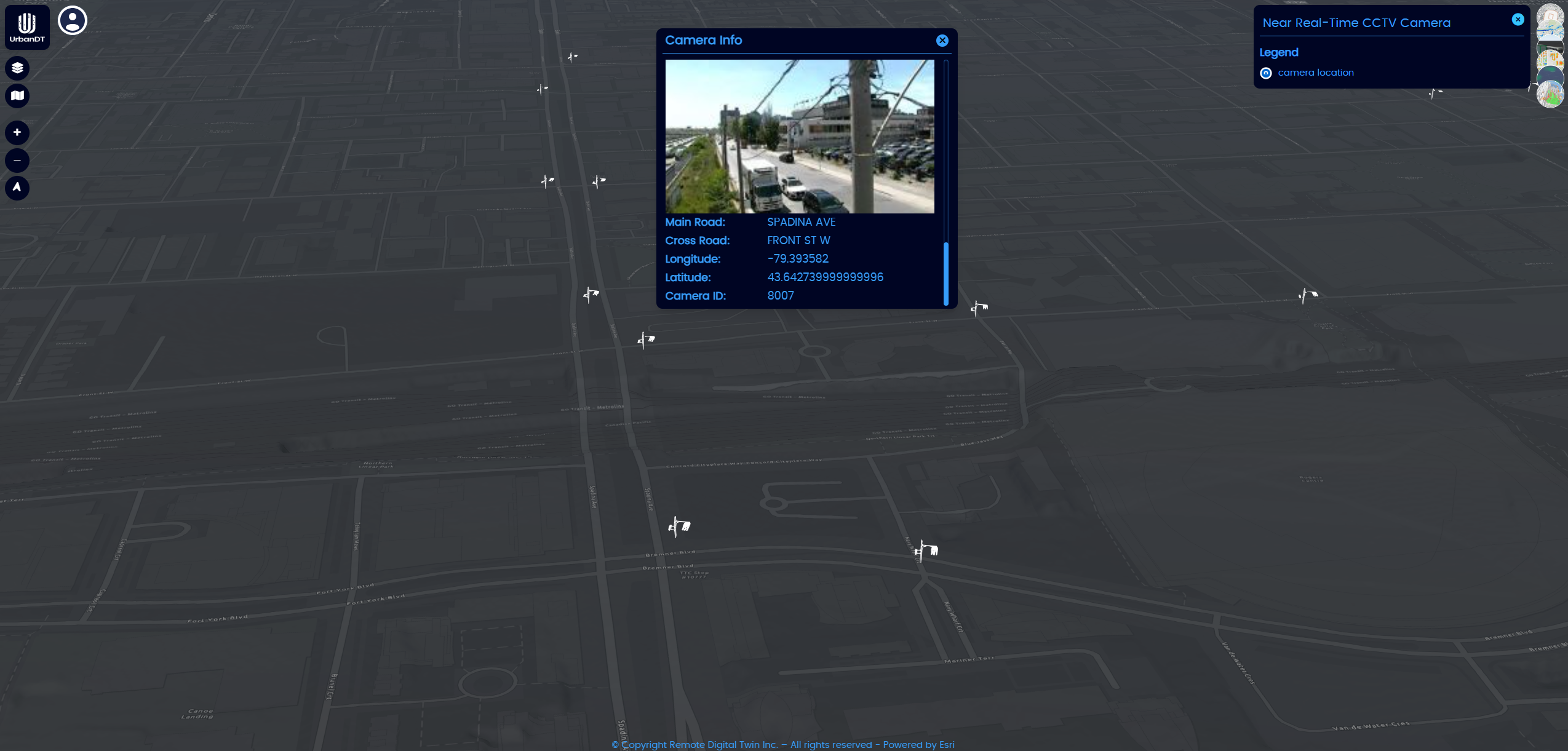
Near-Real-Time Traffic Data
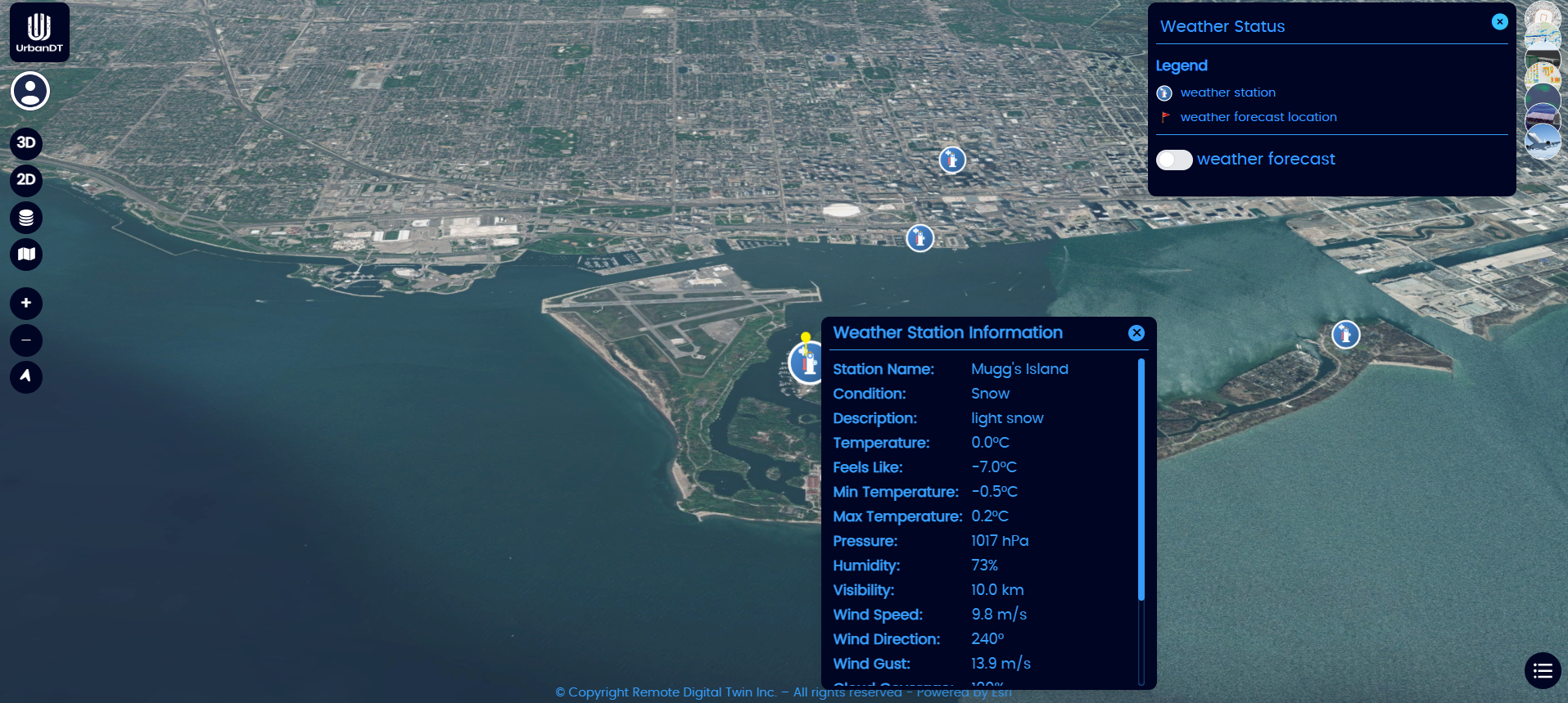
Near-Real-Time Weather Station Data
Near-Real-Time Public Transportation Data