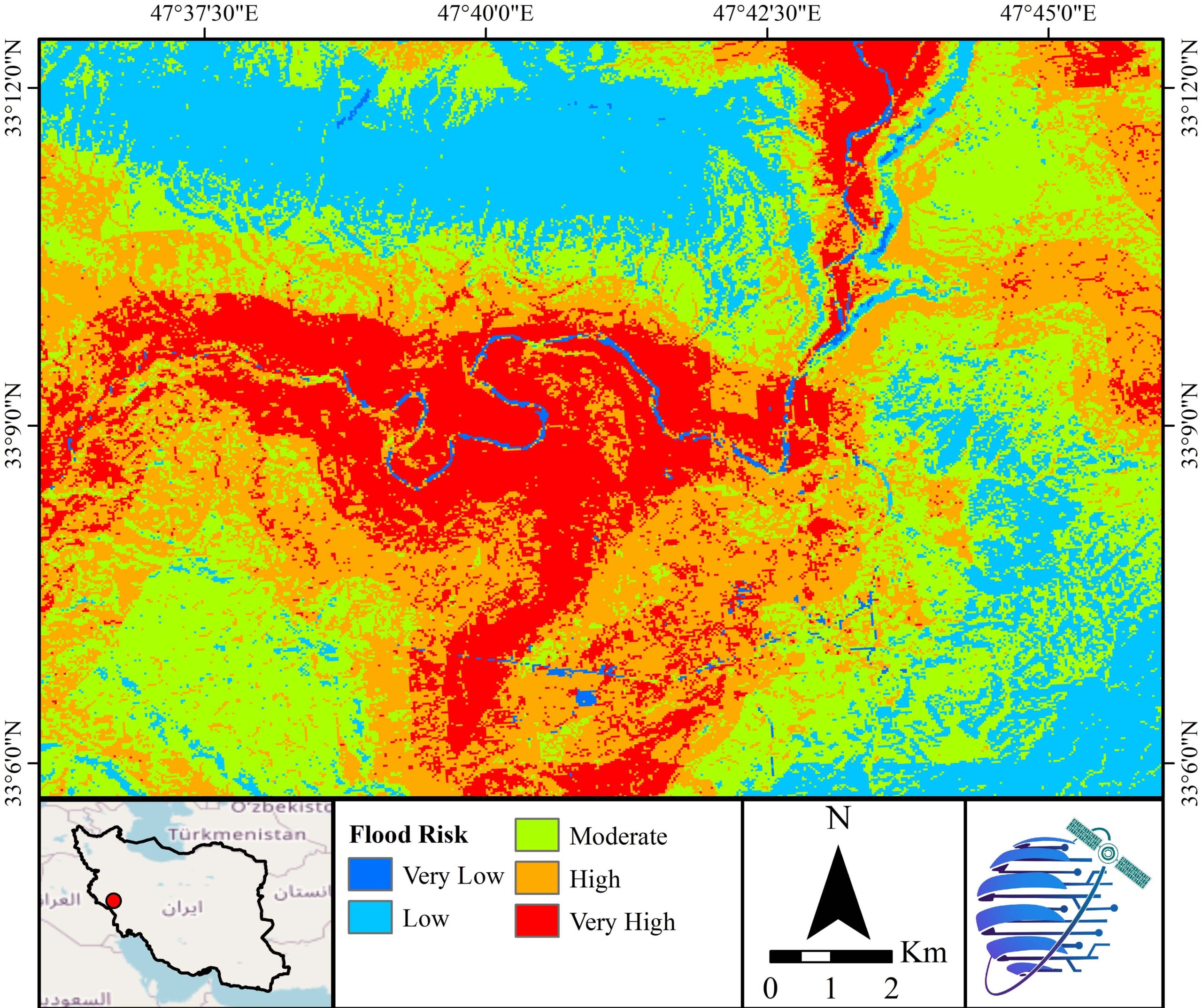
Flood Risk
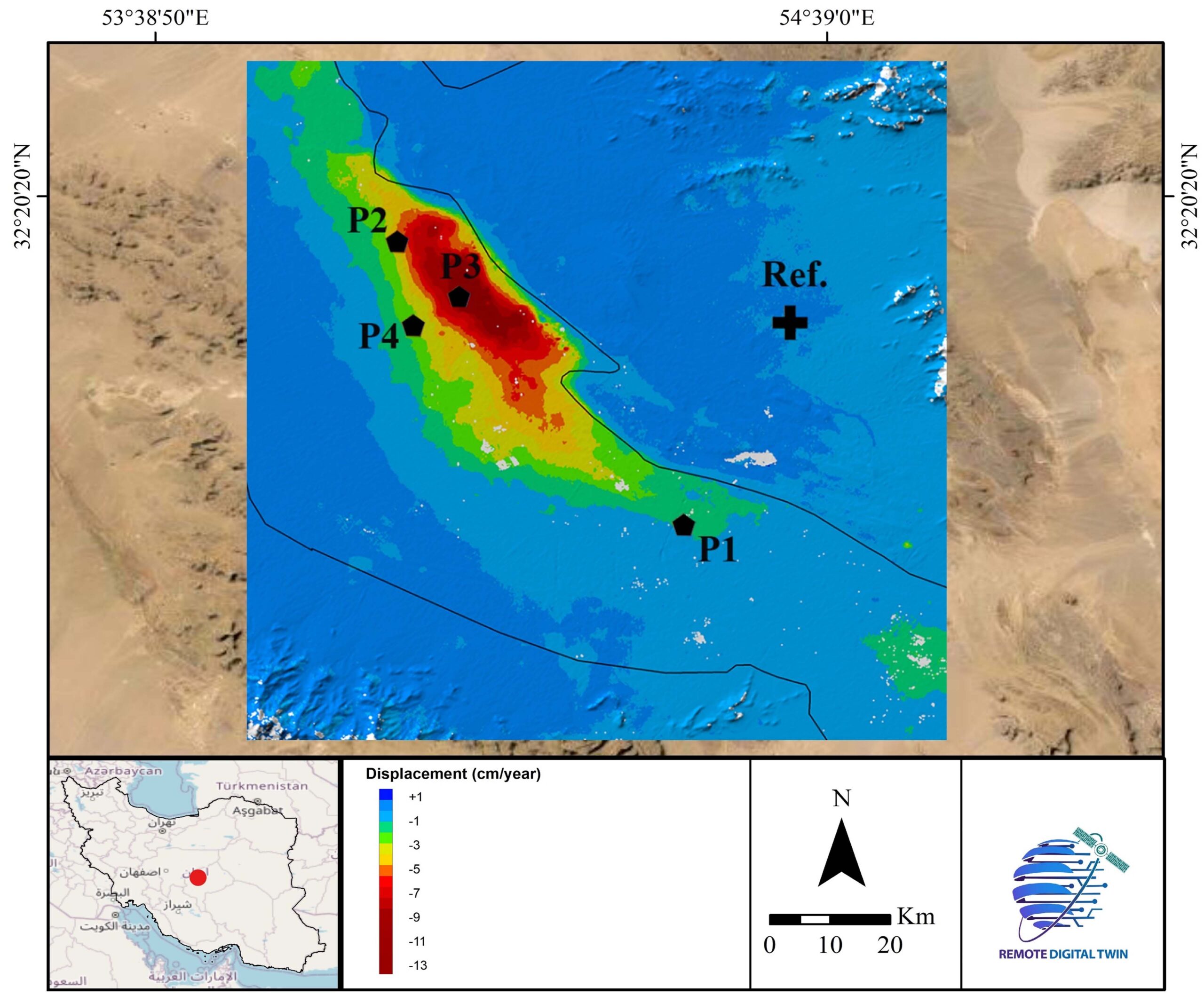
Land Displacement
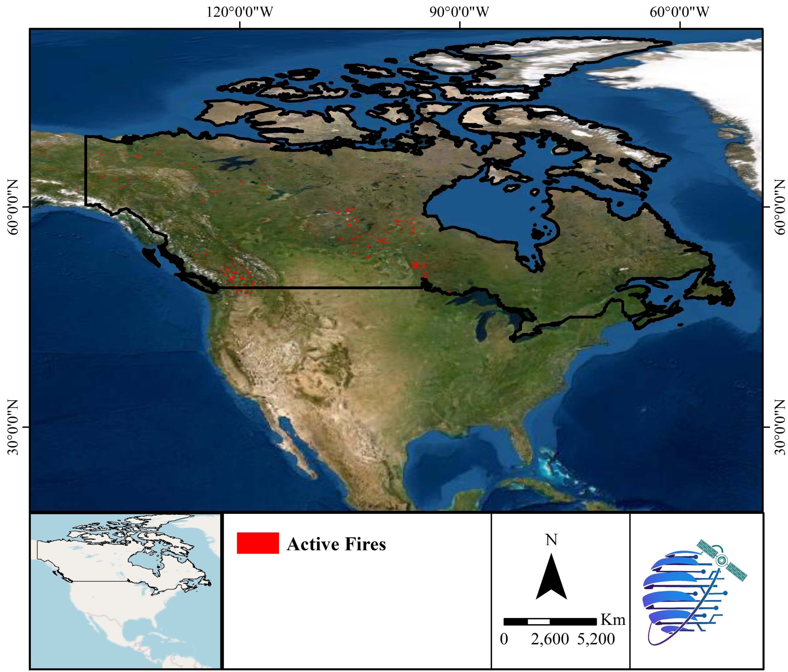
Active Fire
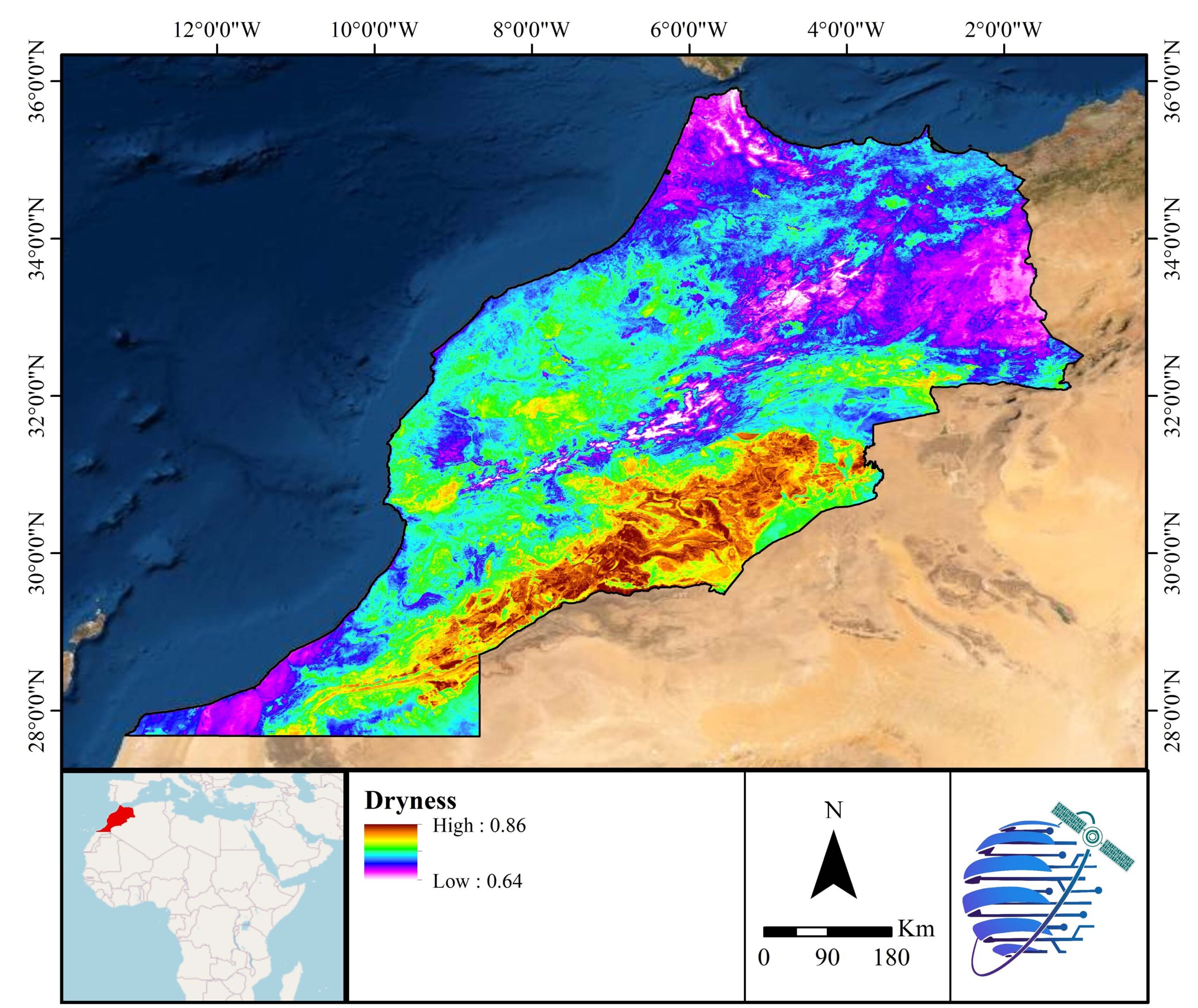
Drought
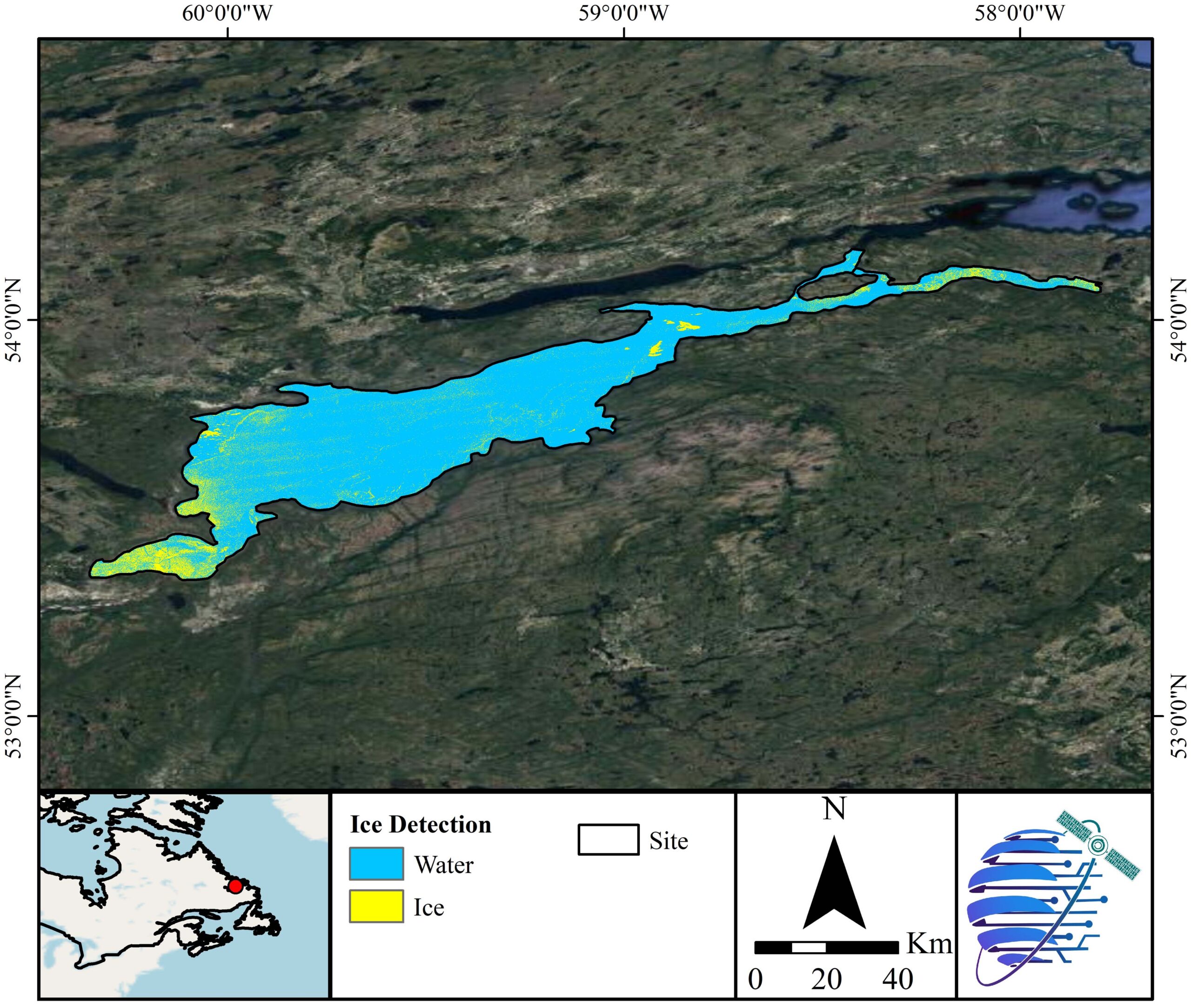
Lake Ice
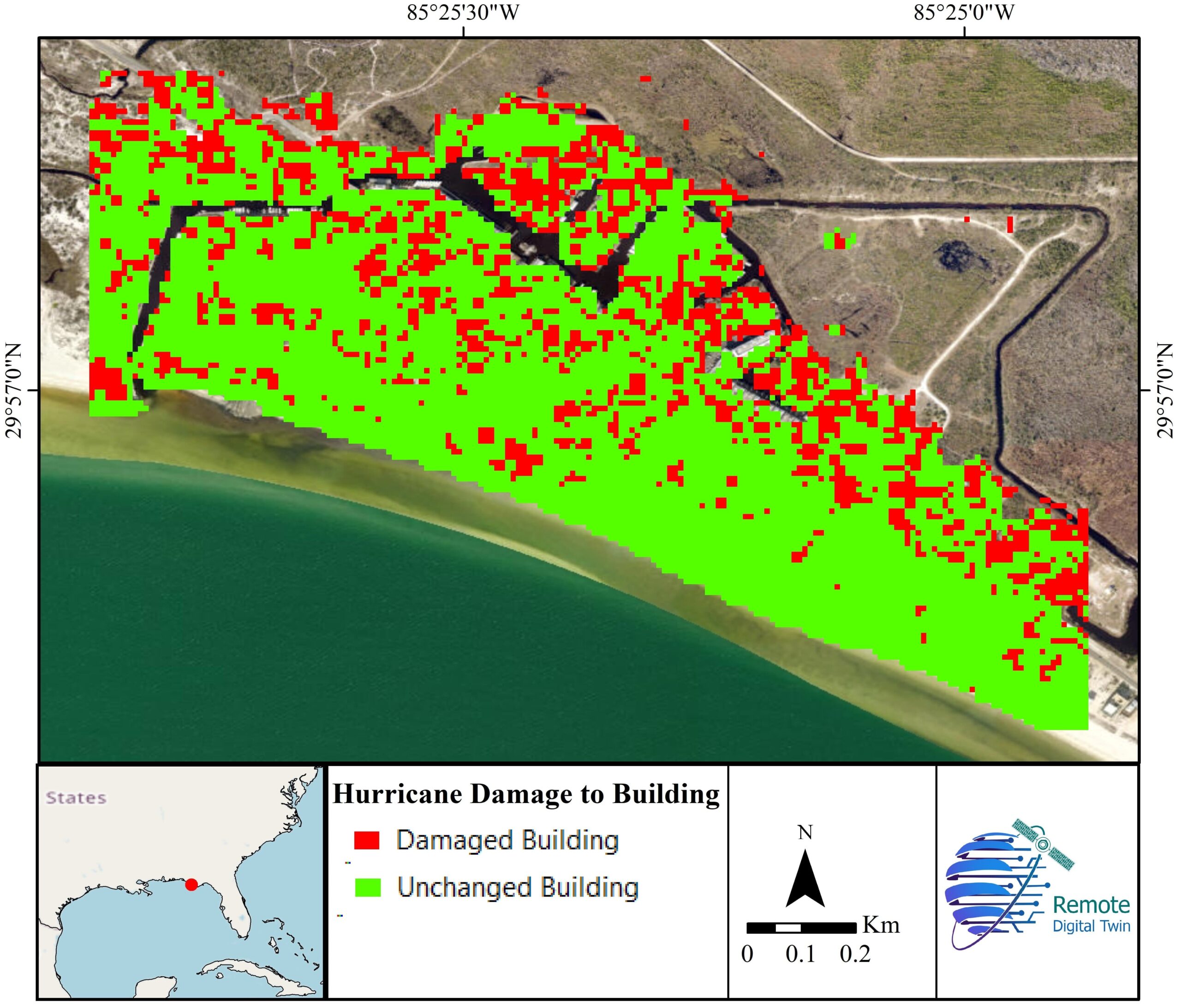
Building Damage
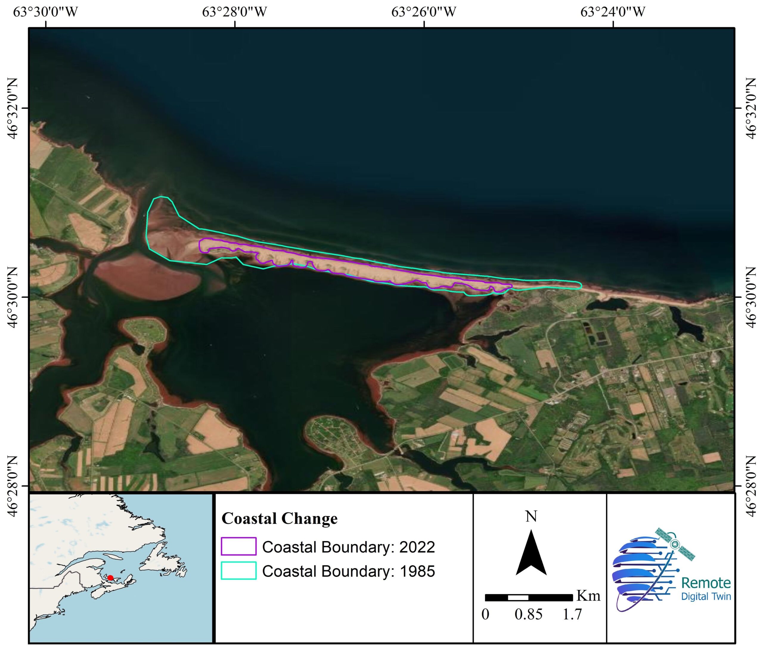
Coastal Erosion
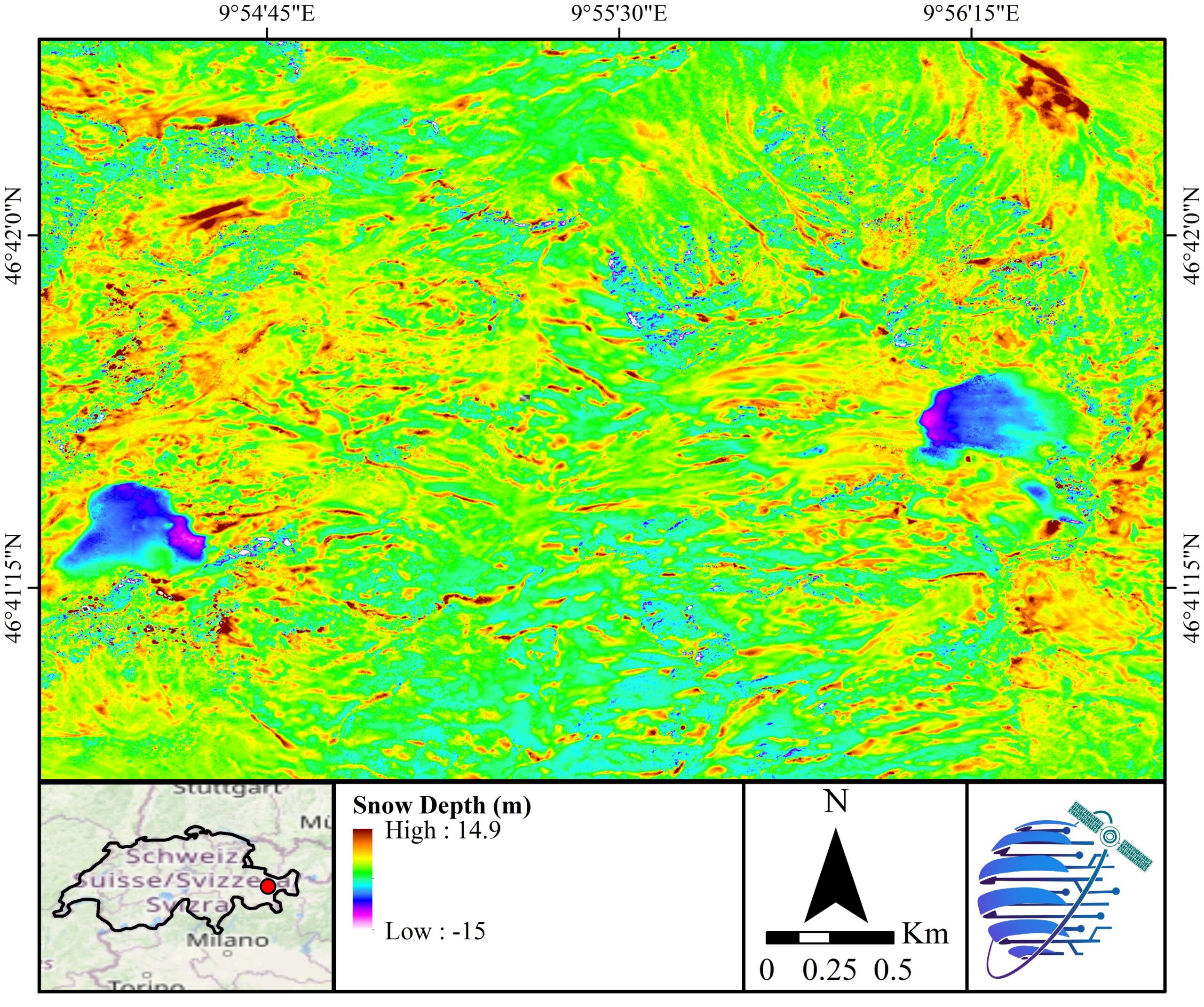
Snow Depth
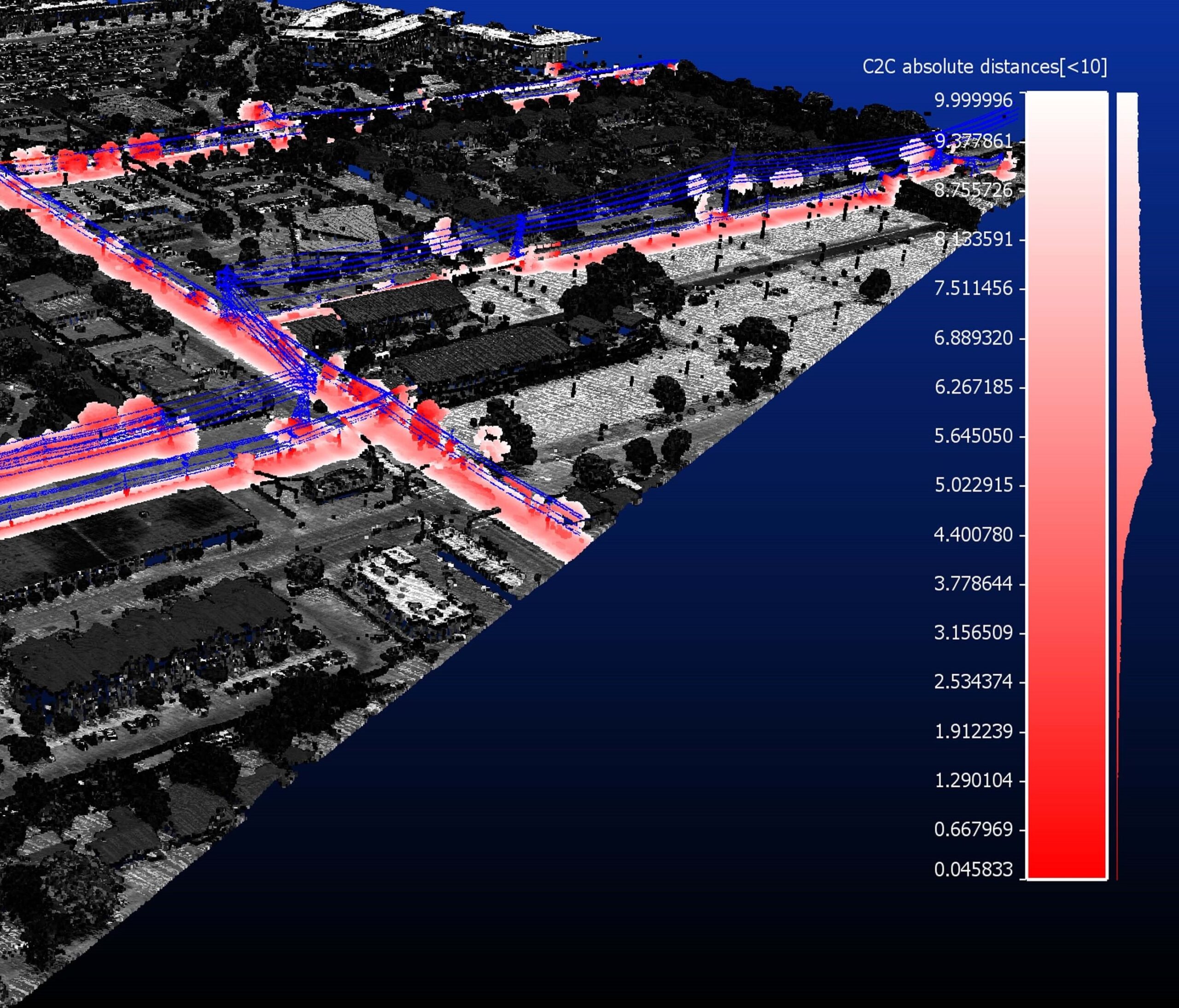
Power & Transmission Lines

Dust
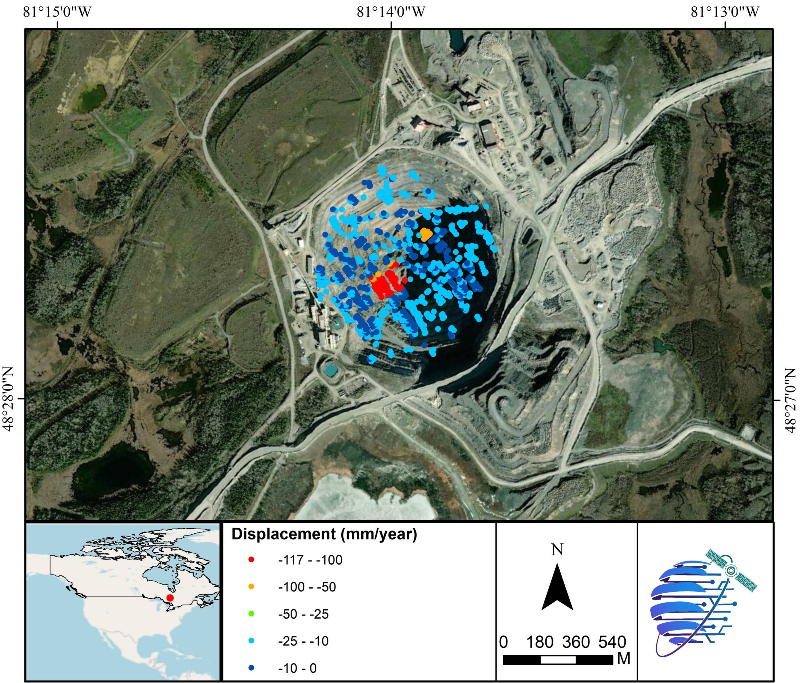
Mine Stability

Land Displacement
Building Damage

Fog
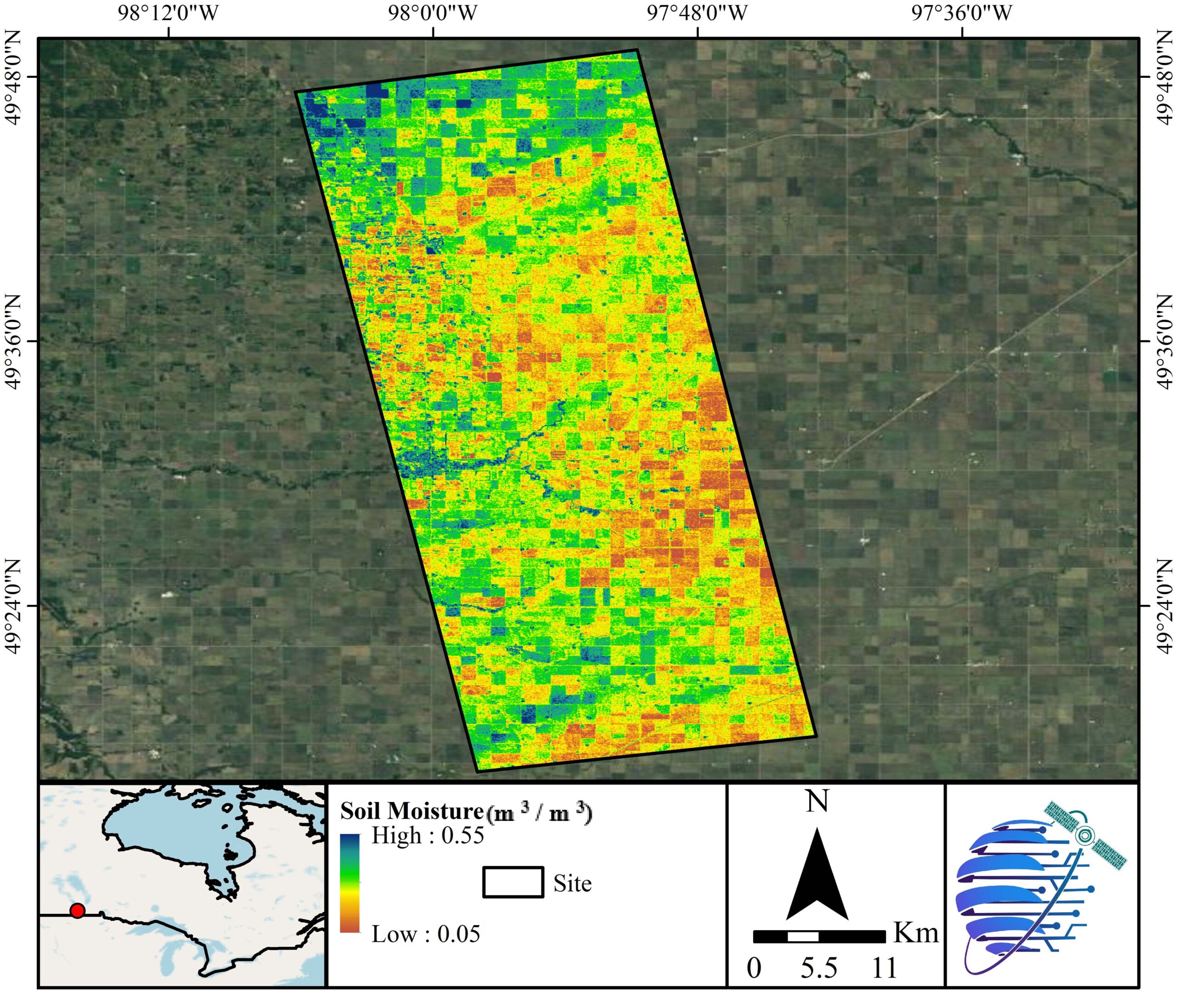
Soil Moisture
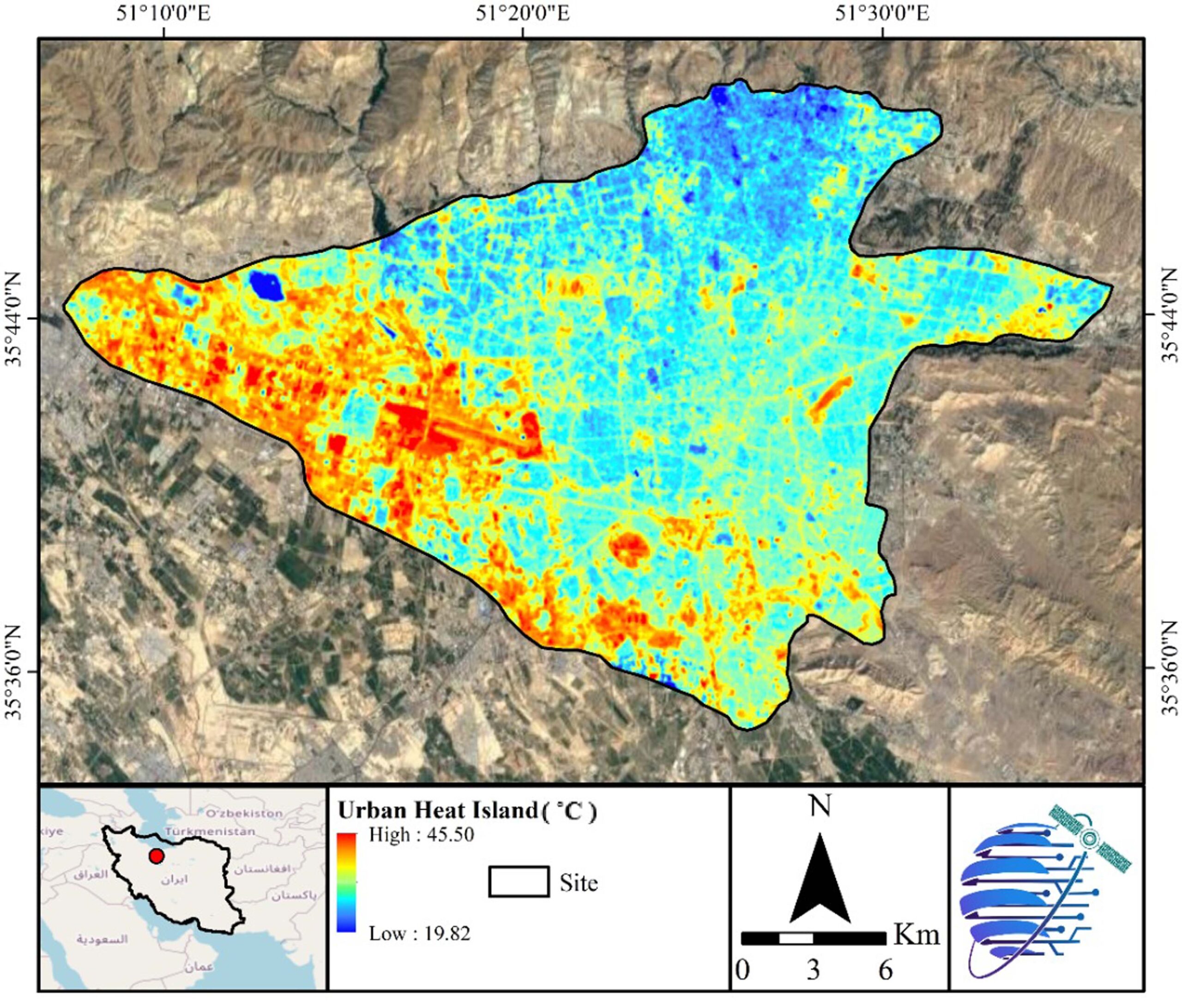
Land Surface Temperature
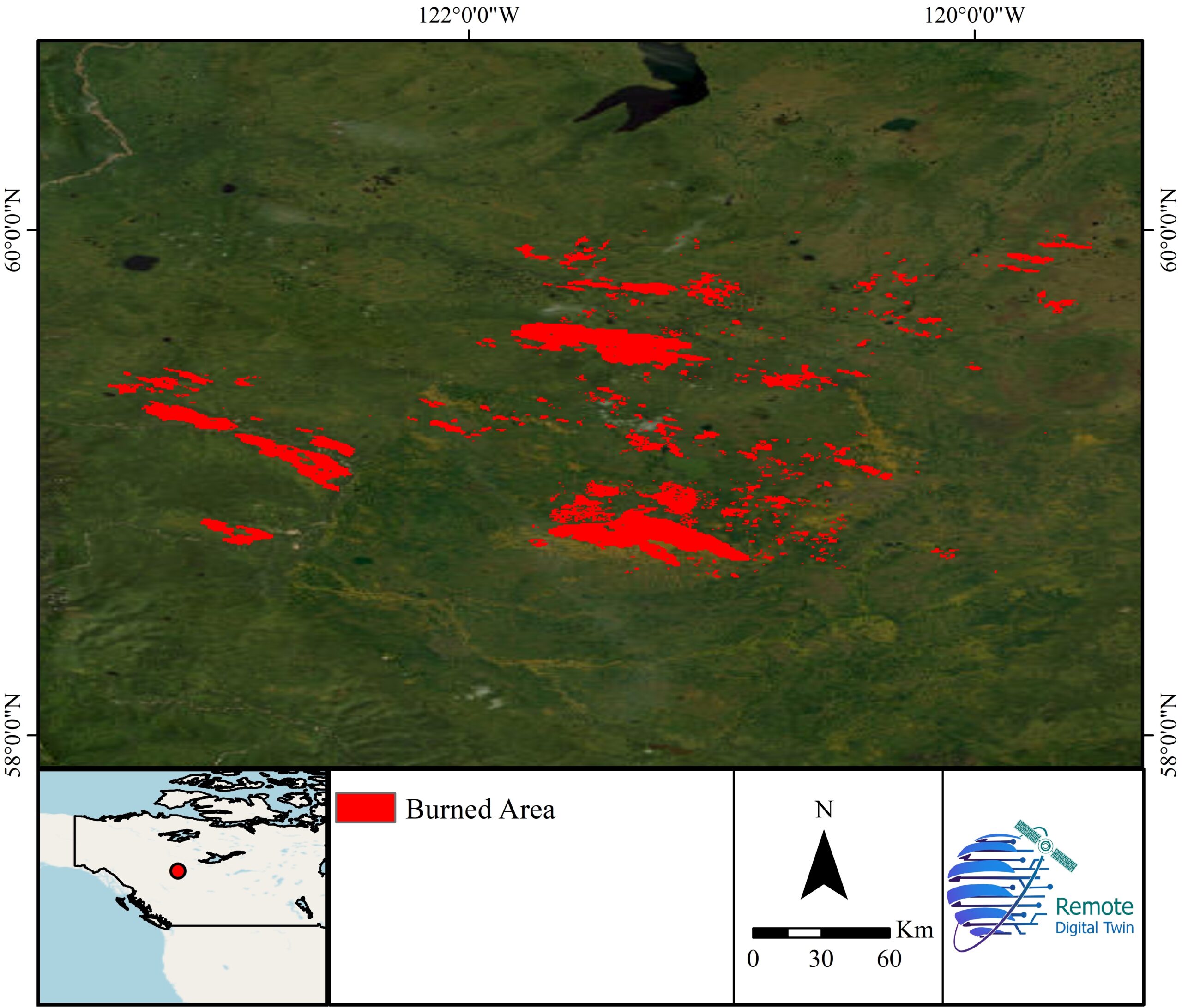
Burned Area
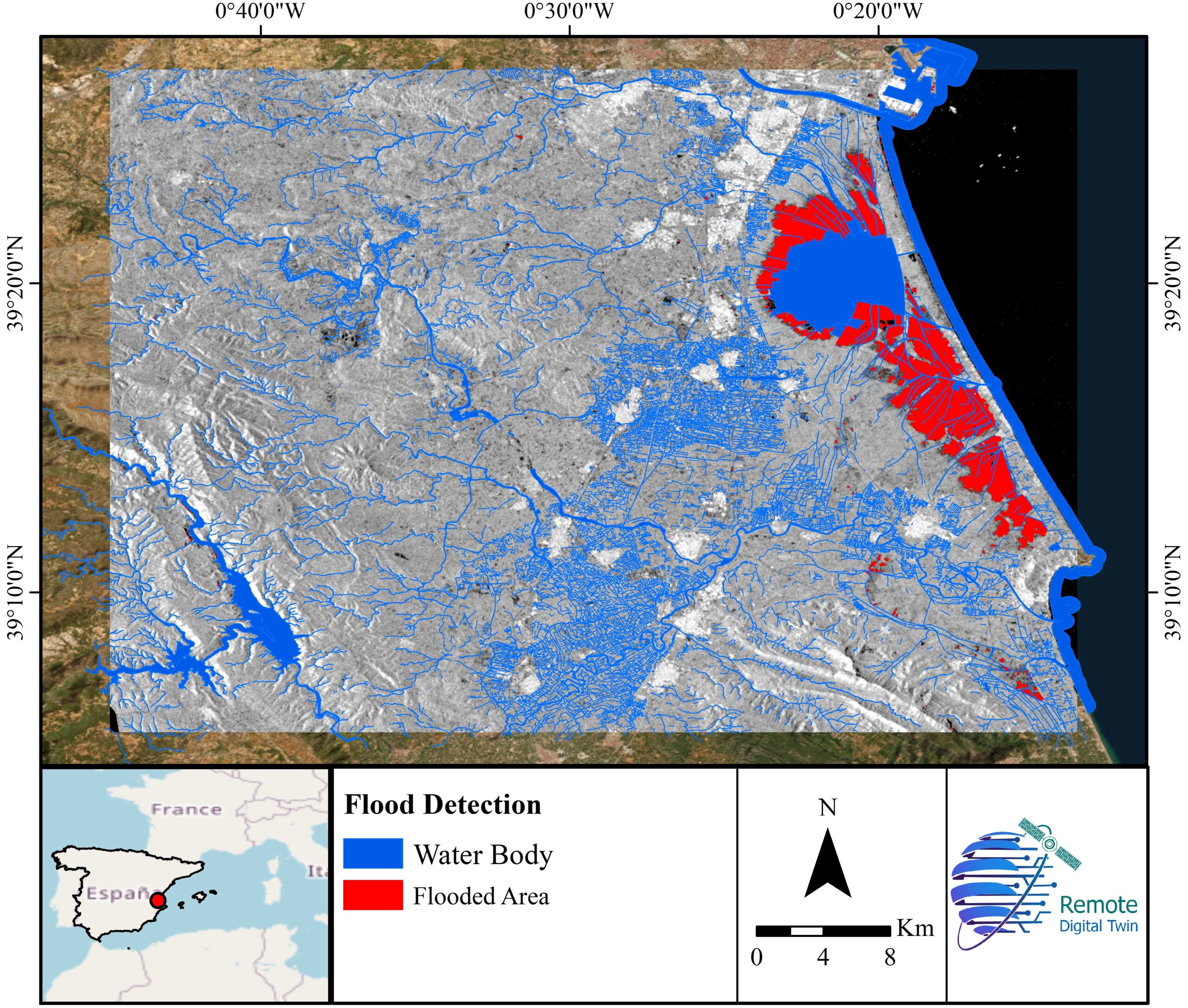
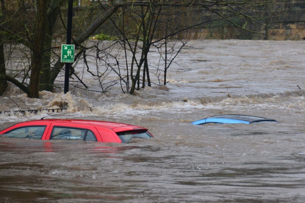
Flood Detection
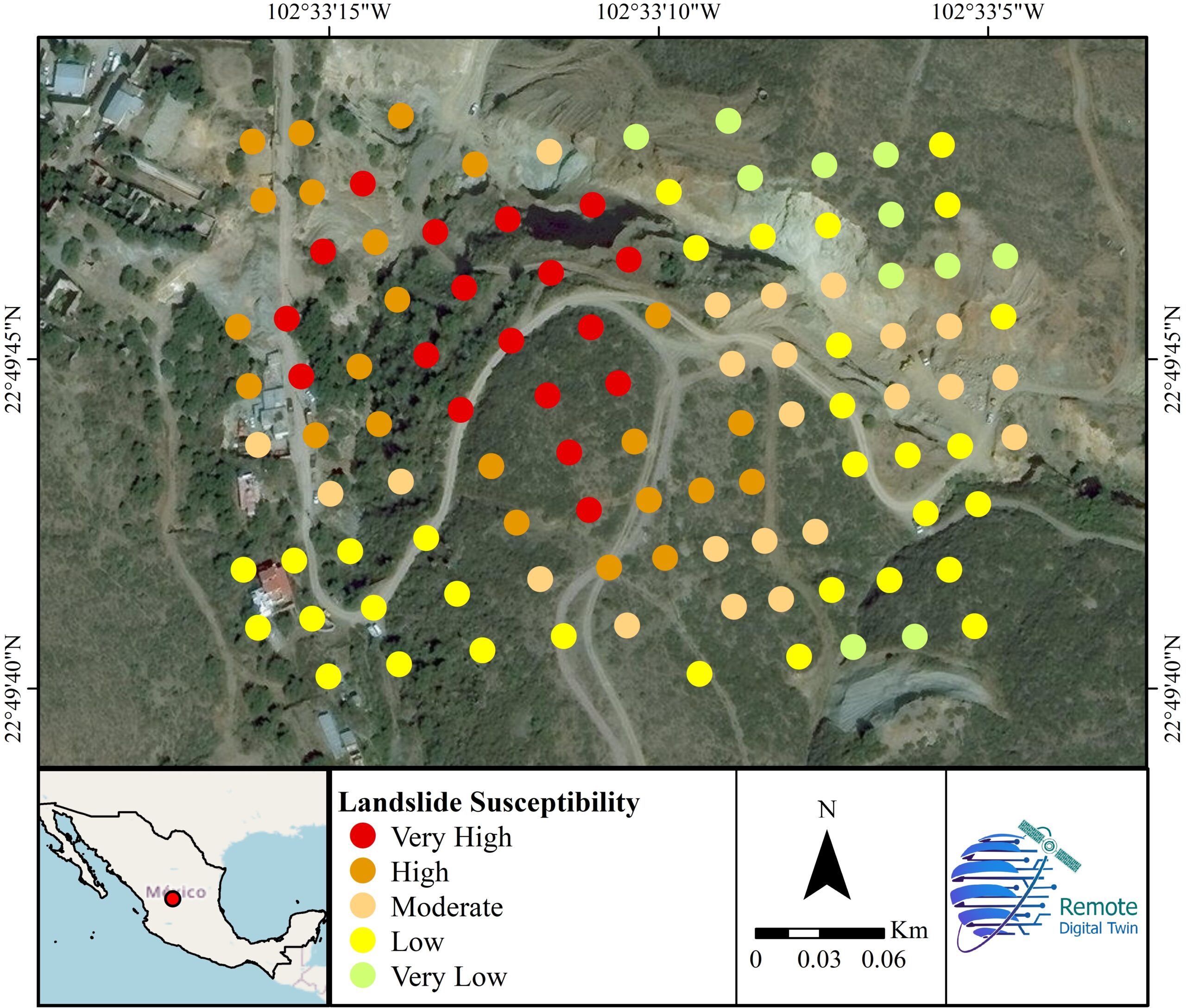
Landslide
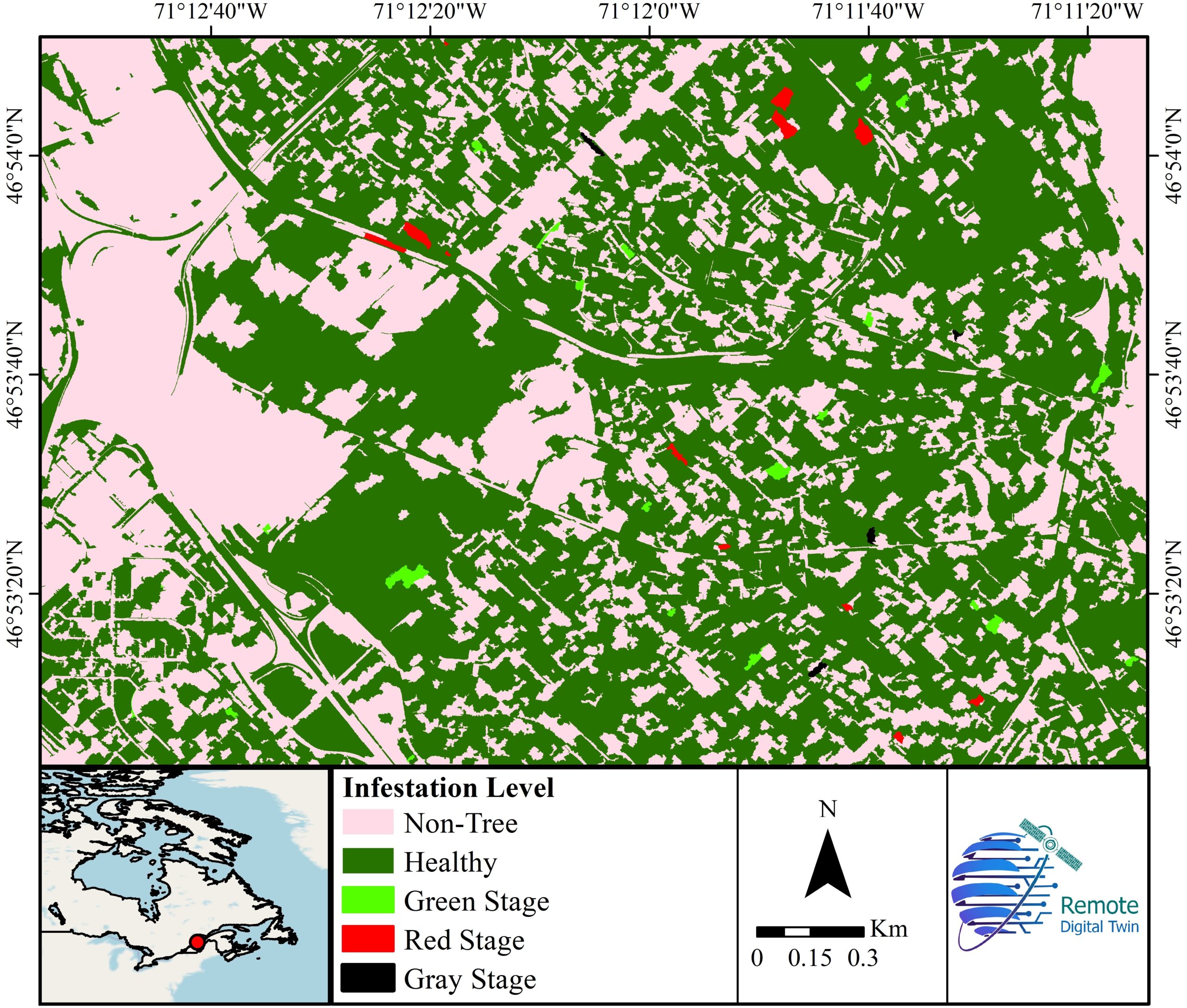
Tree Infestation
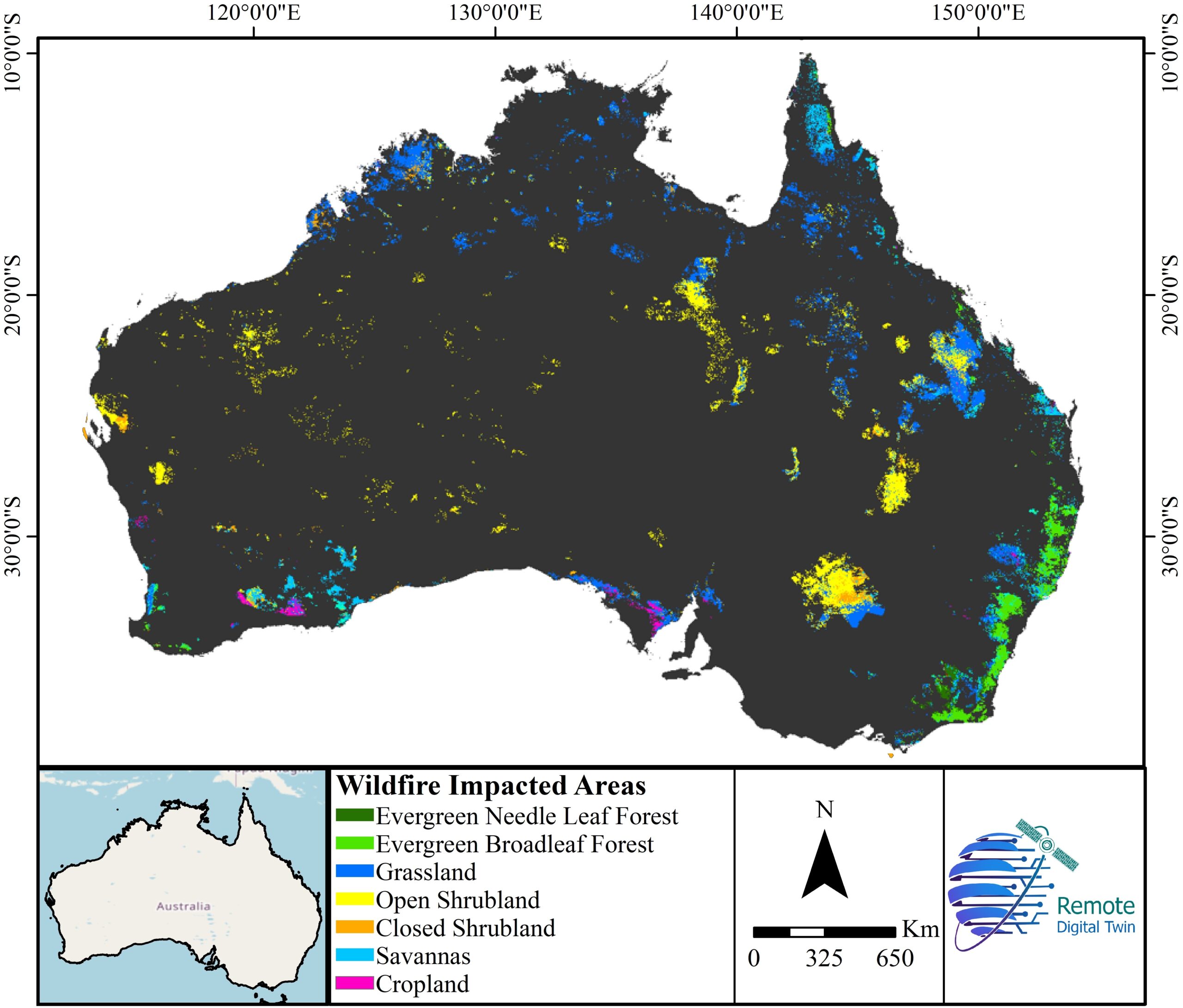
Wildfire Impact
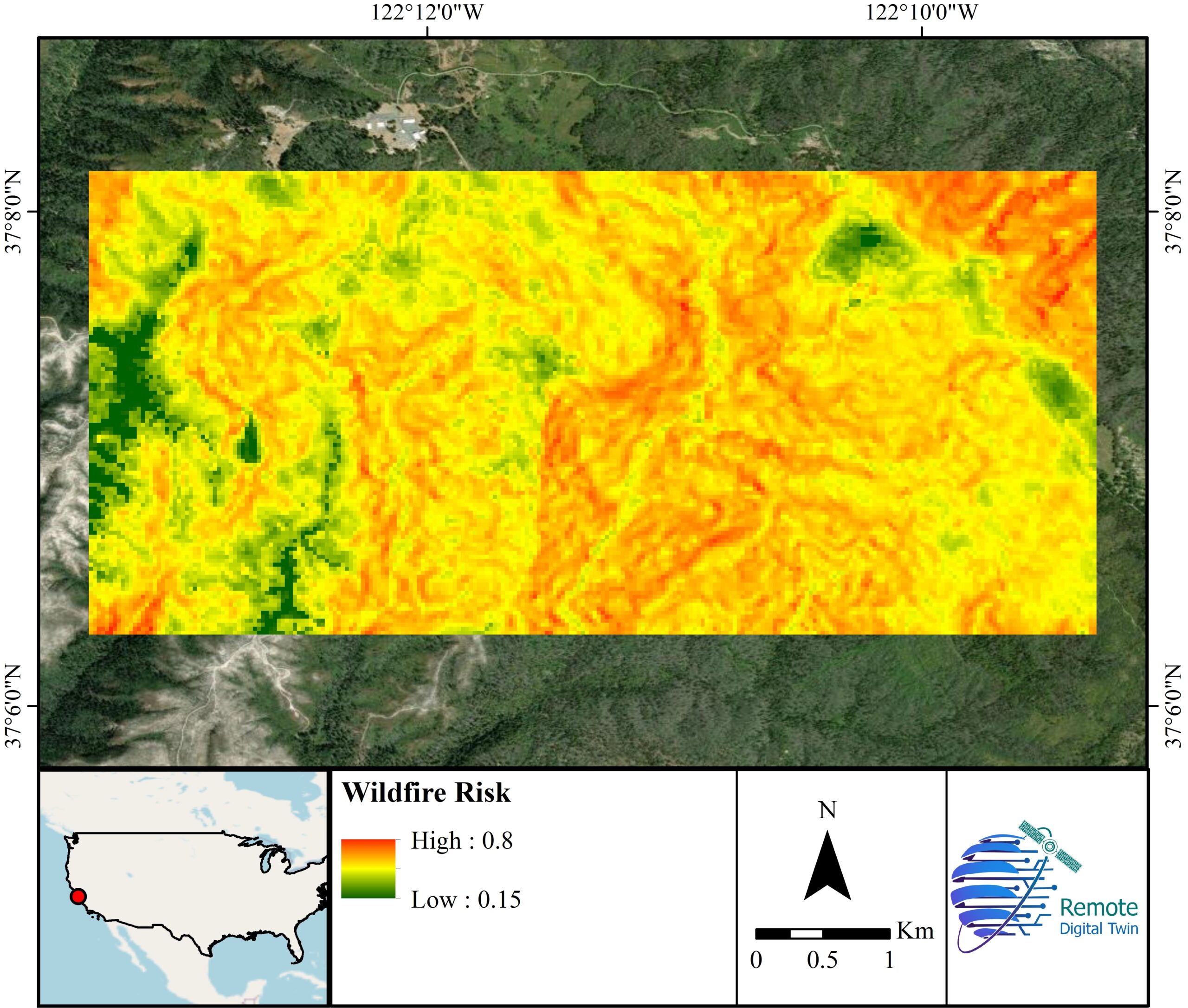
Wildfire Risk