

Precipitation

Cloud Top Height

Cloud Top Pressure

Cloud Top Temperature

Cloud Water Liquid

Fog Probability

Max Relative Humidity

PM2.5

Dust
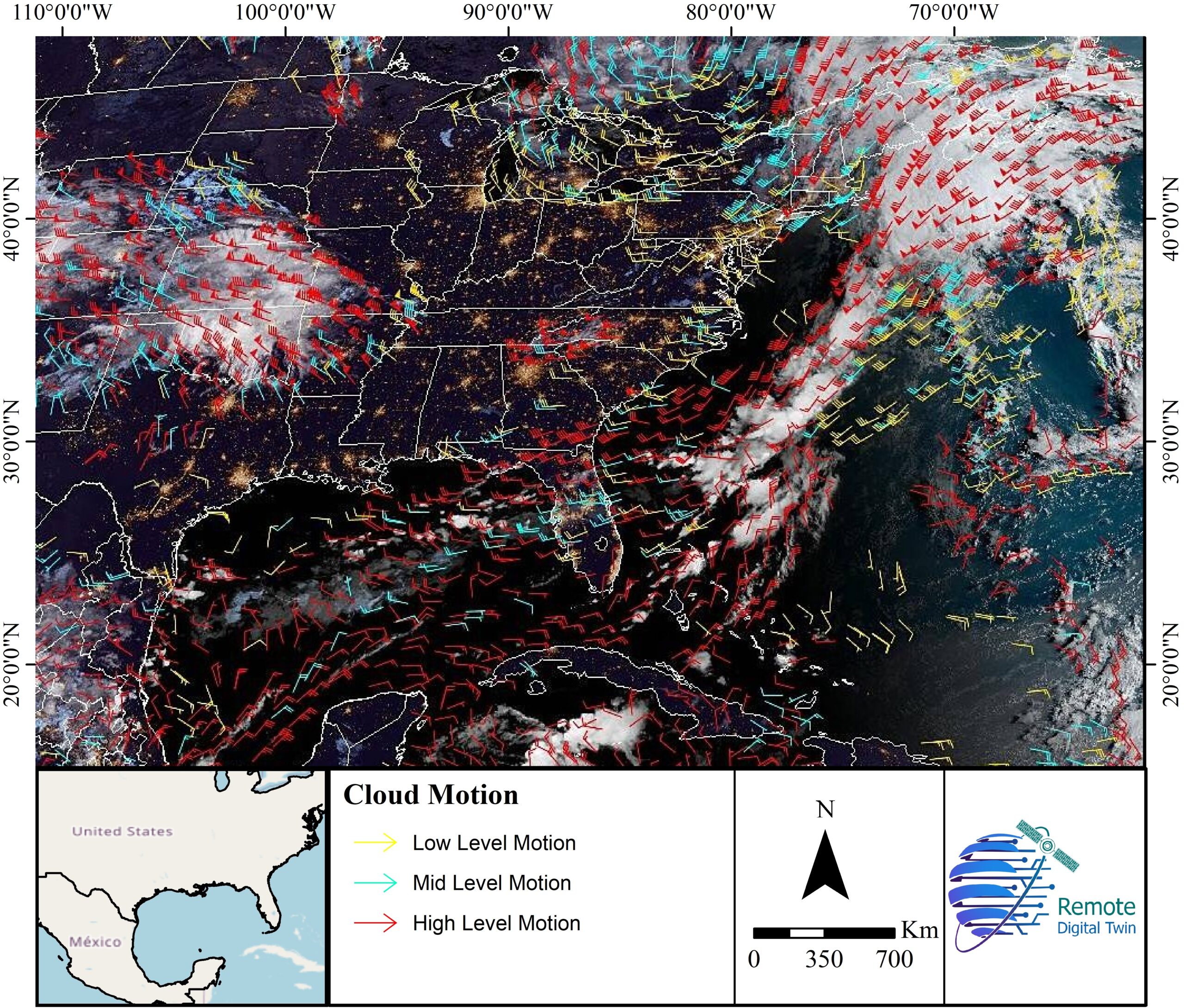
Cloud Motion Wind
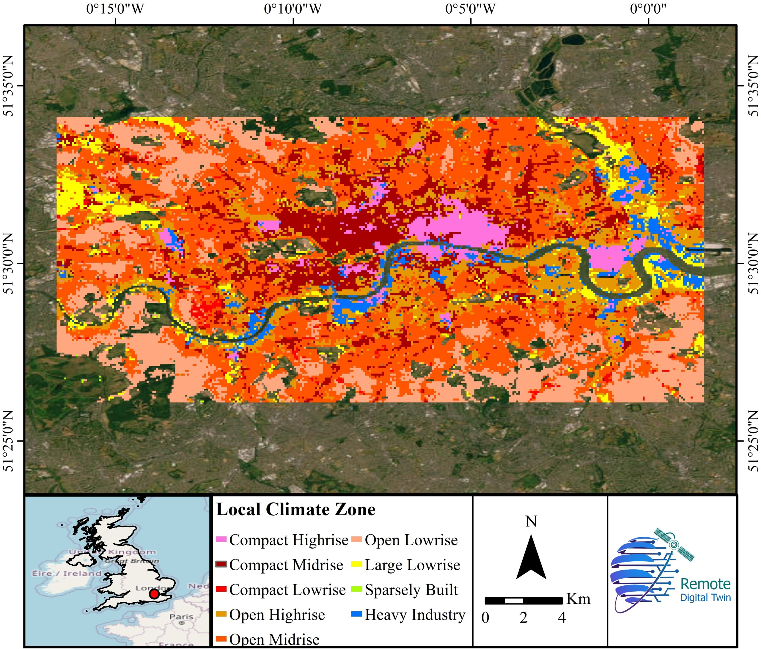
Local Climate Zone
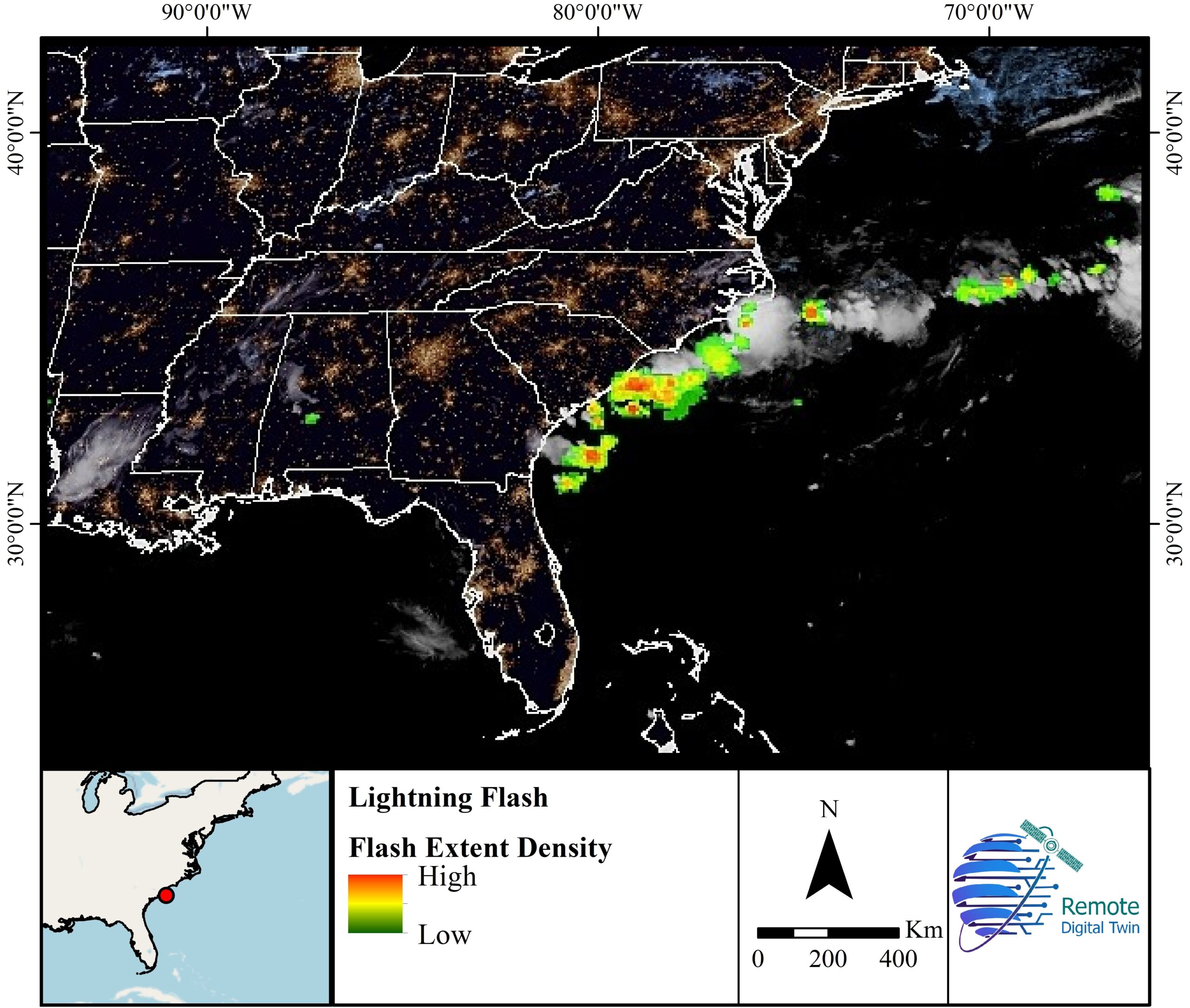
Lightning
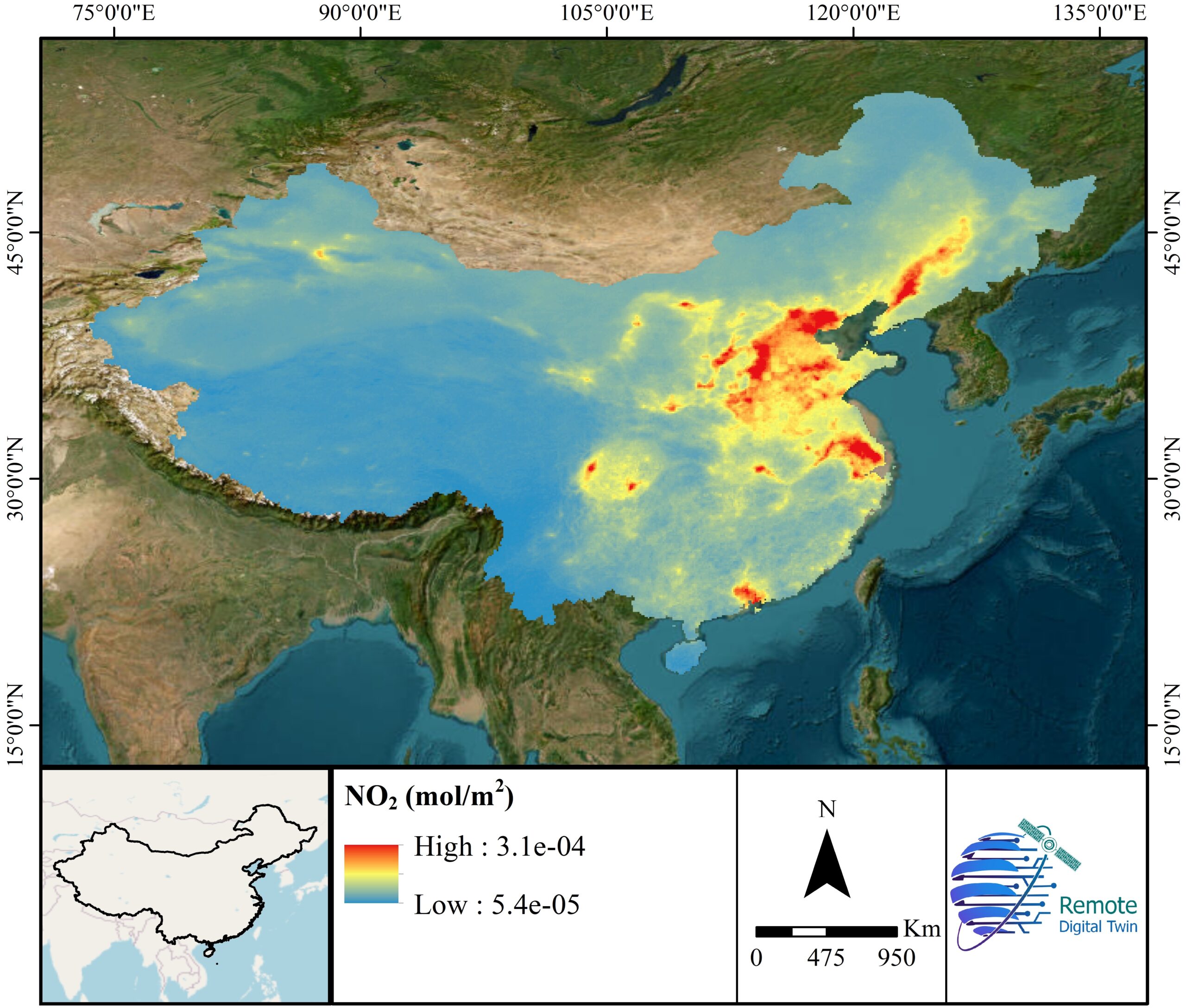
NO2
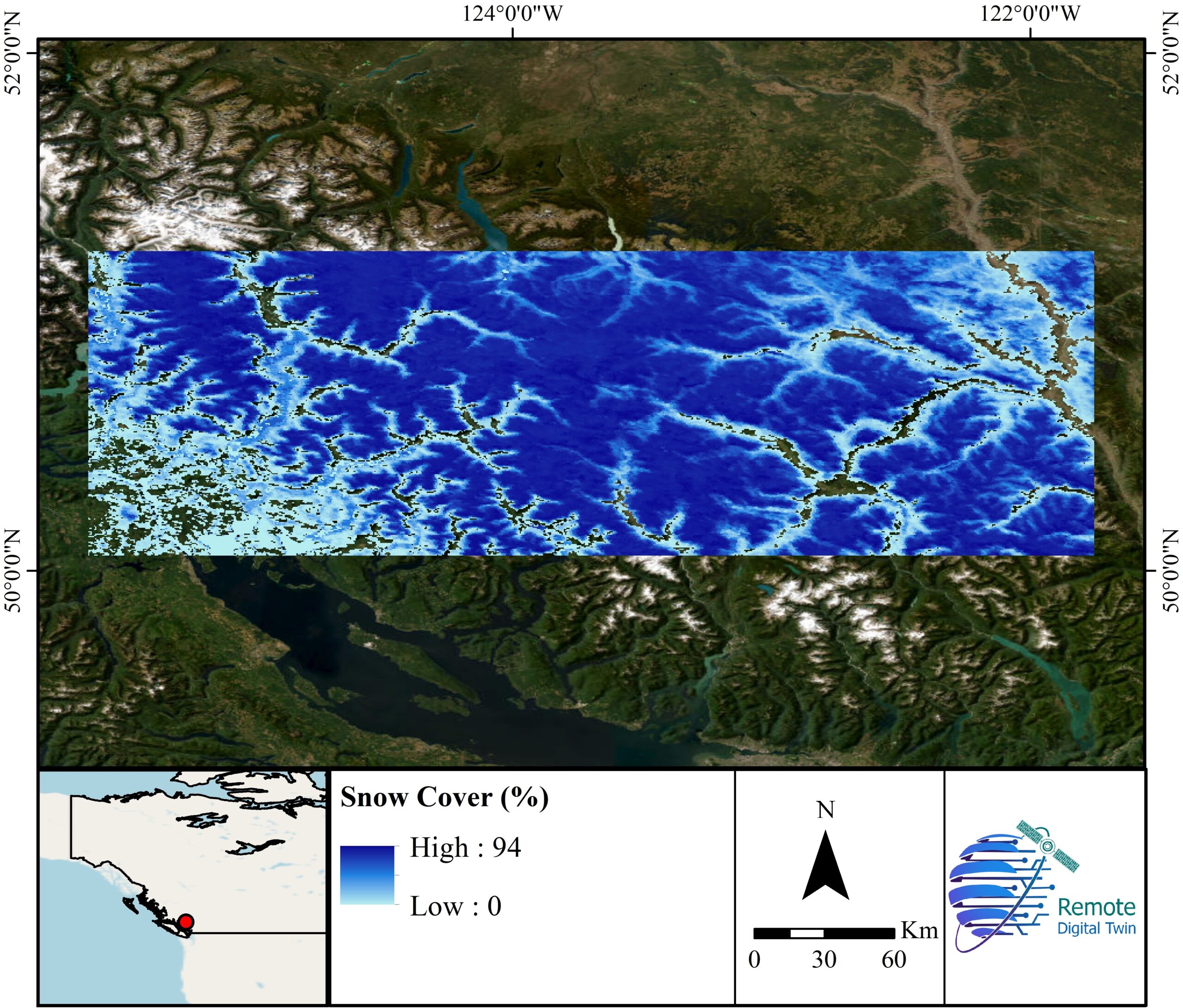
Snow Cover