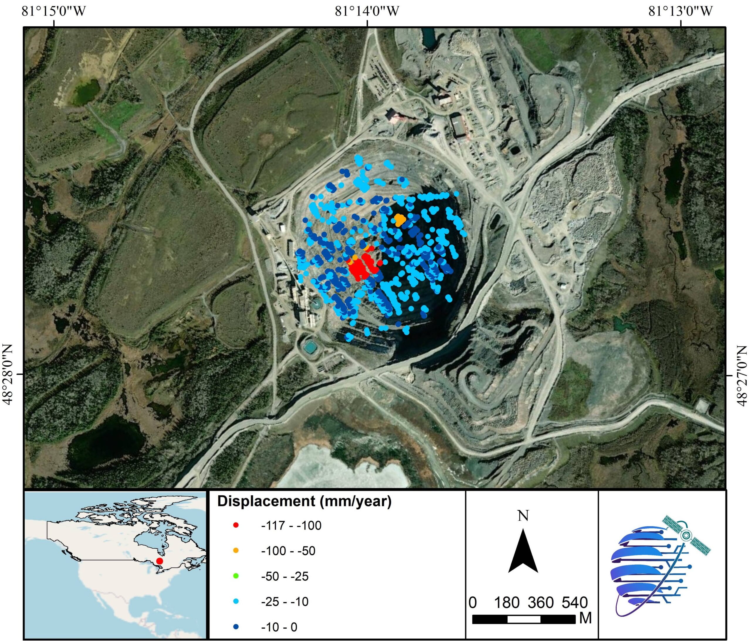
Mine Stability
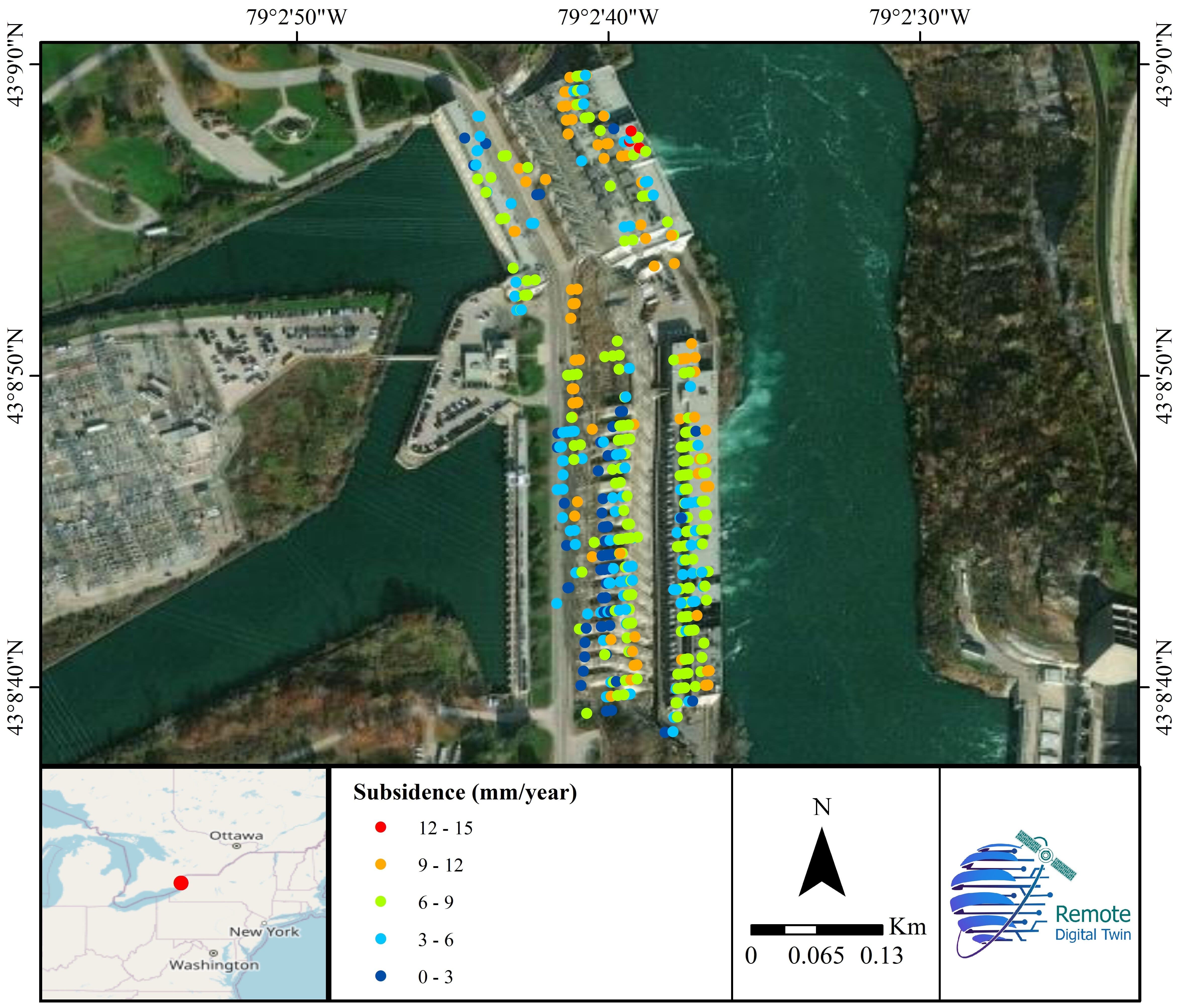
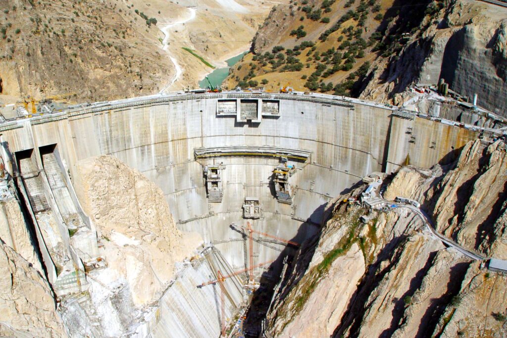
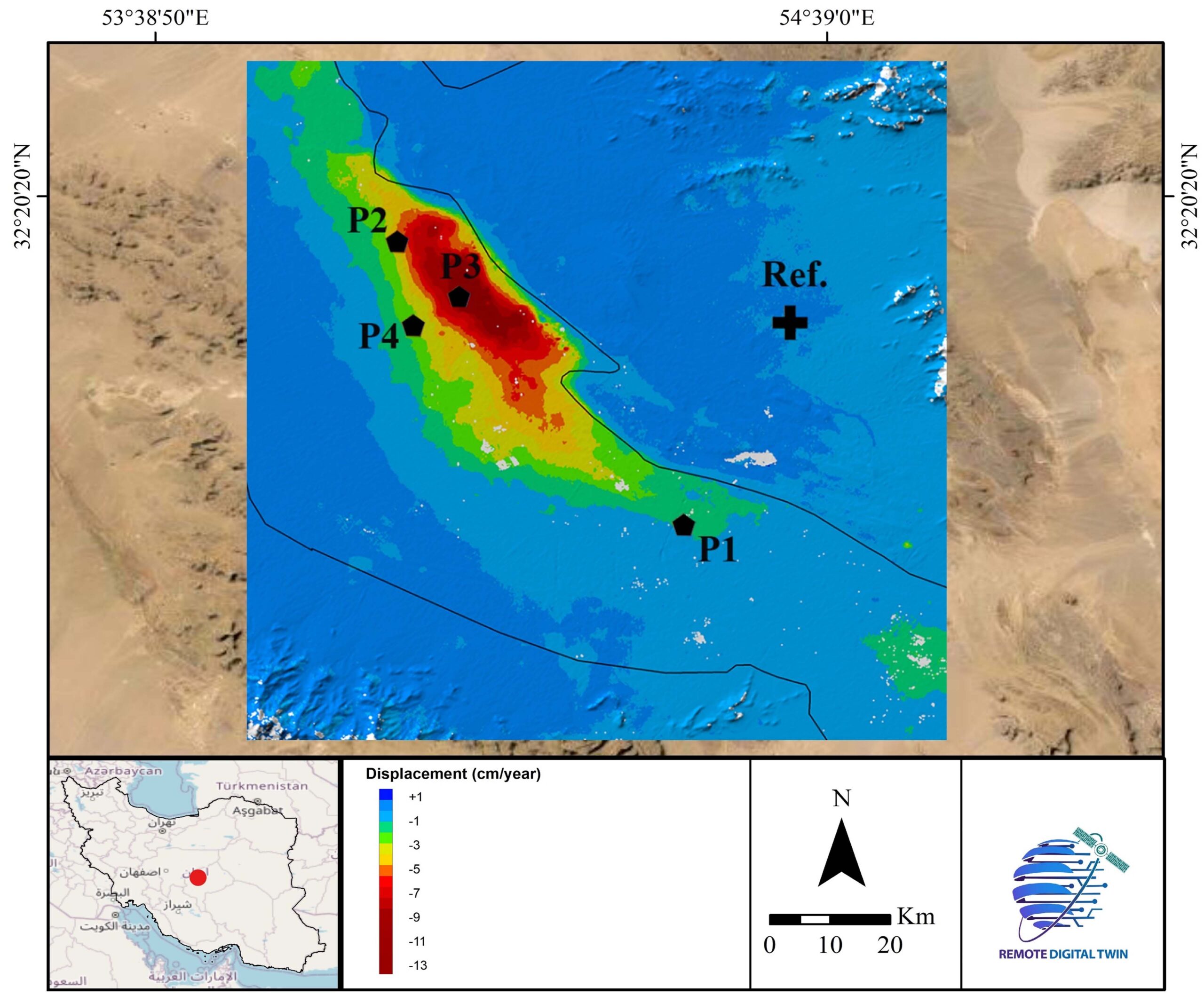
Dam Deformation

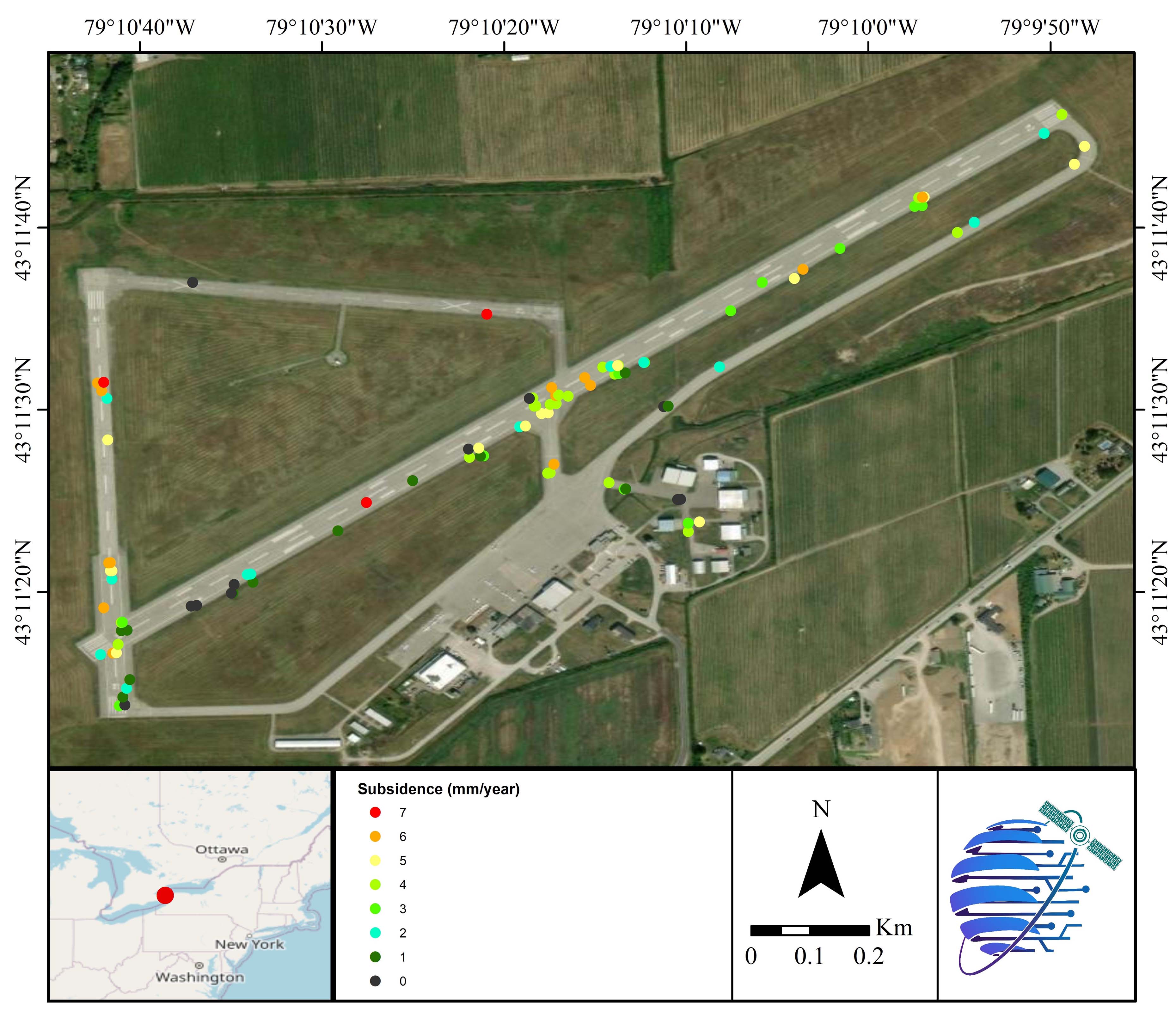
Airport Displacement
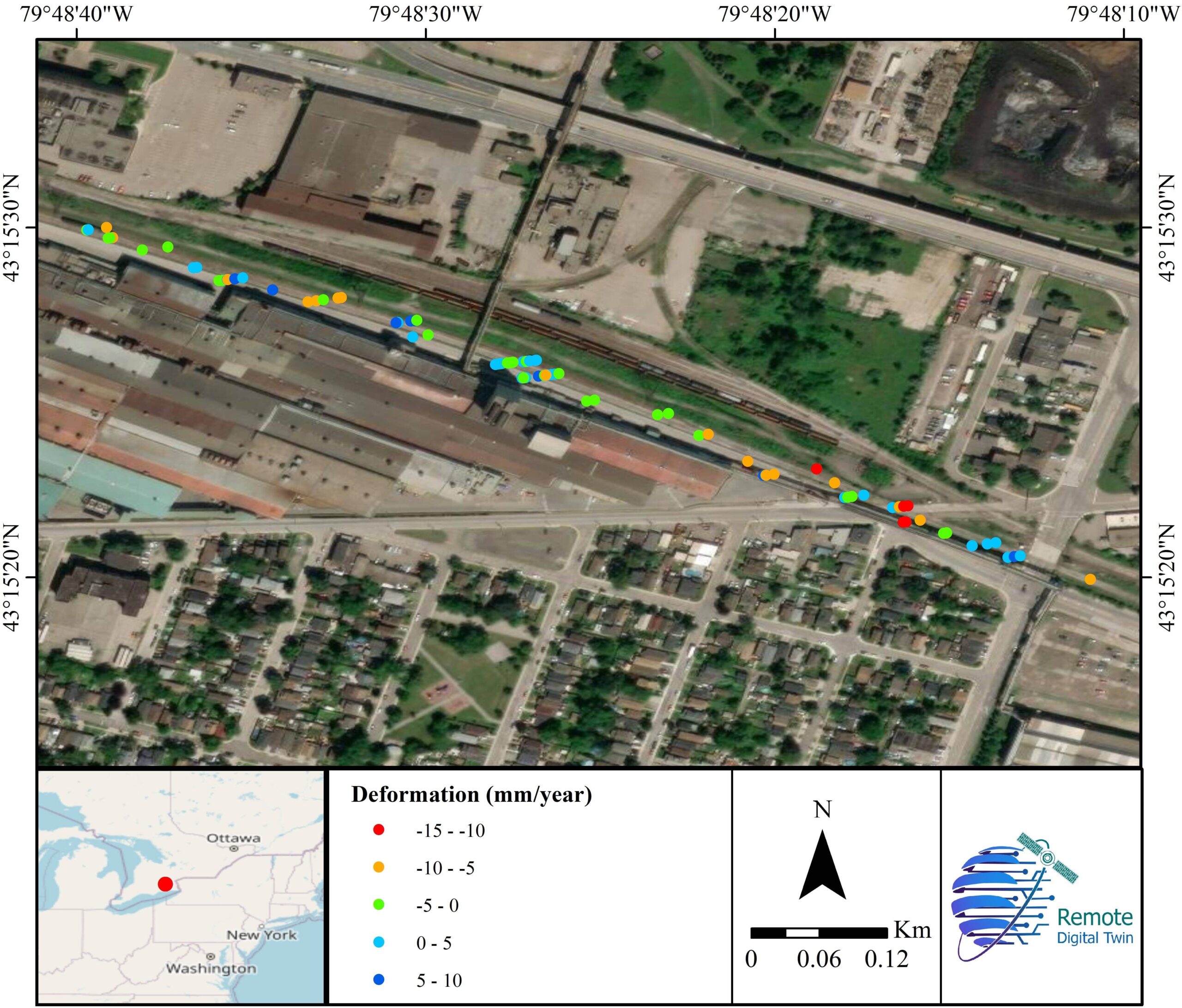
Railway Displacement
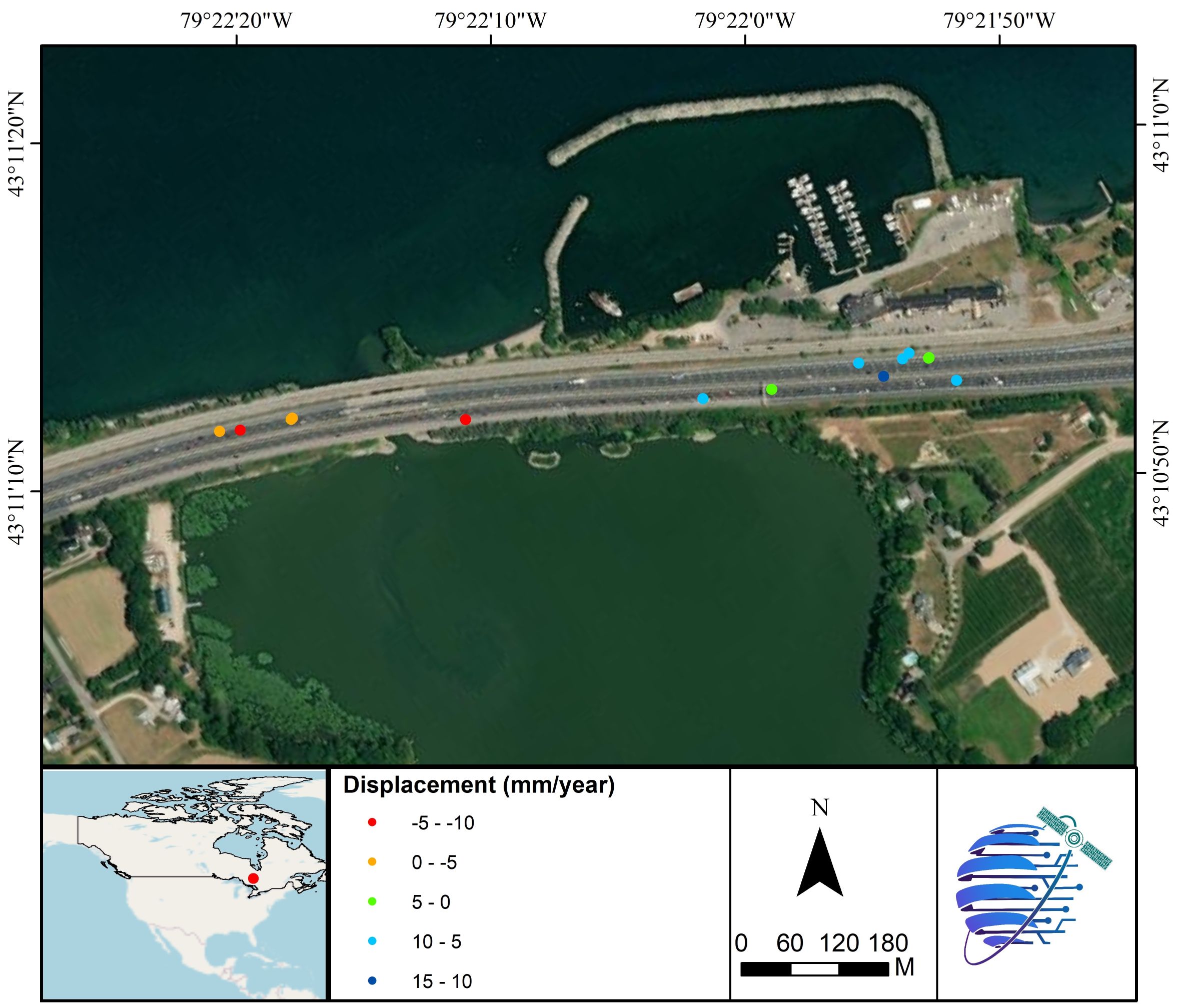
Highway Displacement
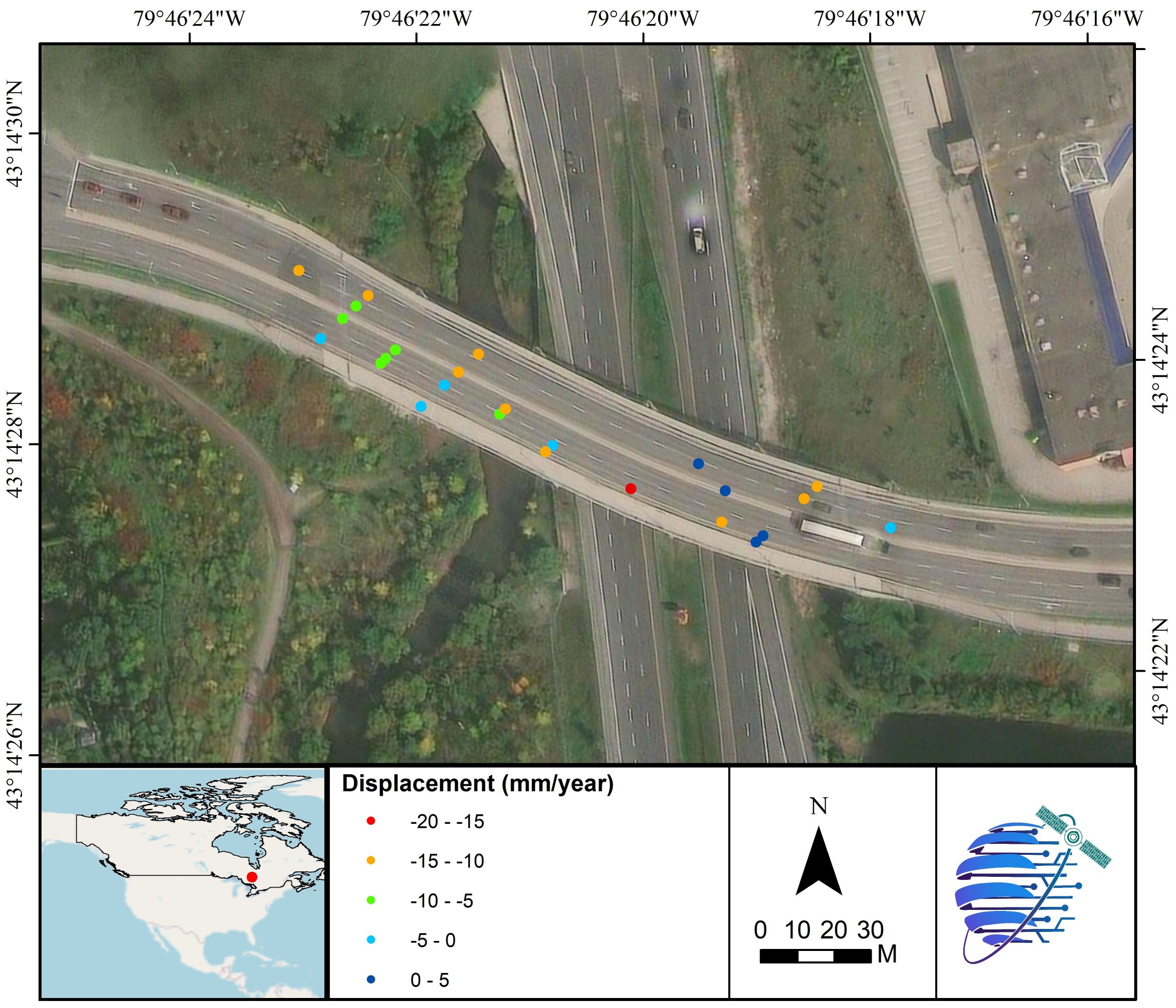
Bridge Displacement
Land Displacement
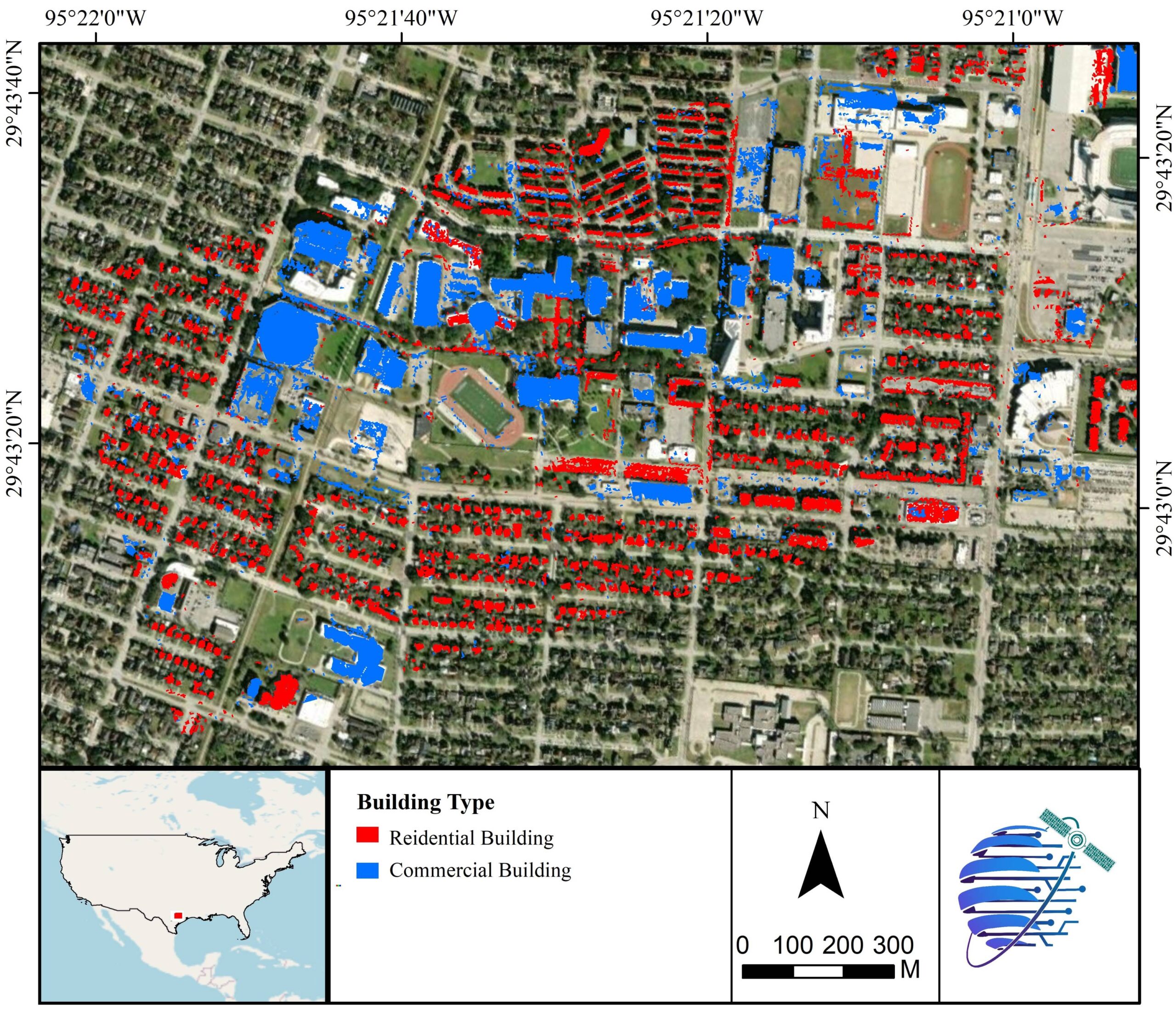
Building Type
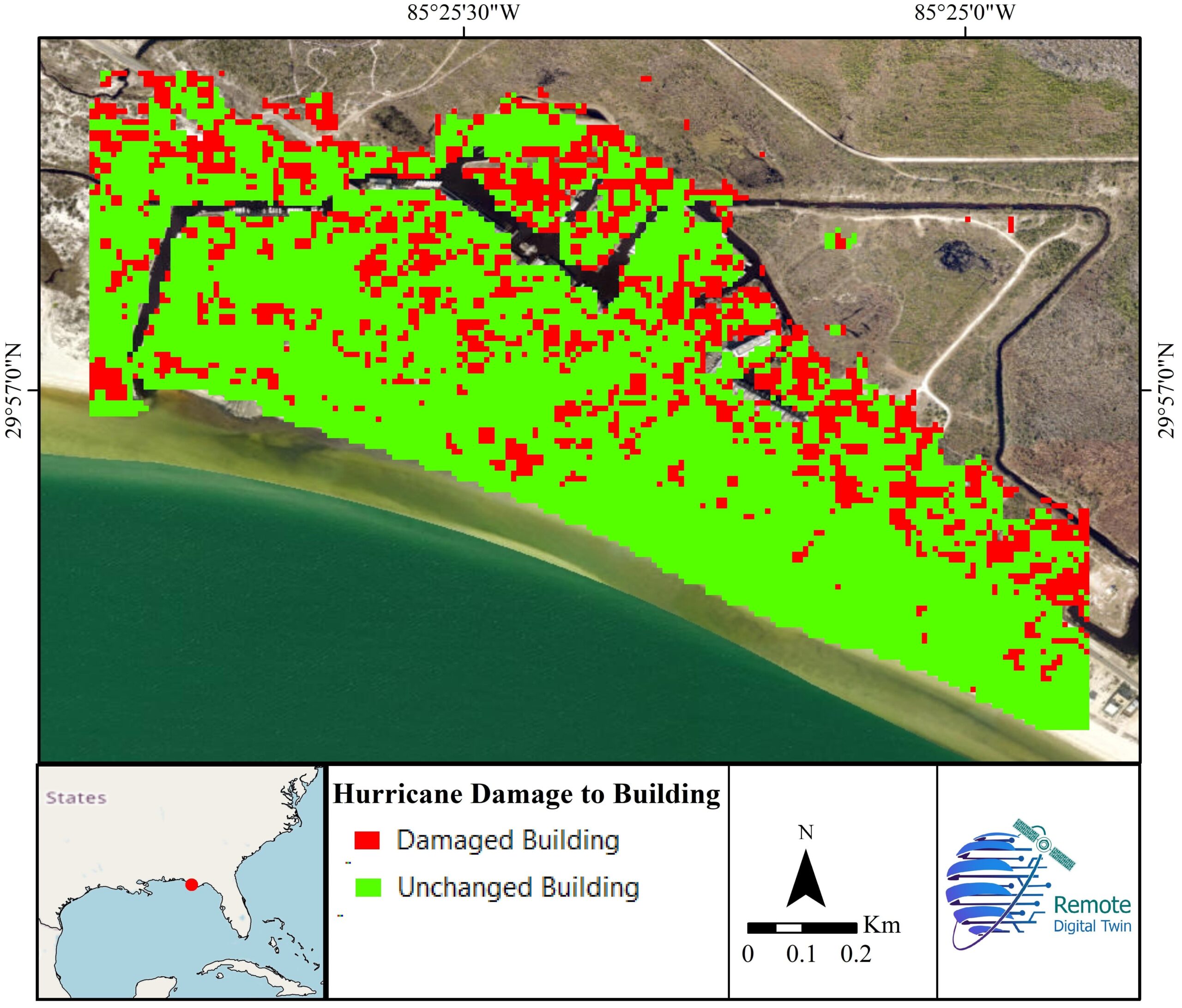
Building Damage

Land Use / Land Cover Type
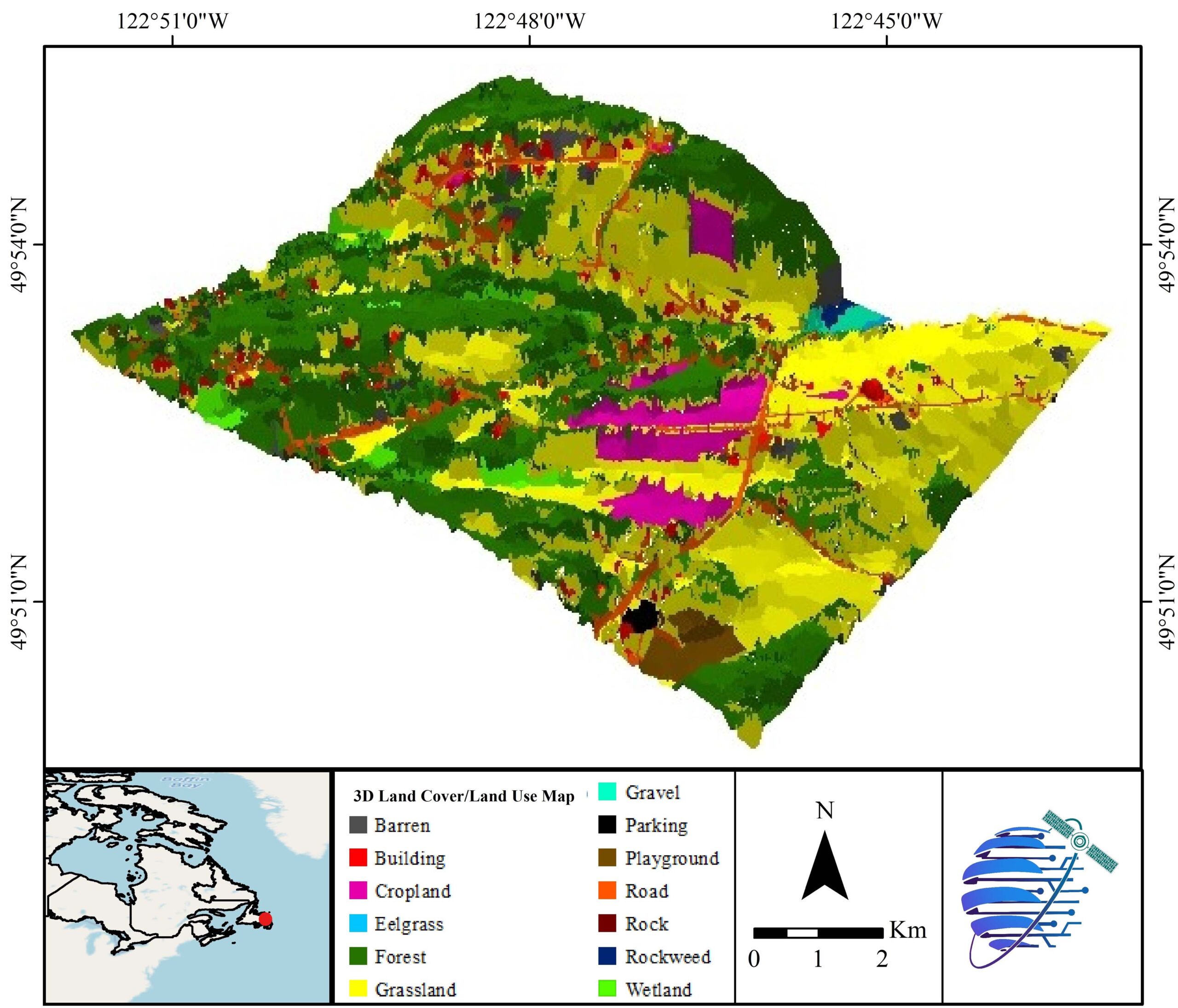
3D Land Use / Land Cover Map
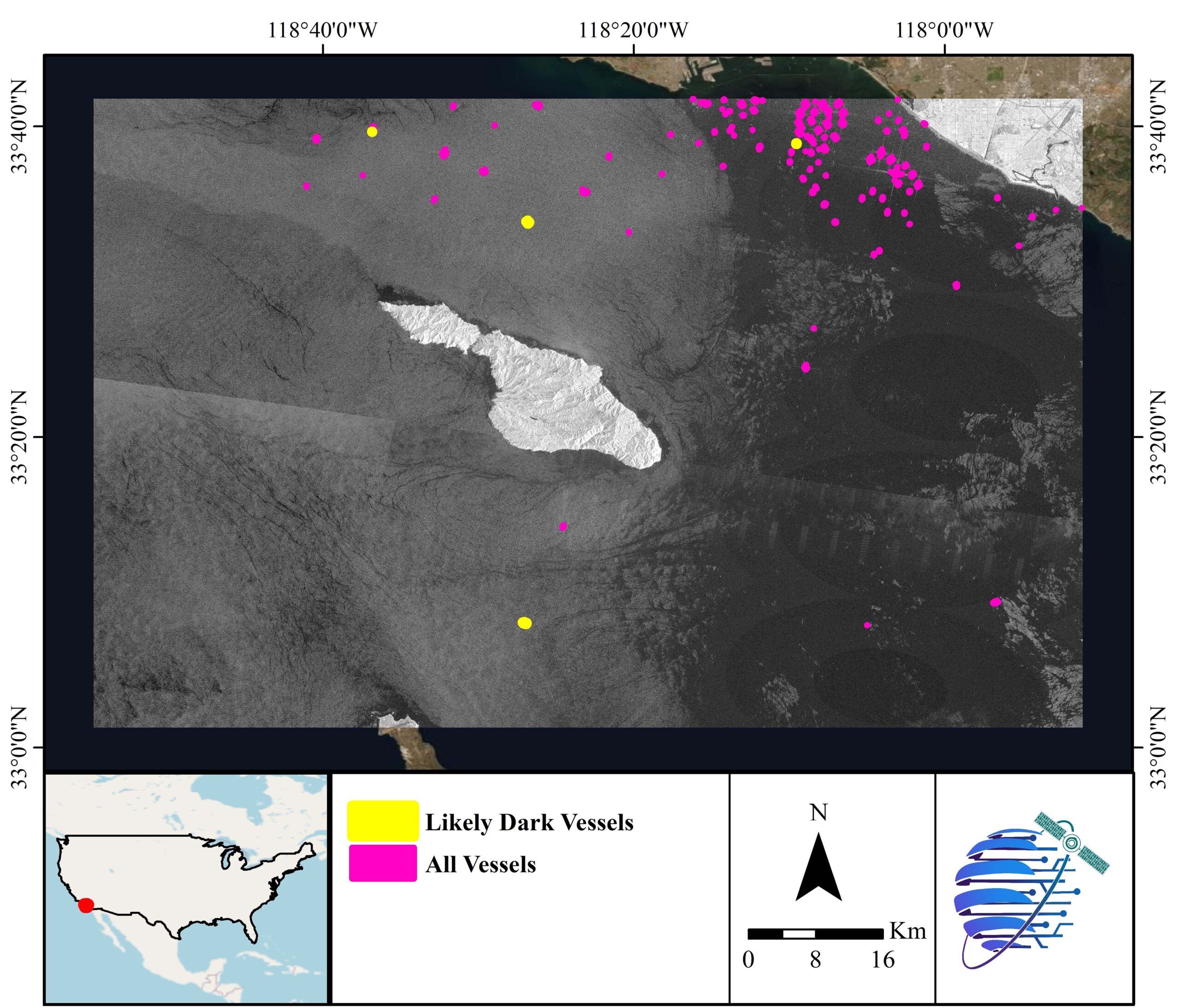
Dark Vessels
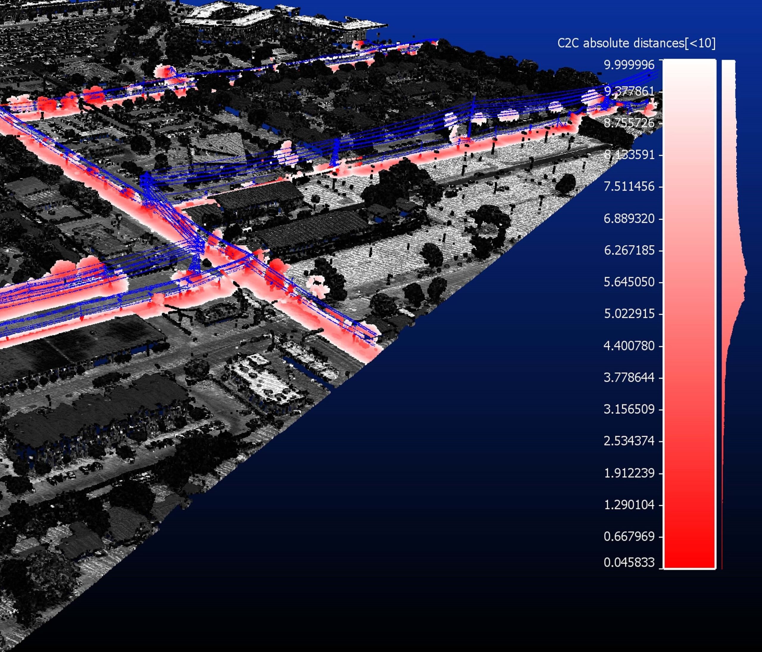
Power & Transmission Lines
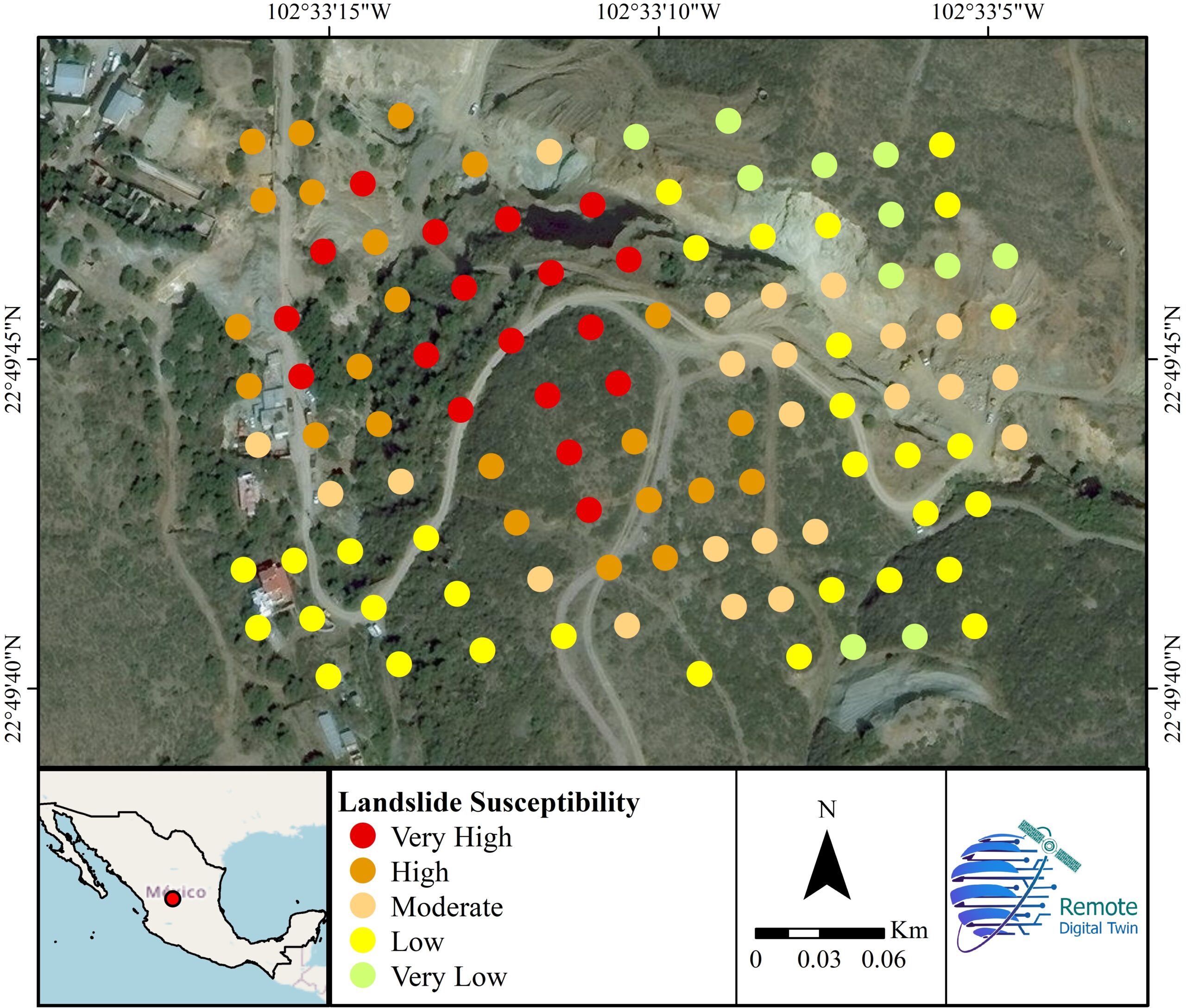
Landslide
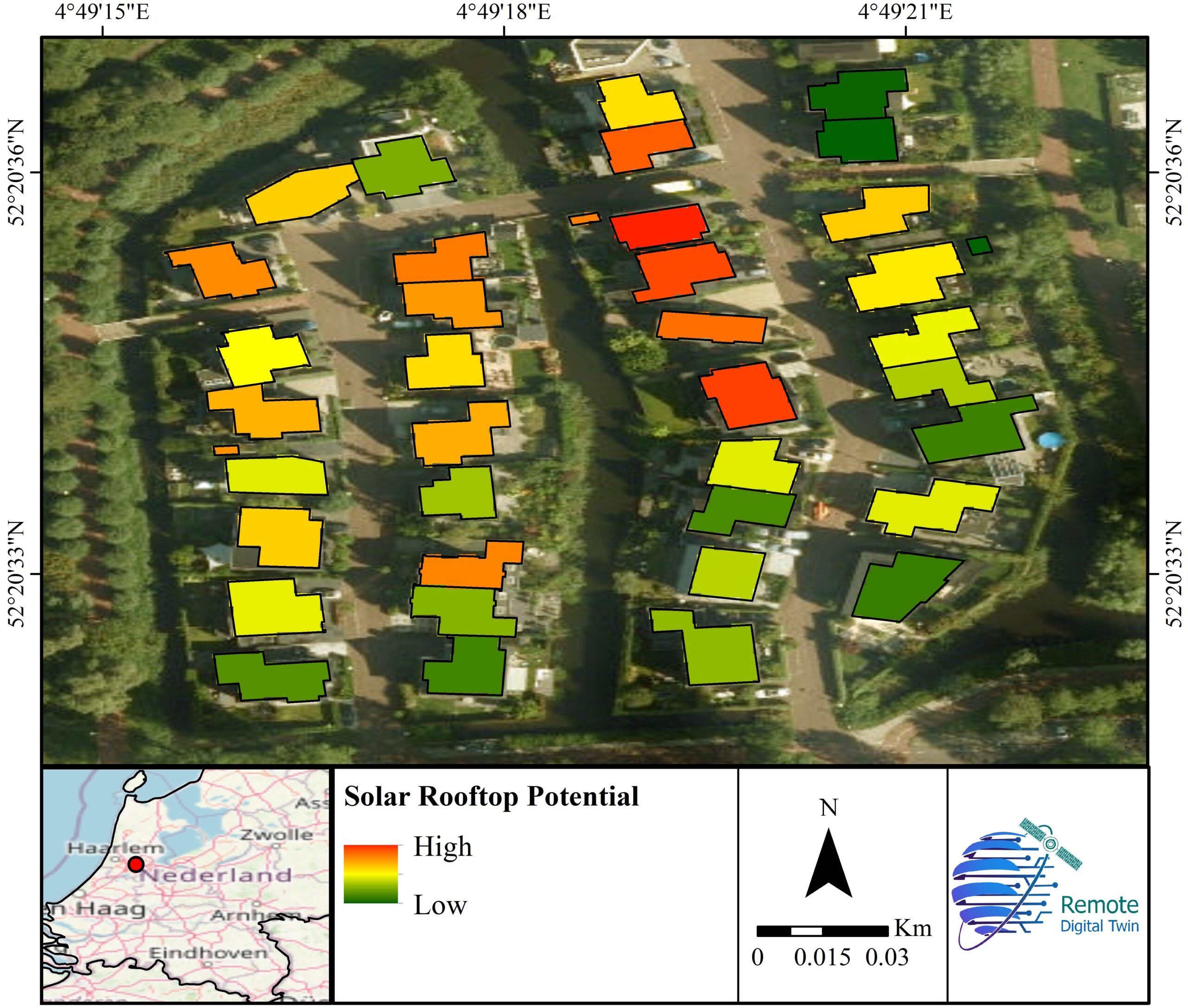
Solar Rooftop Potential
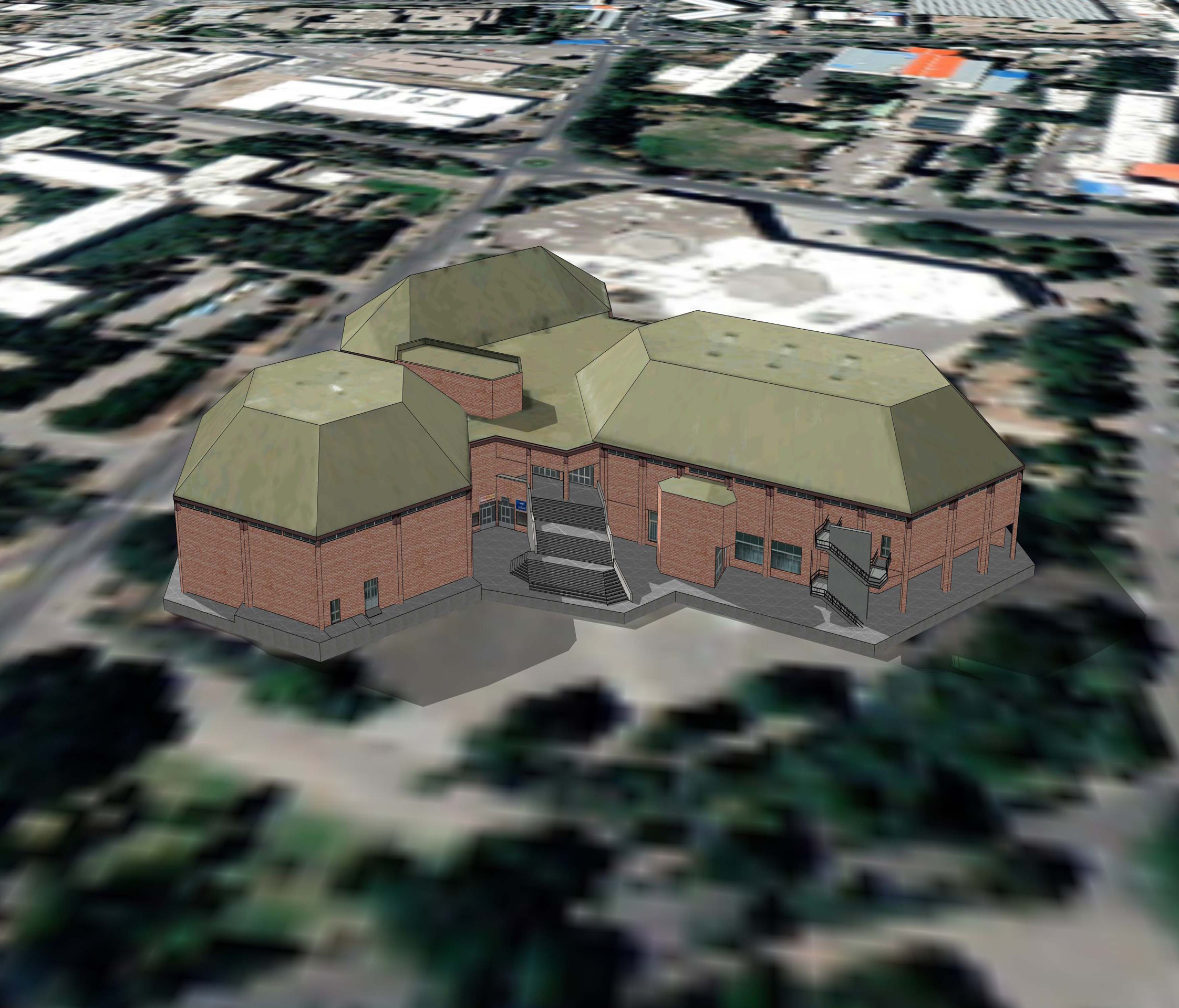
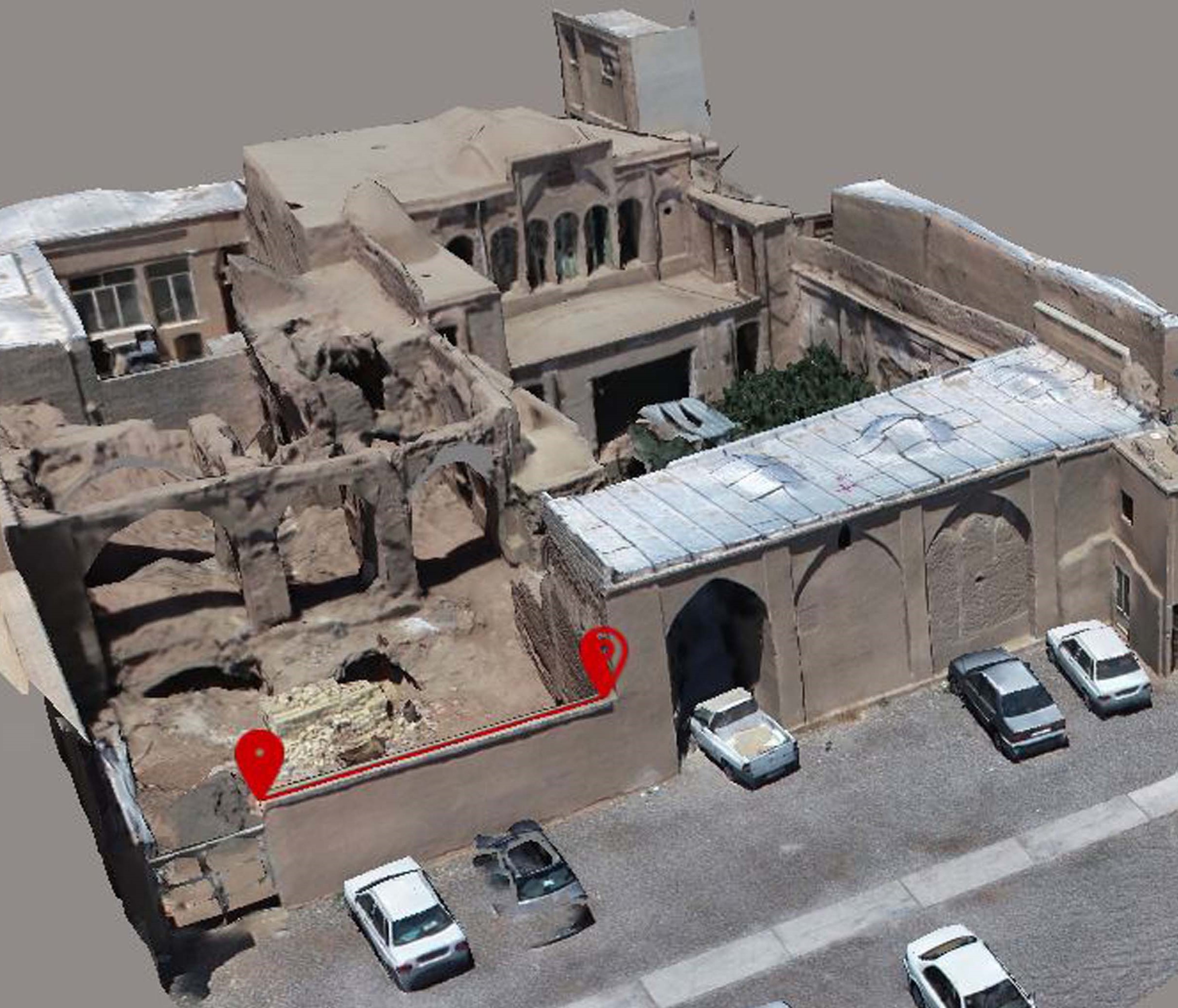
3D Model 1
3D Model 2
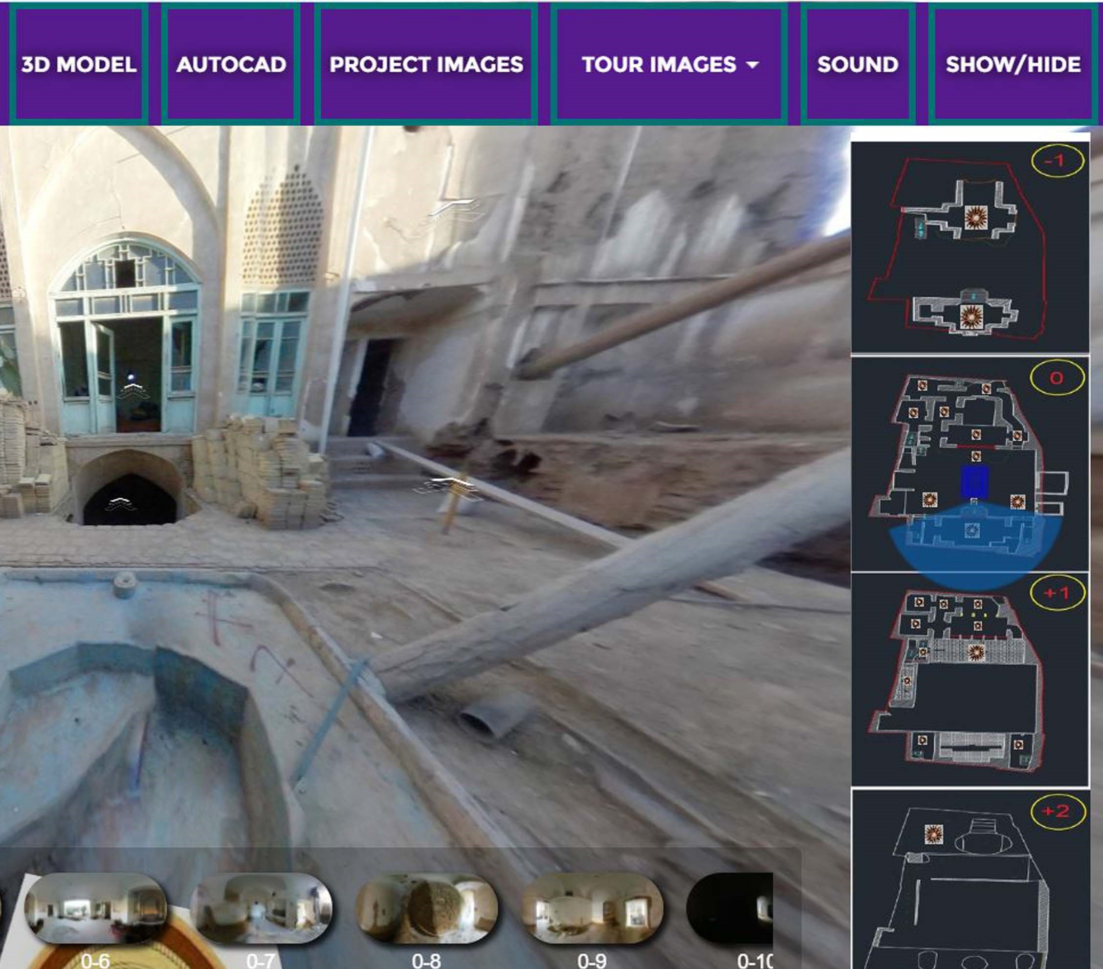
Virtual Tour