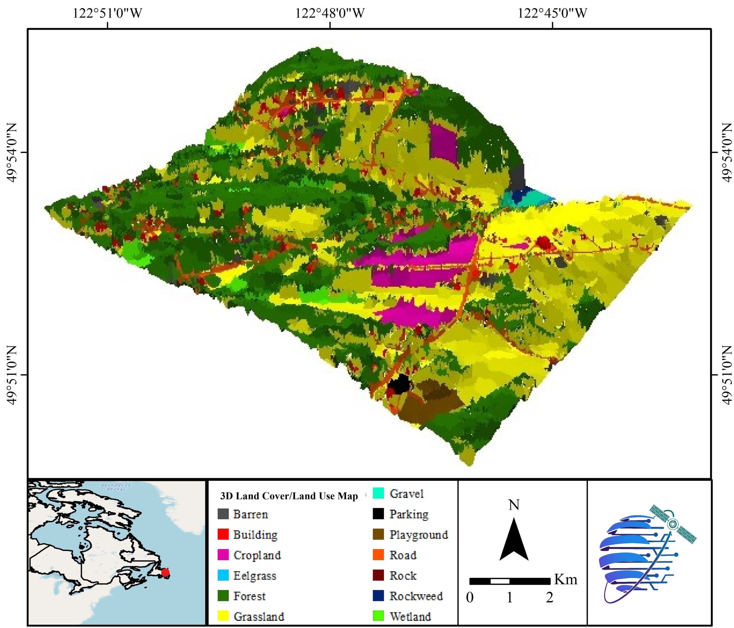
3D Land Use / Land Cover Map
Transmission Lines
Land Surface Temperature
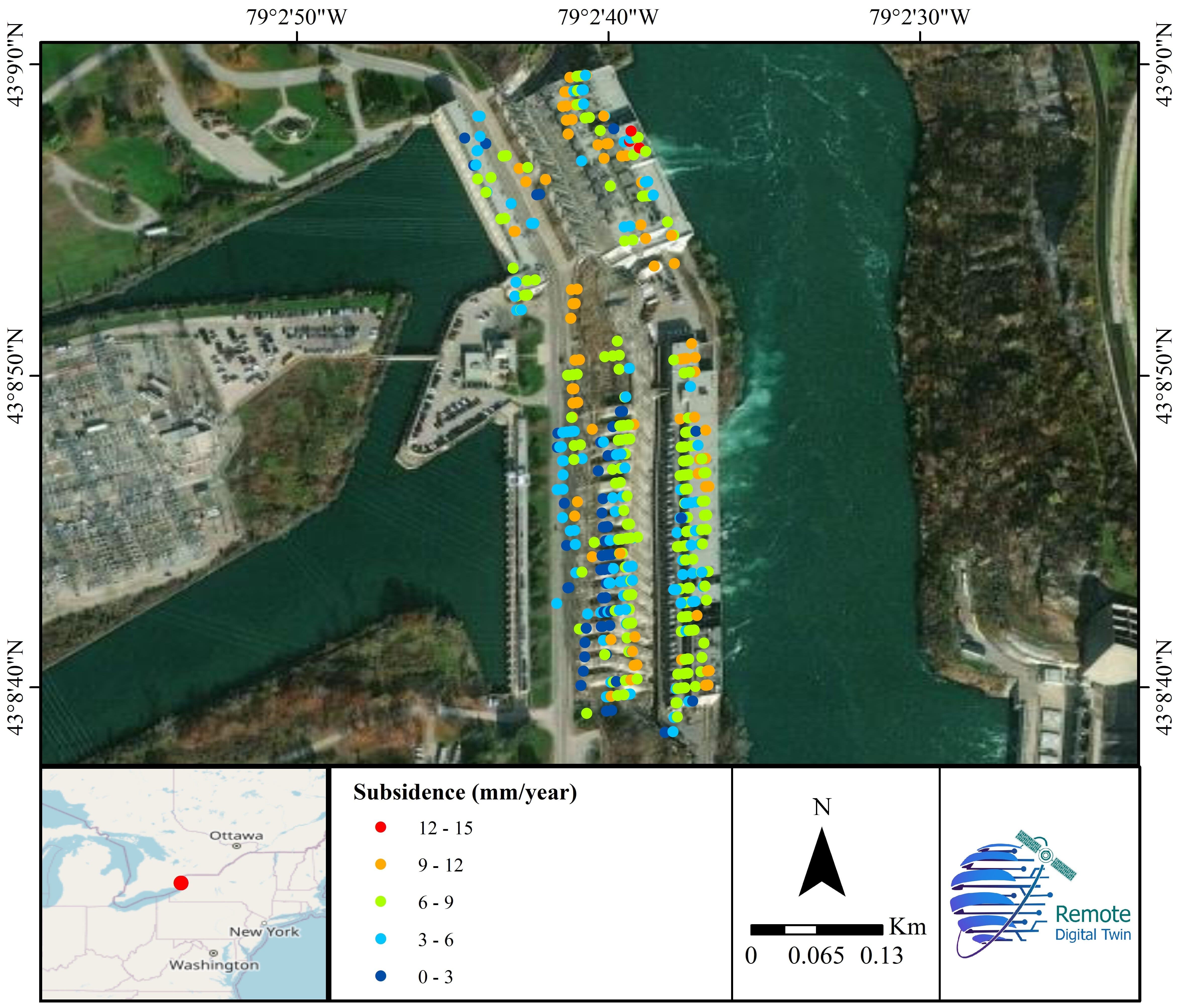
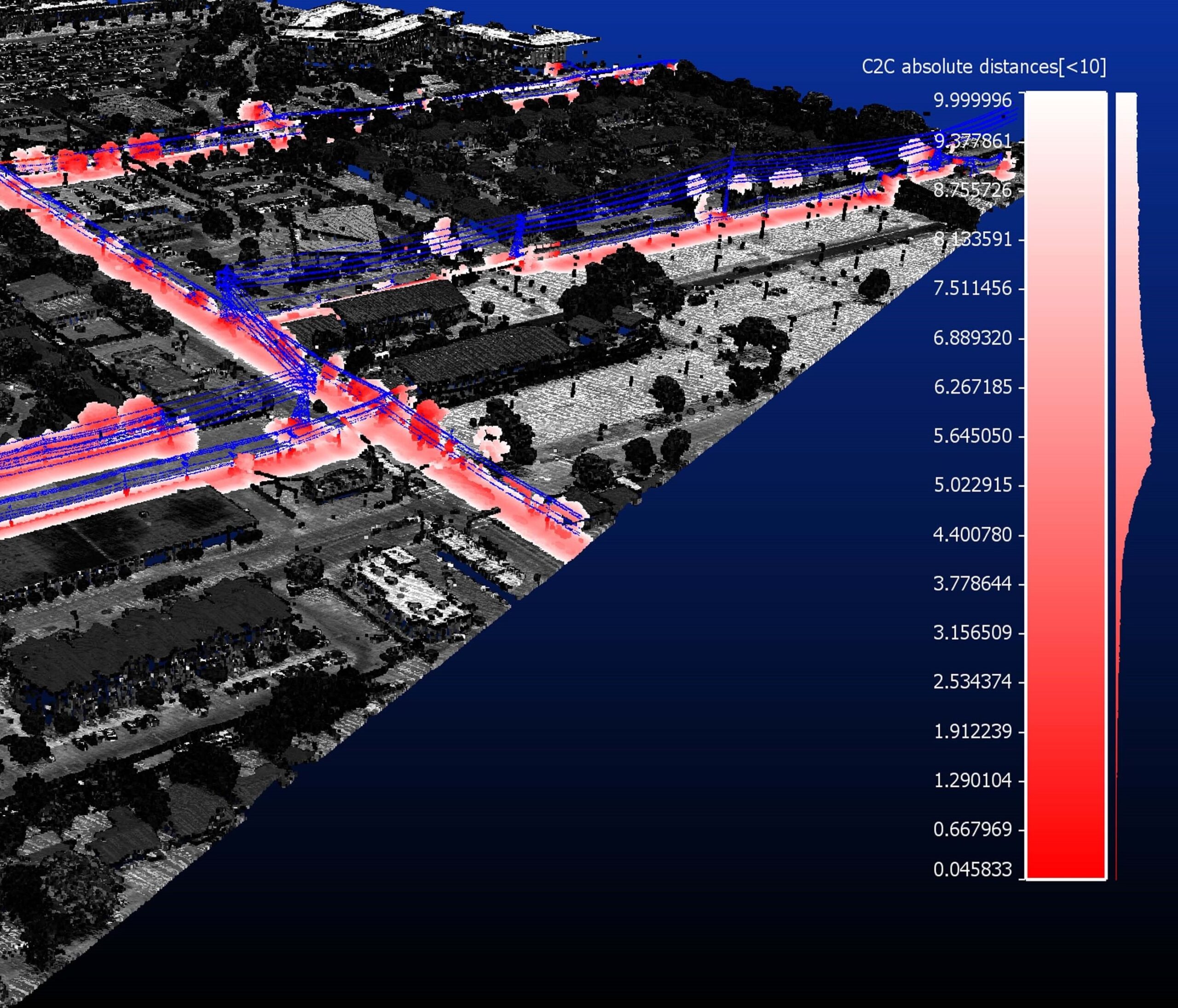
Dam Deformation
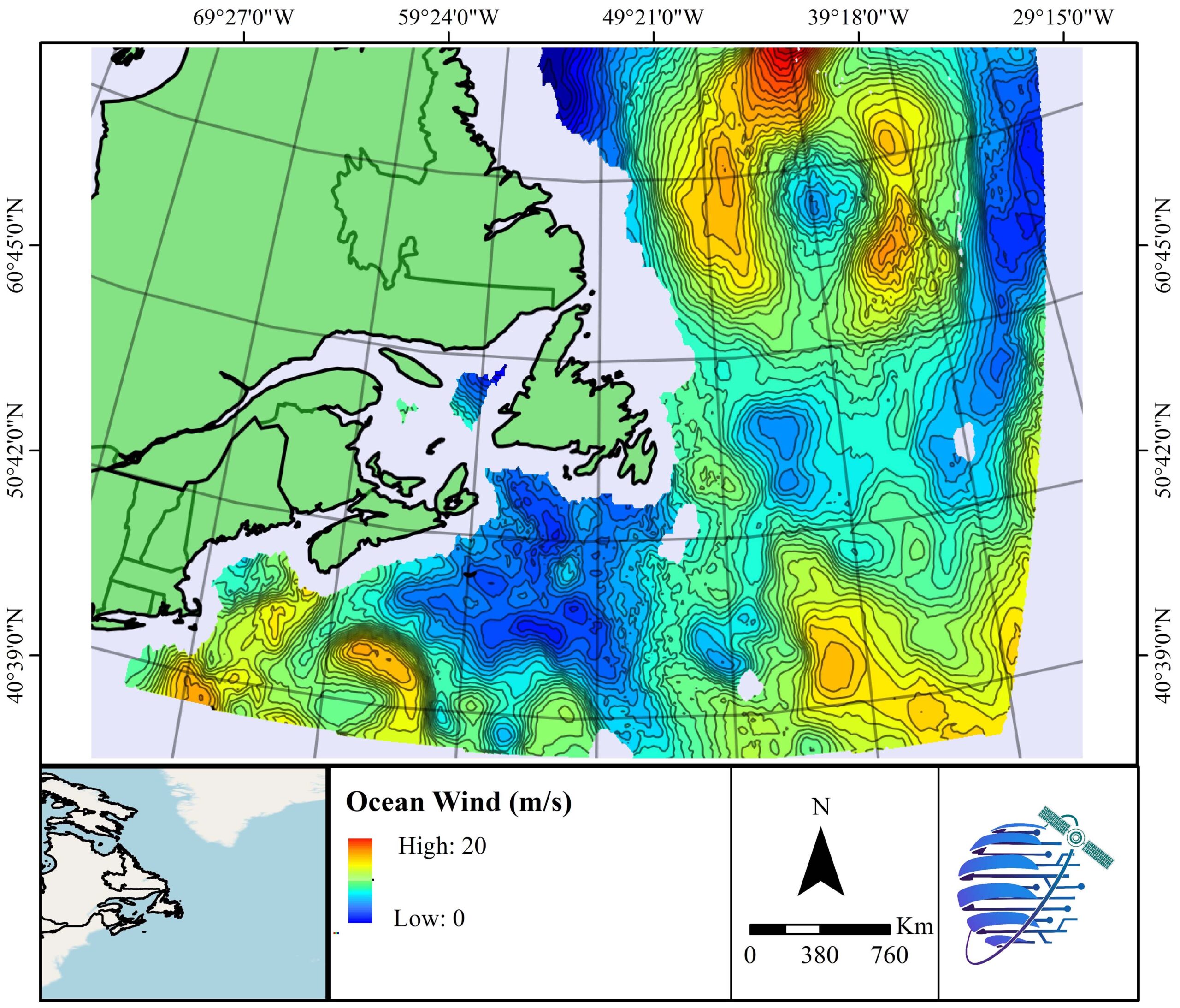
Ocean Wind
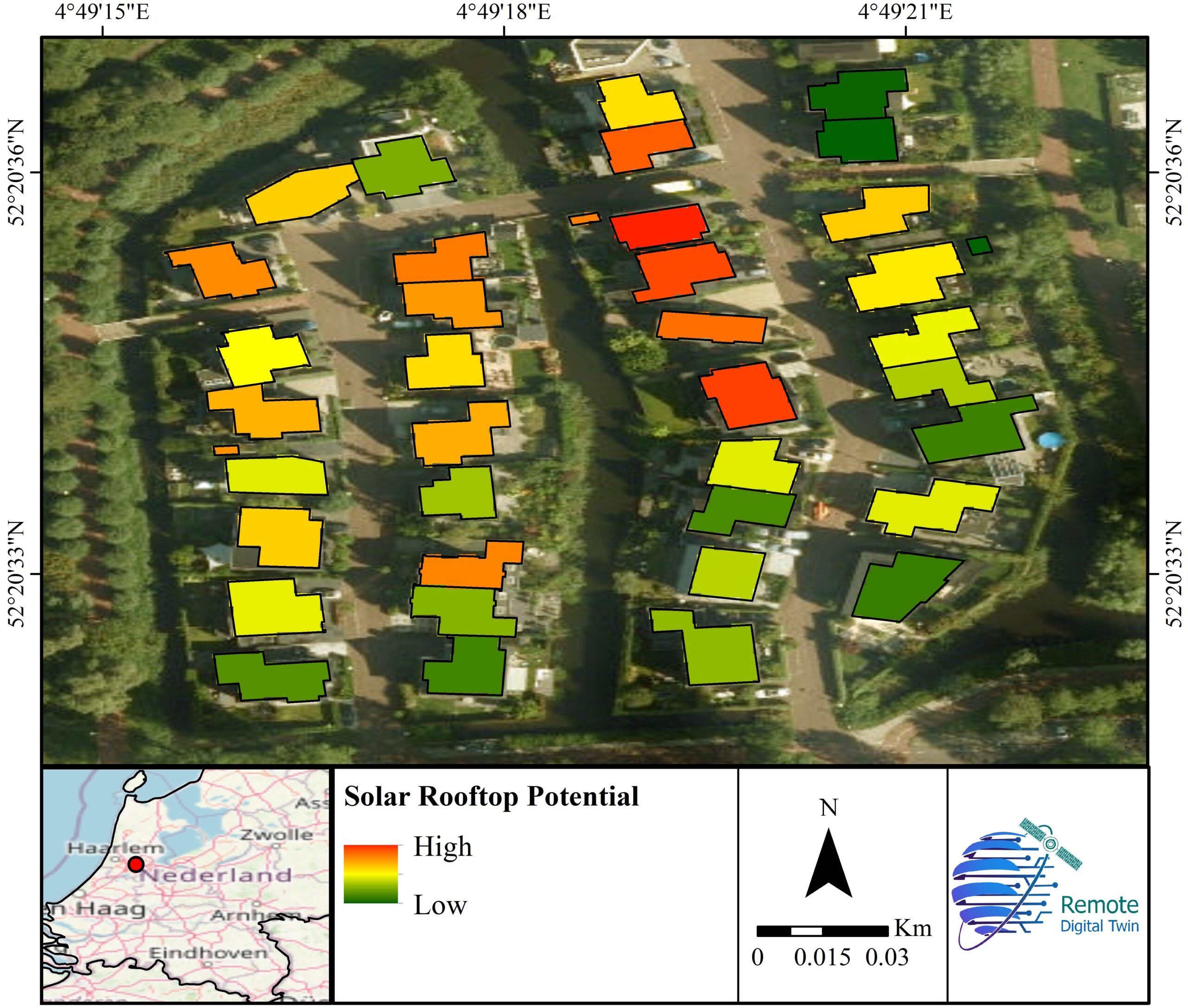
Solar Rooftop Potential
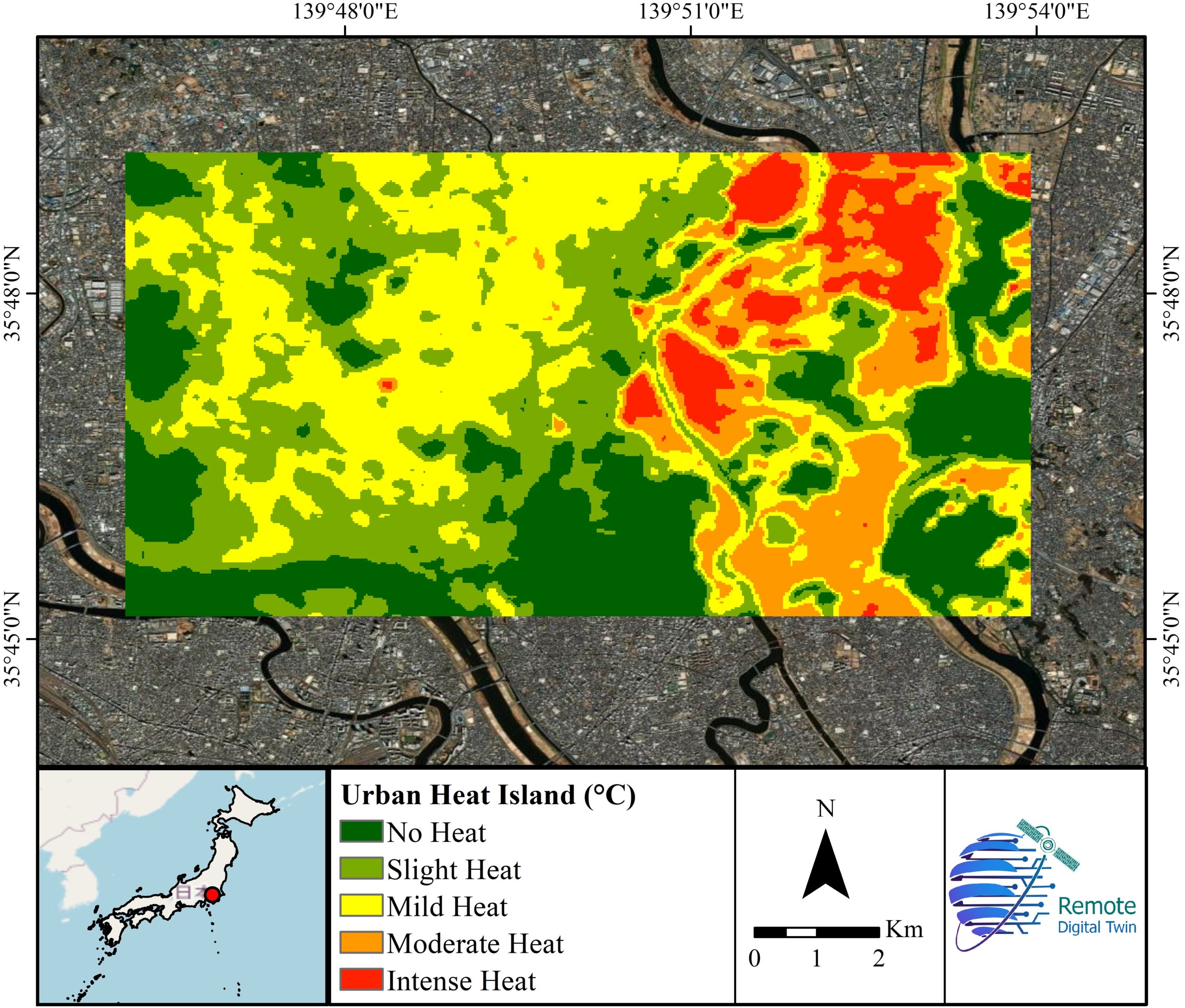
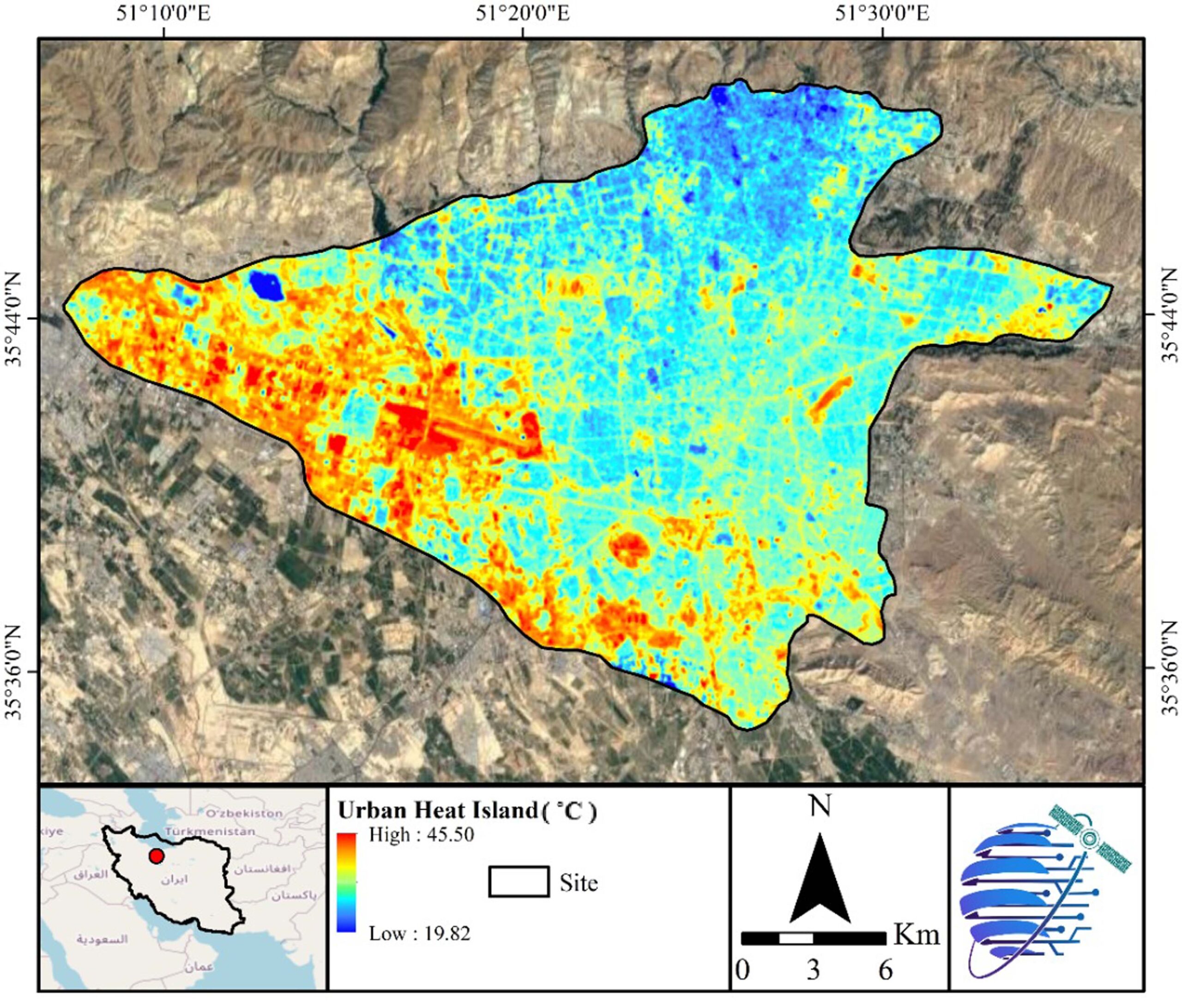
Urban Heat Island