


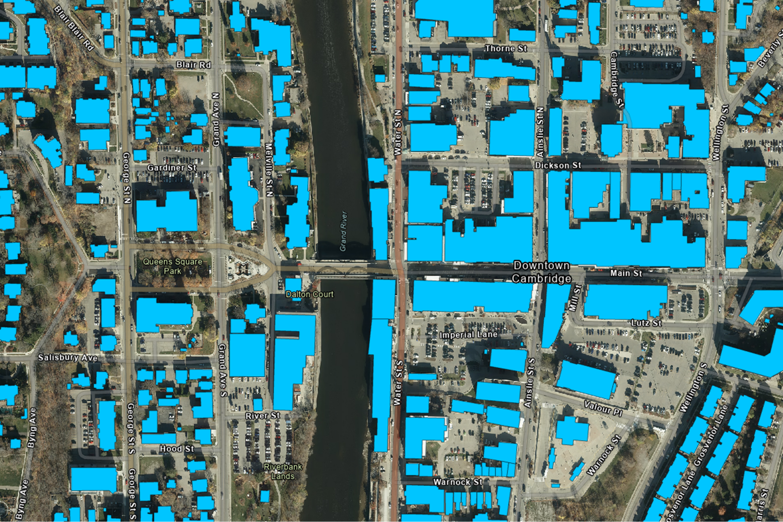
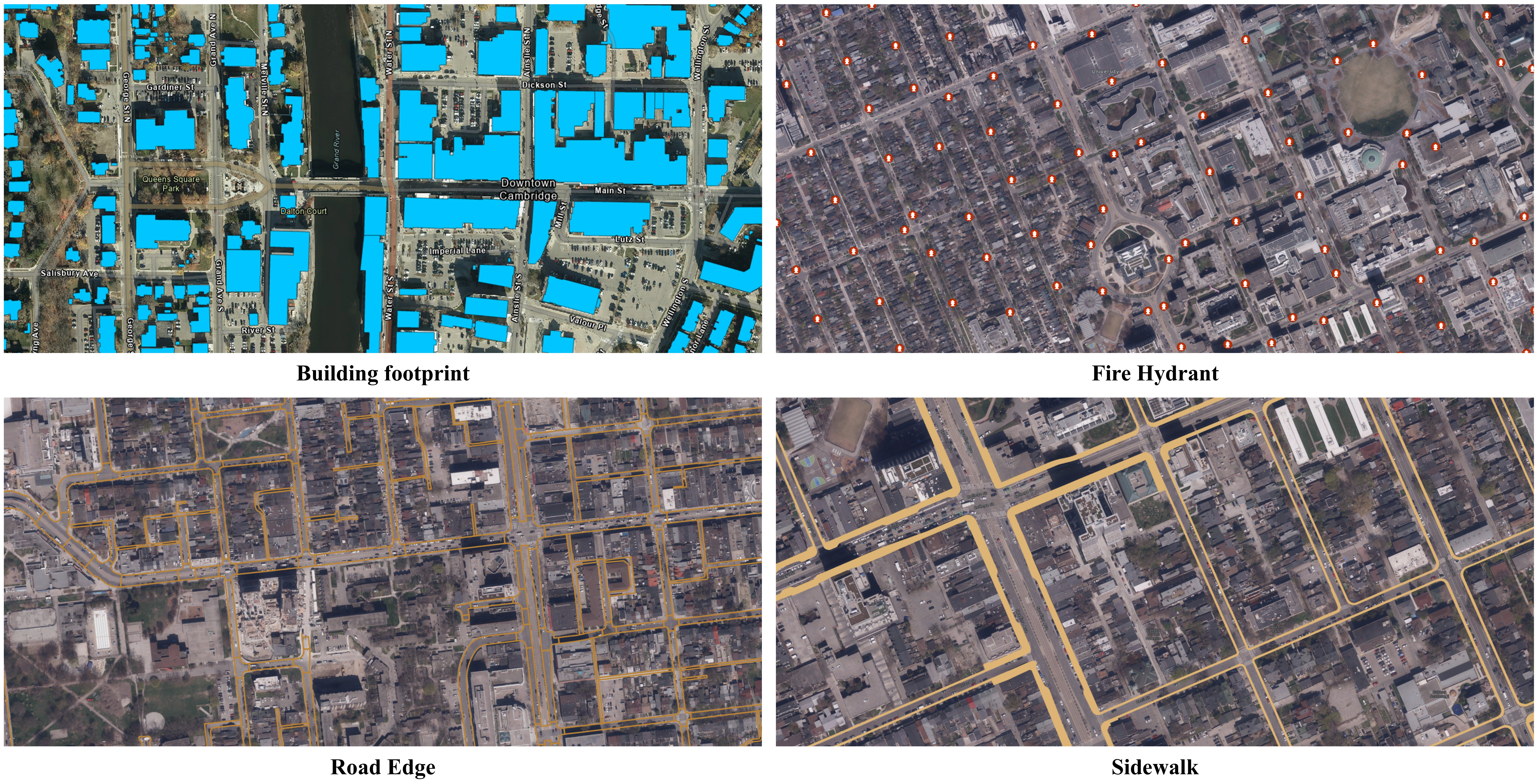
Building Footprint
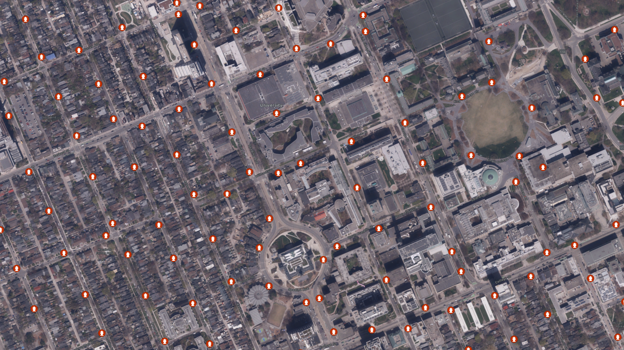
Fire Hydrants
Powerline Poles
Road Edges
Sidewalks
Trees

Ultra-high accuracy and consistency

Customized outputs tailored to your project

Scalable solutions for small or large areas

Up-to-date data that evolves with your needs
Challenges:
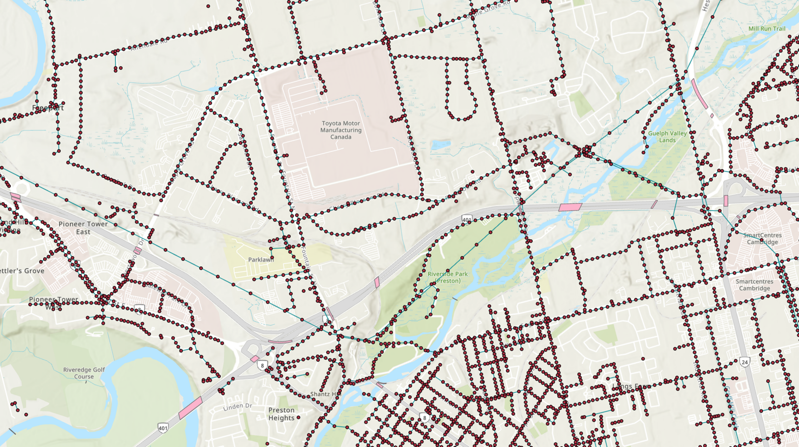
Producing accurate, city-scale HD mapping datasets from very-high-resolution aerial imagery, while ensuring high positional accuracy (over 95%).
Solutions:
Delivered a scalable, AI-driven HD mapping workflow to extract and generate detailed 2D urban features from high-resolution imagery and geospatial data, enabling precise and reliable city-scale mapping products.
Description of Services:
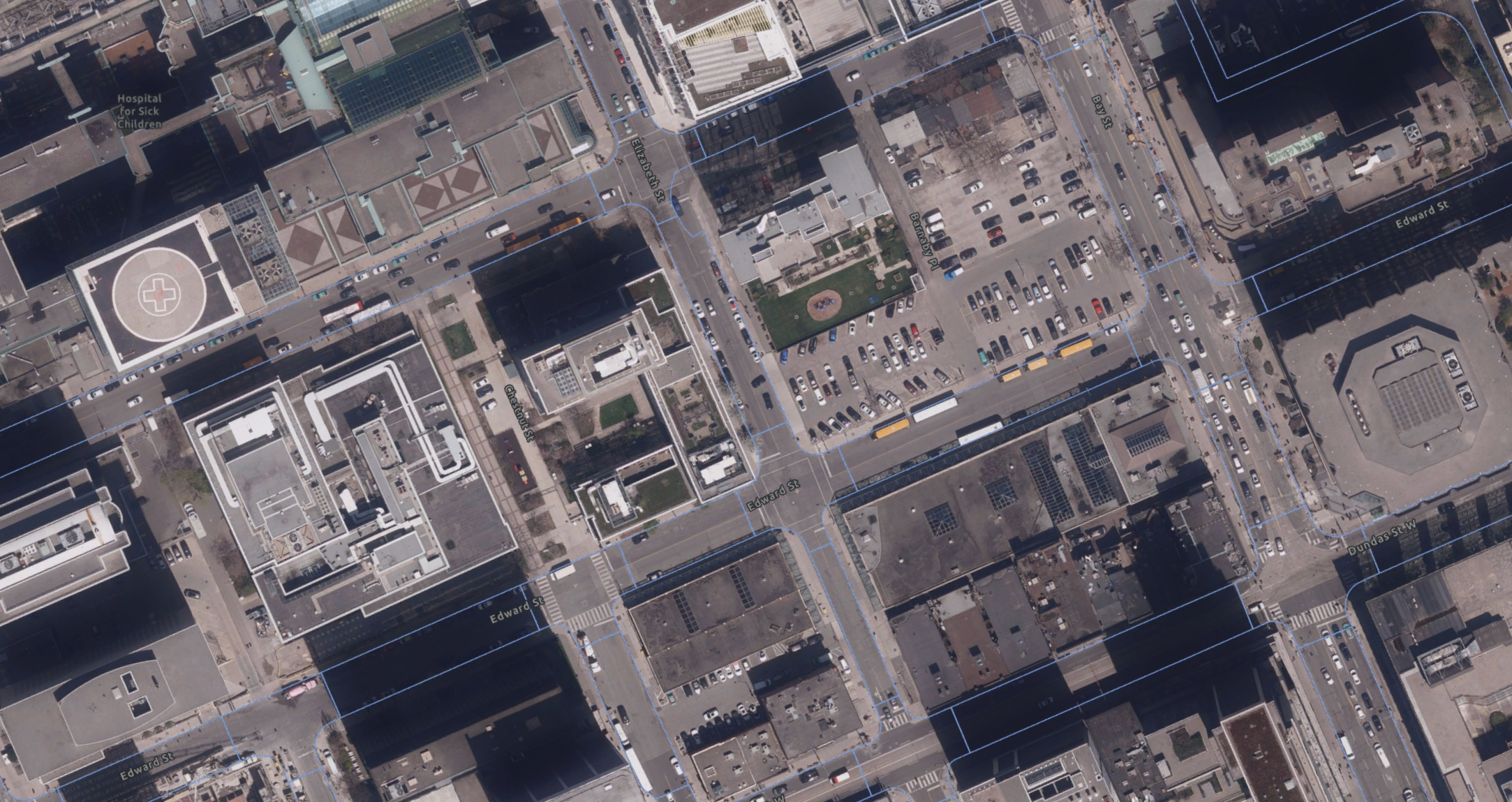
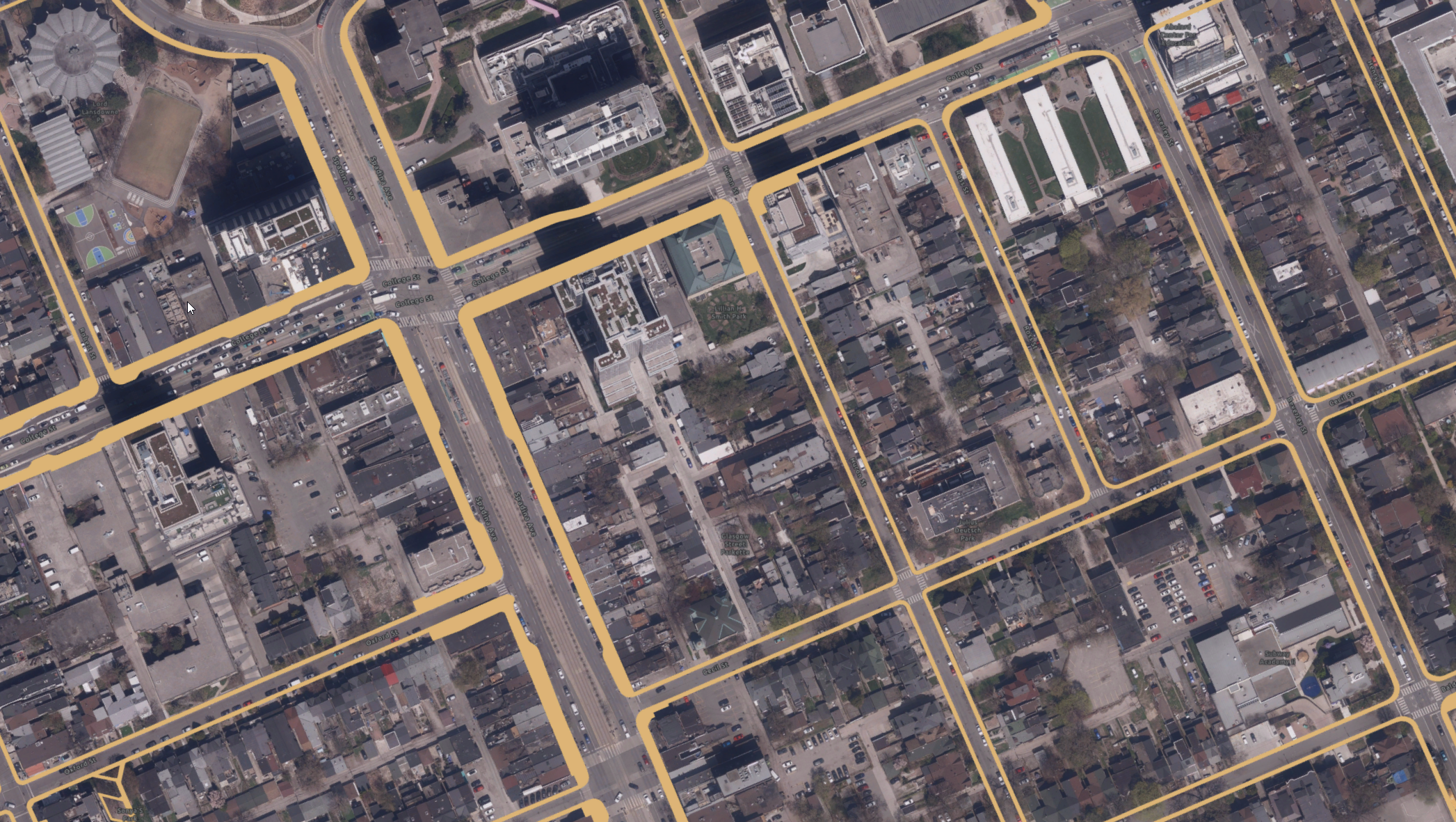
- AI-based HD mapping and extraction of detailed 2D urban features, including trees, power lines, fire hydrants, building footprints, road edges, parking lots, and sidewalks
- High-accuracy delineation and structuring of transportation and infrastructure elements for mapping-grade datasets
- Integration of aerial imagery and street-level data to improve feature completeness and positional accuracy
- Quality control and validation to ensure consistency, accuracy, and usability of HD mapping outputs
- Delivery of structured, ready-to-use geospatial datasets compatible with GIS, asset management, and smart city applications
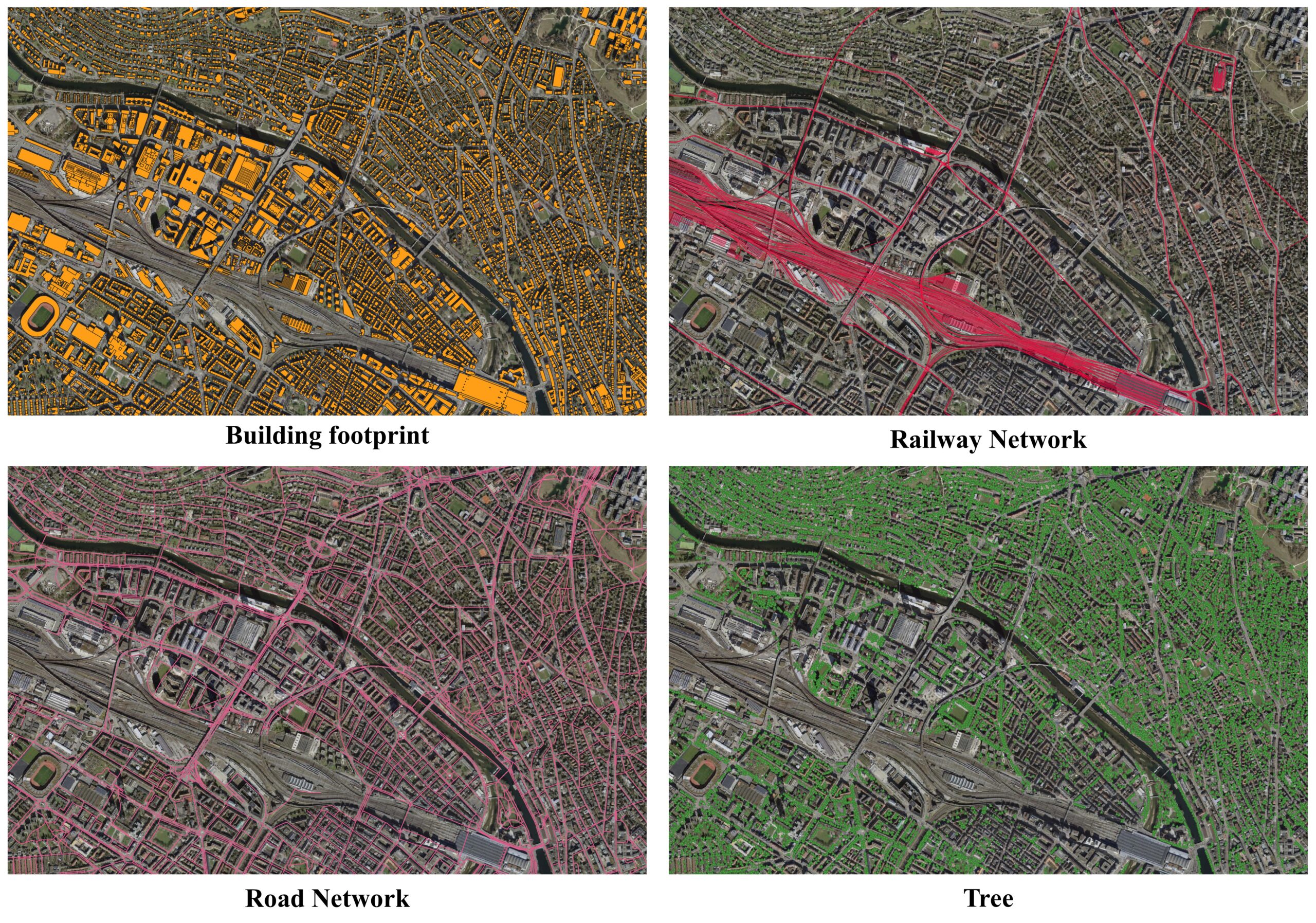
Challenges:
Generating high-accuracy, city-wide HD mapping datasets from very-high-resolution aerial imagery, while consistently achieving mapping-grade positional accuracy (above 95%) across dense and complex urban environments.
Solutions:
Implemented a scalable, AI-enabled HD mapping workflow that integrates aerial and street-level data to efficiently extract and structure detailed 2D urban features.
Description of Services:
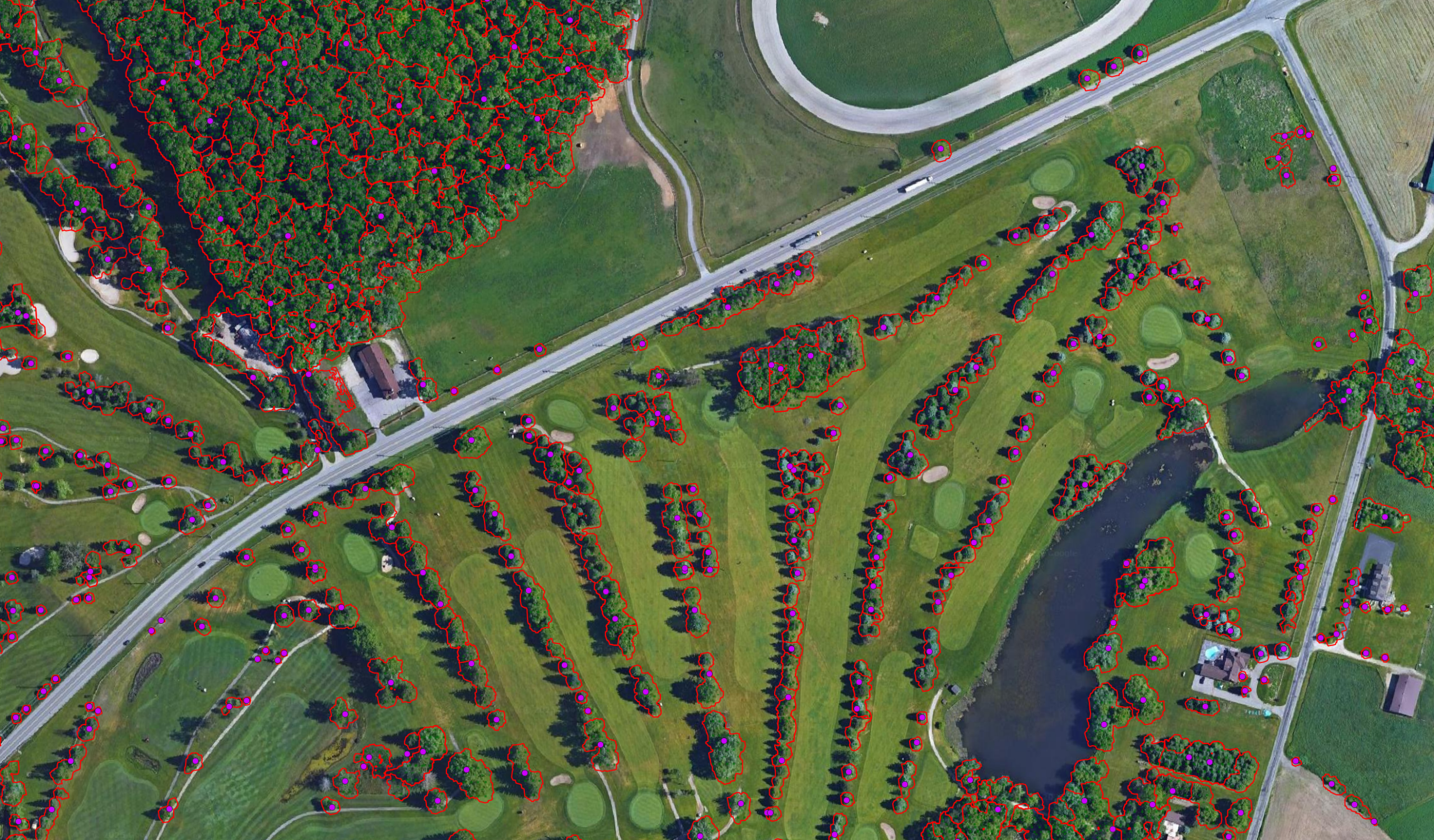
- AI-driven extraction of high-precision 2D urban features including trees, building footprints, road and railway netwroks
- Accurate delineation and structuring of transportation networks and infrastructure elements using multi-source data fusion (aerial and street-level imagery)
- Generation of HD road network models in OpenDRIVE format, capturing road geometry, lane configurations, and traffic rules for autonomous driving, simulation, and ITS applications
- Quality control and validation workflows to ensure high accuracy, consistency, and usability of all mapping outputs
- Delivery of structured, mapping-grade datasets compatible with GIS platforms, digital twins, asset management systems, and mobility applications