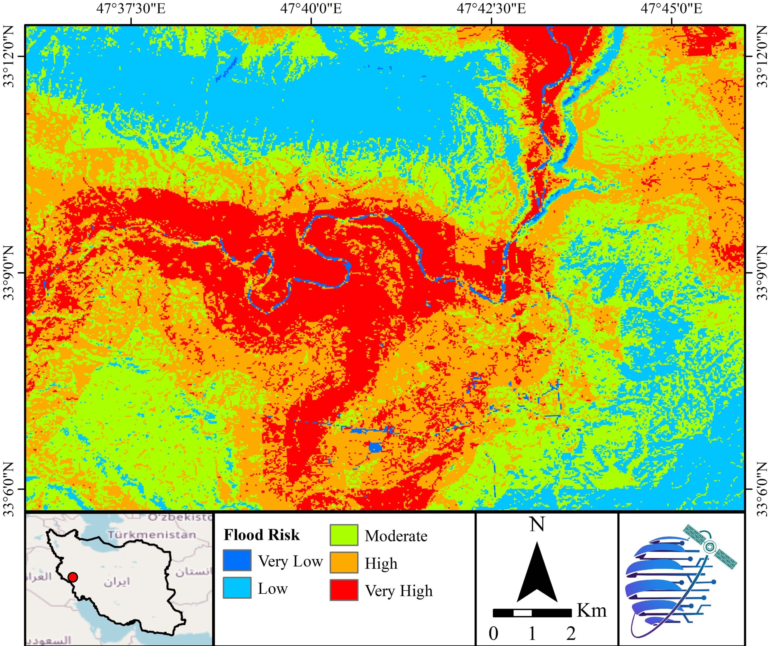
Flood Risk
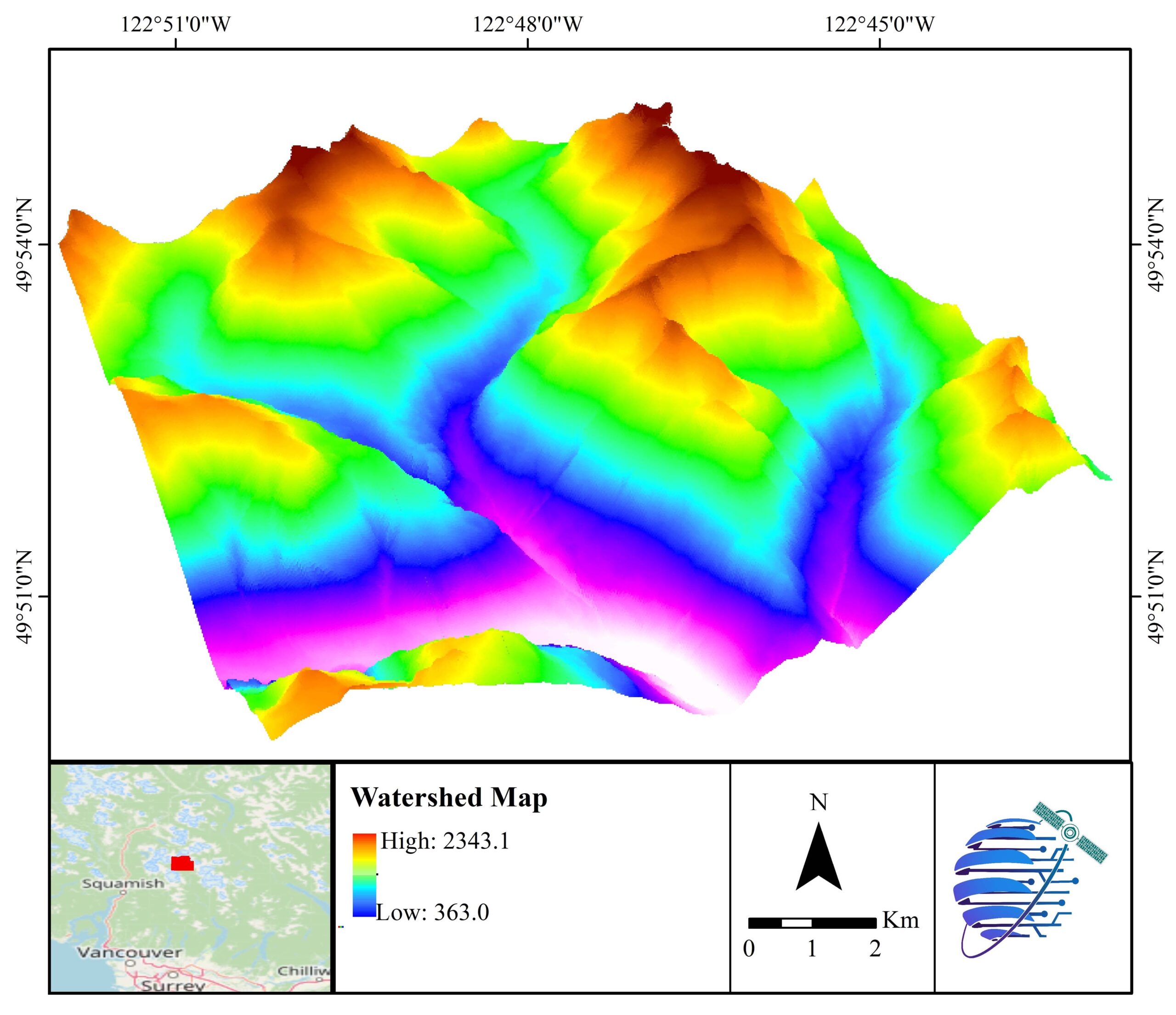
Watershed
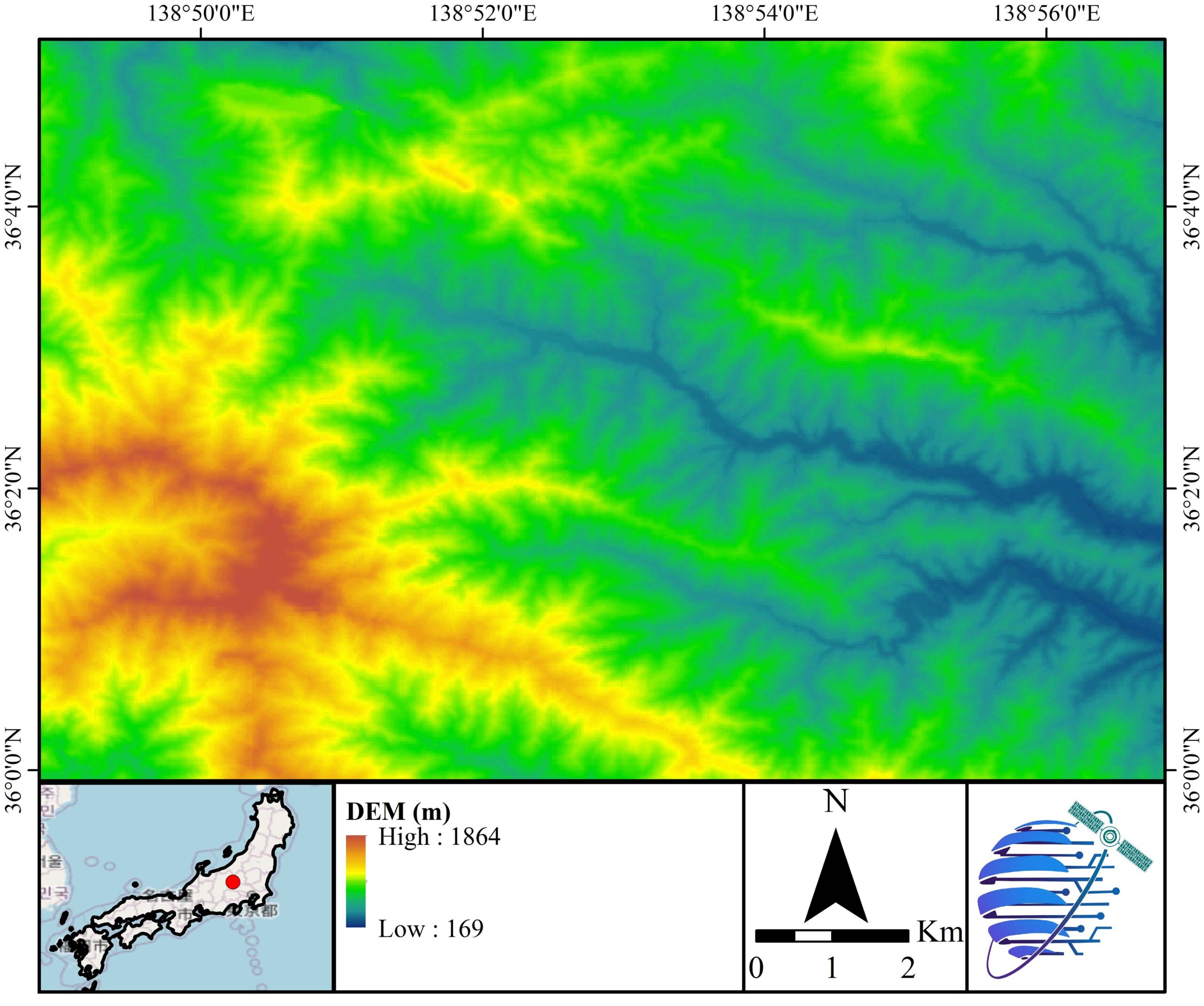
Digital Elevation Model
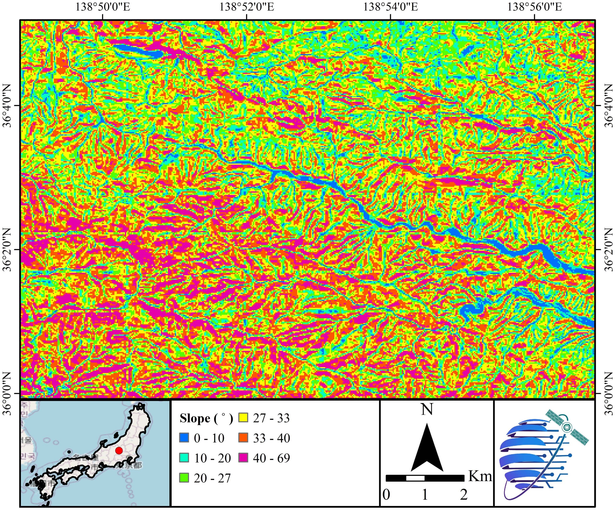
Slope
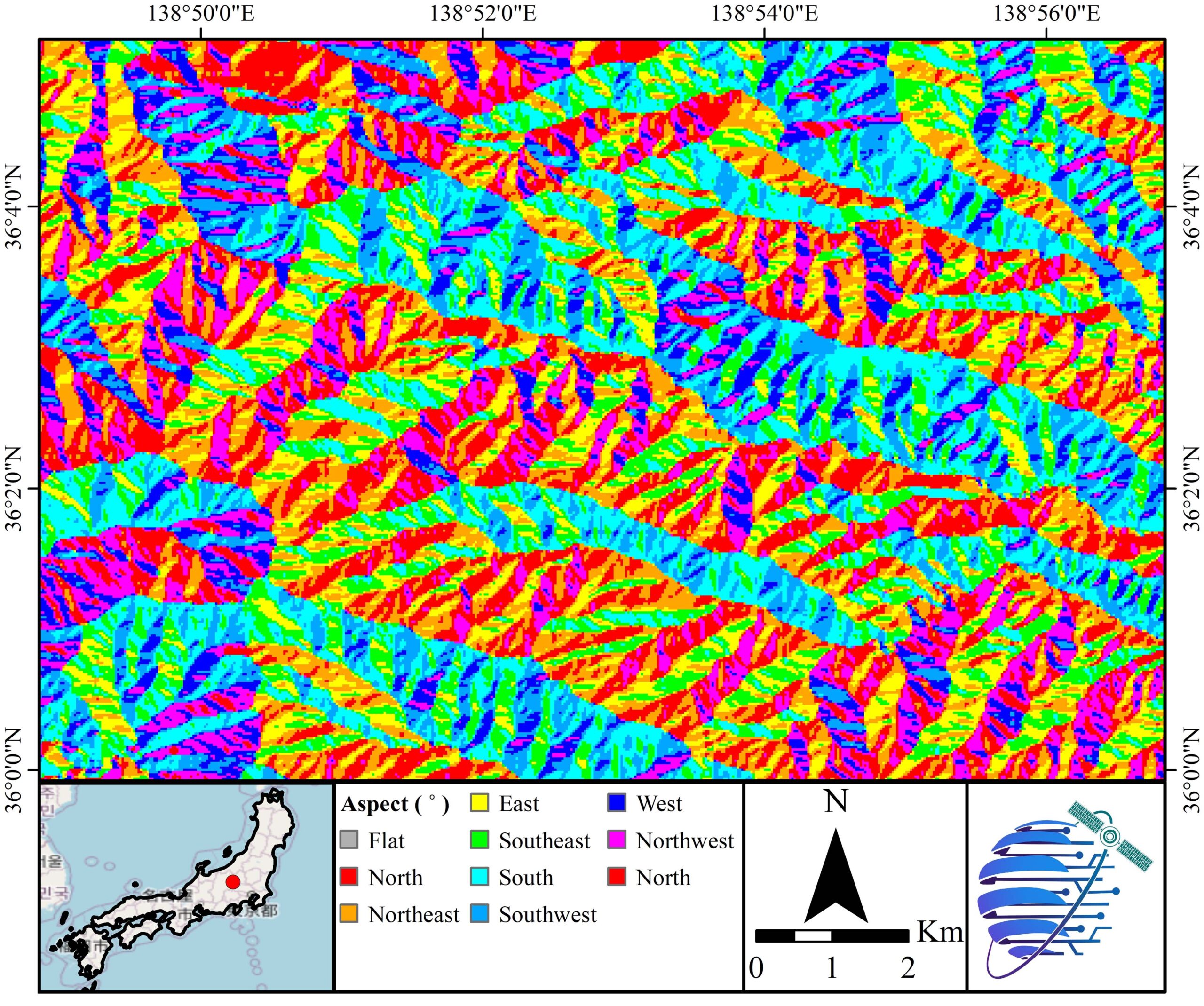
Aspect
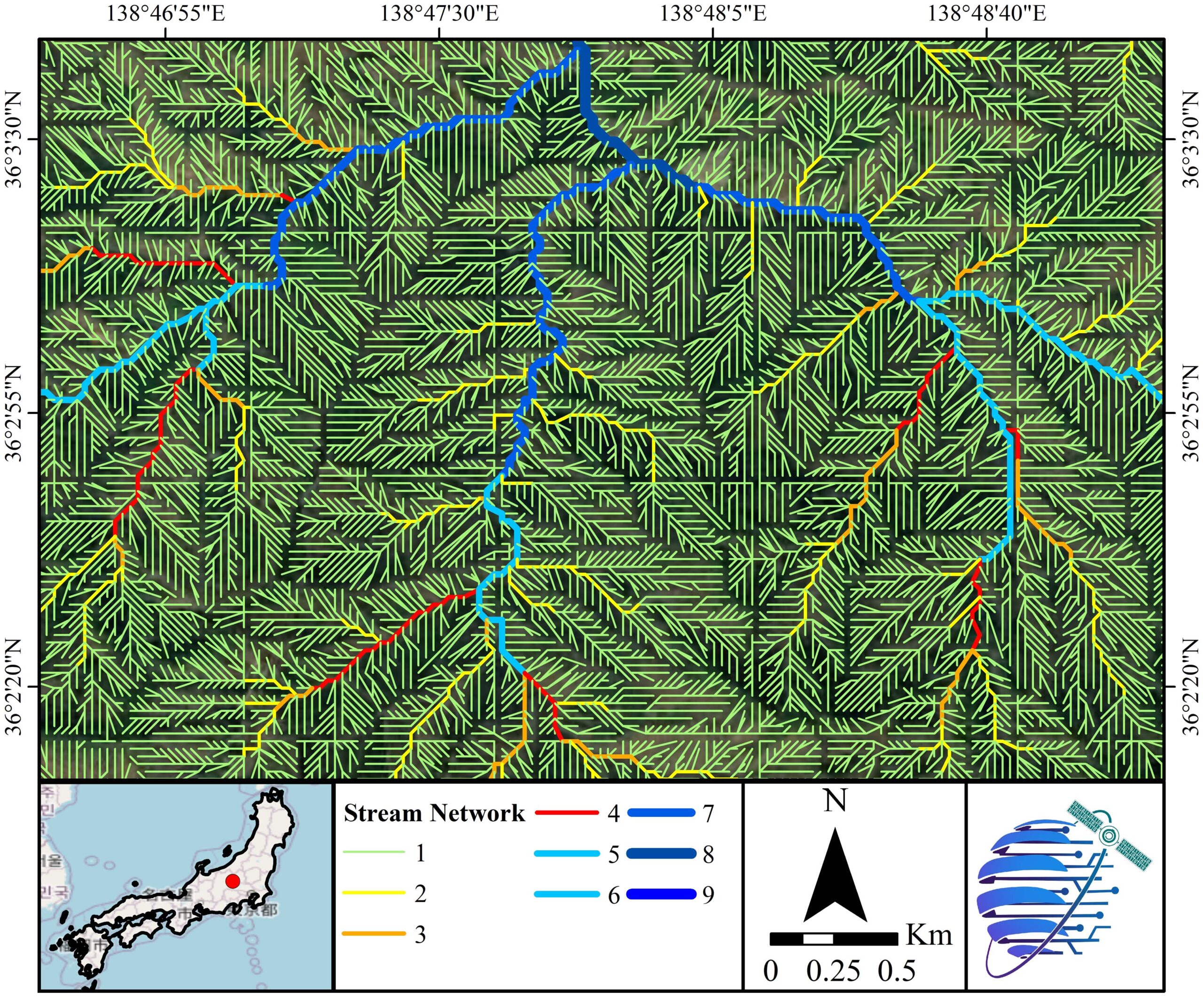
Stream Network
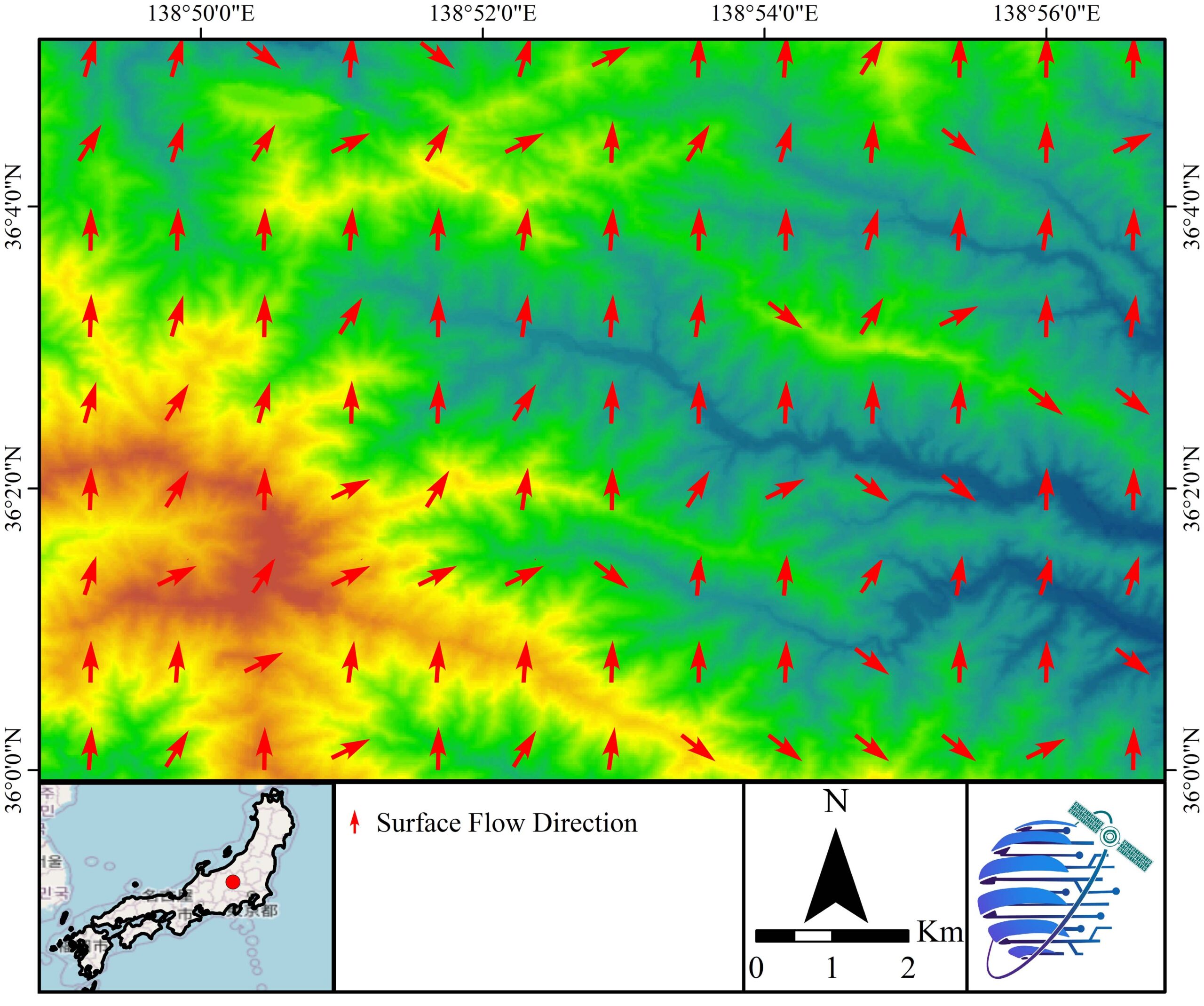
Surface Flow Direction
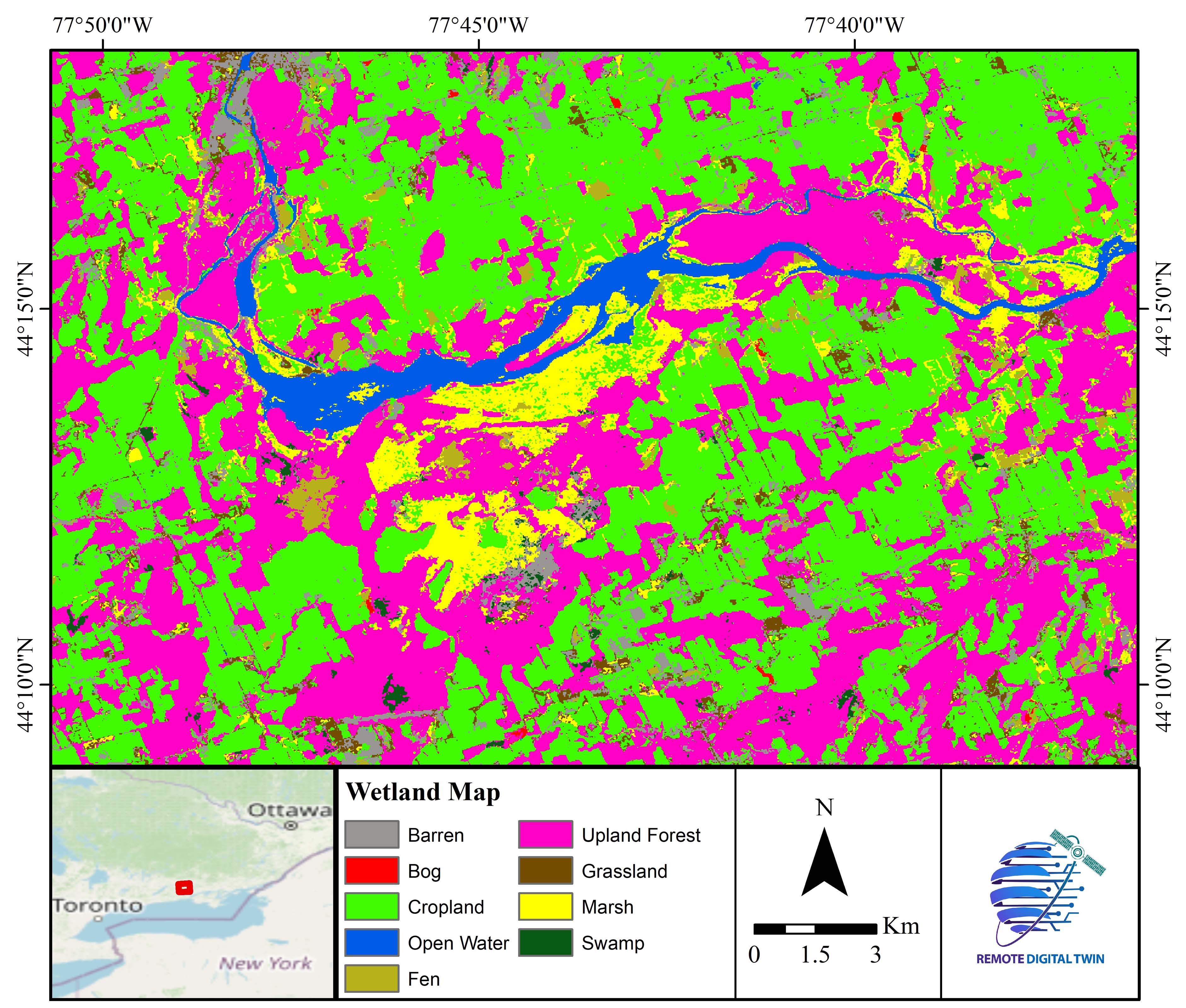
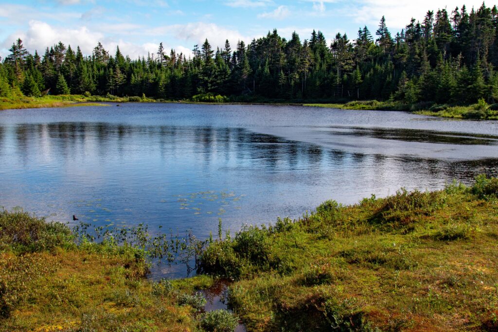
Wetland Type

Wetland Change
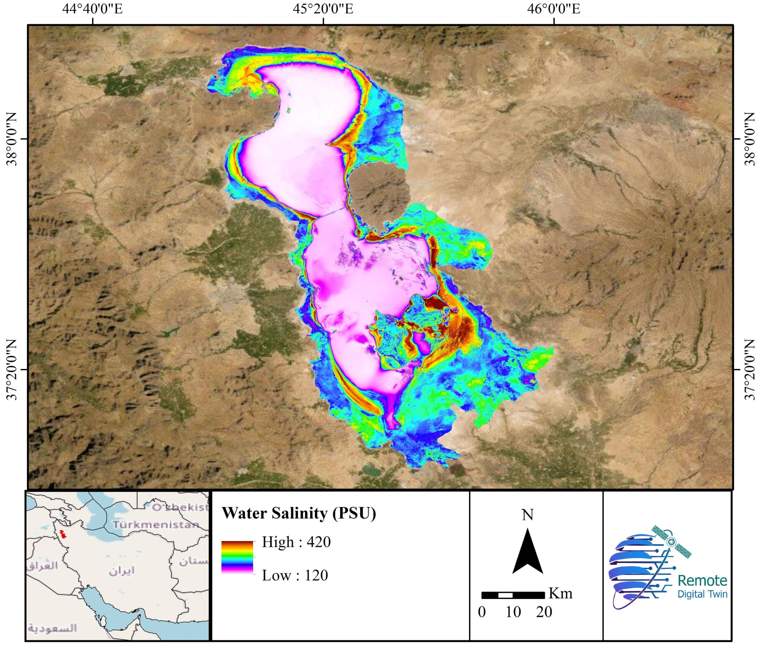
Water Salinity
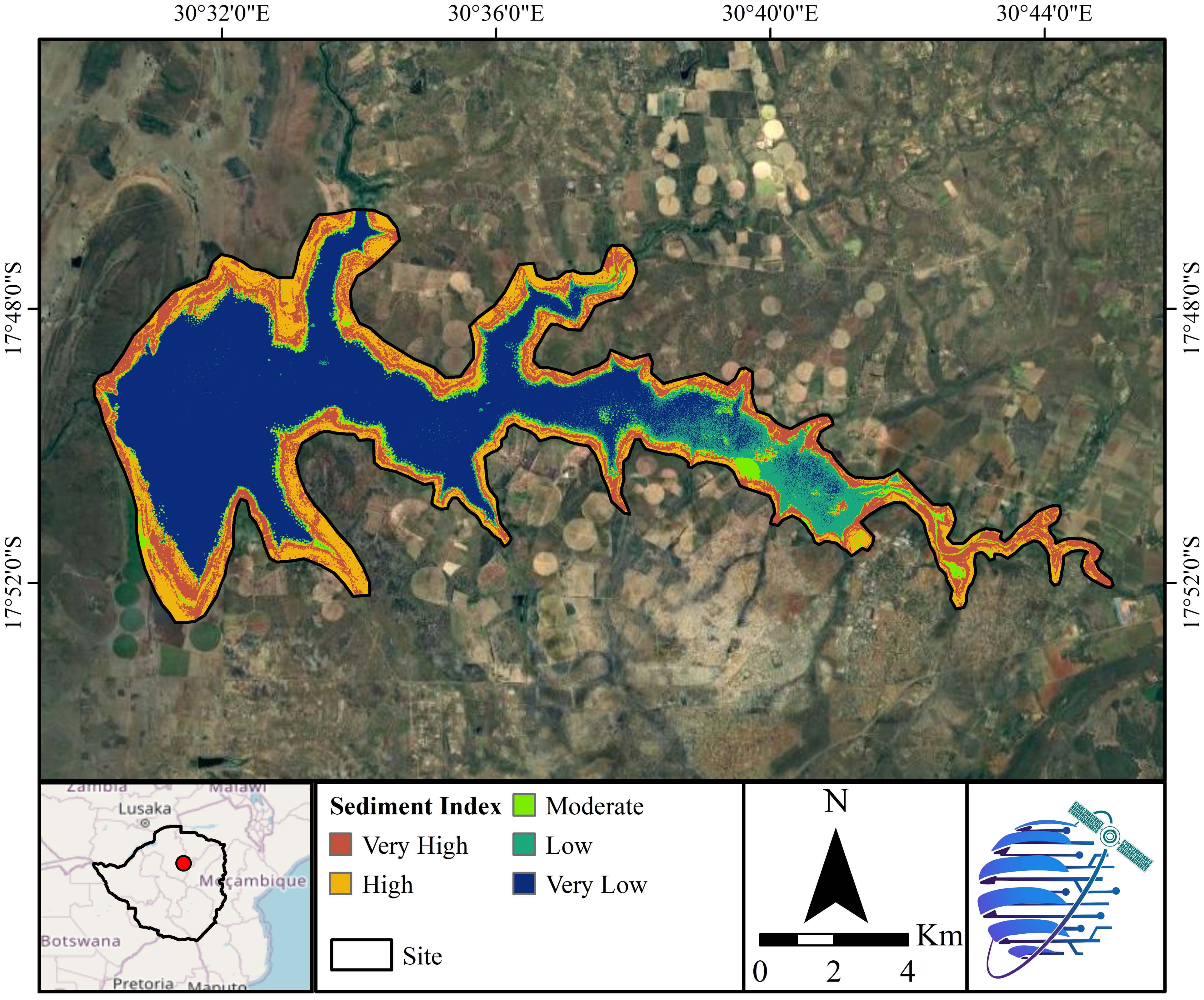
Water Sediment
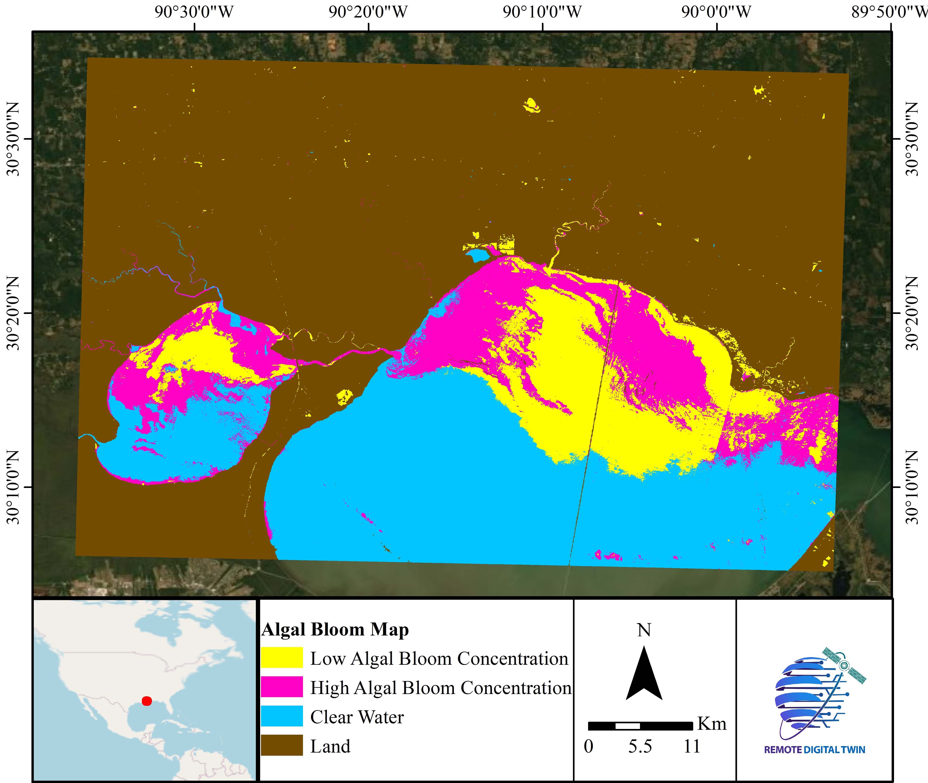
Algal Bloom
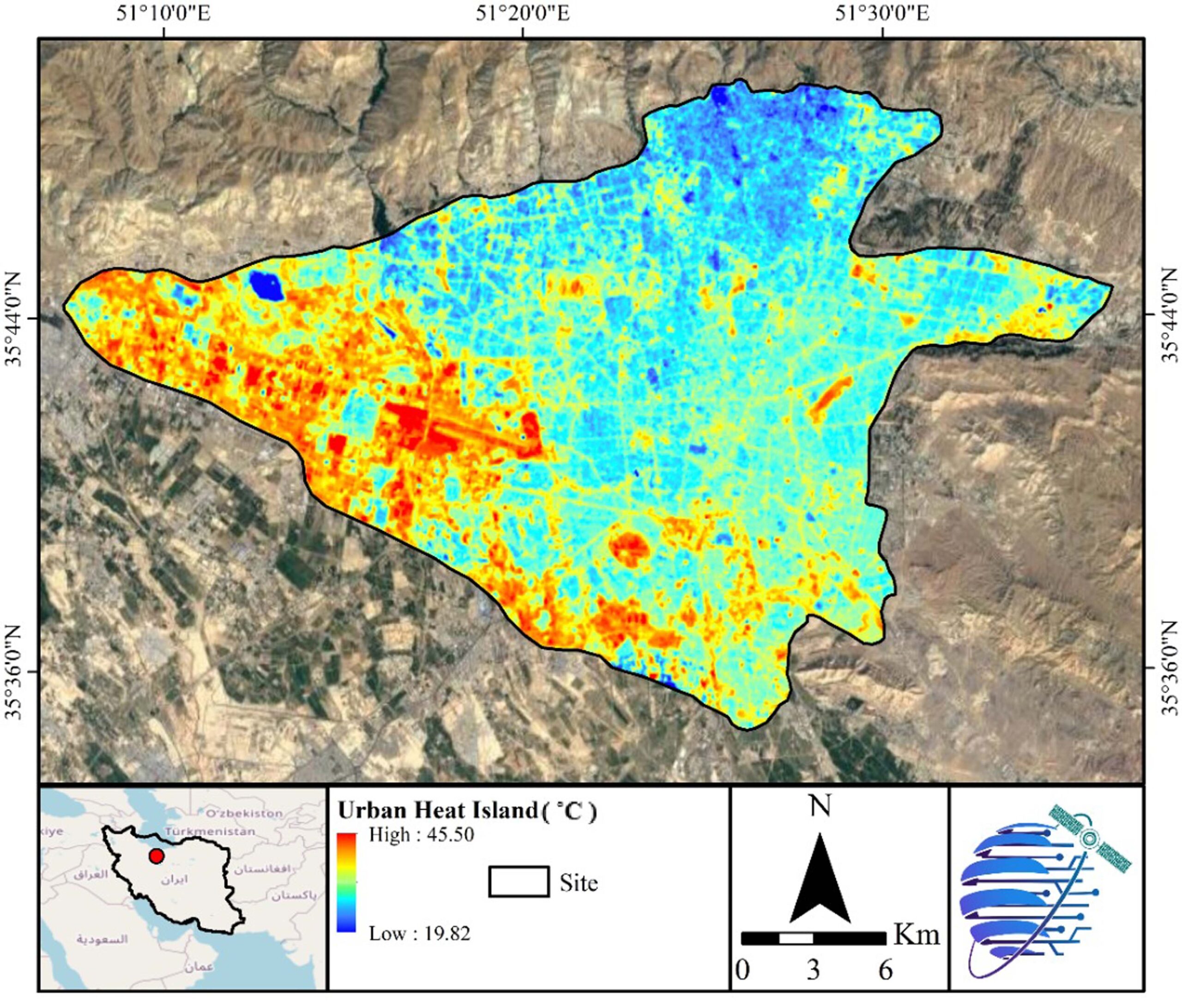
Land Surface Temperature
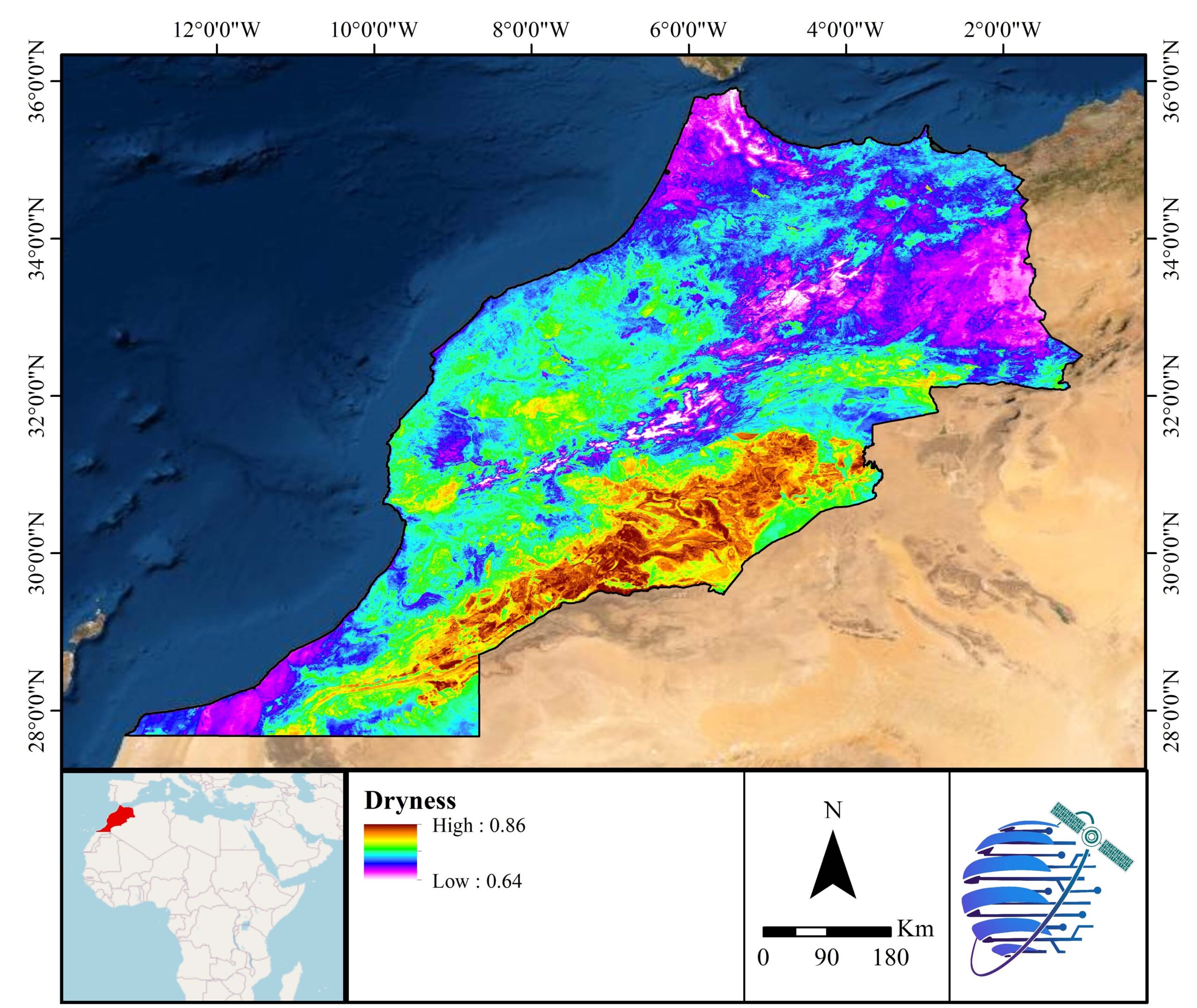
Drought
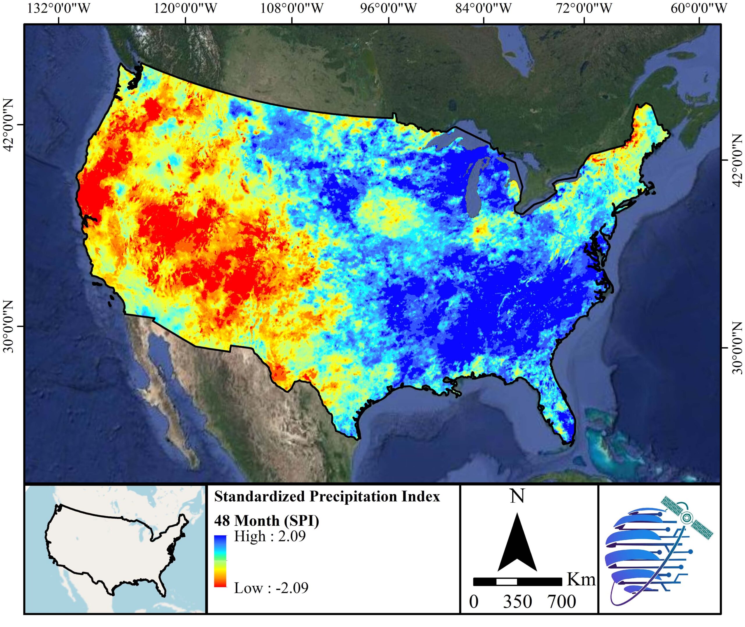
Precipitation
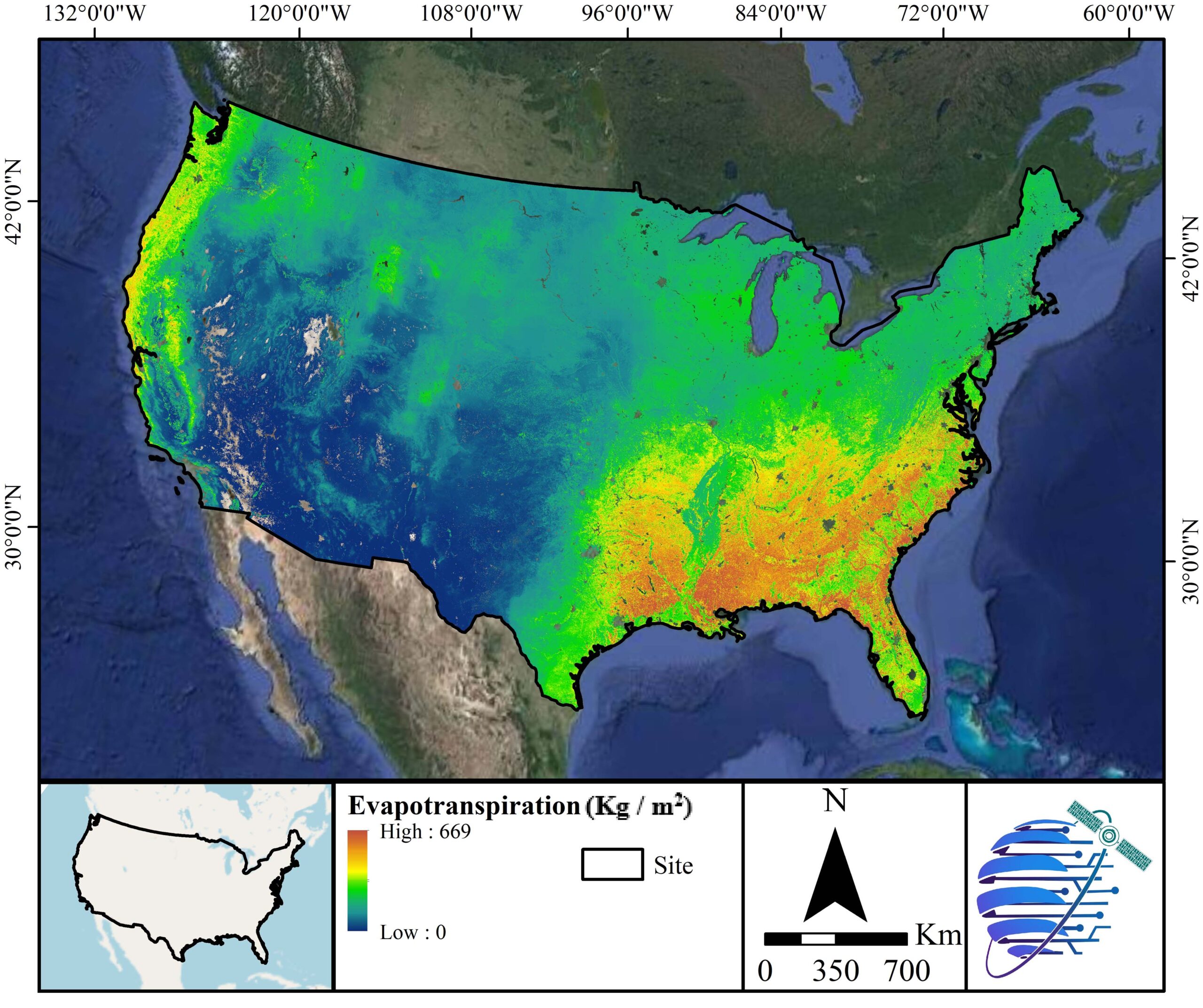
Evapotranspiration
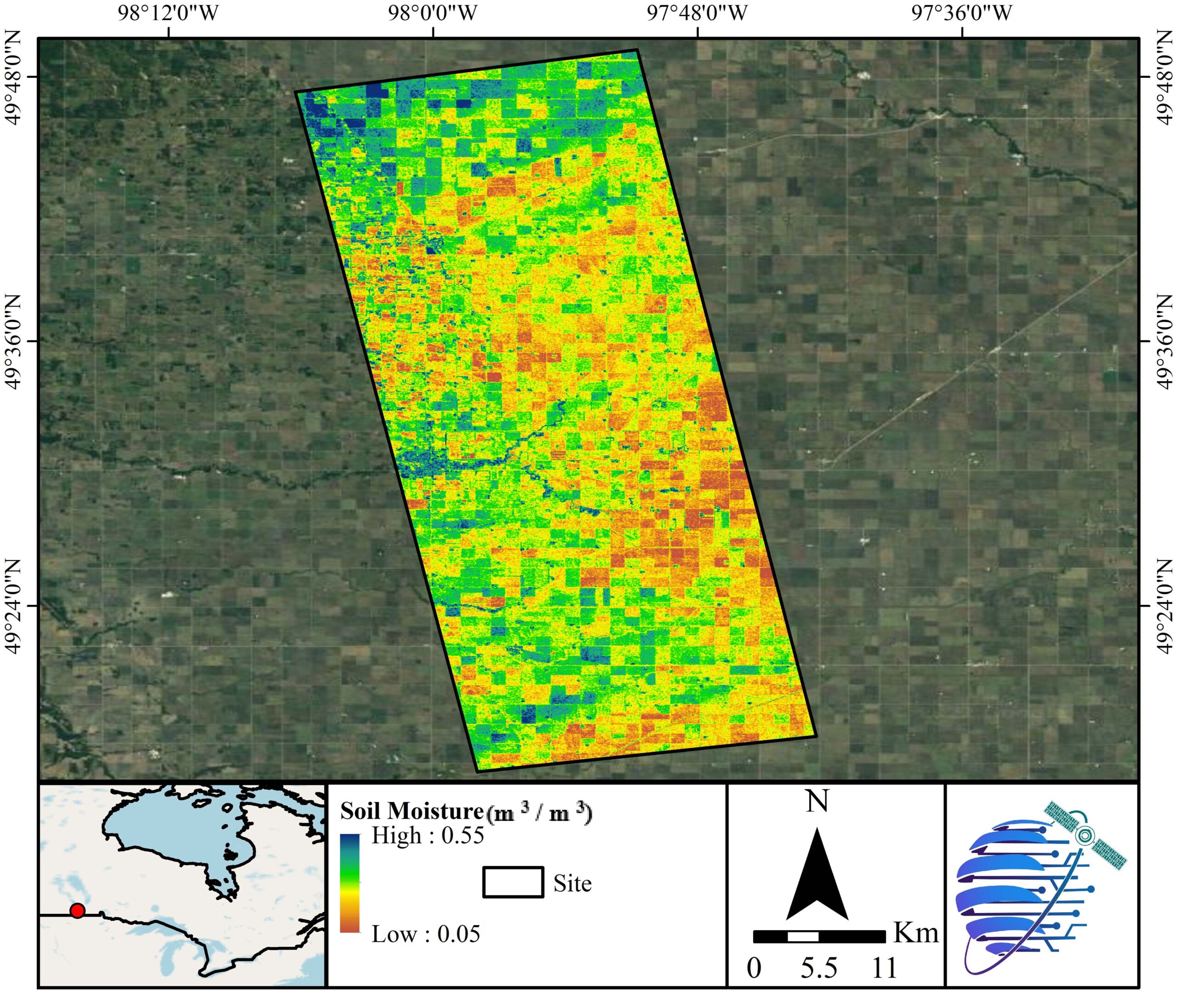
Soil Moisture
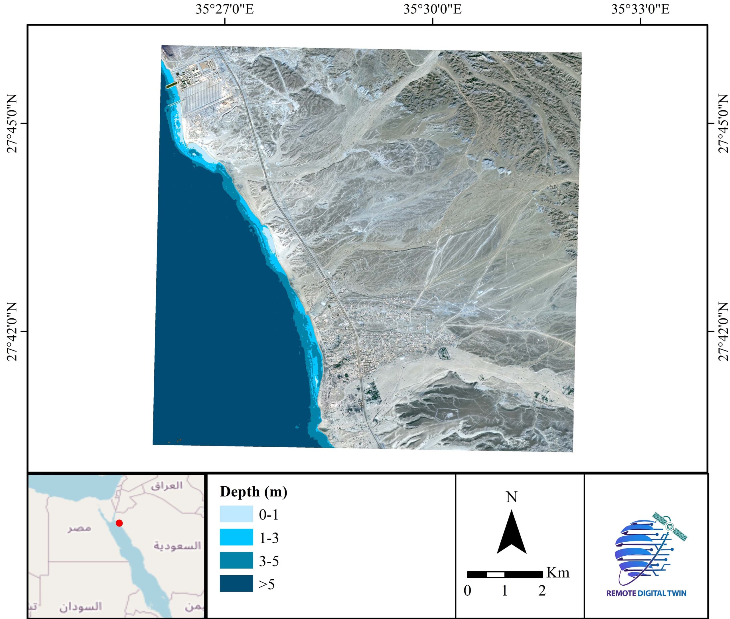
Bathymetry
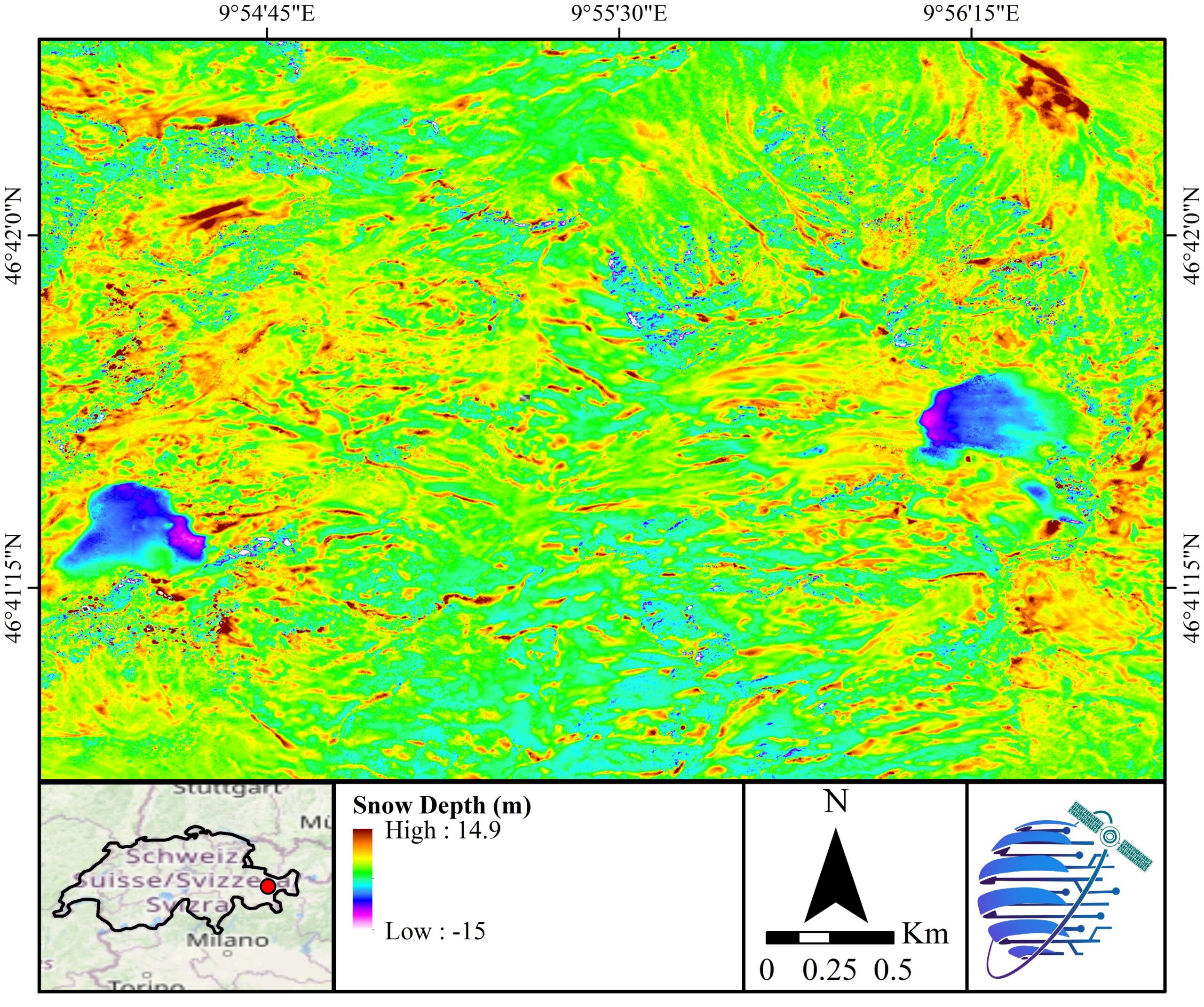
Snow Depth
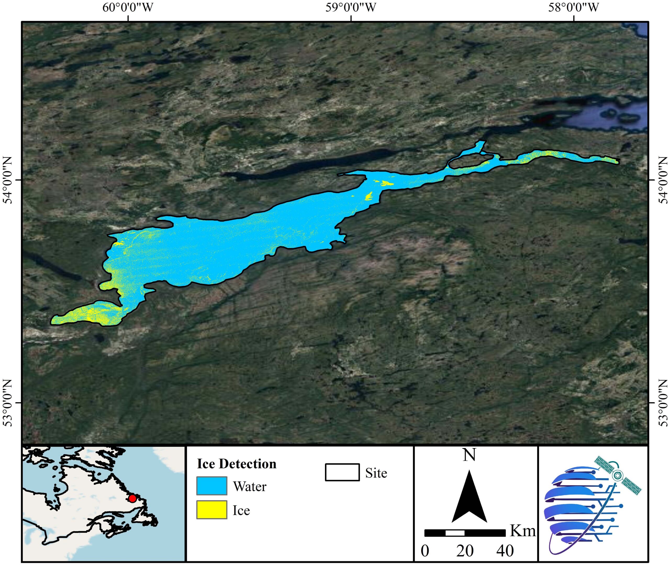
Lake Ice
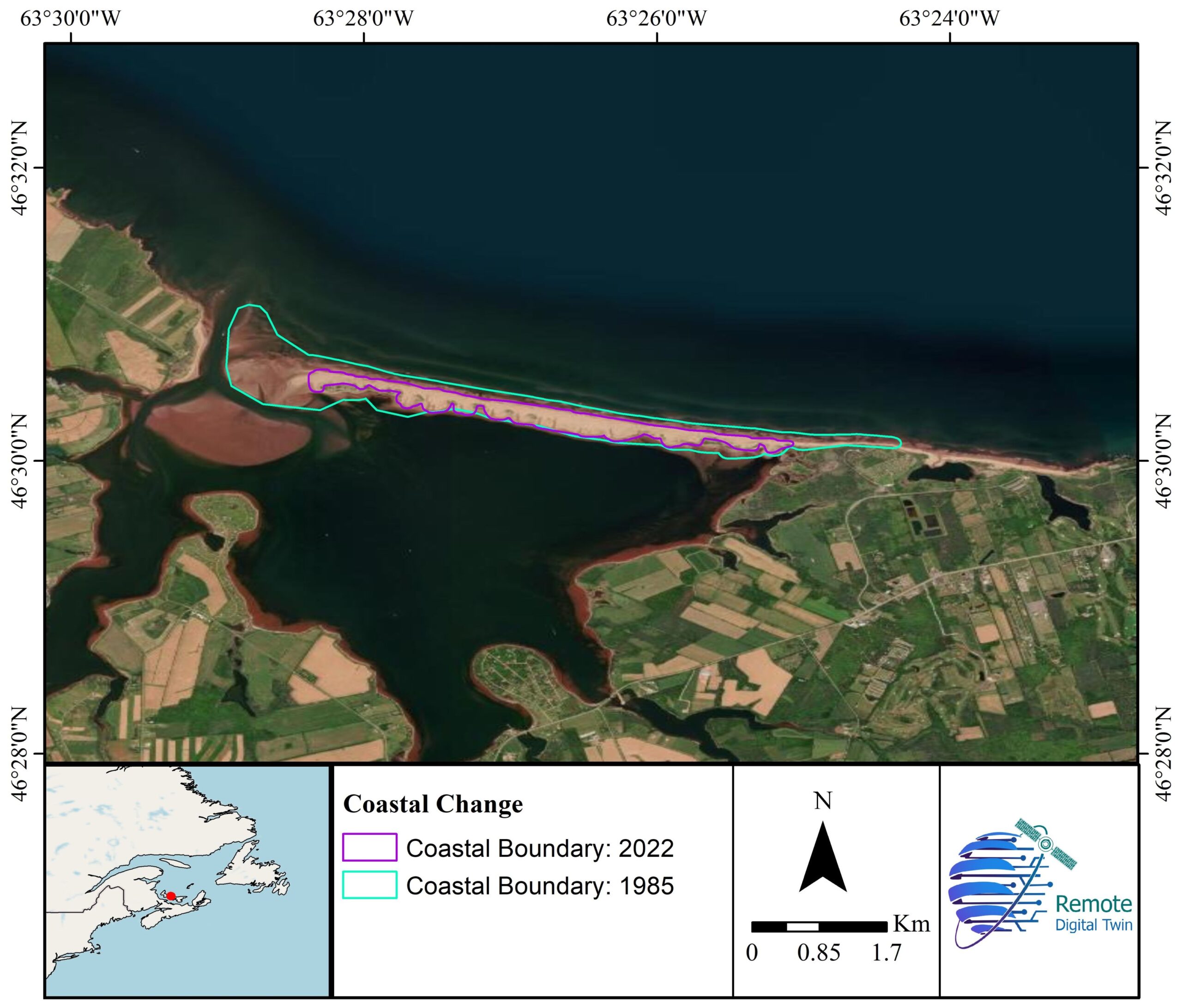
Coastal Erosion
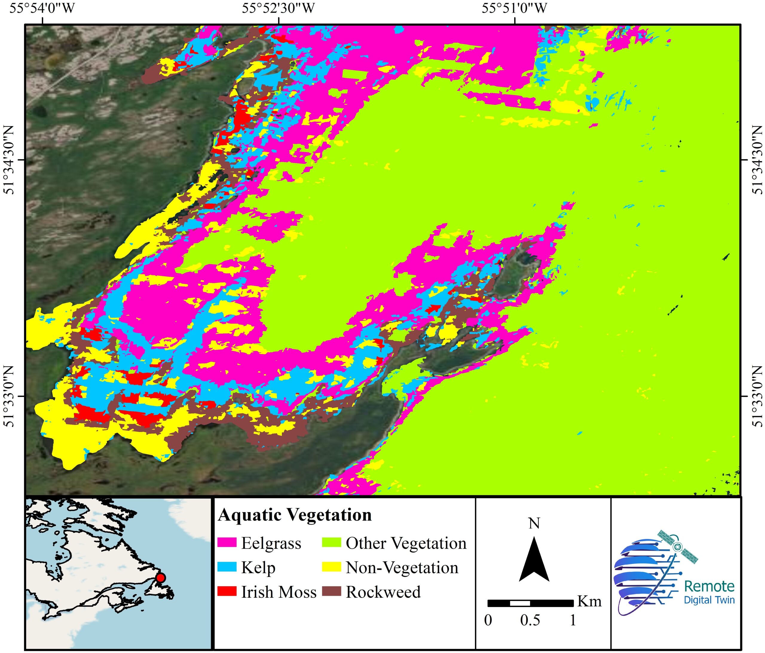
Aquatic Vegetation
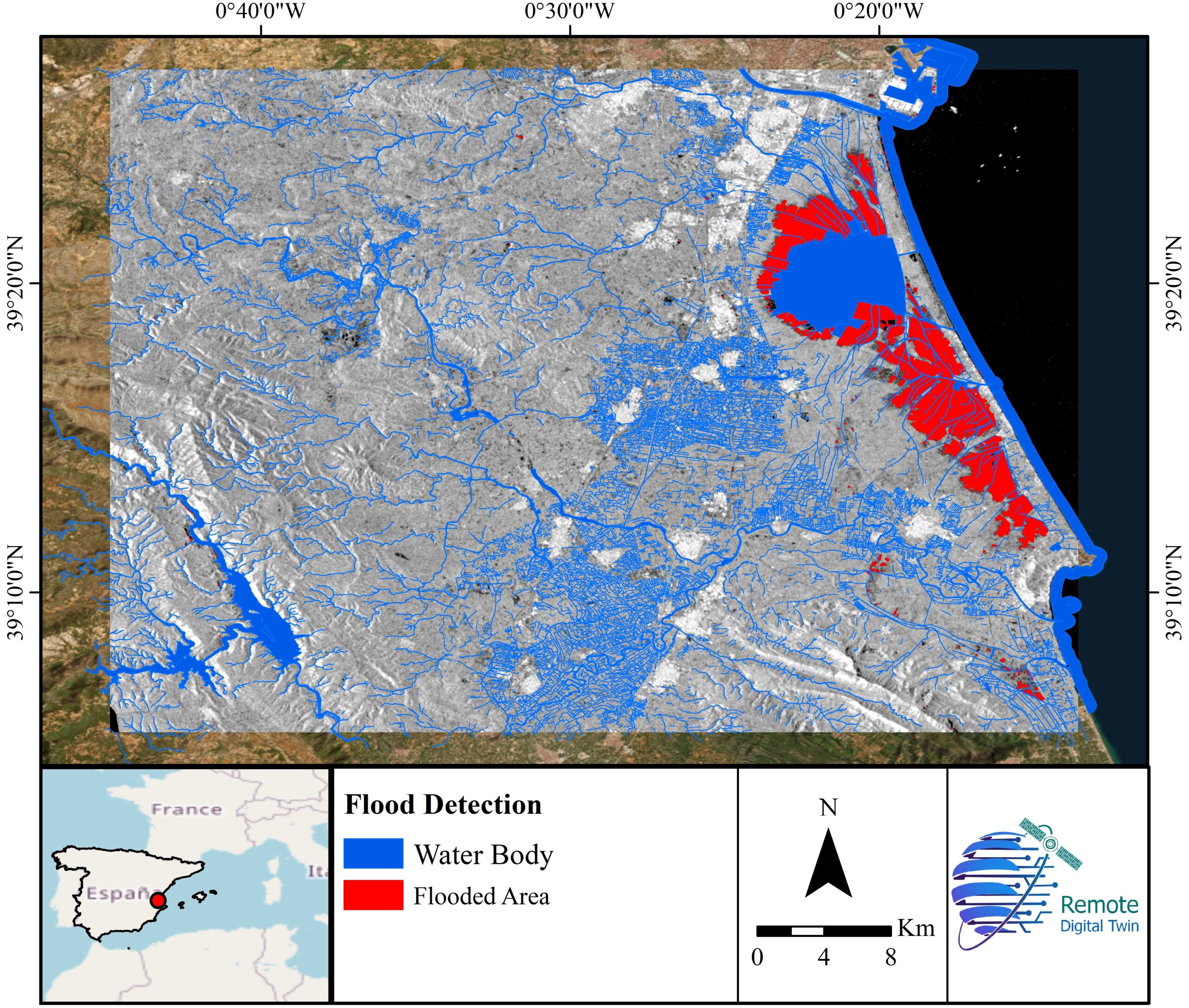
Flood Detection
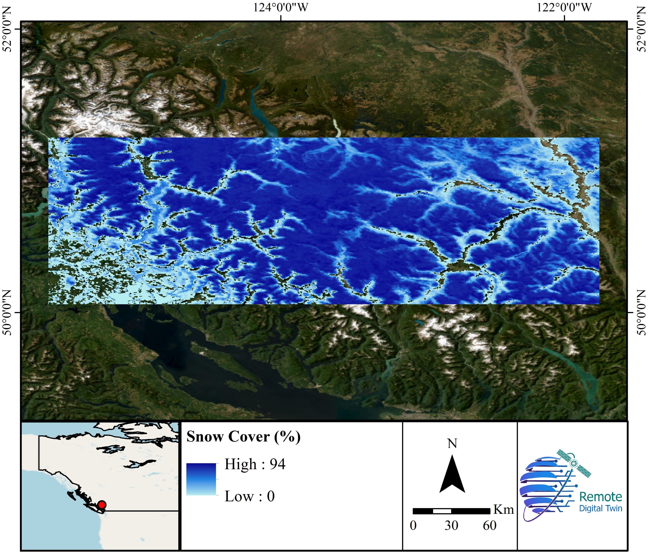
Snow Cover
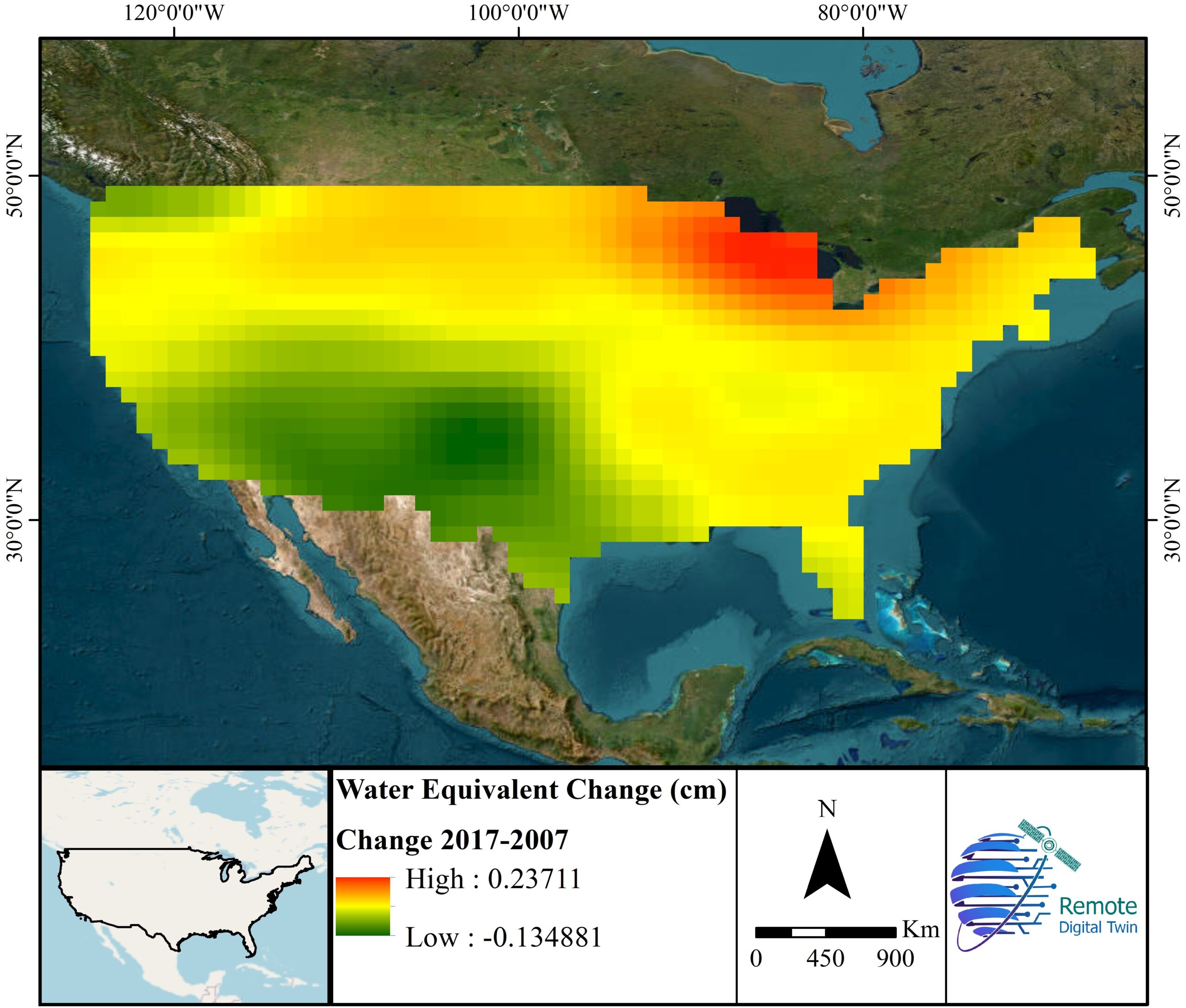
Grace
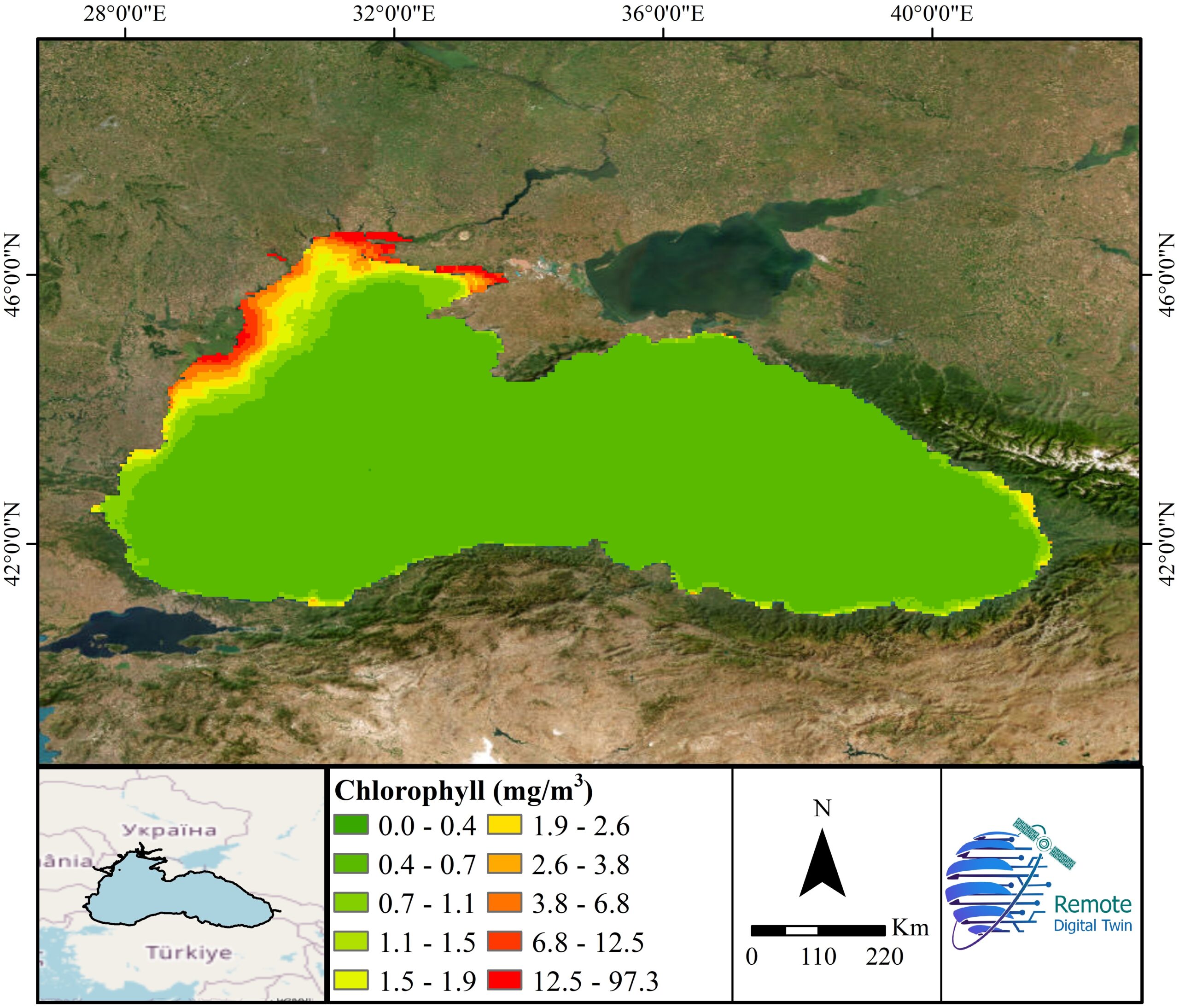
Water Quality