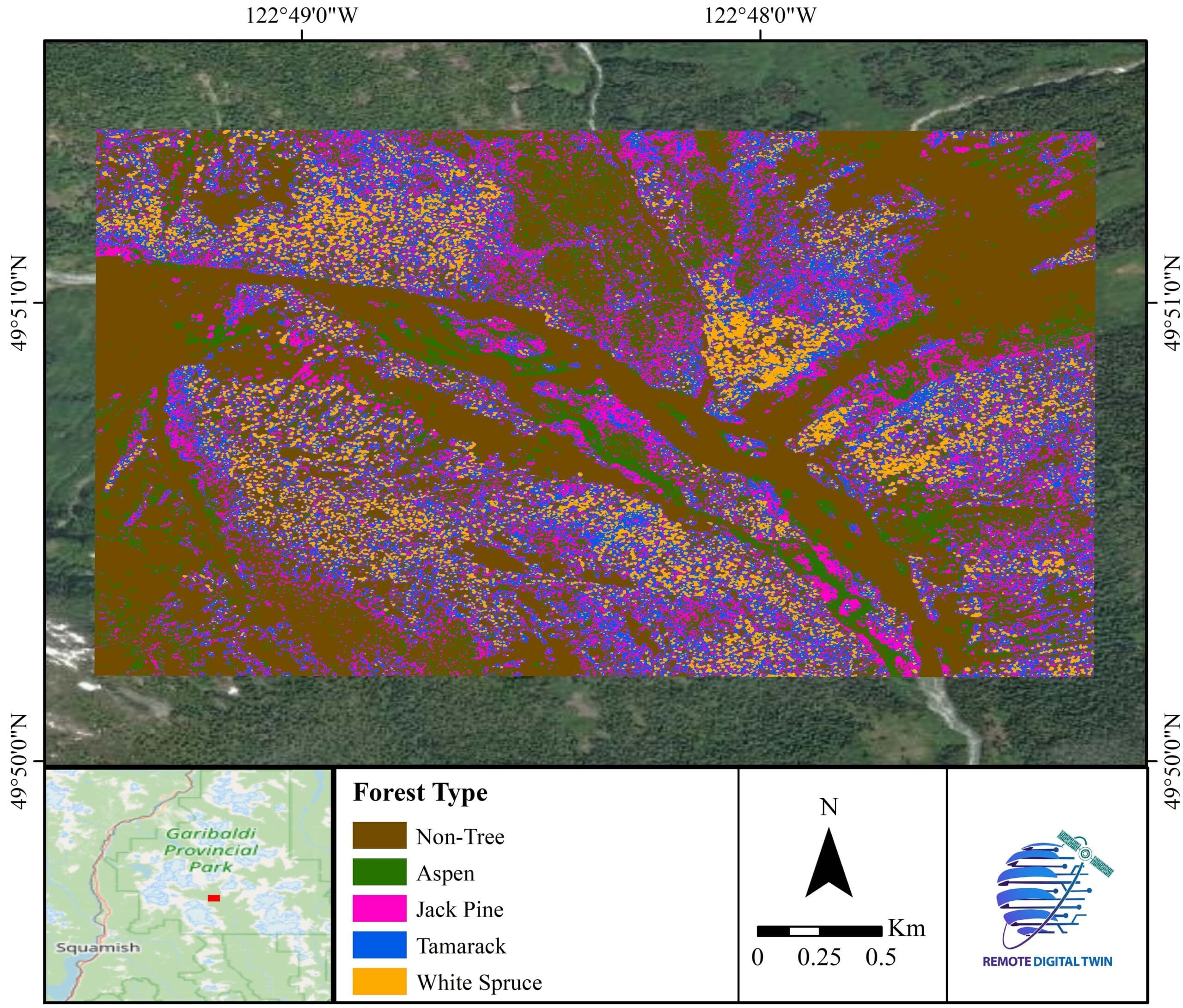
Forest Type
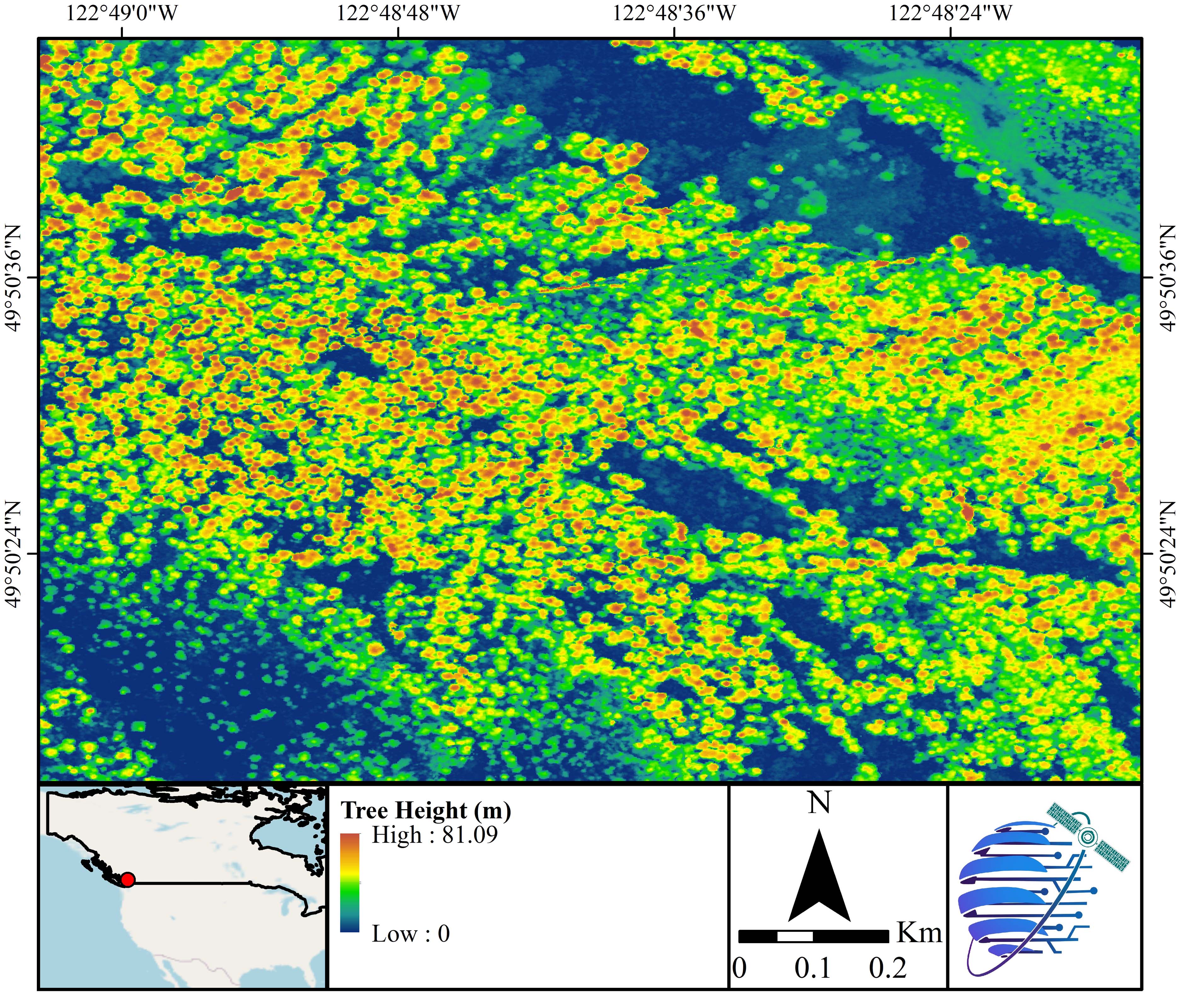
Tree Height

Land Use / Land Cover Type
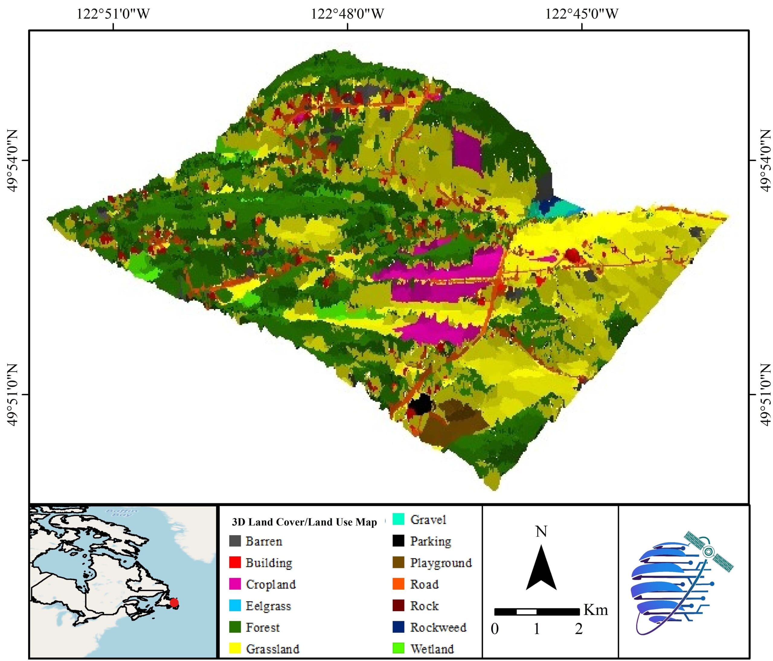
3D Land Use / Land Cover Map
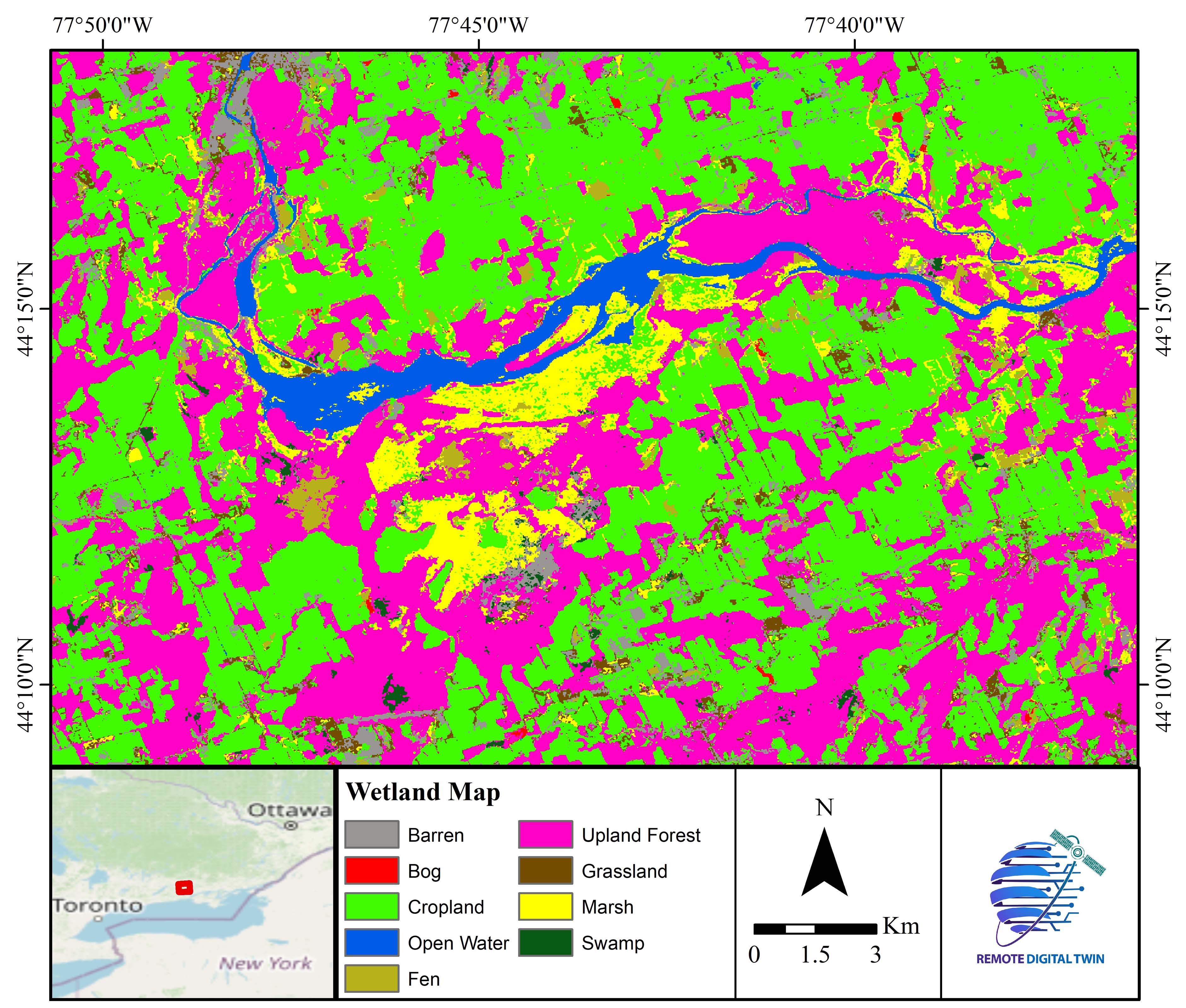
Wetland Type
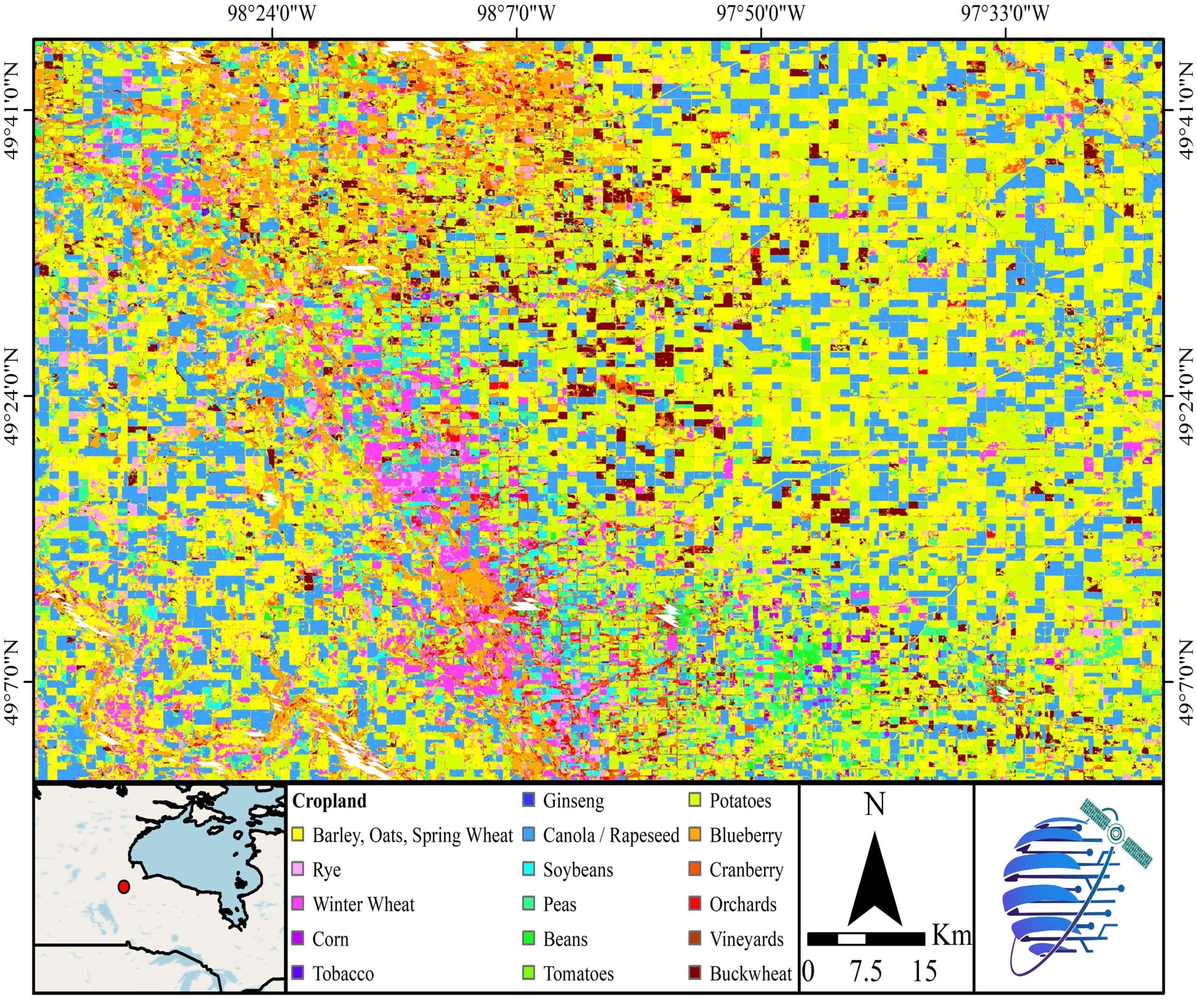
Cropland Type

NDVI Vegetation Index
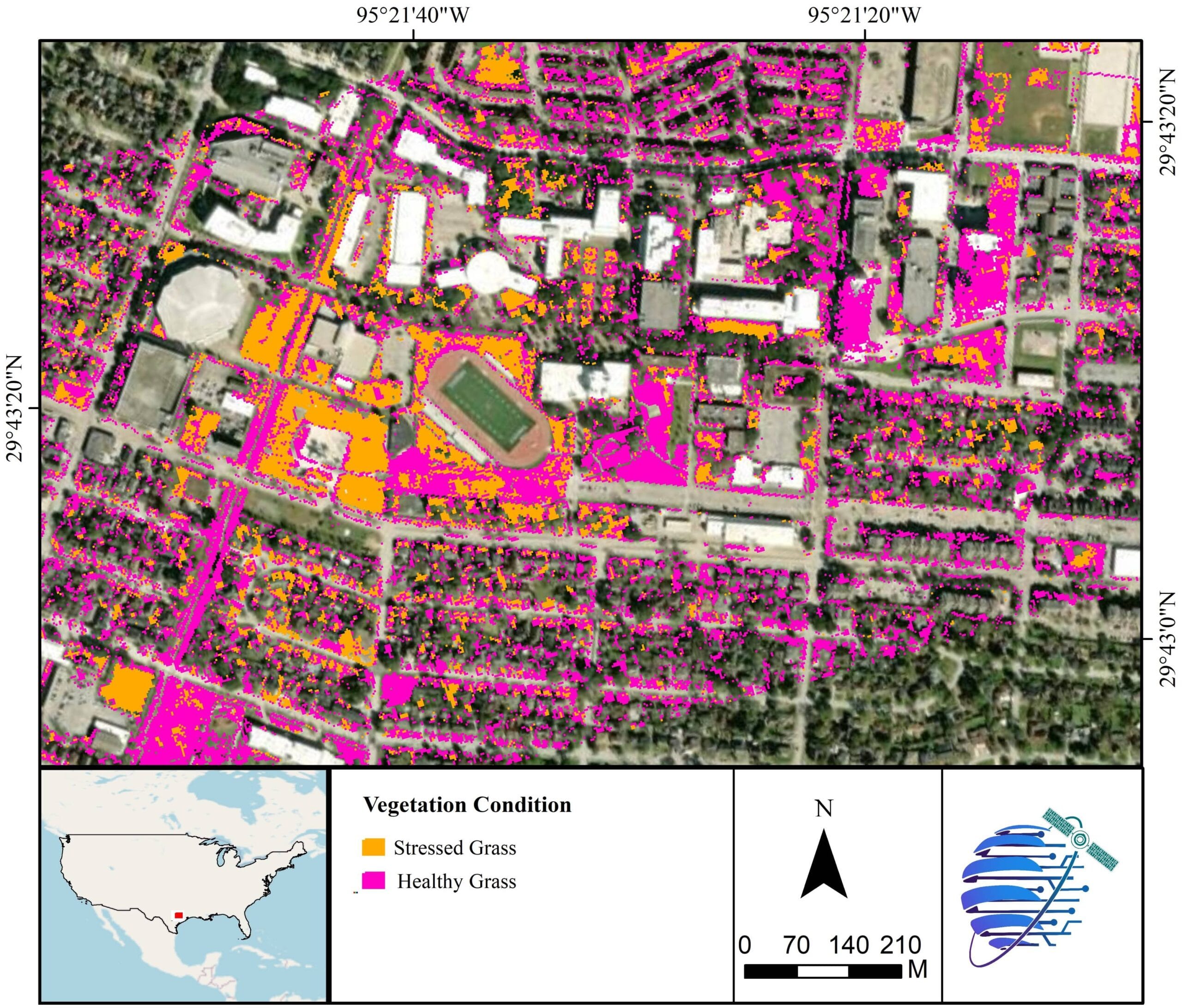
Vegetation Health
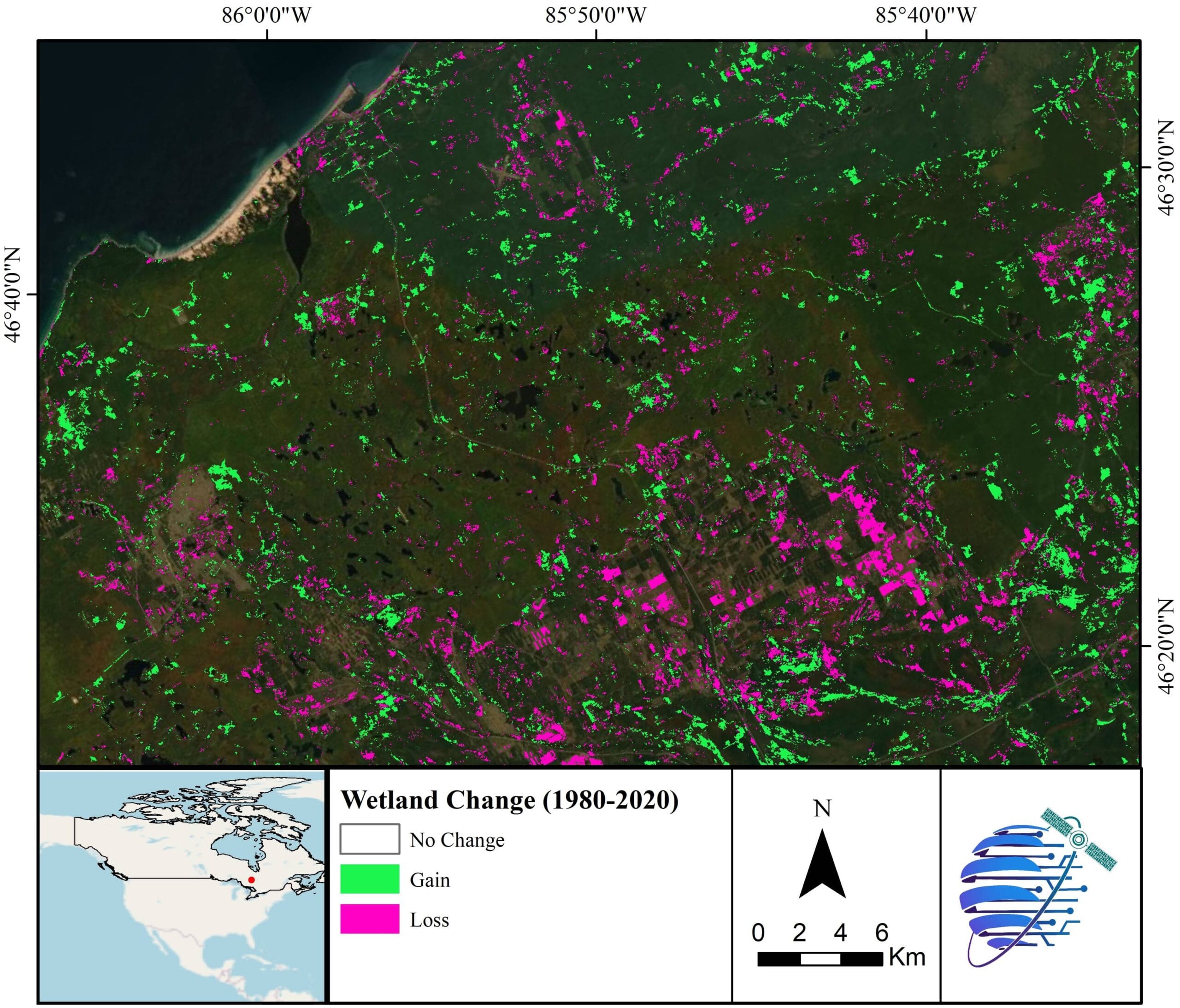
Vegetation Change
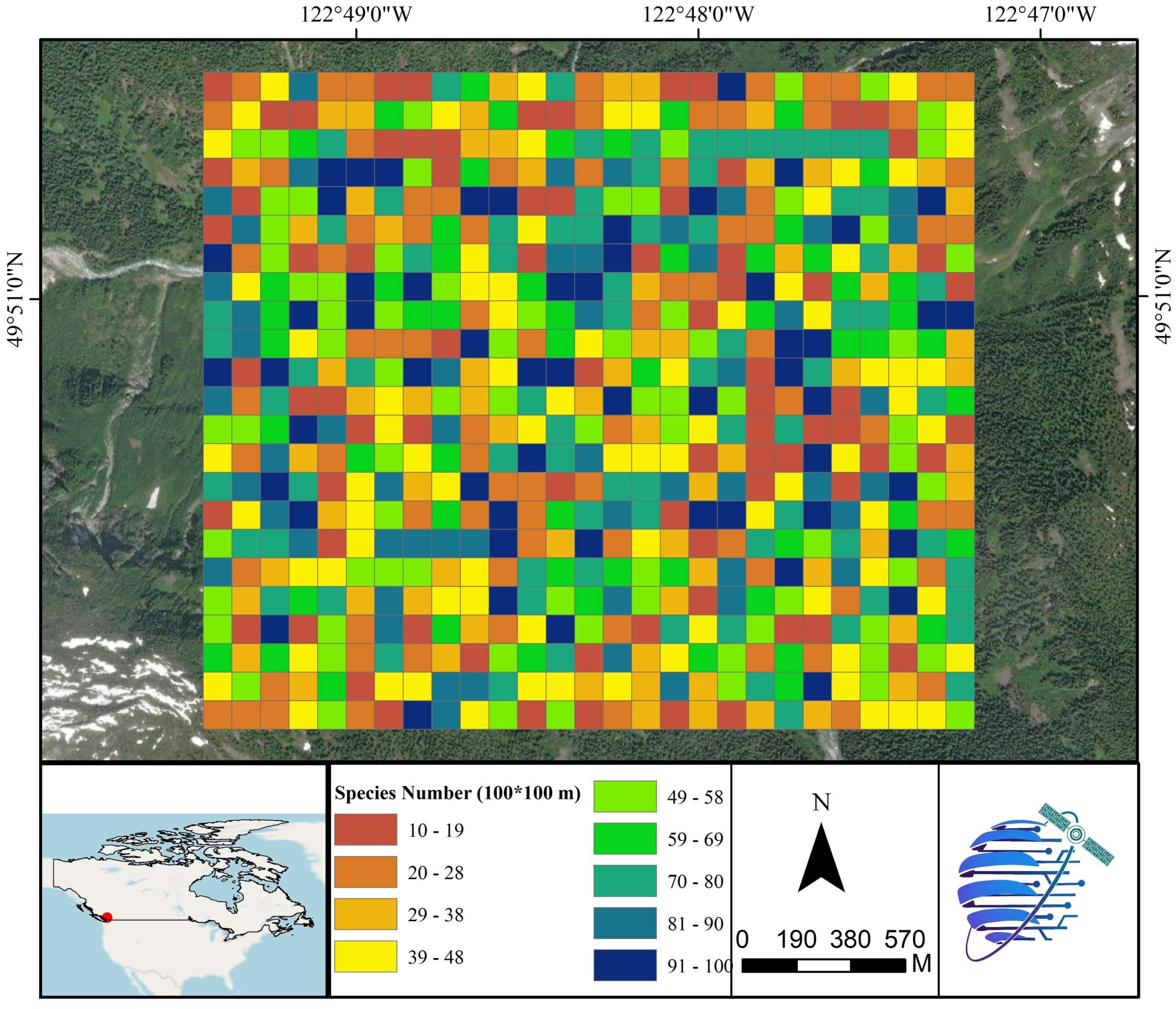
Species Diversity
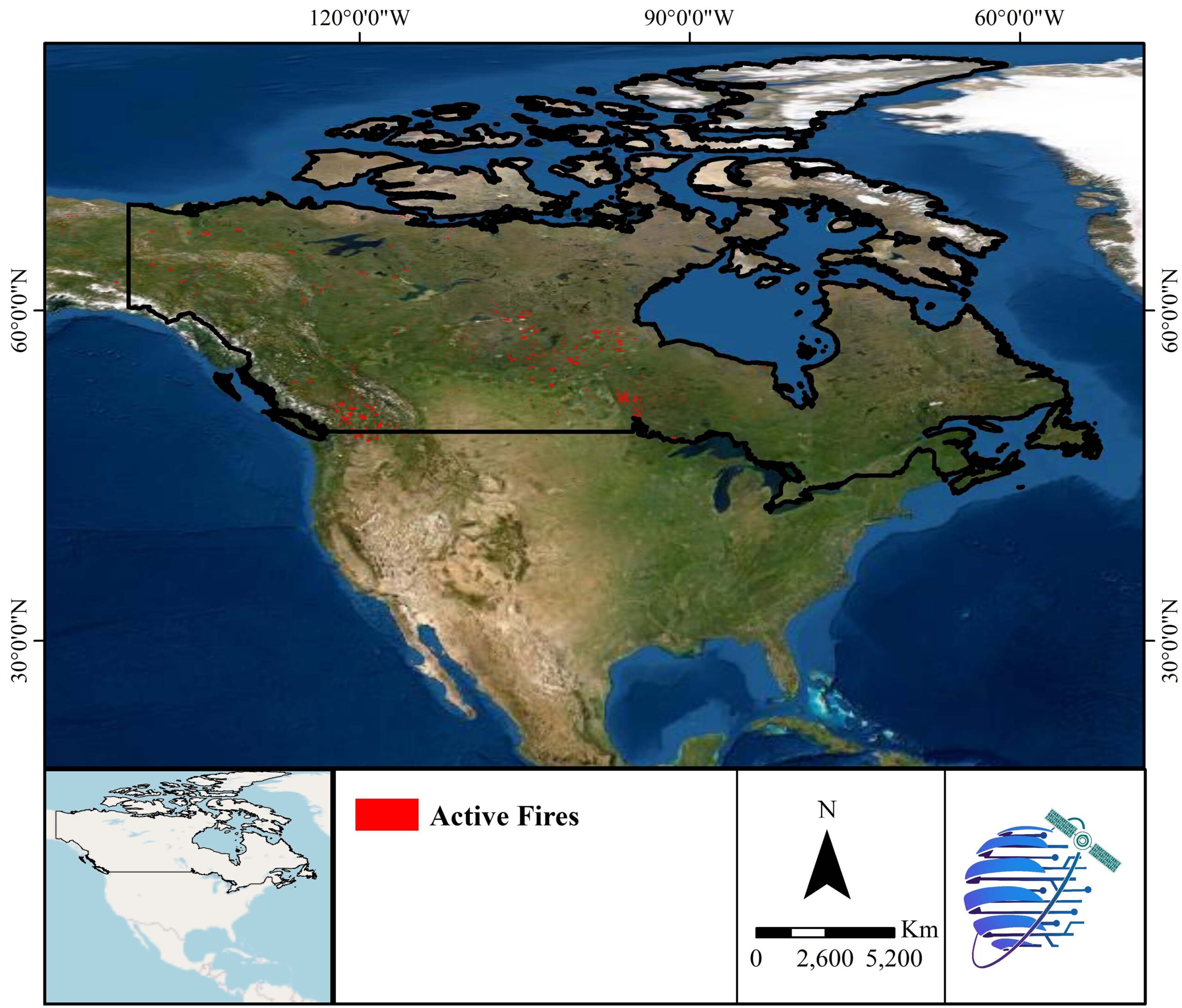
Active Fire
Vegetation Management
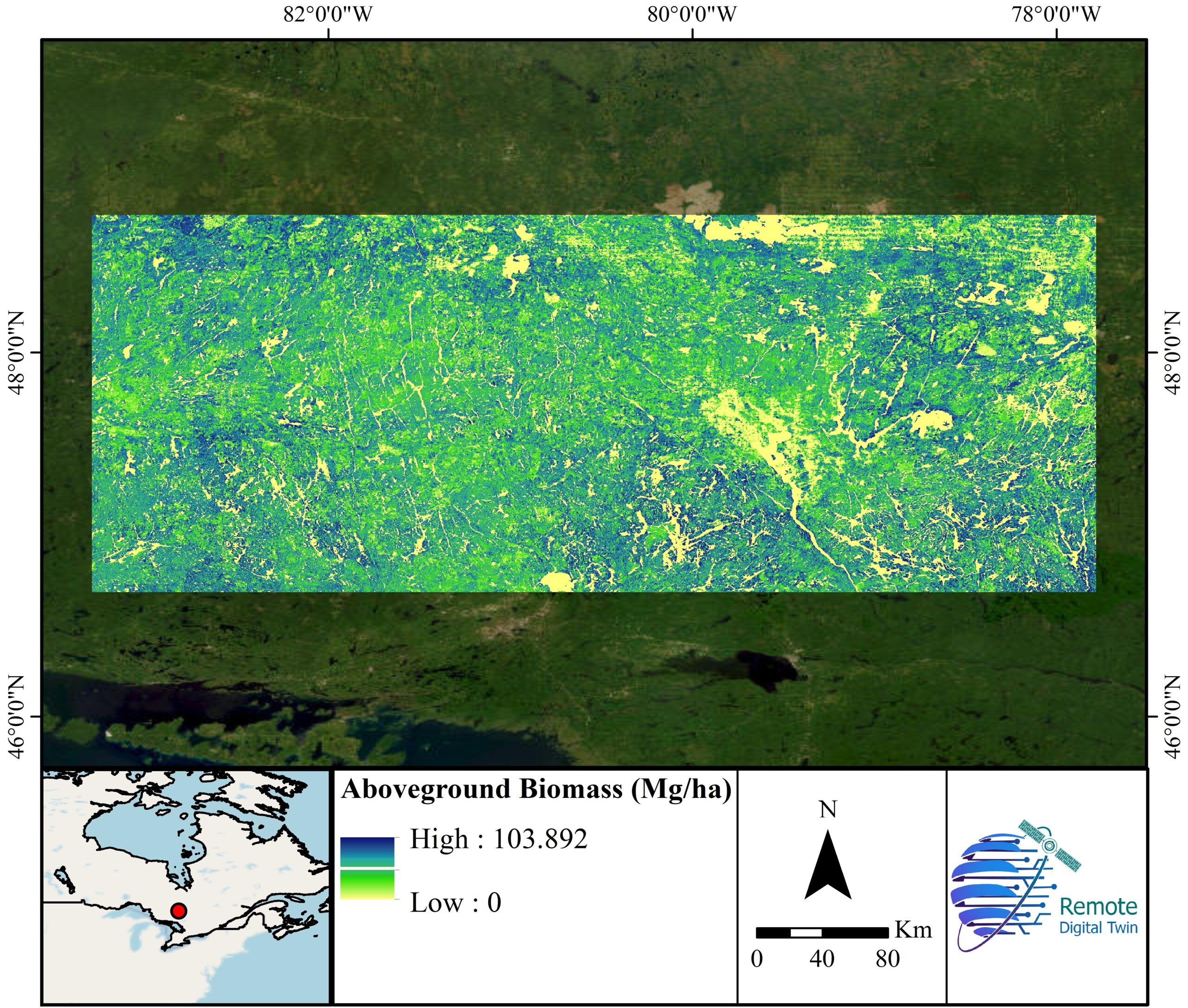
Aboveground Biomass
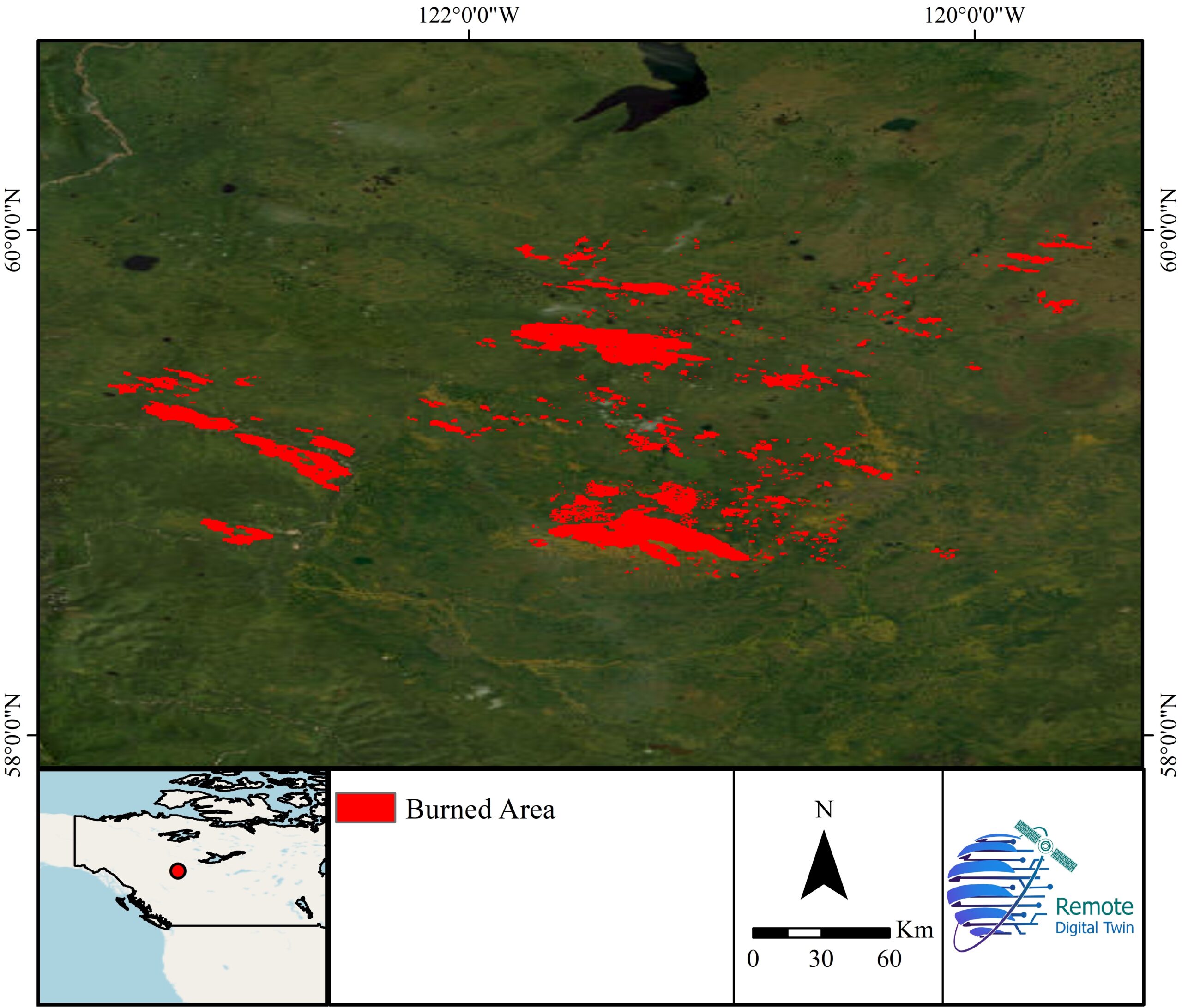
Burned Area
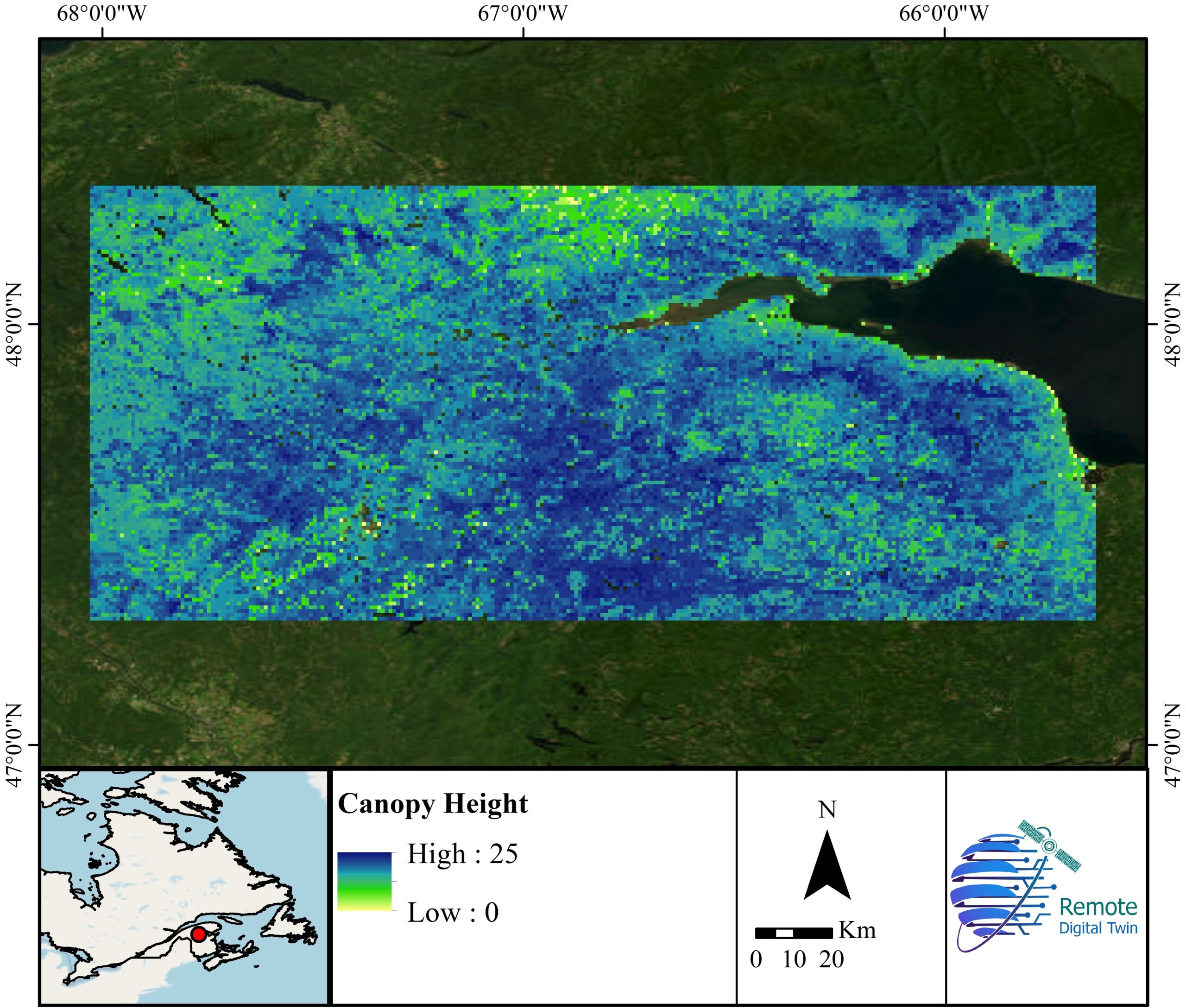
Canopy Height
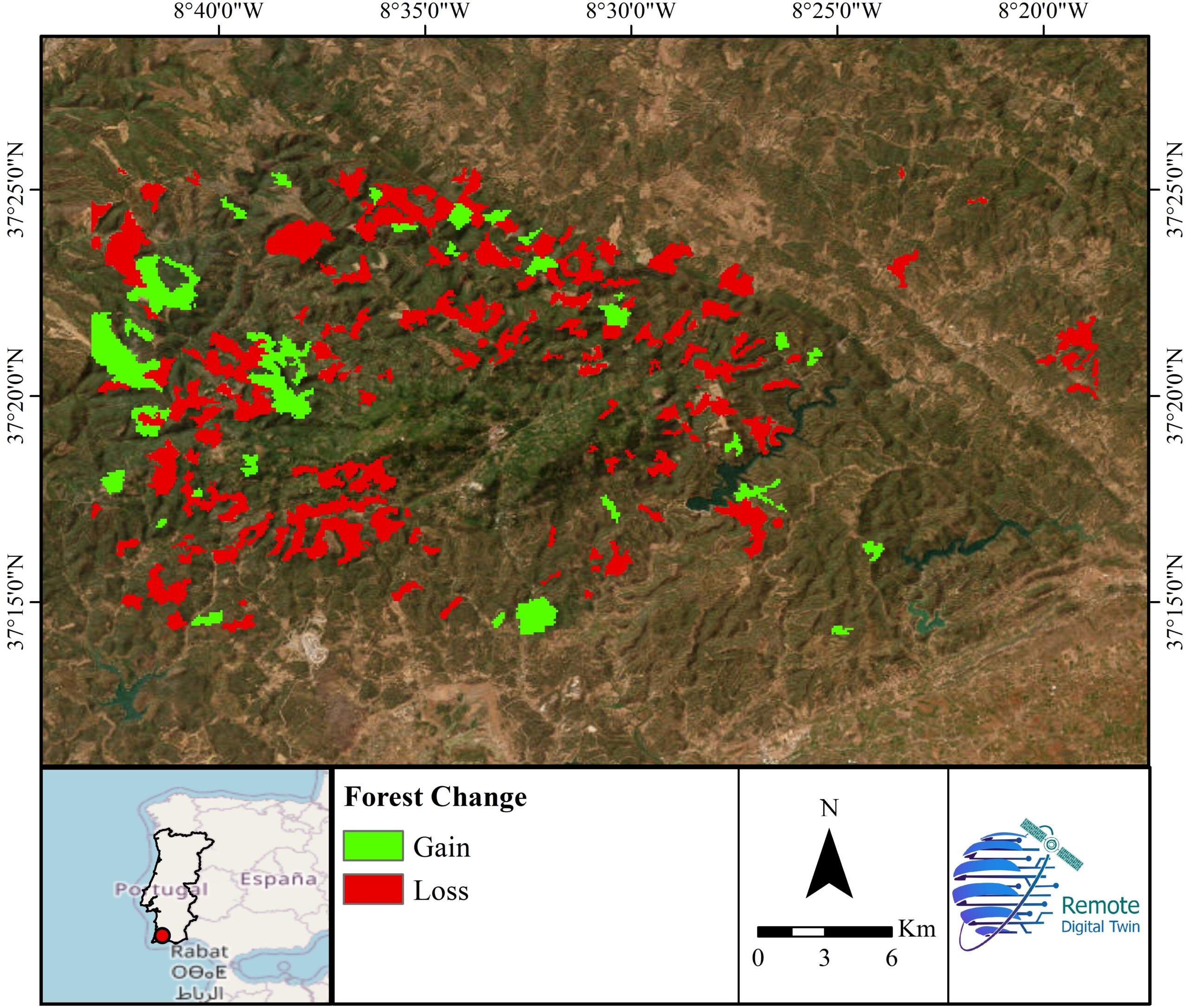
Forest Gain/Loss
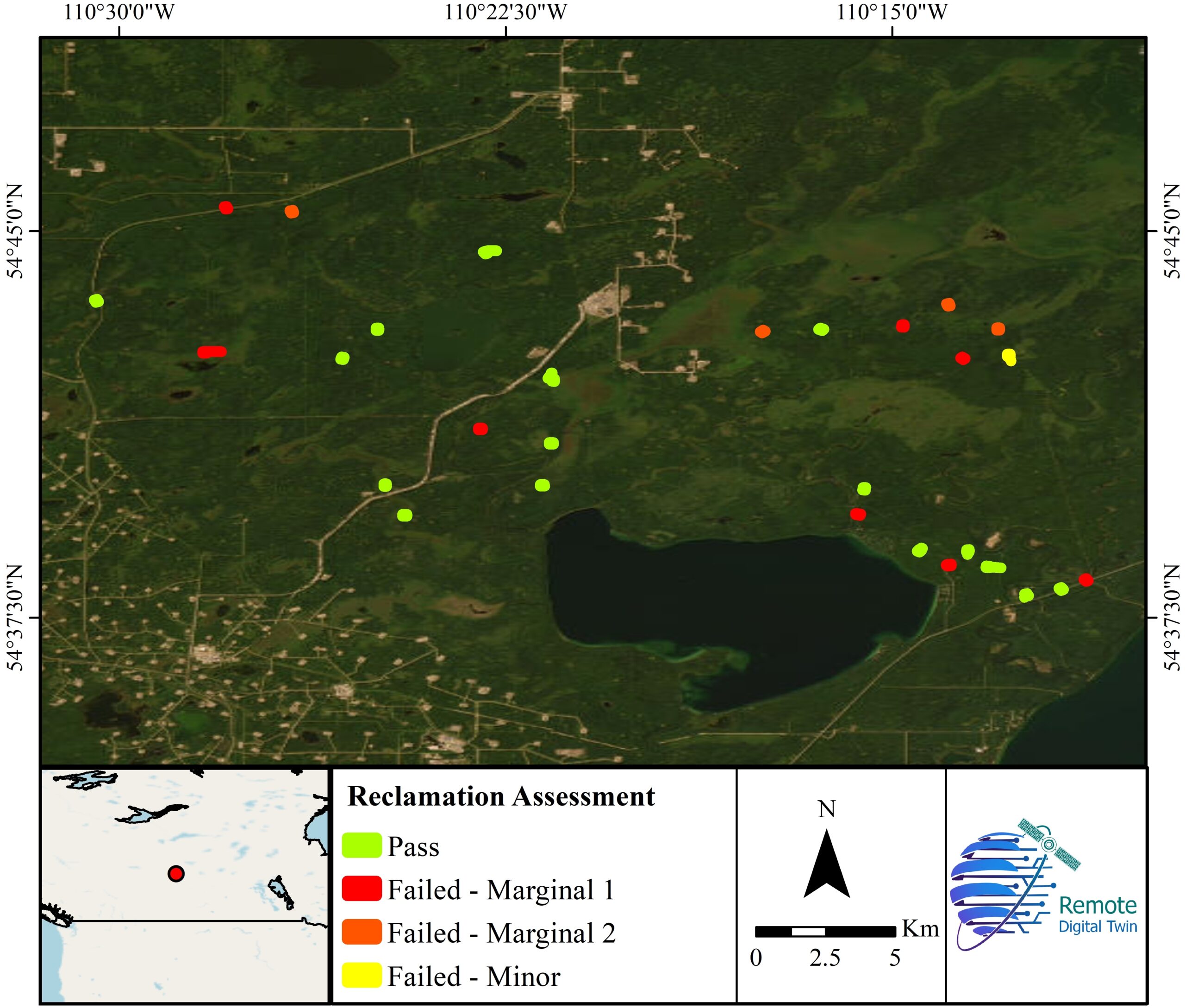
Reclamation
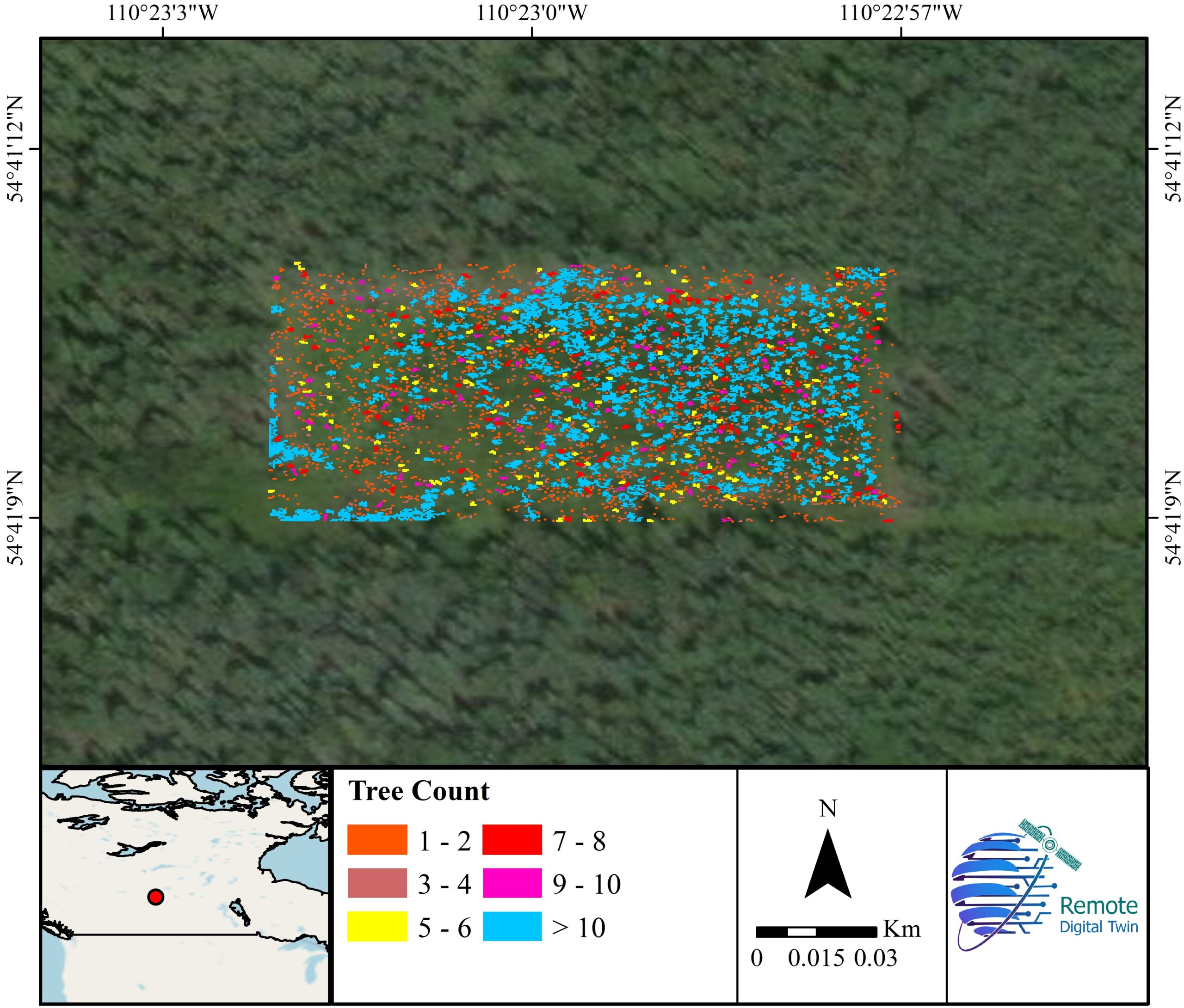
Tree Count
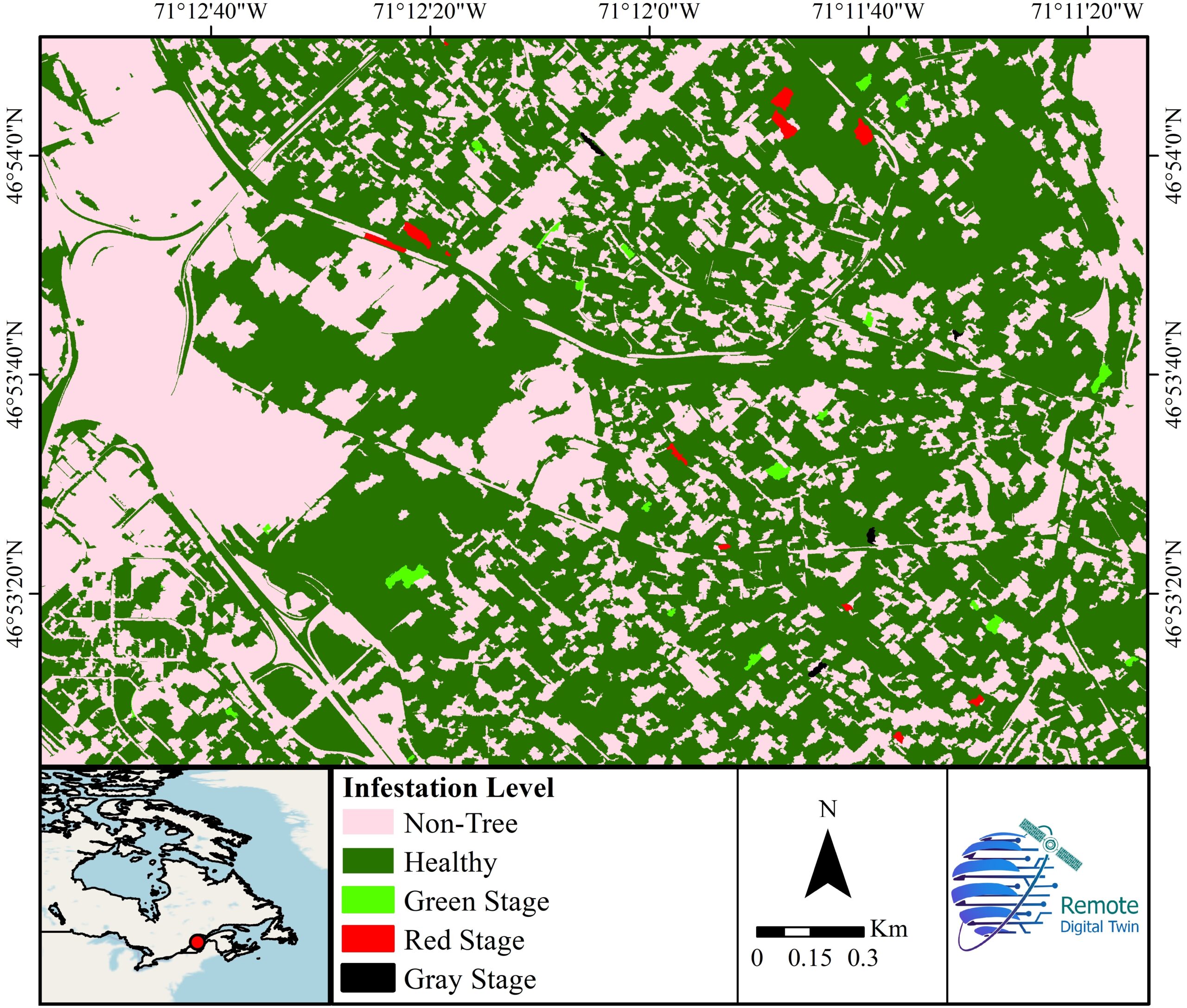
Tree Infestation
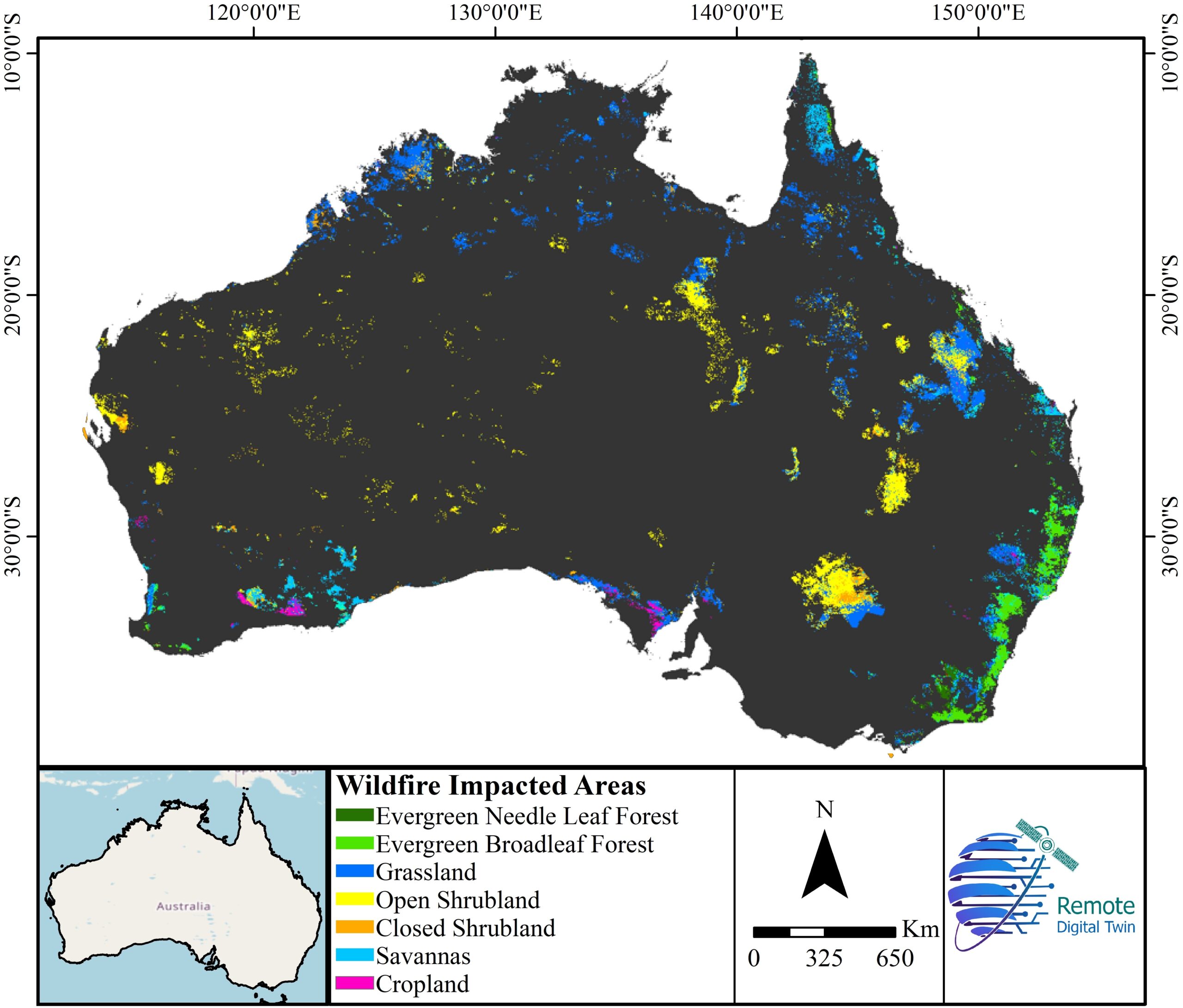
Wildfire Impact
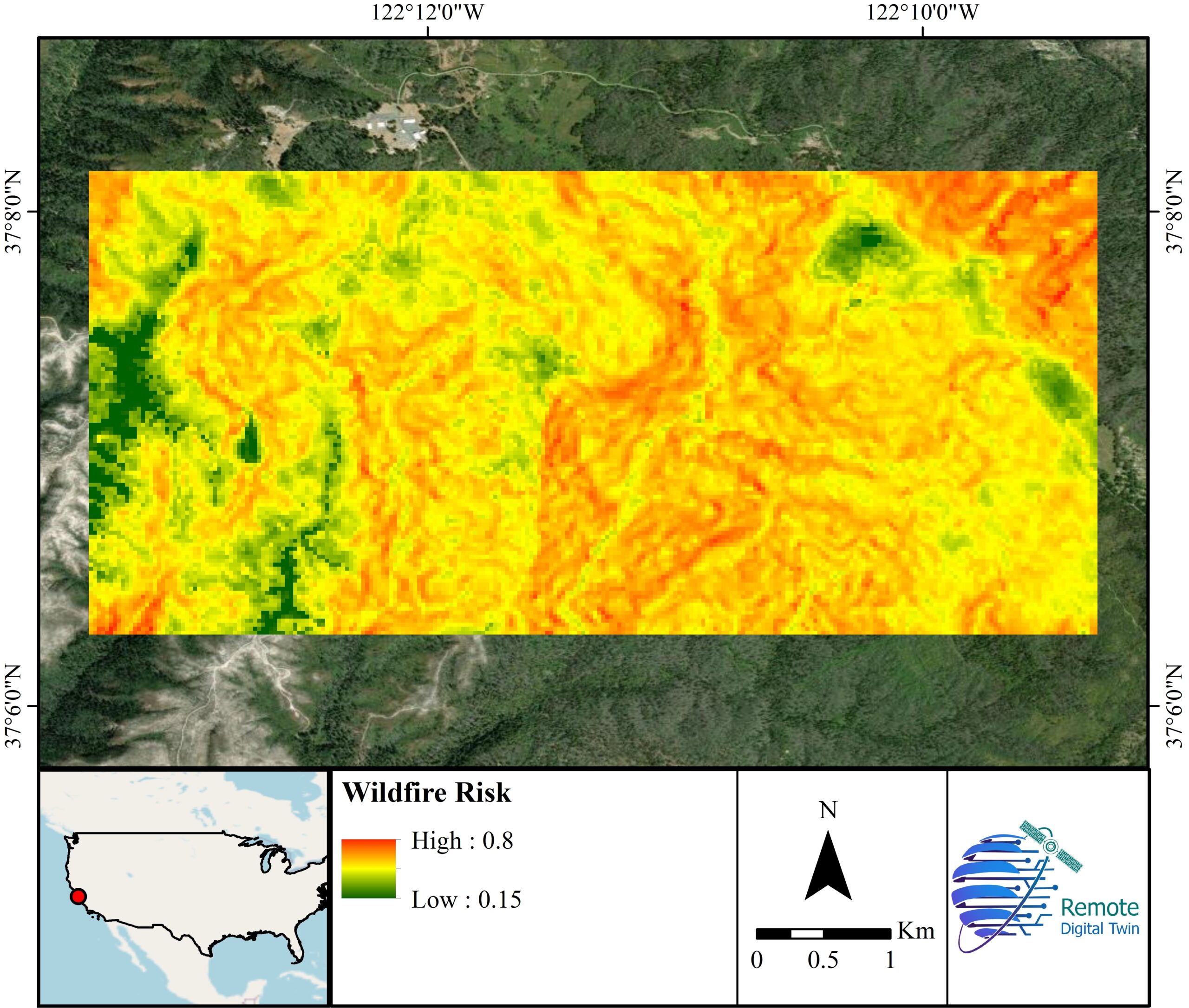
Wildfire Risk