3D Bridge
3D Building LOD2
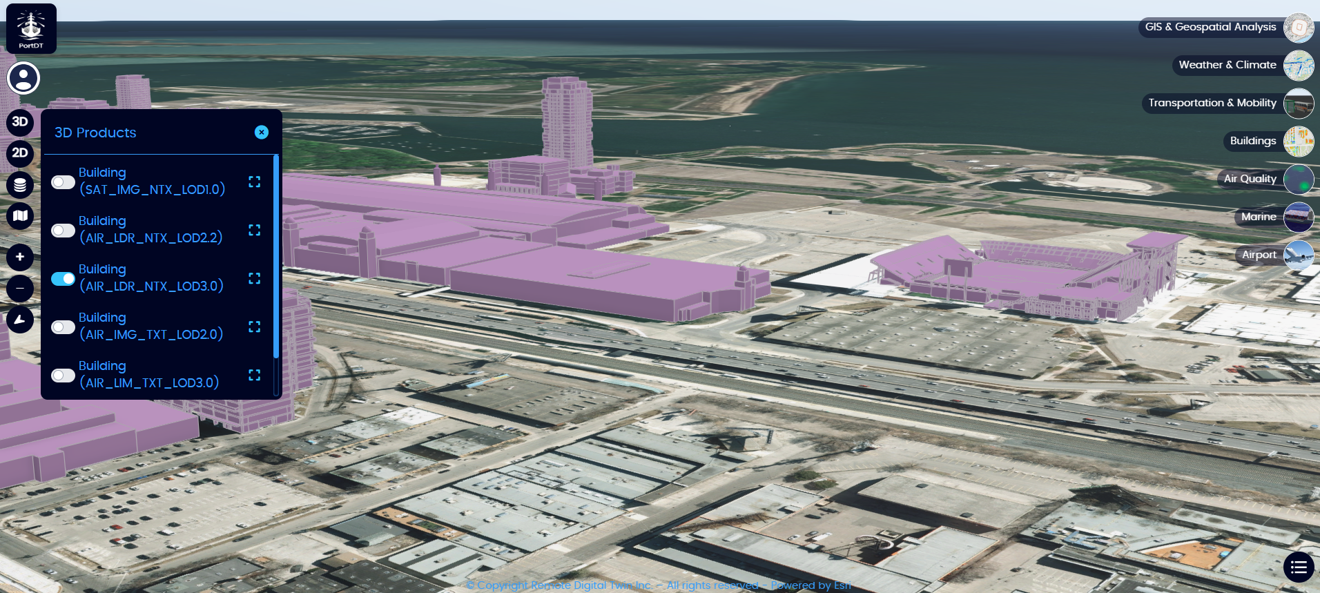
3D Building LOD3
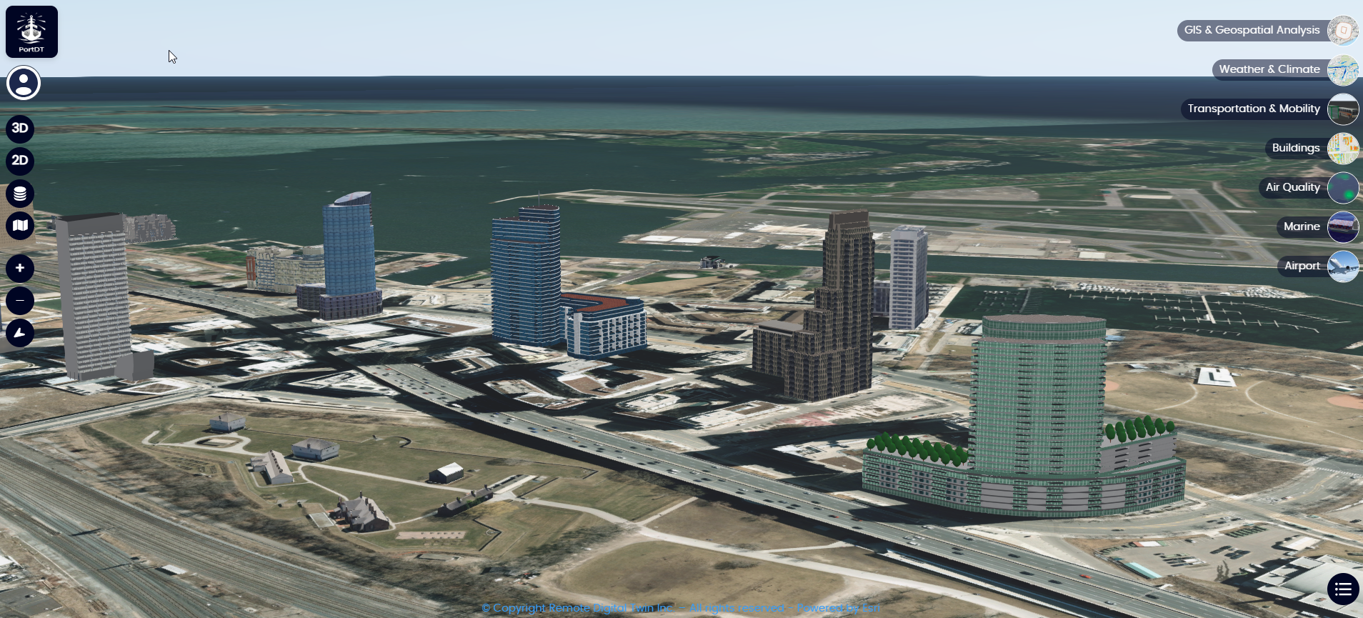
Textured 3D Building LOD3
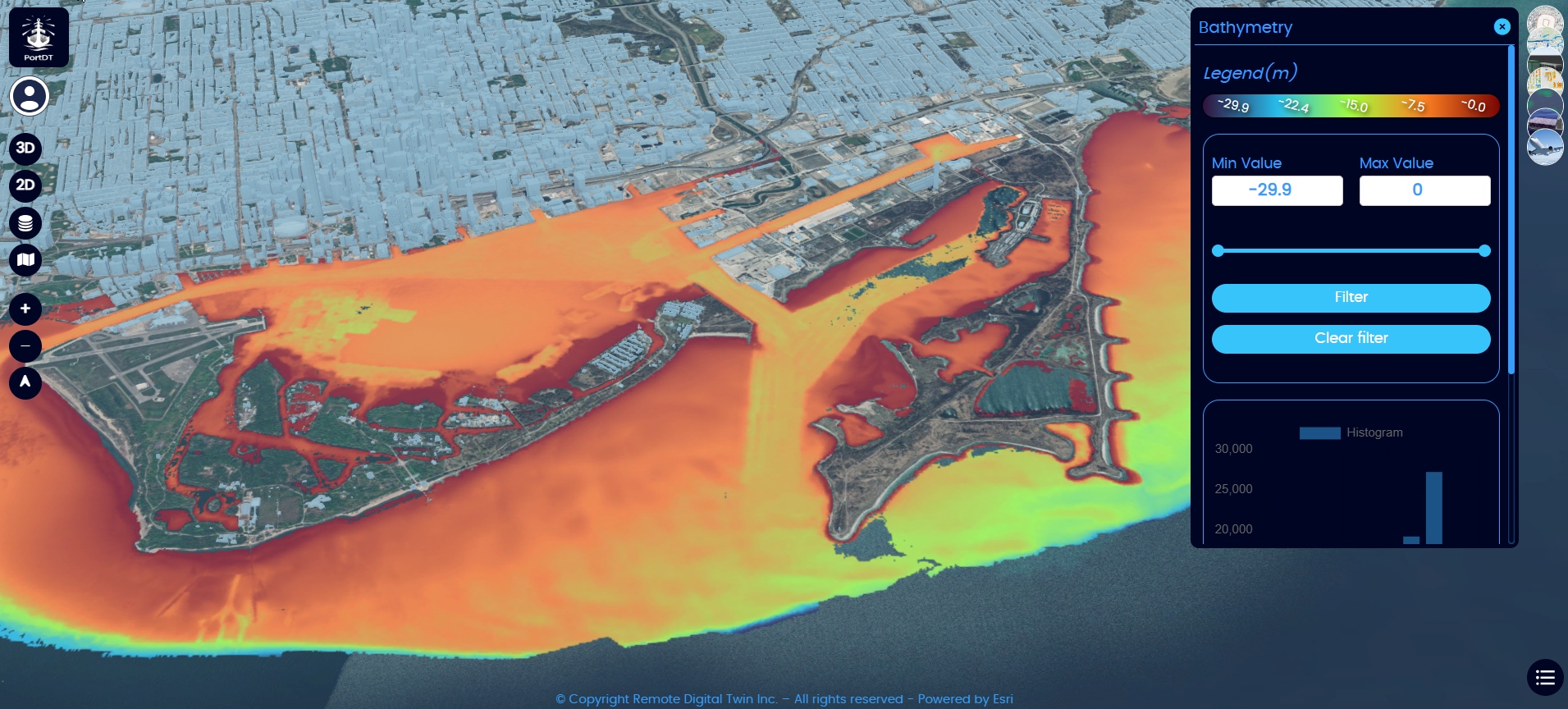
Bathymetry
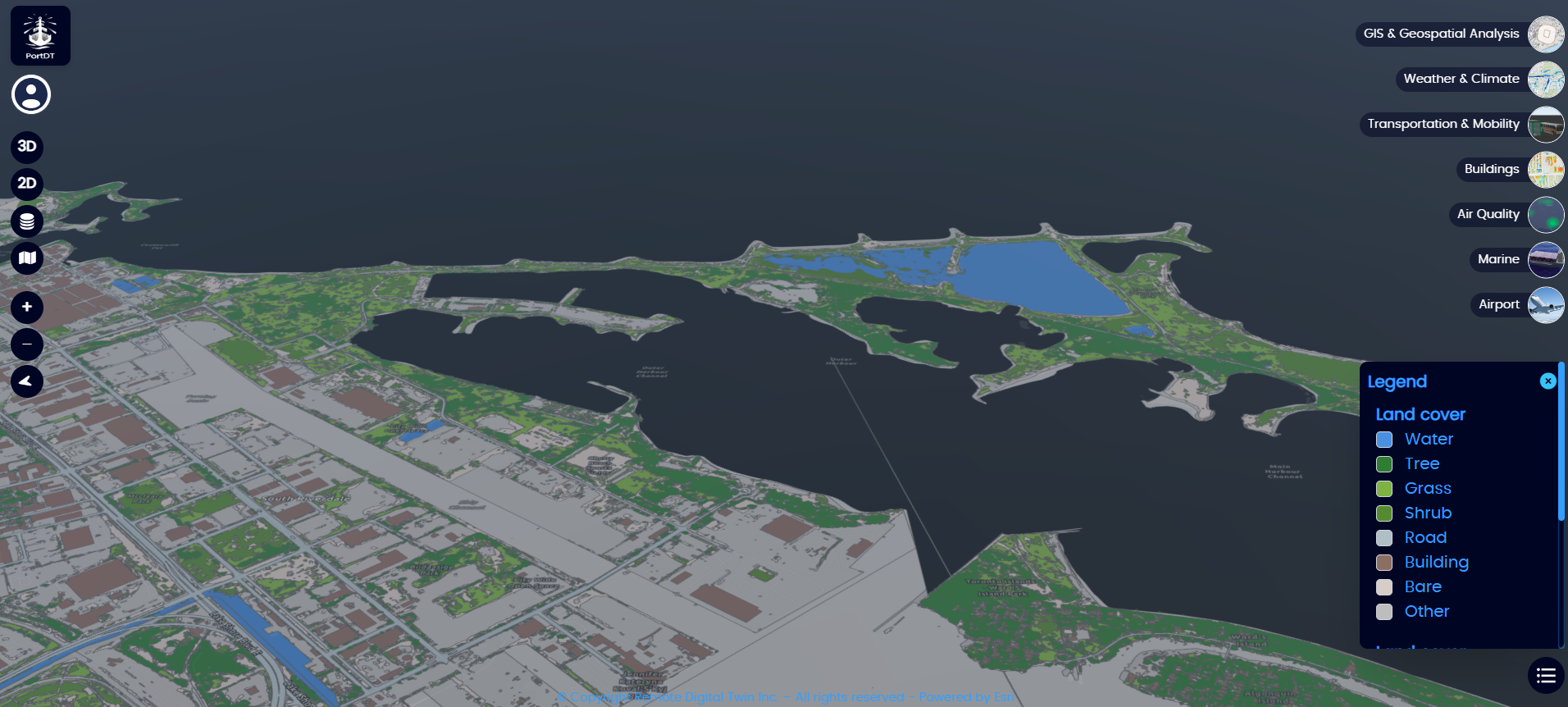
Landcover
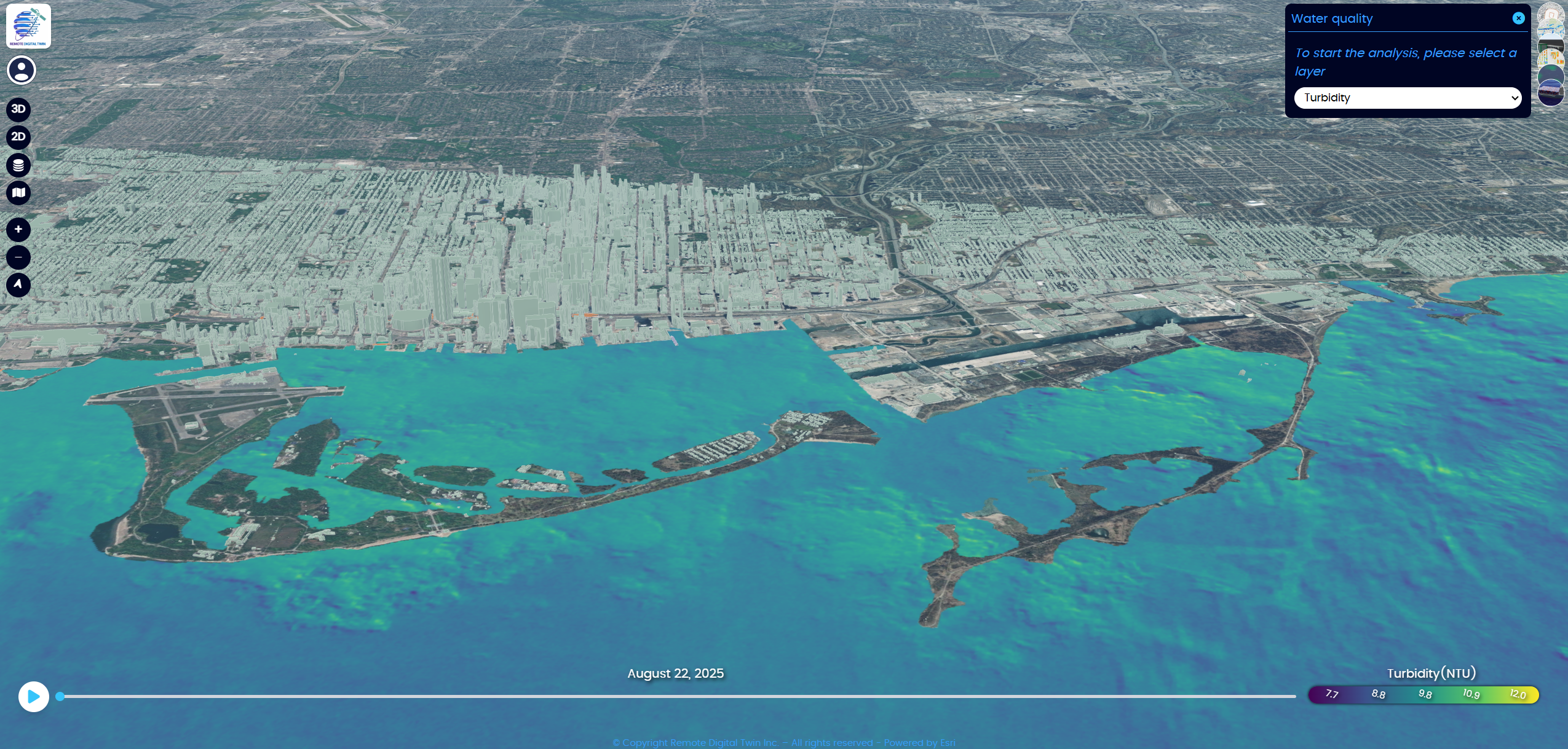
Time Series Turbidity
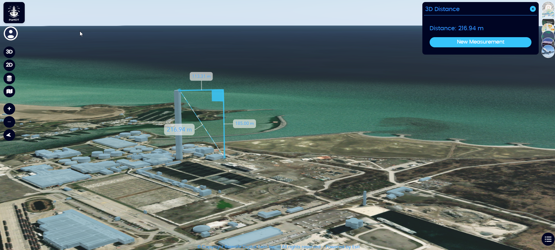
3D Distance Measurement
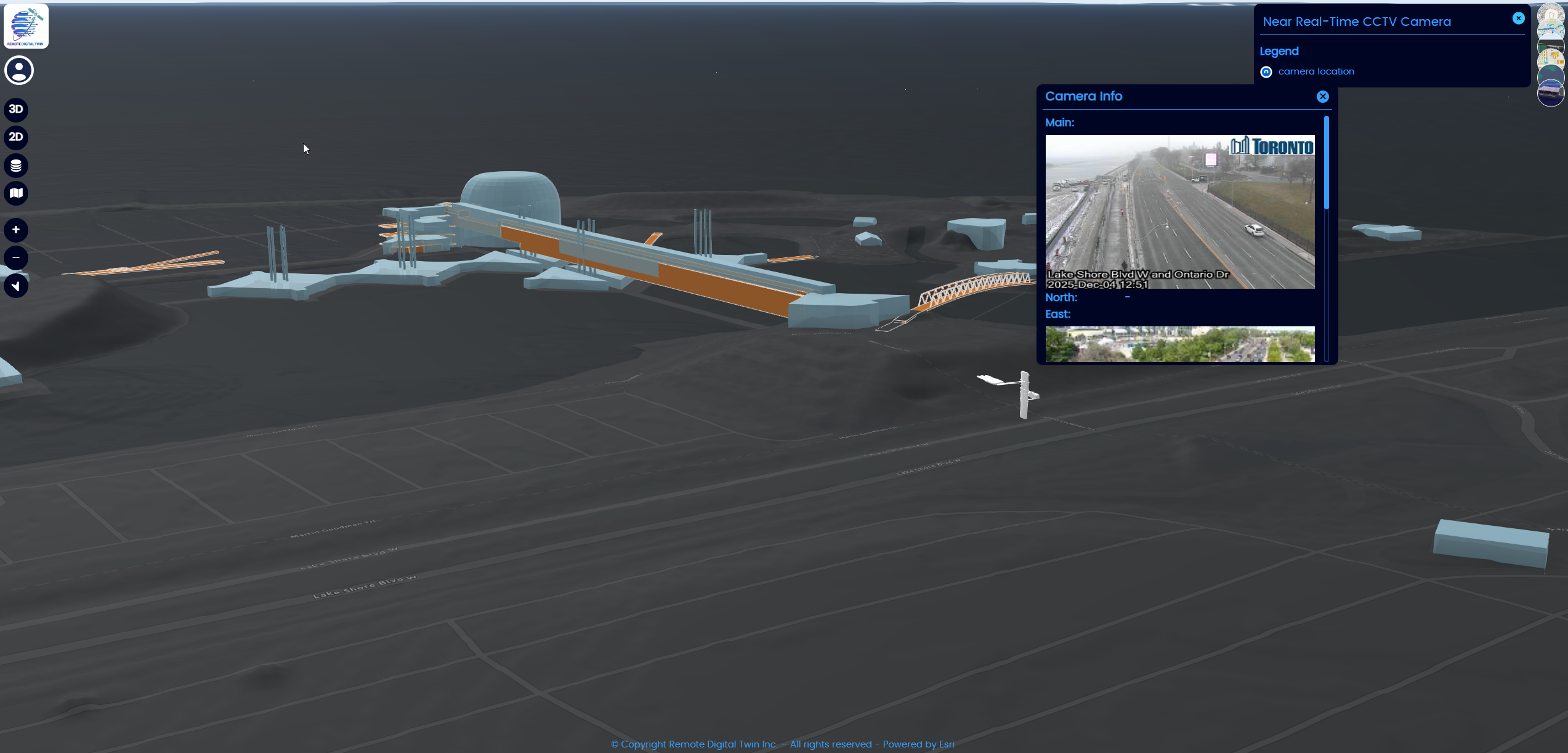
CCTV
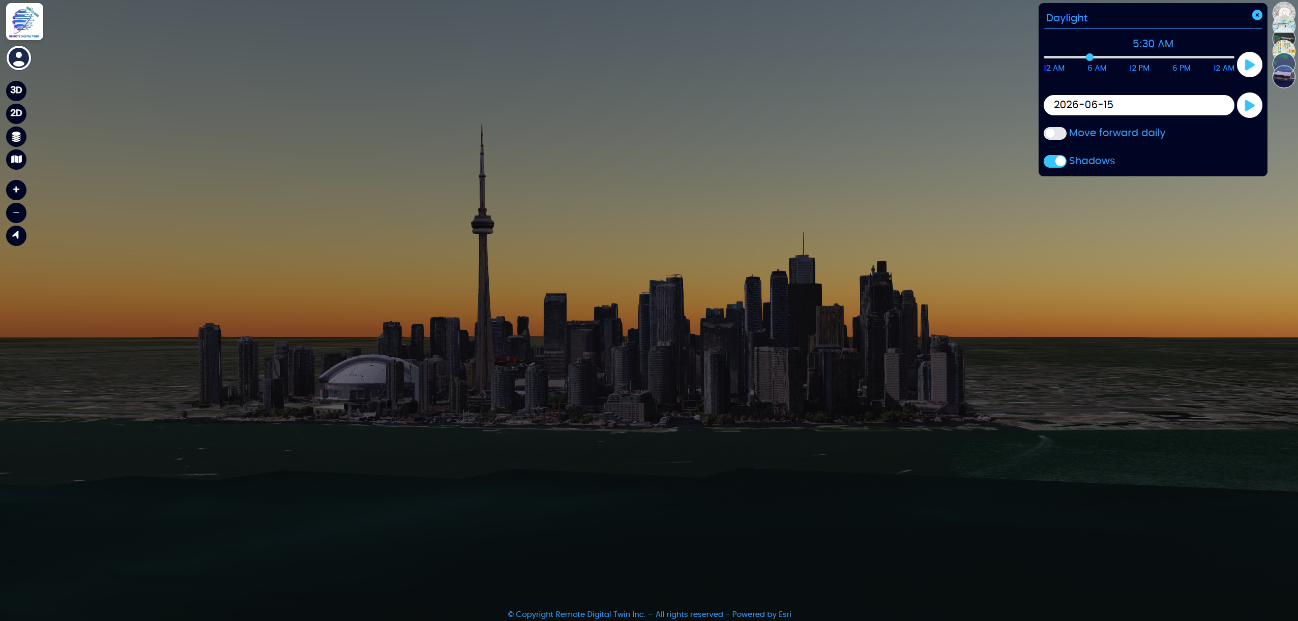
Daylight Analytics
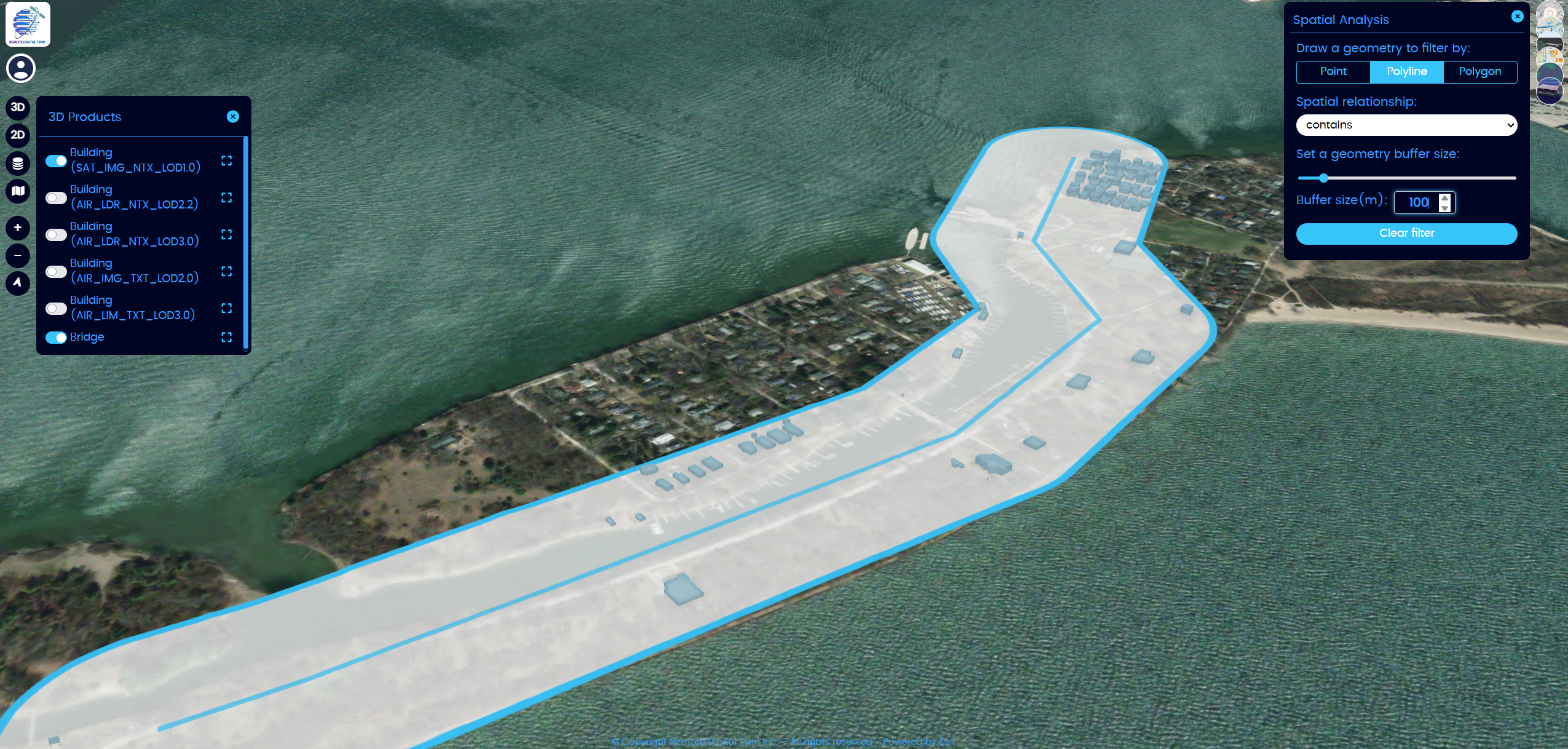
GIS Analytics

IoT Sensors
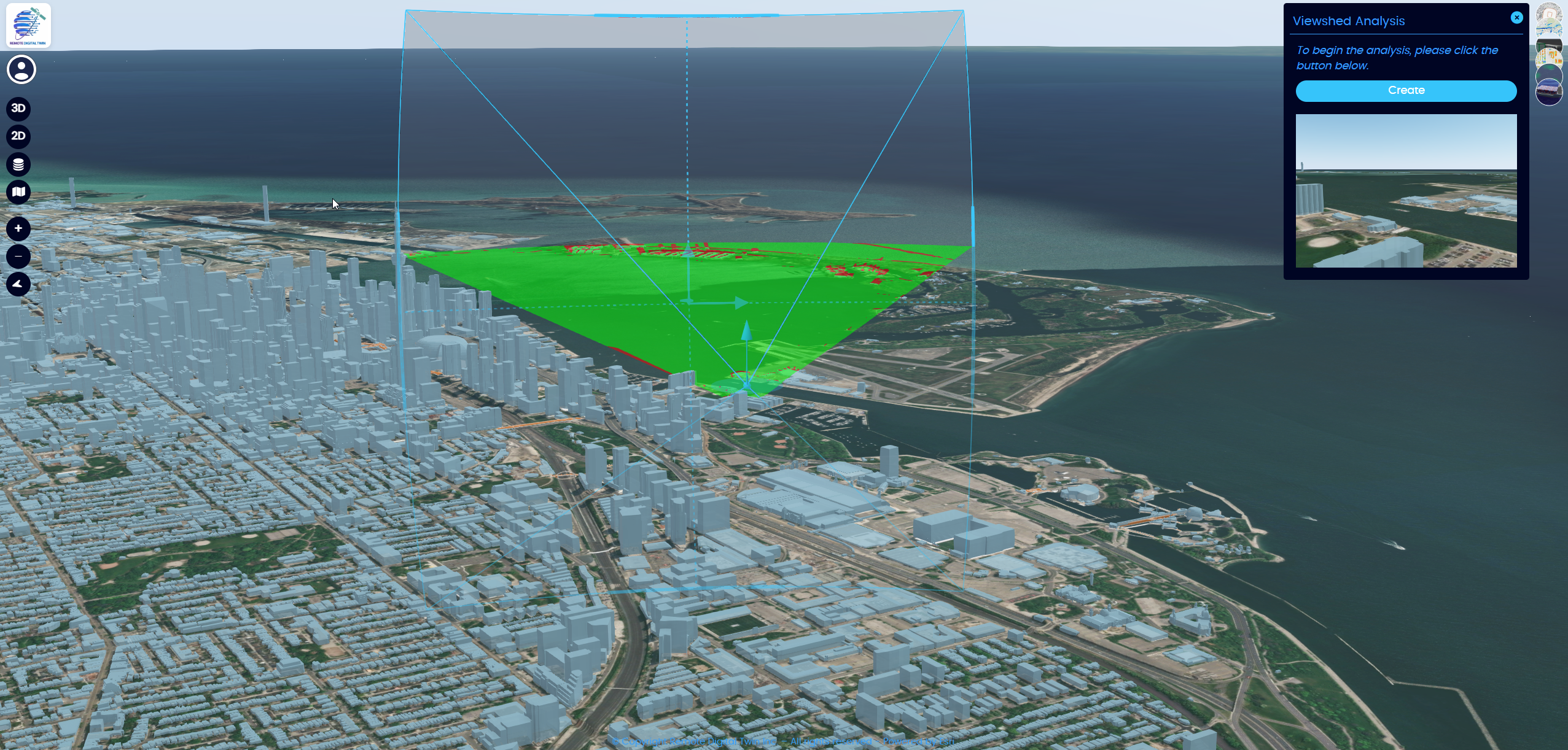
Viewshed Analysis
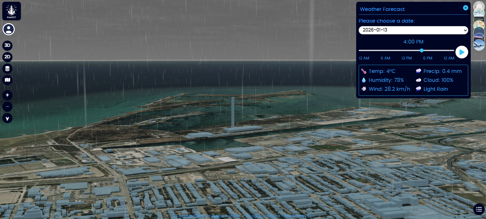
Weather Forecasting
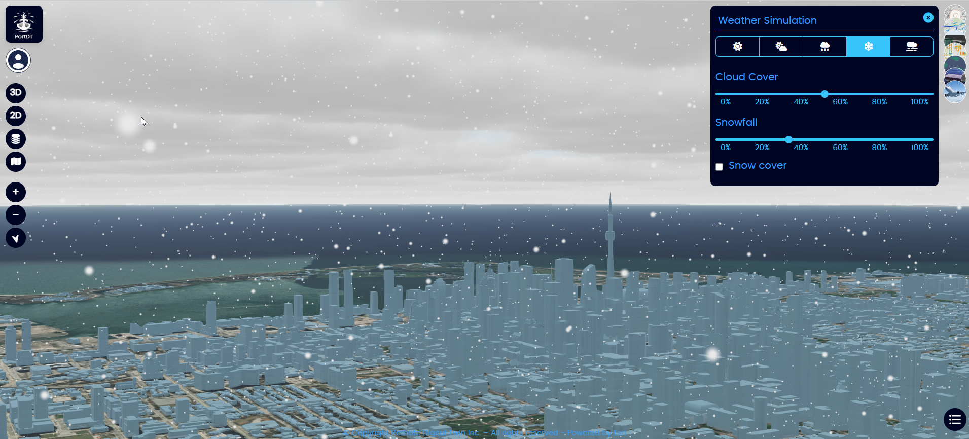
Weather Simulation
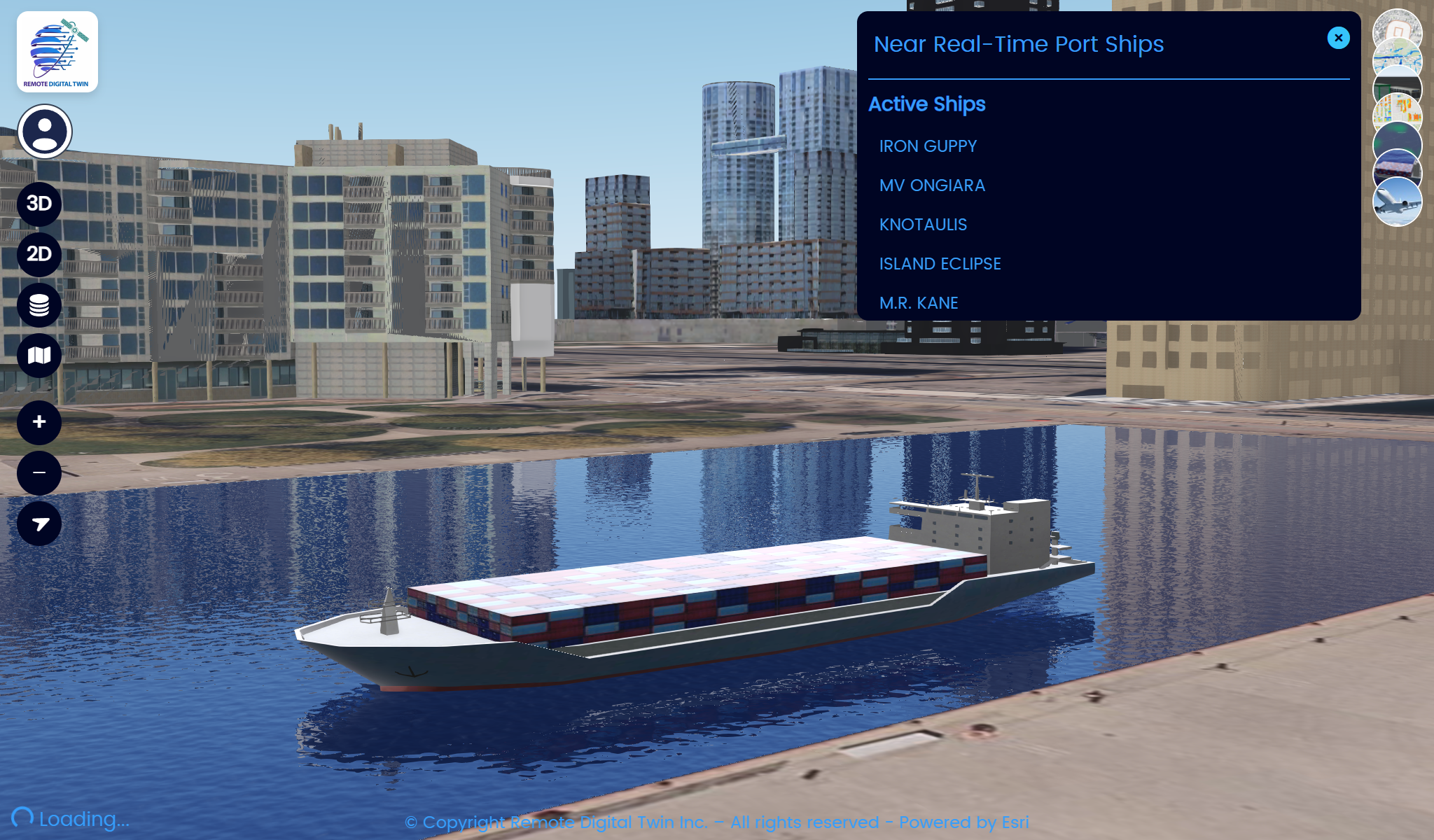
Near-Real-Time Ship Data
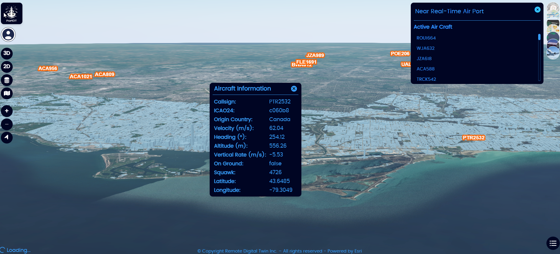
Near-Real-Time Airport Data
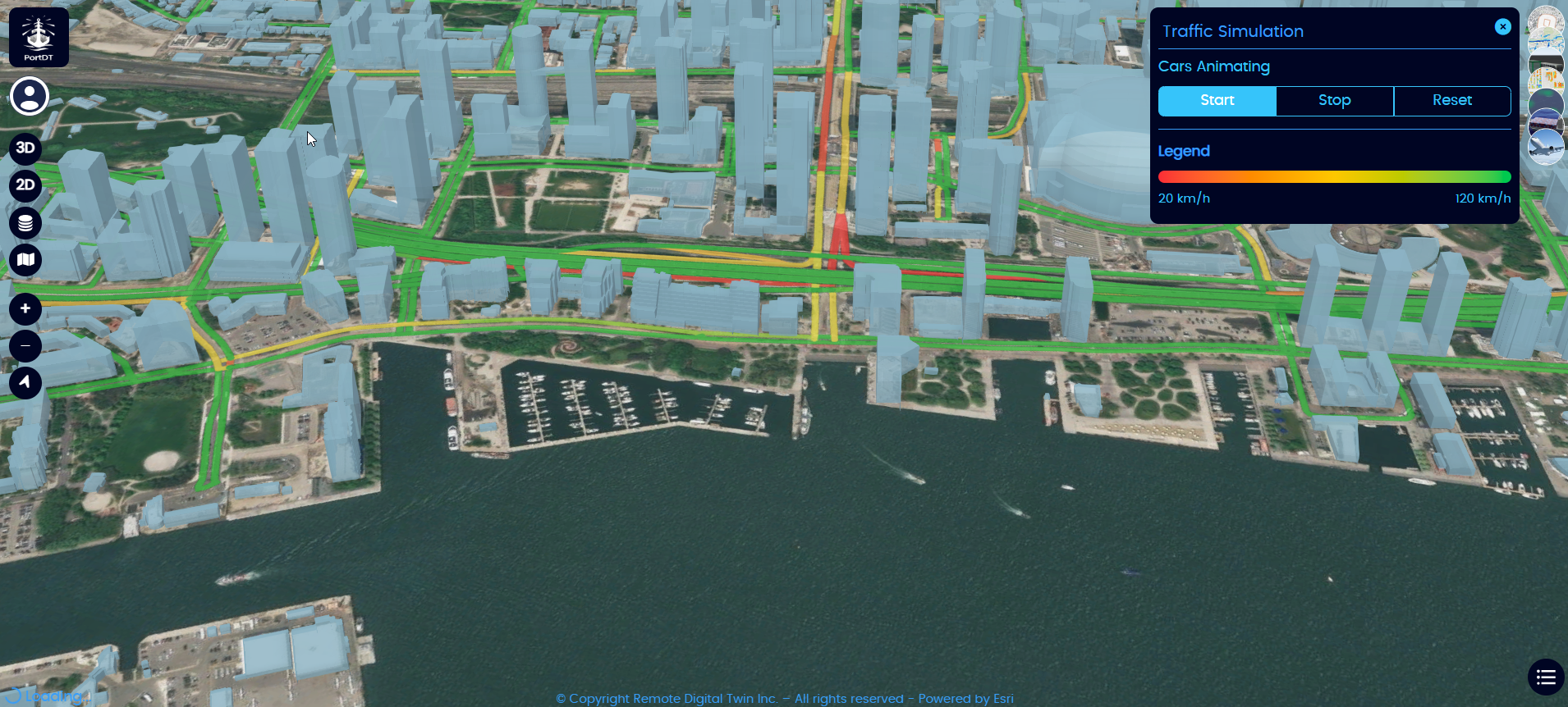
Near-Real-Time Traffic Data
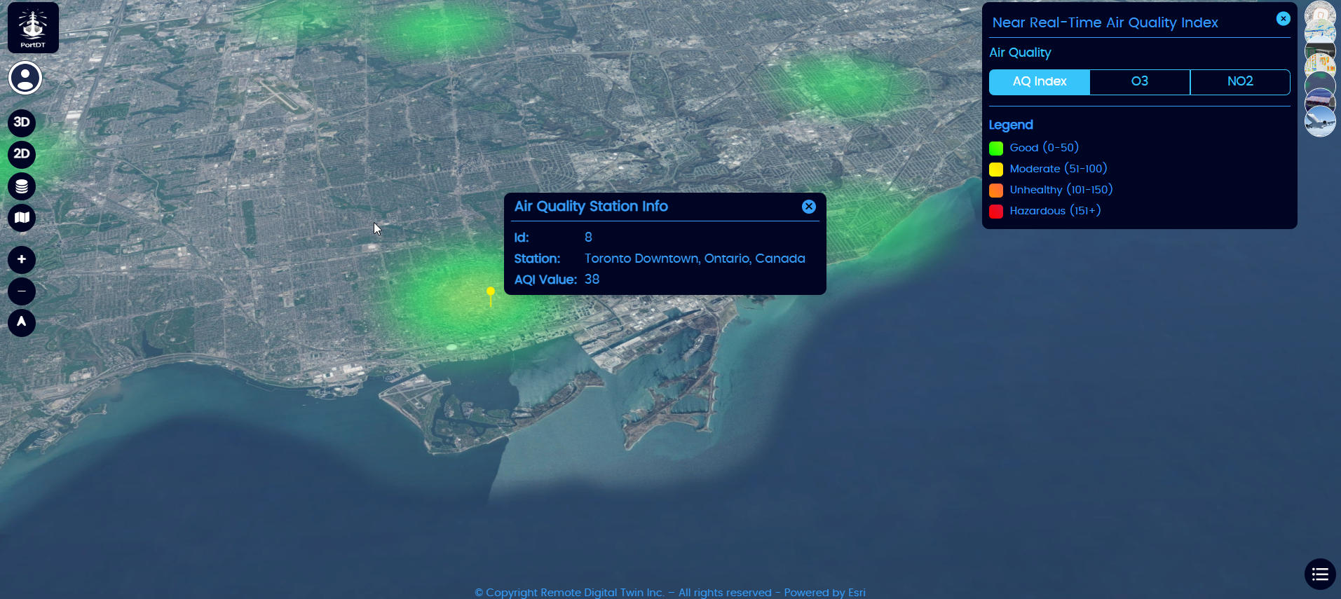
Near-Real-Time Air Quality Data
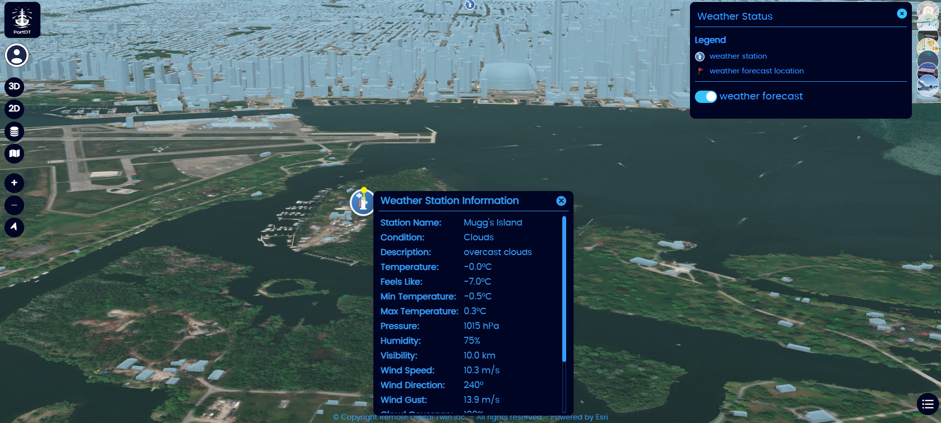
Near-Real-Time Weather Station Data