
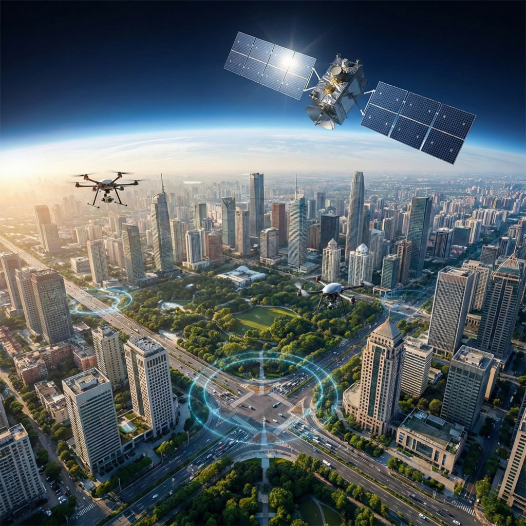
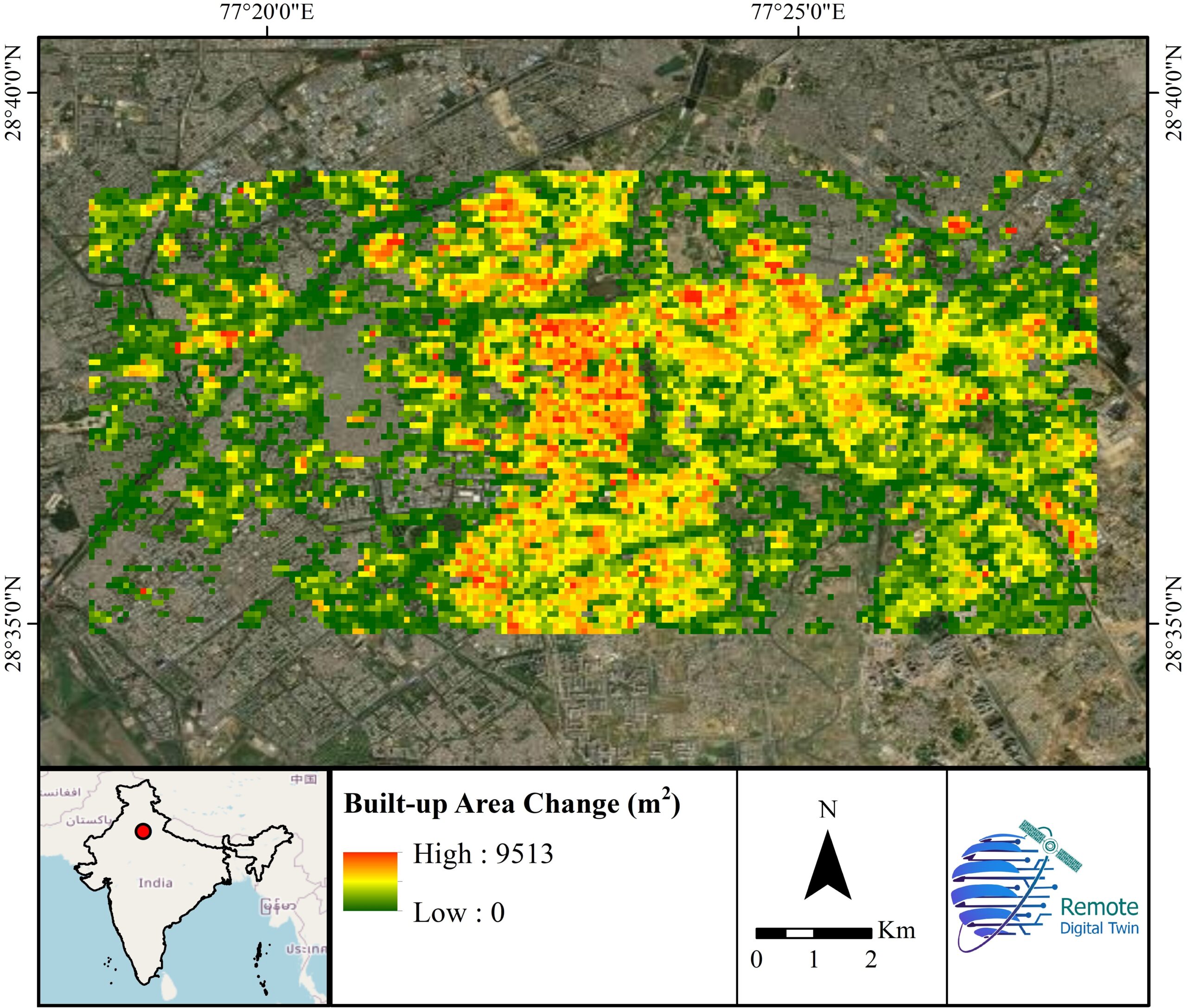
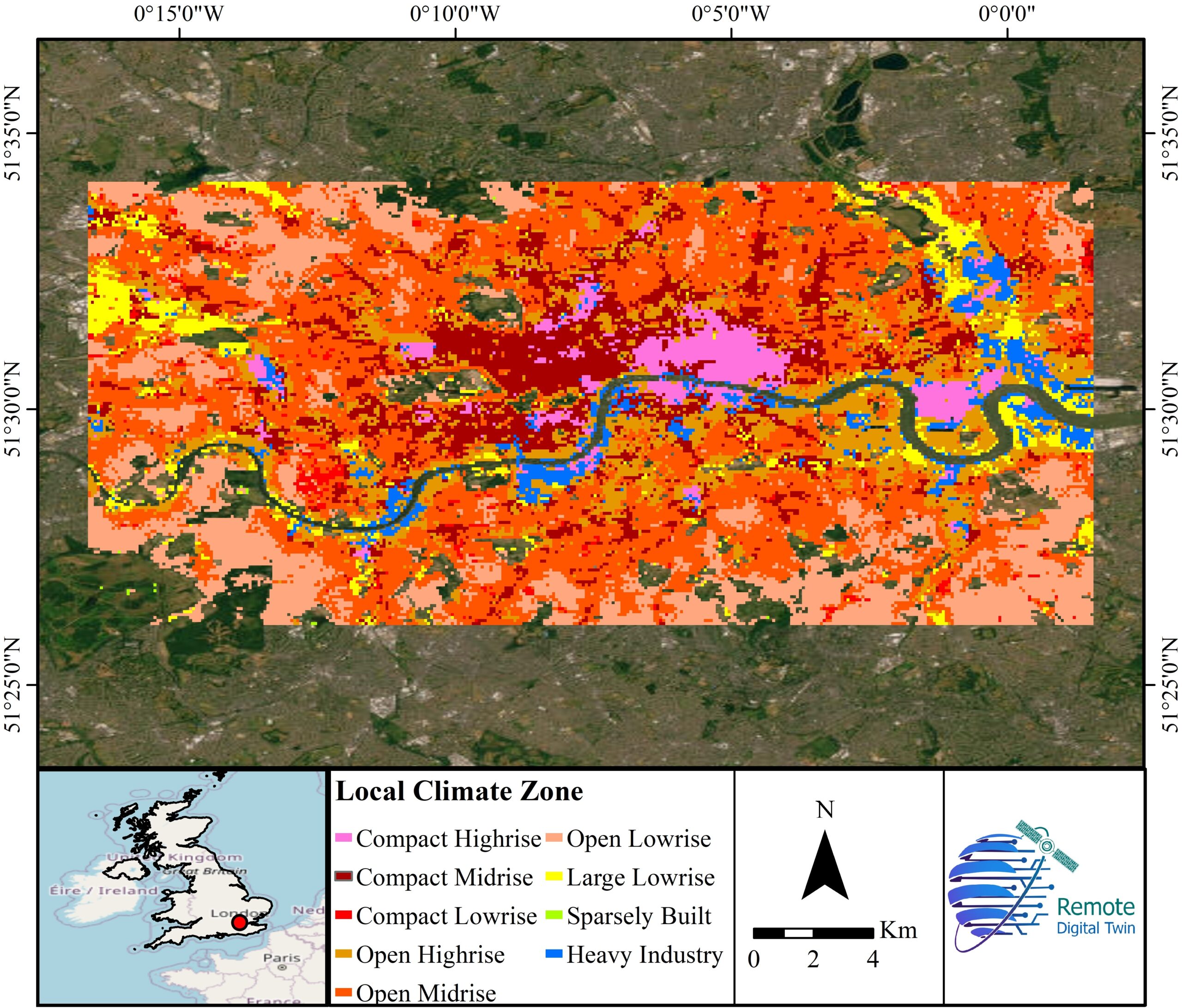
Urban planning and smart cities
Mapping buildings, roads, green spaces, and infrastructure to support development, zoning, and city management.
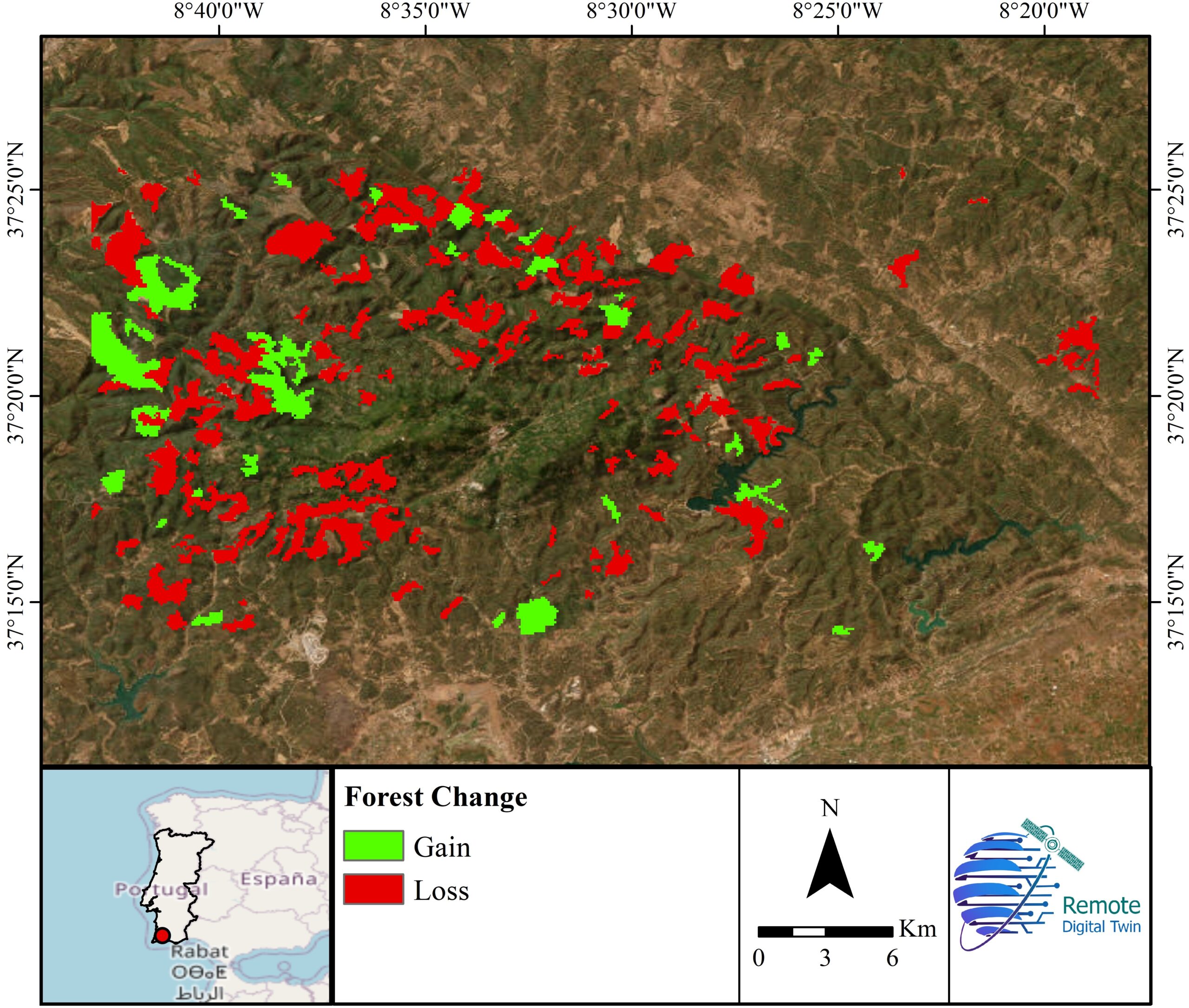
Environmental monitoring
Tracking deforestation, land degradation, wetlands, coastal erosion, and habitat changes over time.
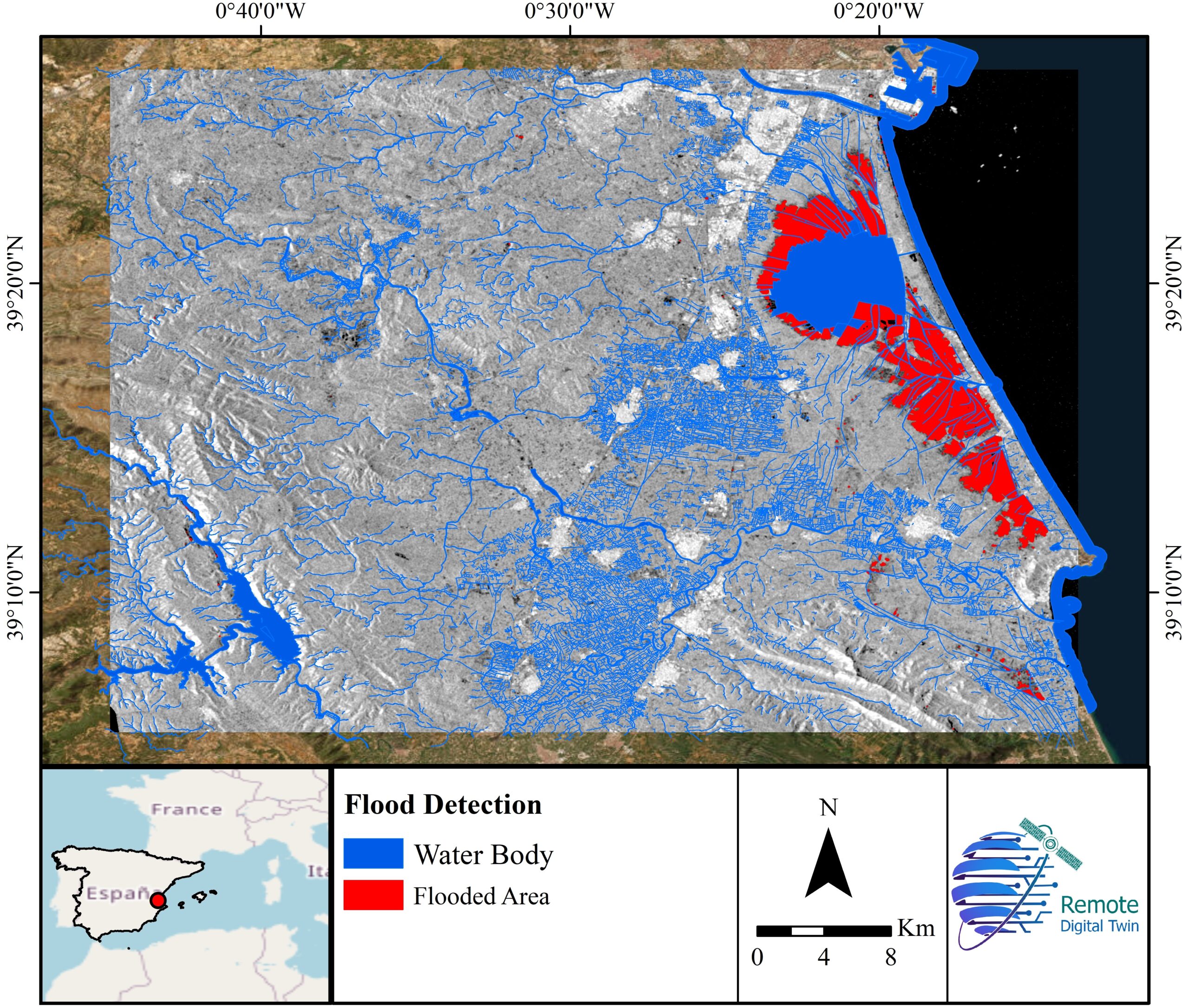
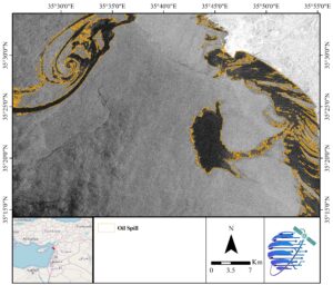
Disaster management
Detecting and assessing floods, wildfires, landslides, earthquakes, and storm damage quickly and safely.
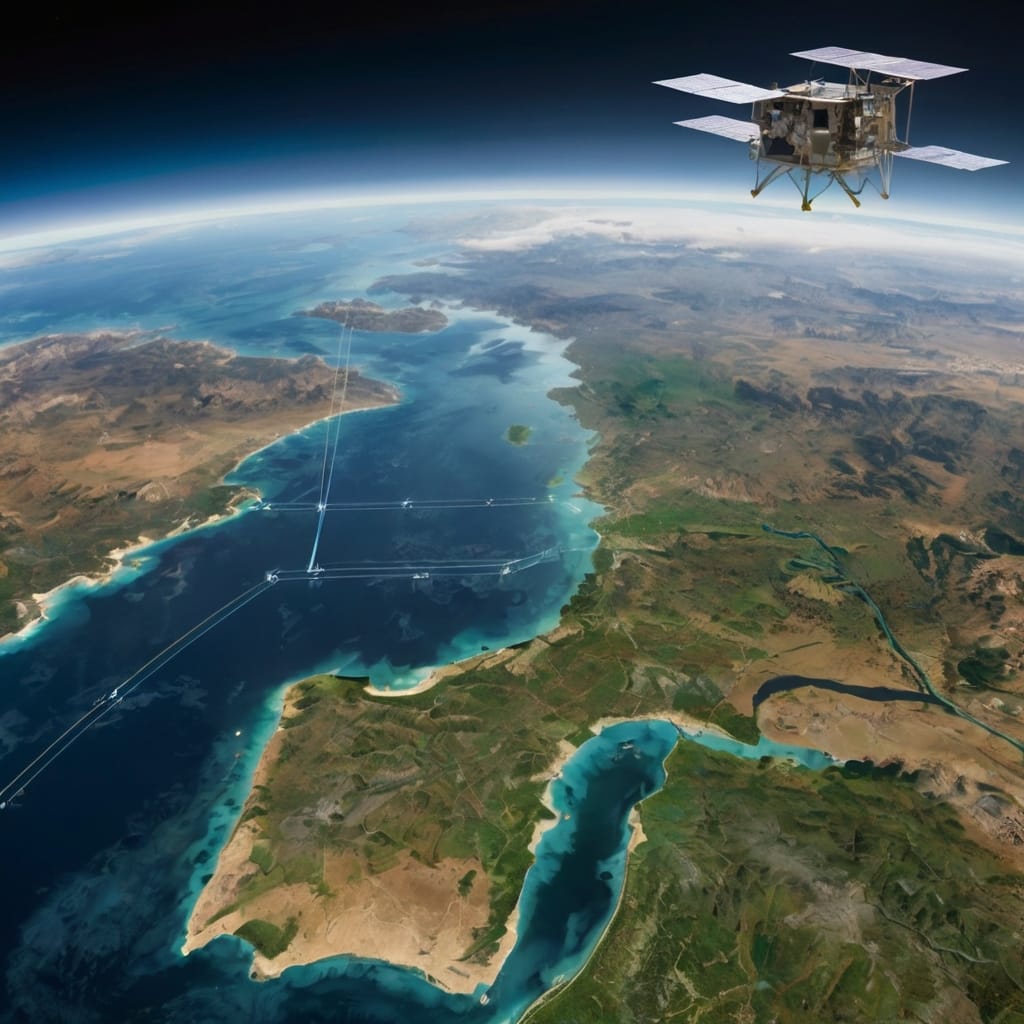
Water resources management
Observing lakes, rivers, snowpack, drought conditions, and water quality.
Climate and weather analysis
Studying temperature patterns, ice cover, sea level rise, and atmospheric conditions.
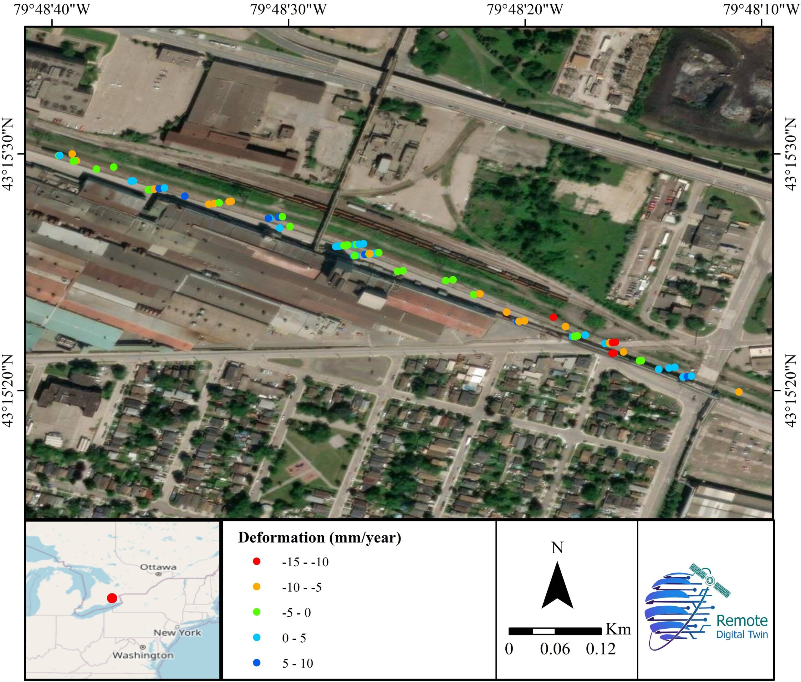
Infrastructure inspection
Monitoring roads, bridges, pipelines, power lines, and railways for deformation, damage, or vegetation encroachment.
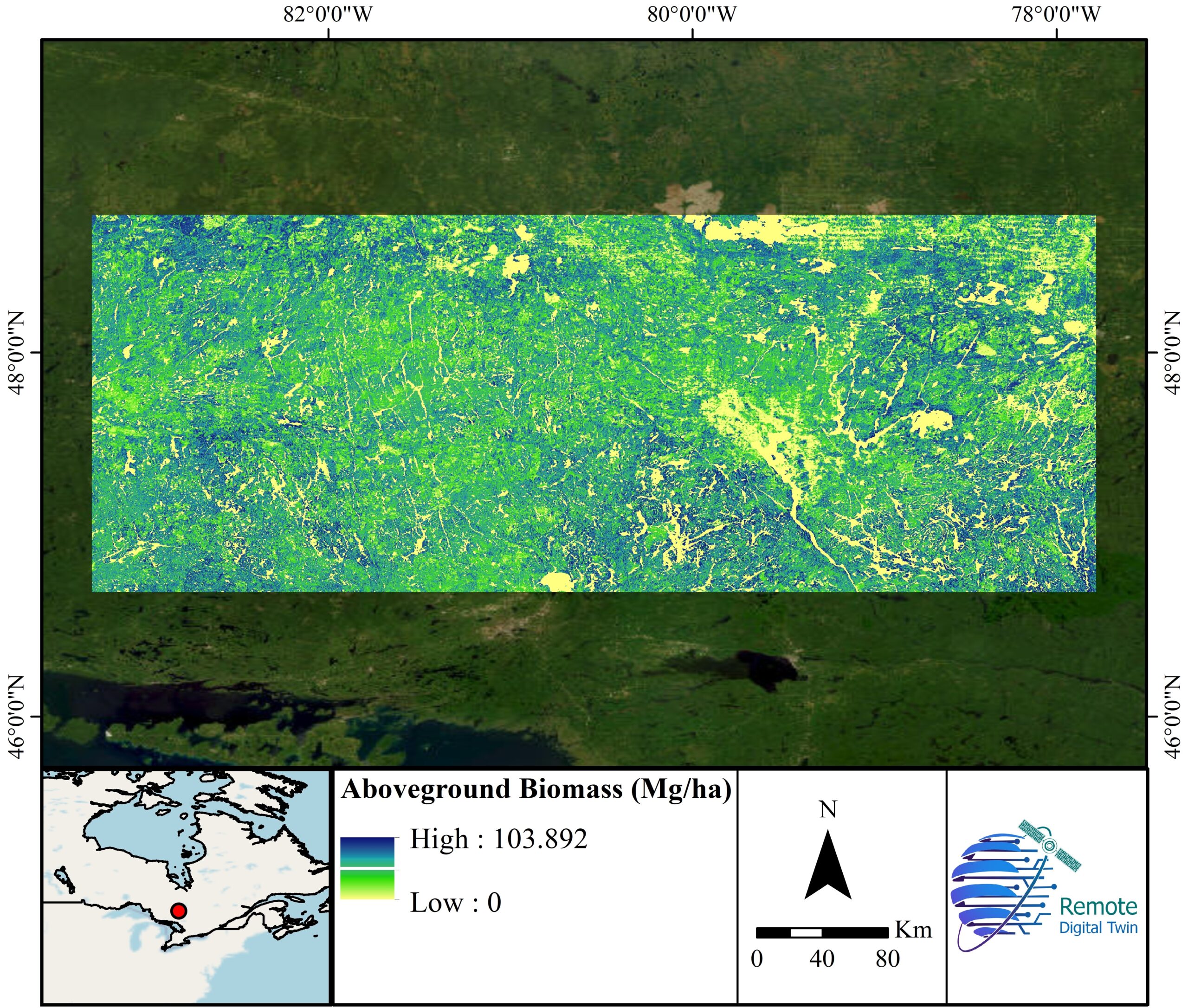
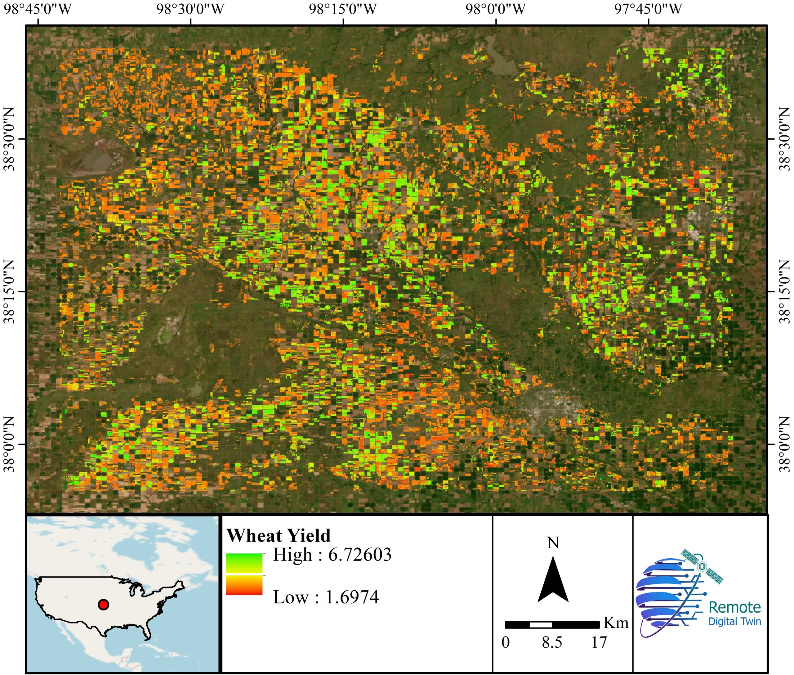
Forestry and vegetation management
Detecting pest infestations, forest health, biomass estimation, and logging activities.
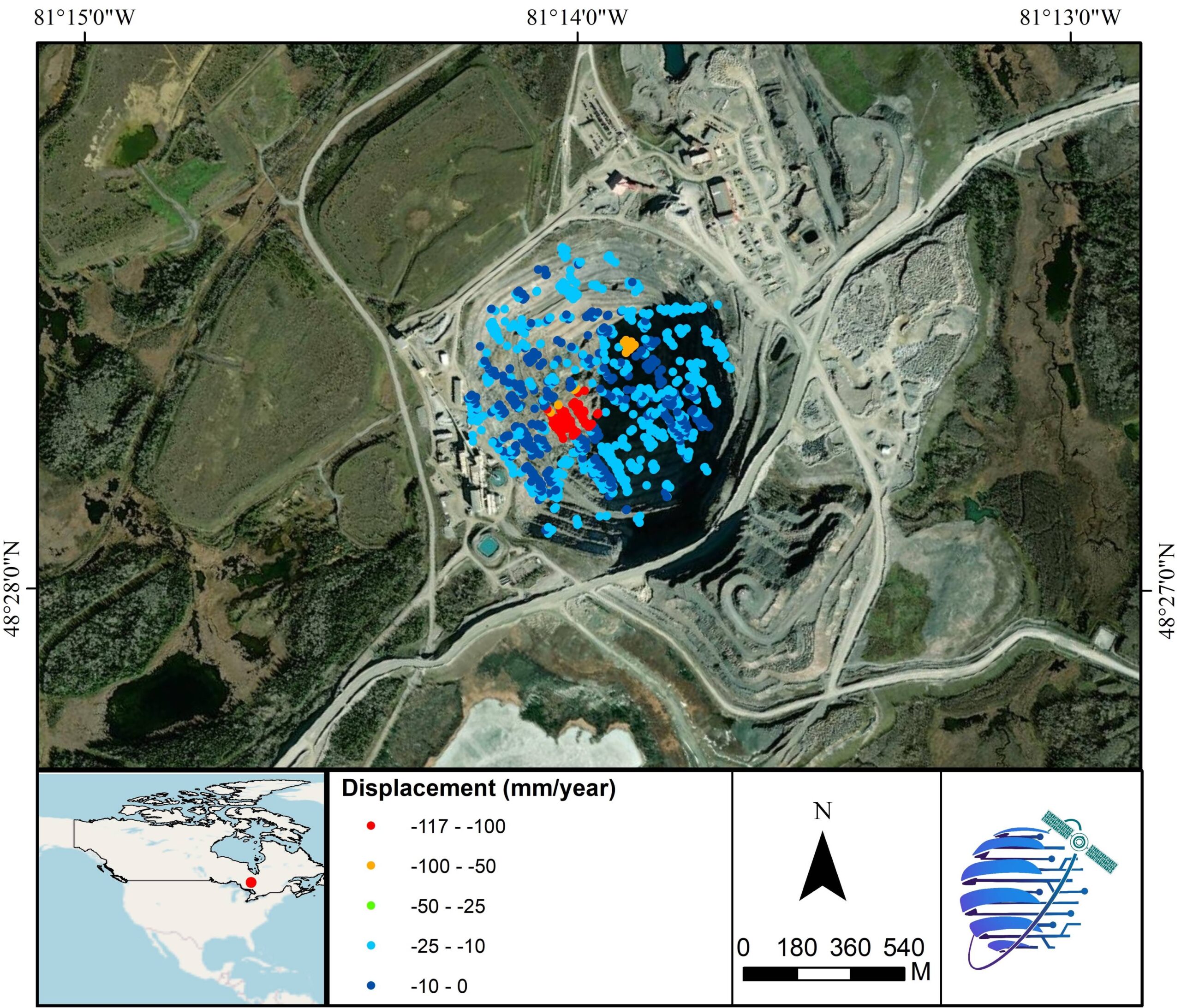
Mining and energy sector
Monitoring land deformation, tailings dams, reclamation progress, and environmental impacts.
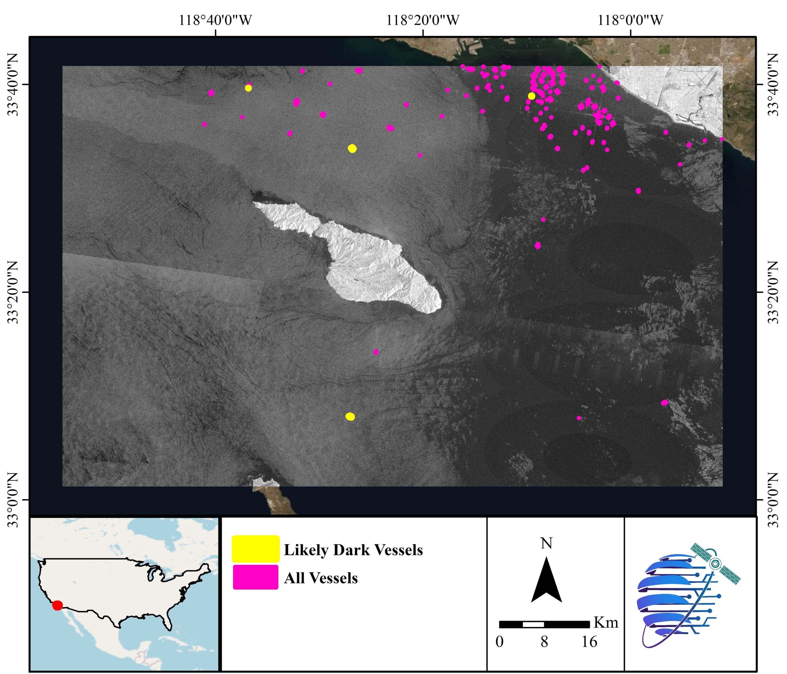
Security and border monitoring
Observing large areas for unauthorized activities or changes in land use.
Challenges:
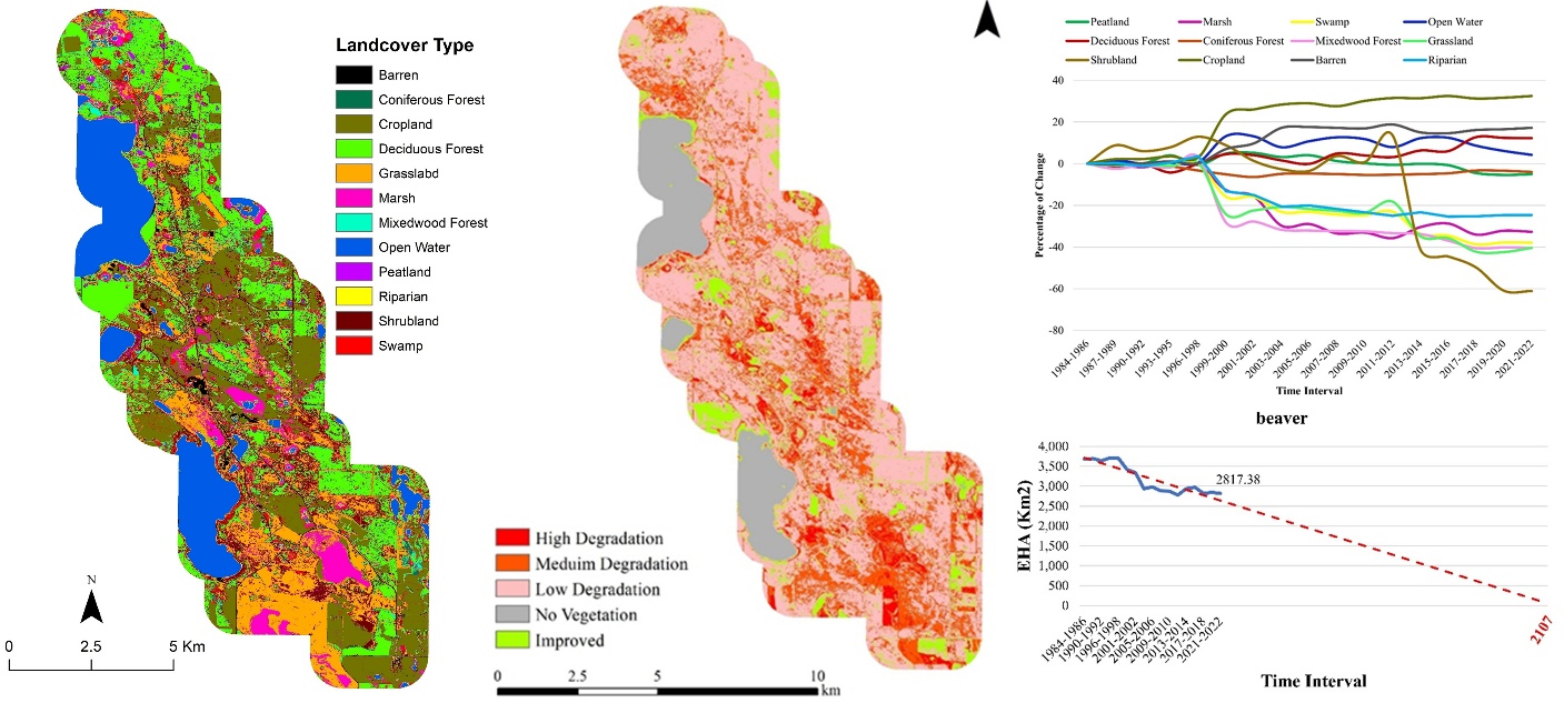
Assessing cumulative environmental impacts over large and remote areas, while integrating multi-source datasets (satellite, field, and ecological data) and linking land cover changes to biodiversity and ecosystem health.
Solutions:
Developed an integrated geospatial solution leveraging cutting-edge remote sensing, AI, and cloud computing models to monitor land cover change, species diversity, and vegetation health, supported by field data and Traditional Ecological Knowledge (TEK) for improved accuracy and ecological relevance.
Description of Services:
- Acquisition and processing of multi-source satellite and field data
- AI-based land cover classification and change detection
- Linear feature extraction and environmental impact assessment
- Species diversity and vegetation health analysis
- Development of GIS-ready datasets, maps, and geodatabases
- Cloud-based processing and scalable analytics workflows
- Indigenous communications and stakeholder engagement
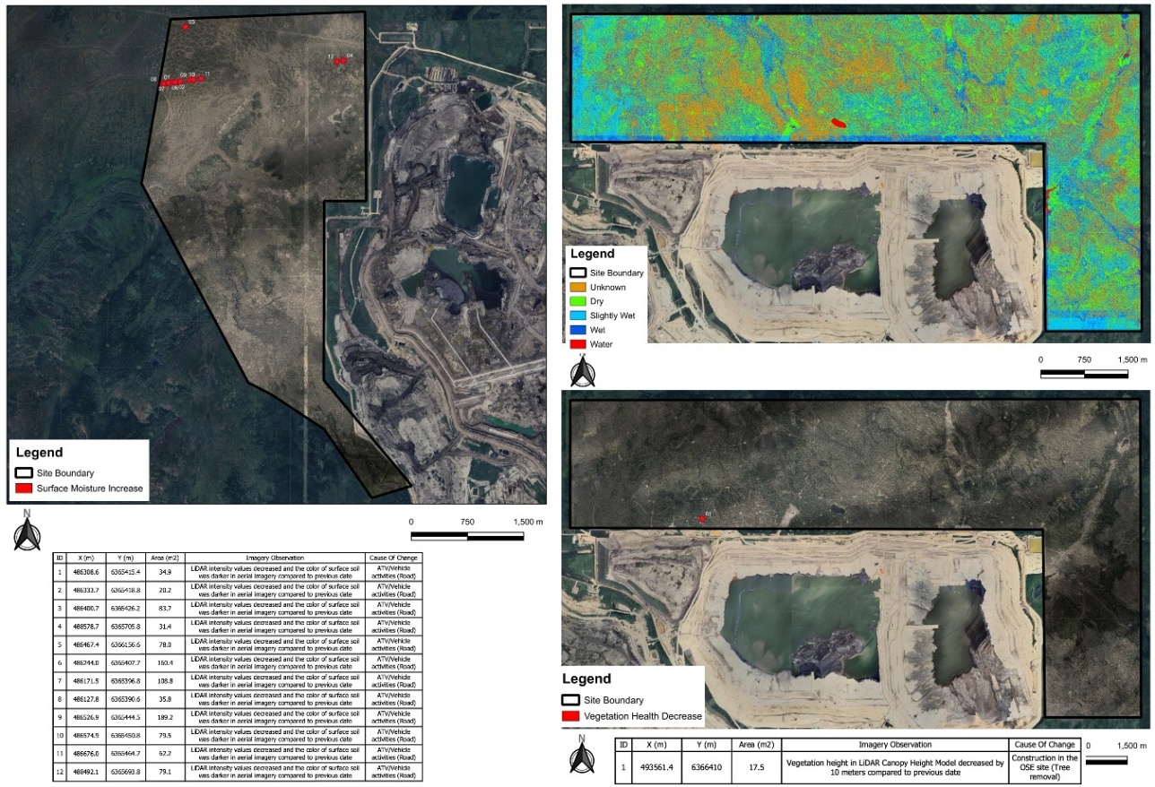
Challenges:
Monitoring environmental impacts (e.g., seepage) over large and dynamic industrial areas required frequent, high-resolution analysis while distinguishing anthropogenic changes from natural variations (e.g., rainfall, seasonal effects). Integrating aerial imagery, LiDAR, radar data, and limited in-situ measurements added further complexity.
Solutions:
Developed advanced remote sensing workflows using aerial imagery, LiDAR, and L-band radar data to generate biweekly maps of vegetation health, surface water, and soil moisture. Implemented change detection models and filtering techniques to isolate impacts caused by industrial activities and potential seepage.
Description of Services:
- Processing and analysis of very-high-resolution aerial imagery and LiDAR datasets
- Development of models for vegetation health, surface water, and soil moisture mapping
- Biweekly change detection and environmental monitoring workflows
- Integration of radar (ALOS-2 L-band) data for subsurface and under-canopy moisture analysis
- Identification and mapping of potential seepage-affected areas
- Delivery of GIS-ready datasets, change maps, and coordinate-based reporting of anomalies
- Validation using in-situ data and comparative analysis with satellite-derived outputs