

Immersive 3D Models
Explore lifelike 3D buildings, bridges, trees, and infrastructure generated from various remote sensing data with different Level of Details (LODs) based on your needs.
Accurate 2D Layers
View highly accurate 2D layers such as building footprints, parcel boundaries, power lines, sidewalks, and parks, derived from the most recent AI and HD mapping models.
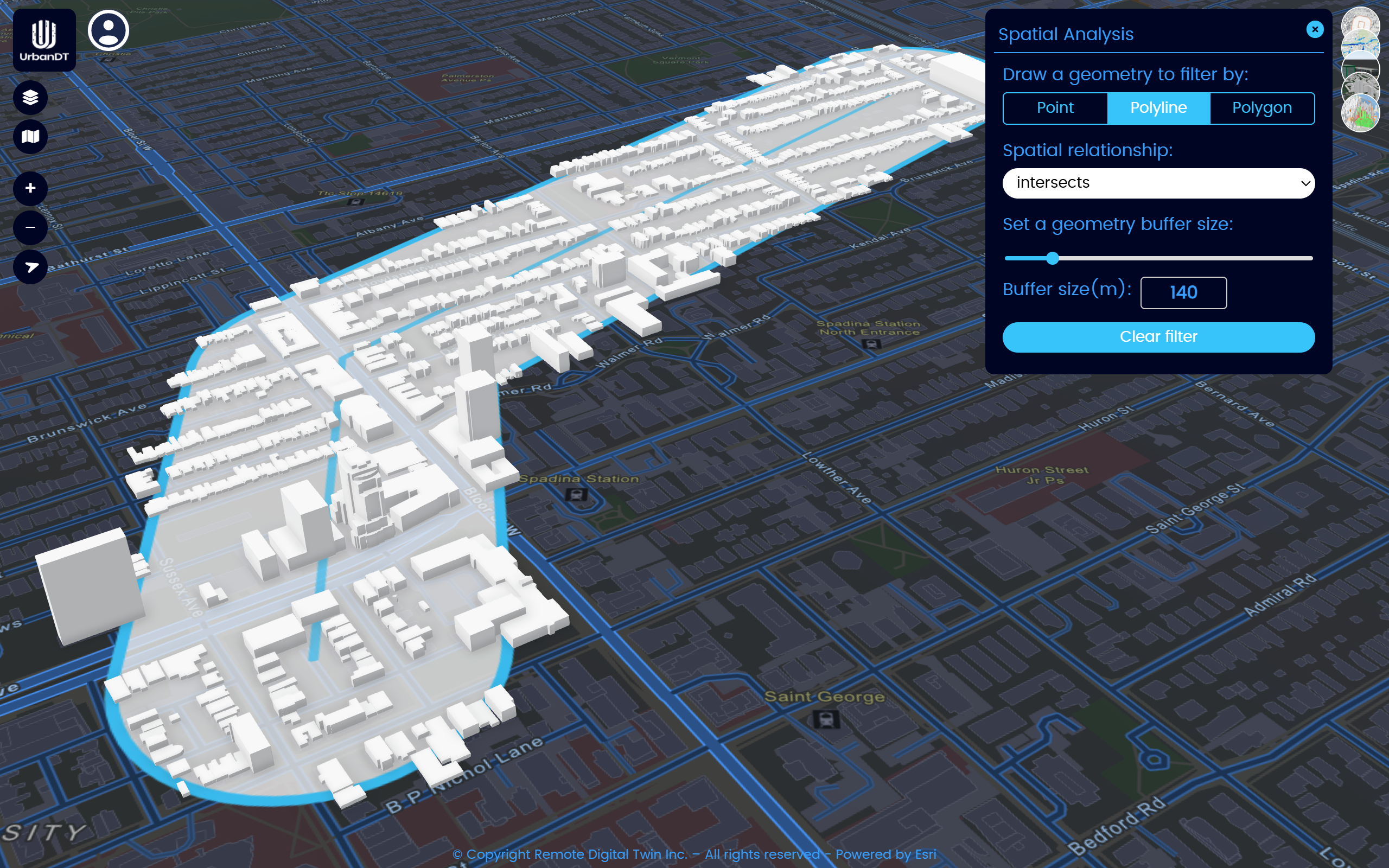
GIS & Geospatial Tools
Measure distances, run spatial analysis, compare map layers, style datasets, search and identify assets, and navigate with smooth camera controls and flight animations.
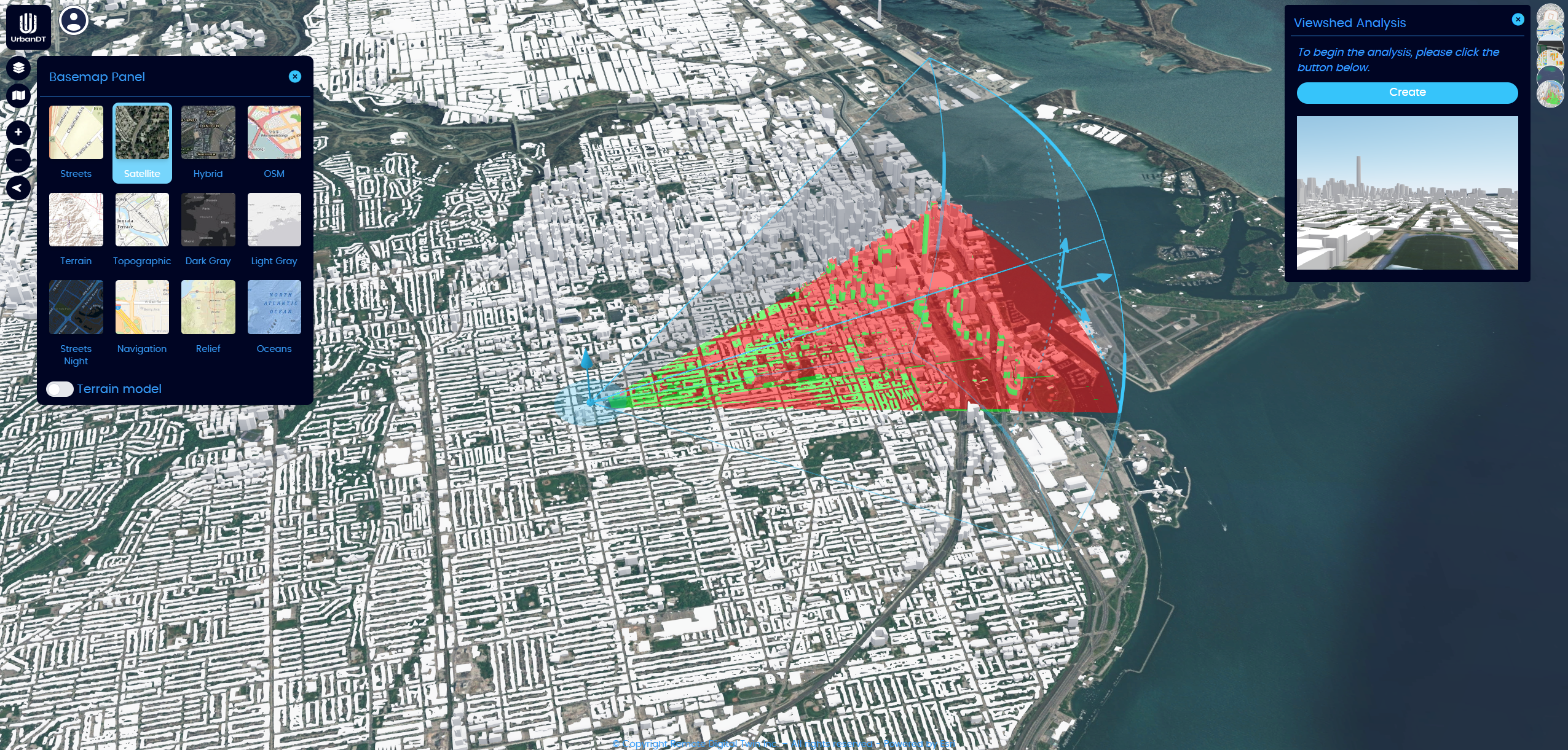
Advanced Visualization Features
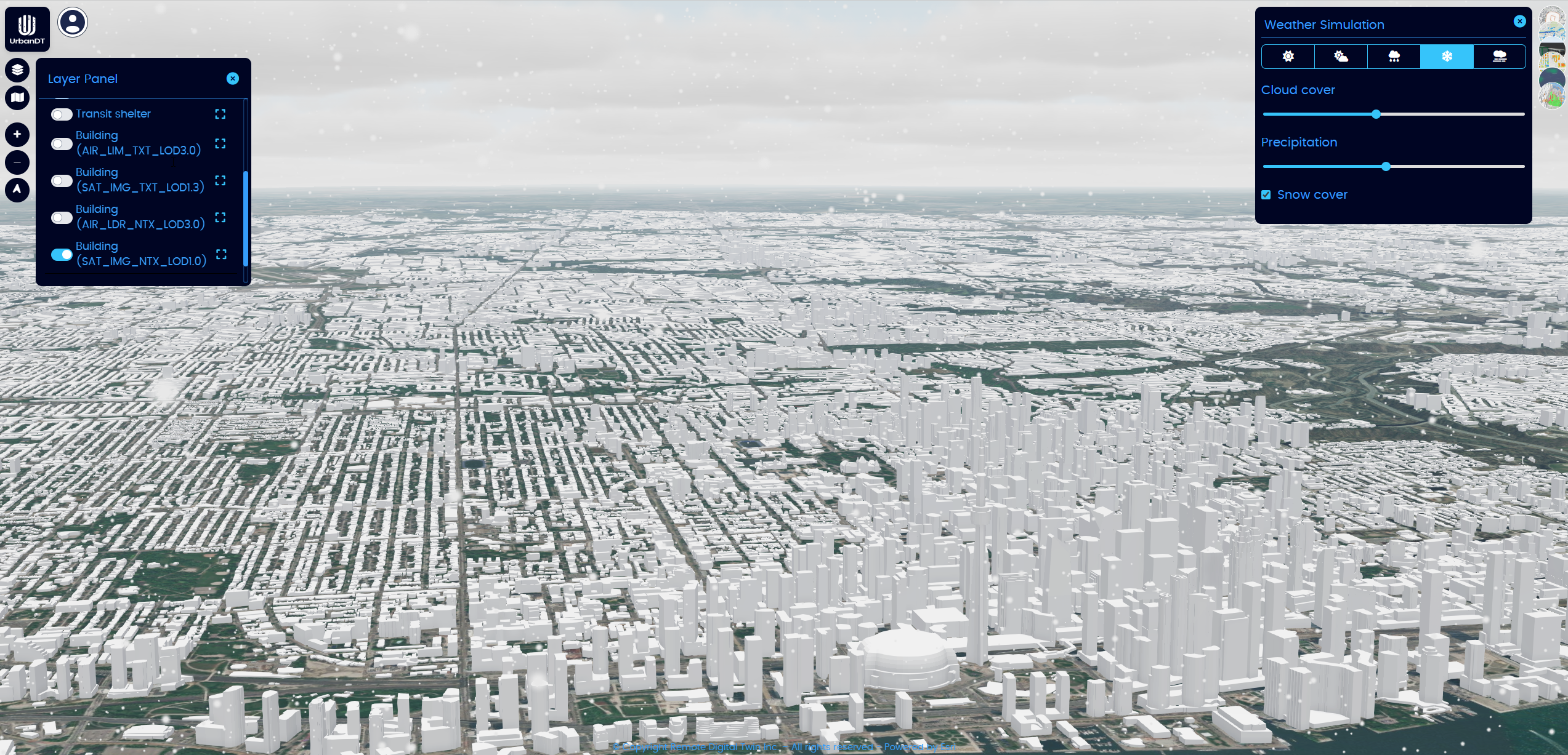
Interactive Simulations
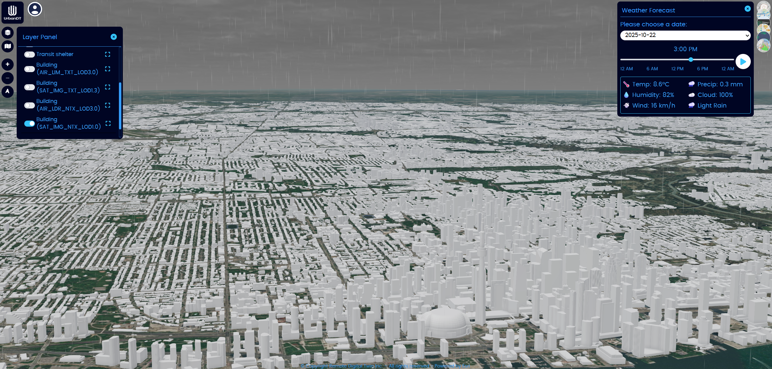
Forecasting & Analysis
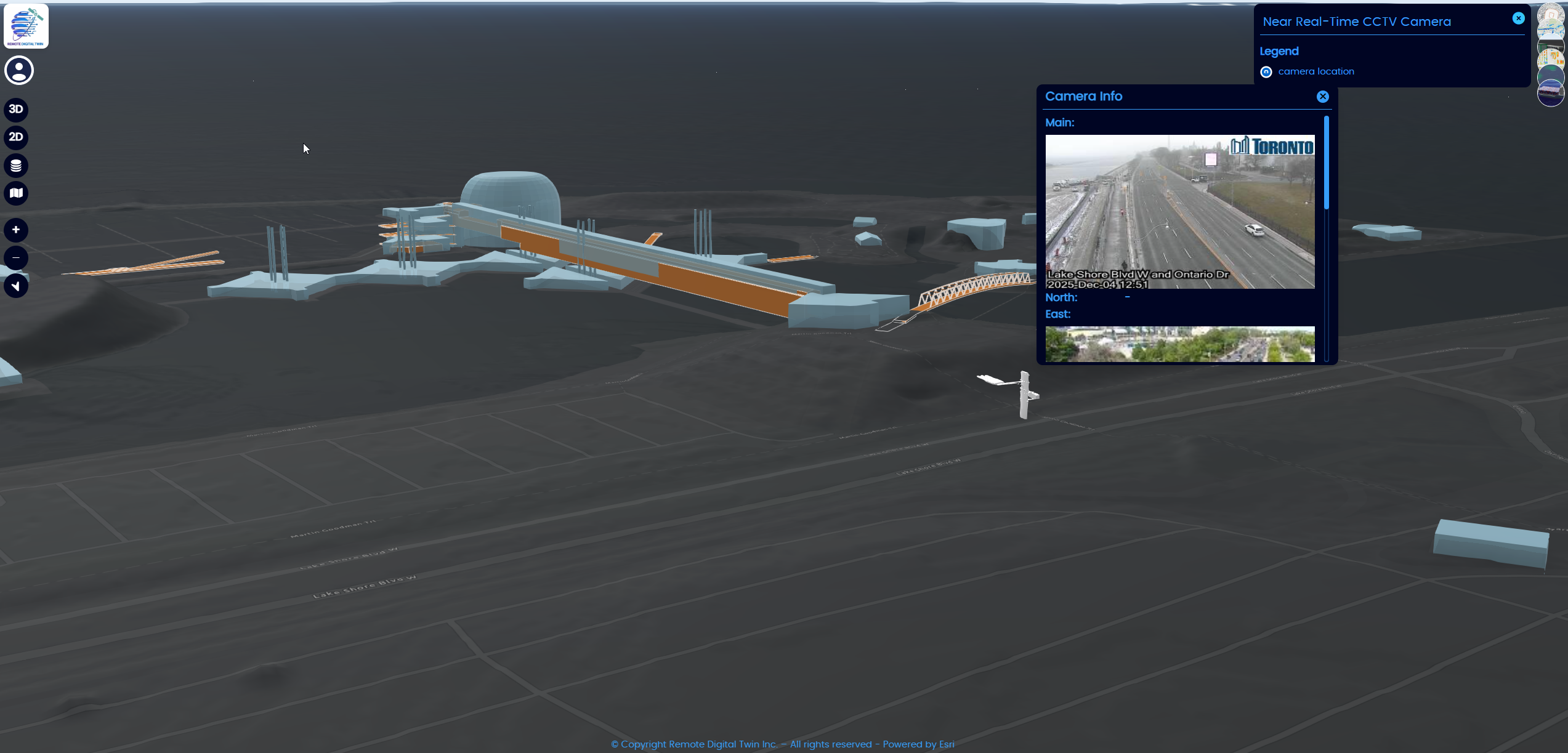
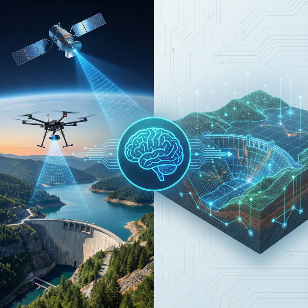
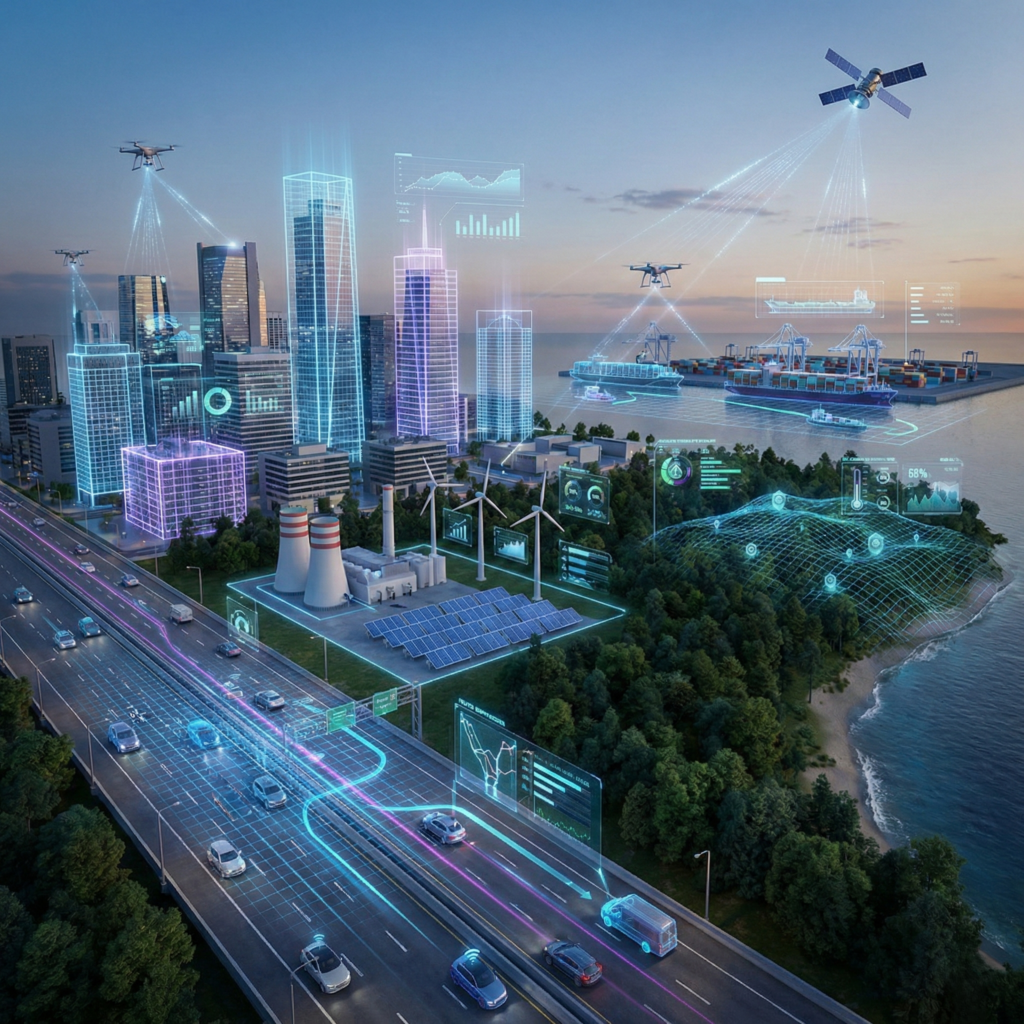
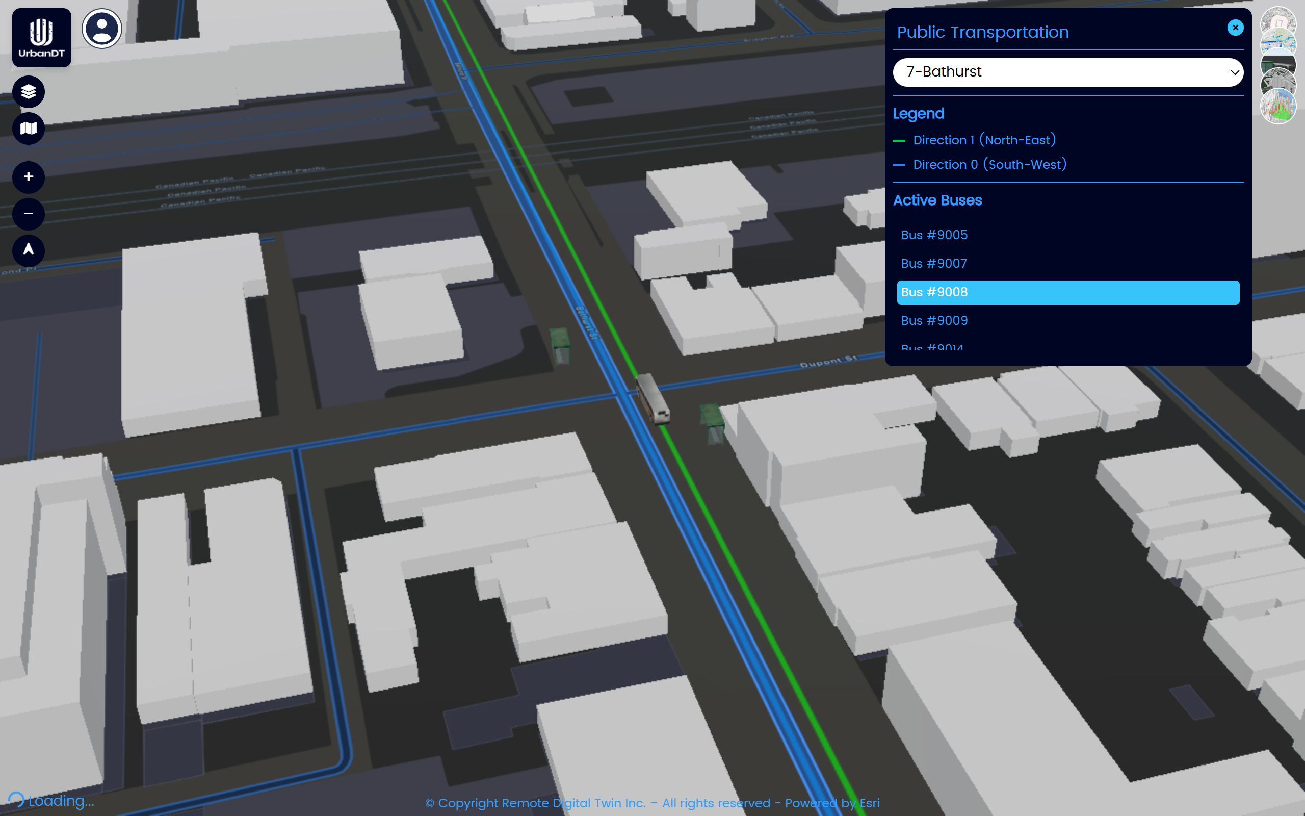
IoT Sensors
Connect to live feeds for wildfire alerts, traffic flow, public transport, CCTV, smart meters, and other urban sensors.
Near-Real-Time Data Injestation
Obatin NRT datasets from weather, air quality, noise pollution, and marine stations.


Fast turnaround times
The most accurate AI modelling

Customized outputs based on your needs

Support from a skilled and responsive team
Challenges:
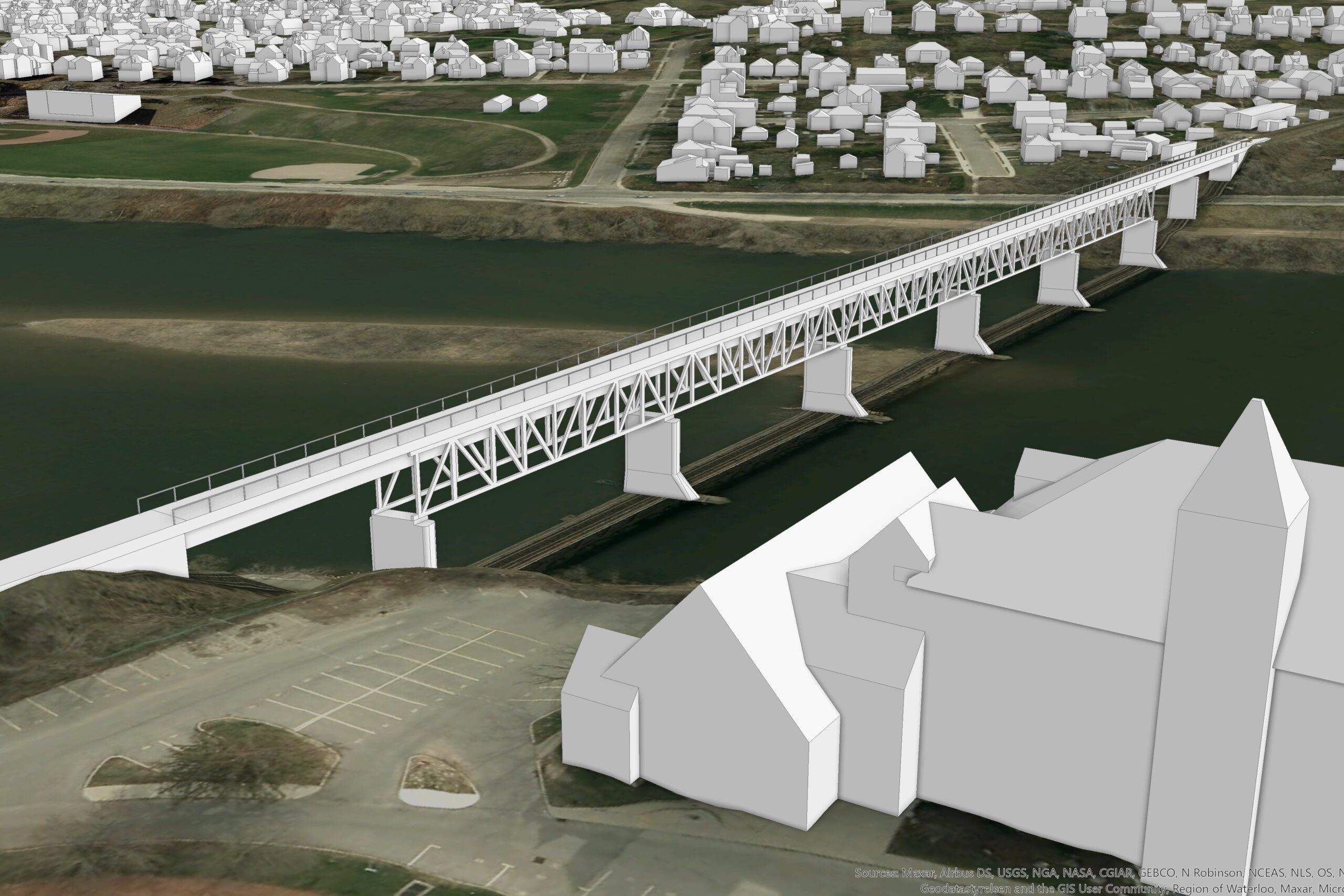
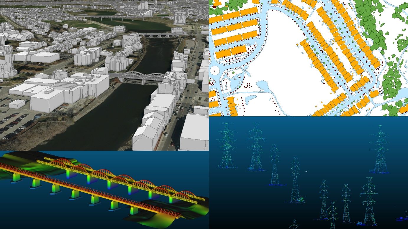
Developing a high-resolution, city-wide digital twin over a large area (≈175 km²), while ensuring accurate 3D reconstruction from LiDAR data, extracting detailed urban features, and delivering standardized, GIS-ready datasets compatible with municipal systems.
Solutions:
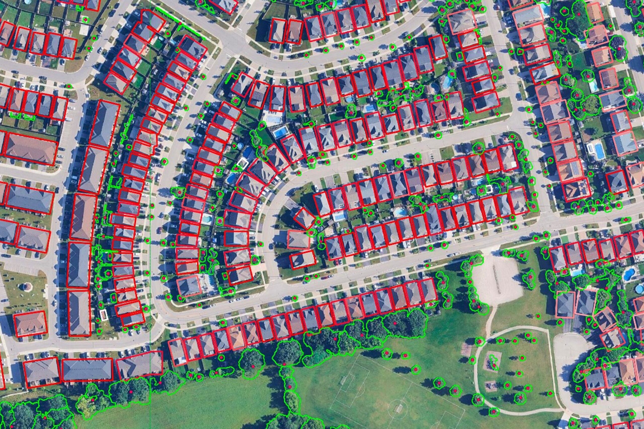
Delivered 2D and 3D (LOD 2.2) GIS layers of urban features, such as buildings, trees, and powerlines/poles using airborne LiDAR and imagery, combined with AI-driven processing and advanced 3D modeling techniques to support the City’s planning, analysis, and asset management.
Description of Services:
- Processing and quality assessment of LiDAR and orthophoto imagery
- Extraction and generation of LoD 2.2 3D building models with accurate roof geometries
- 3D modeling of bridges and key infrastructure elements
- Automated extraction of urban features including trees, permeable/non-permeable surfaces, and utility networks
- Generation of GIS-ready datasets (point, line, polygon, and 3D mesh formats)
- Integration of datasets into a digital twin framework for visualization and analysis
- Delivery of training sessions and user support for City staff
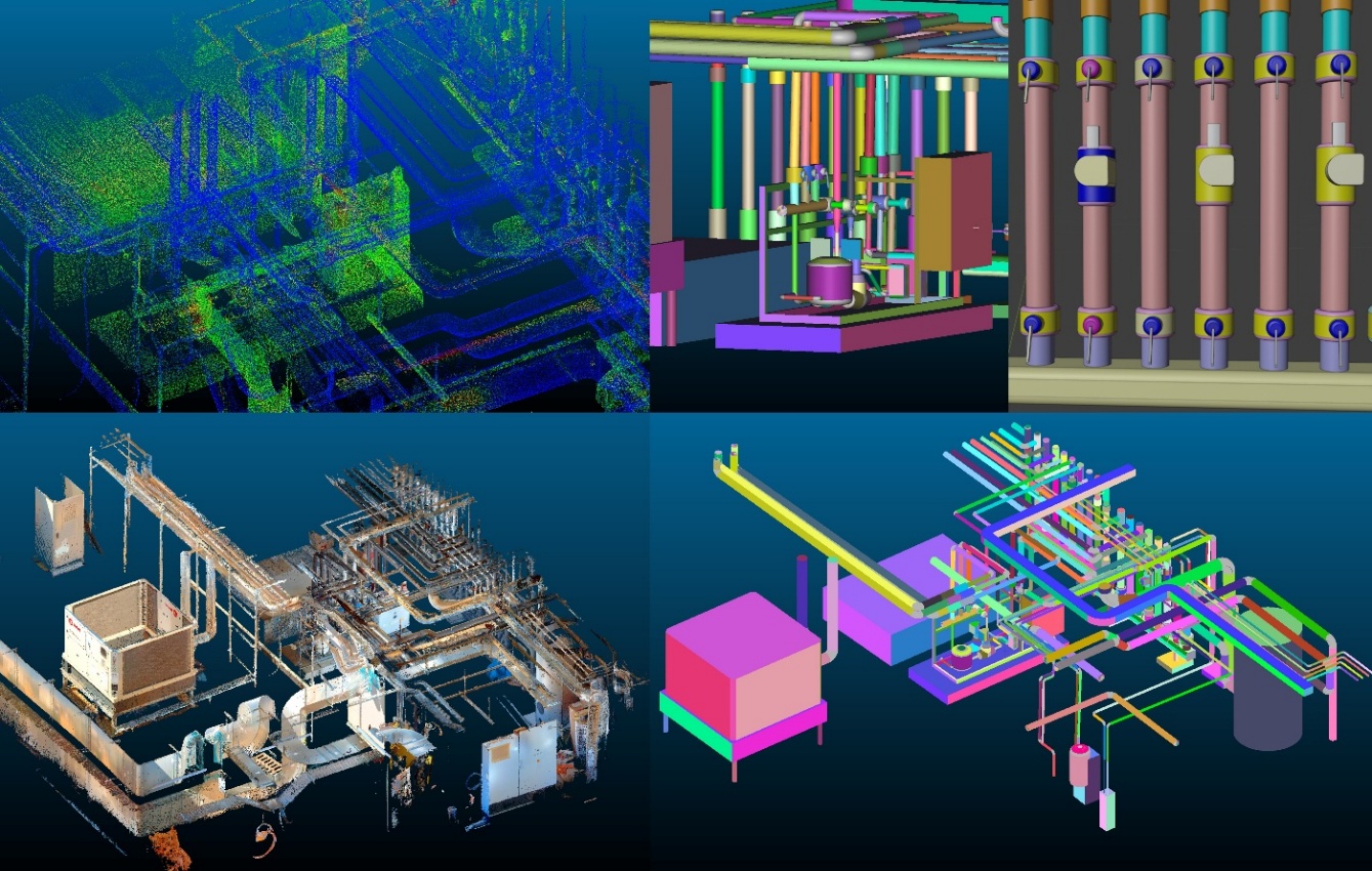
Challenges:
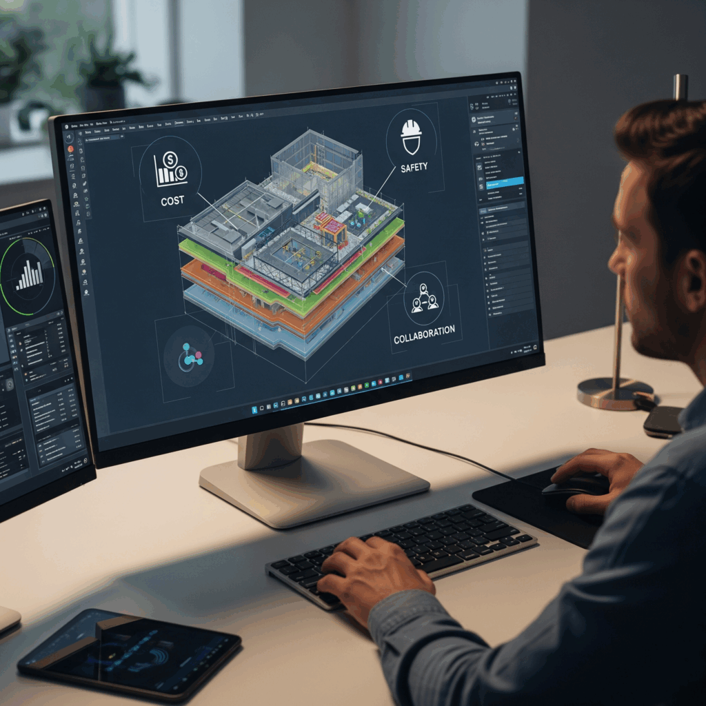
Transforming raw indoor point cloud data into structured, information-rich 3D models, while accurately identifying complex MEP systems, structural elements, and indoor objects, and ensuring outputs are tailored to different end-use applications such as BIM, digital twins, and analytics.
Solutions:
Developed a semi-automated, AI-driven workflow for intelligent 3D scene understanding, combining semantic segmentation, geometric primitive fitting, and expert refinement to generate high-accuracy, structured, and customizable indoor 3D models.
Description of Services:
- Acquisition and preprocessing of indoor point cloud datasets (noise removal and filtering)
- AI-based semantic classification of MEP systems, structural elements, and scene objects
- Object-based filtering and selection tailored to project objectives
- Semi-automatic 3D reconstruction using geometric primitive fitting
- Expert refinement and quality control to ensure engineering-grade accuracy
- Generation of BIM-ready, CAD-ready, and digital twin-compatible outputs
- Scalable workflow enabling efficient processing and faster project delivery