

Iceberg

Sea Ice Type

Sea Ice Concentration
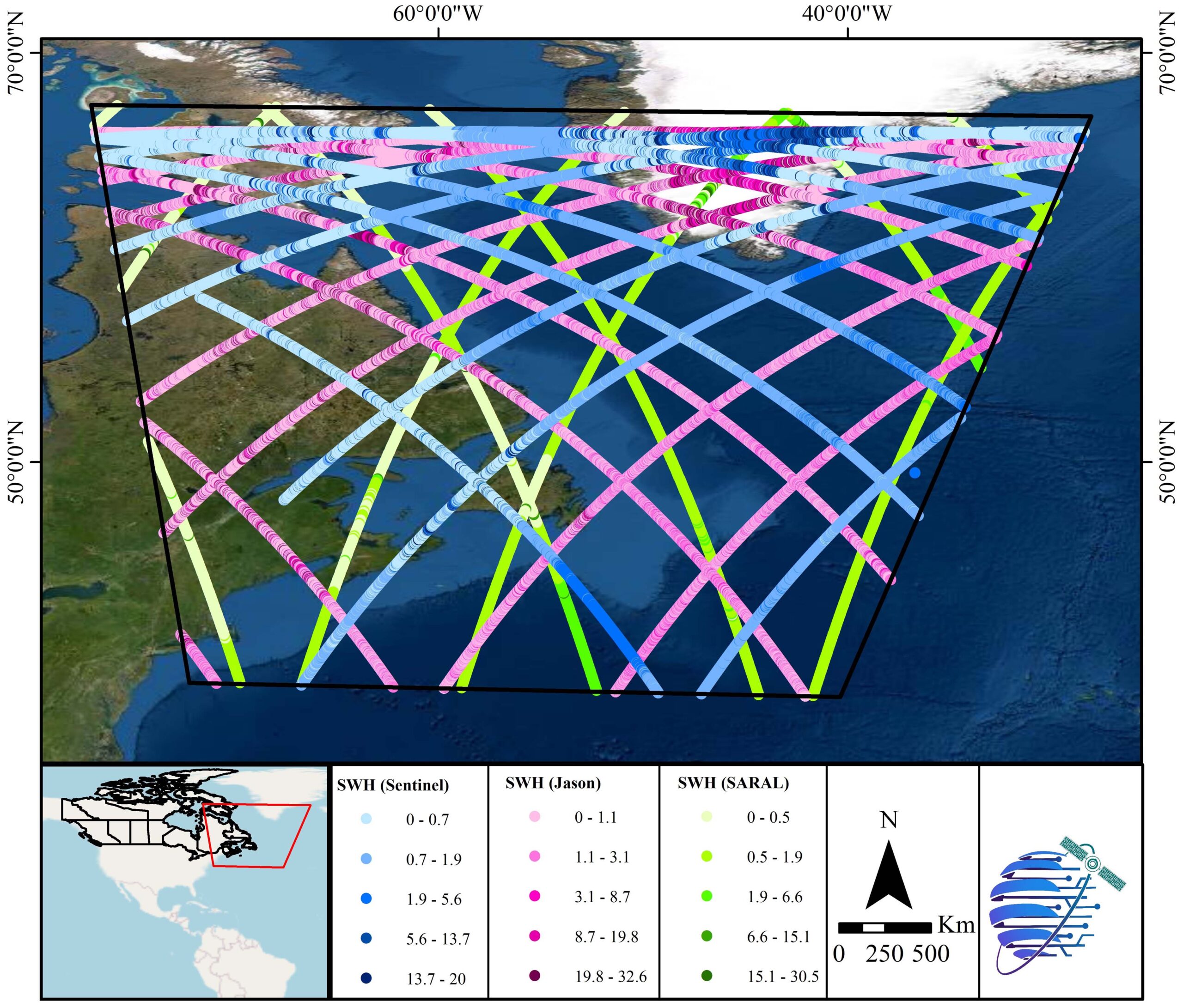
Ocean Wave

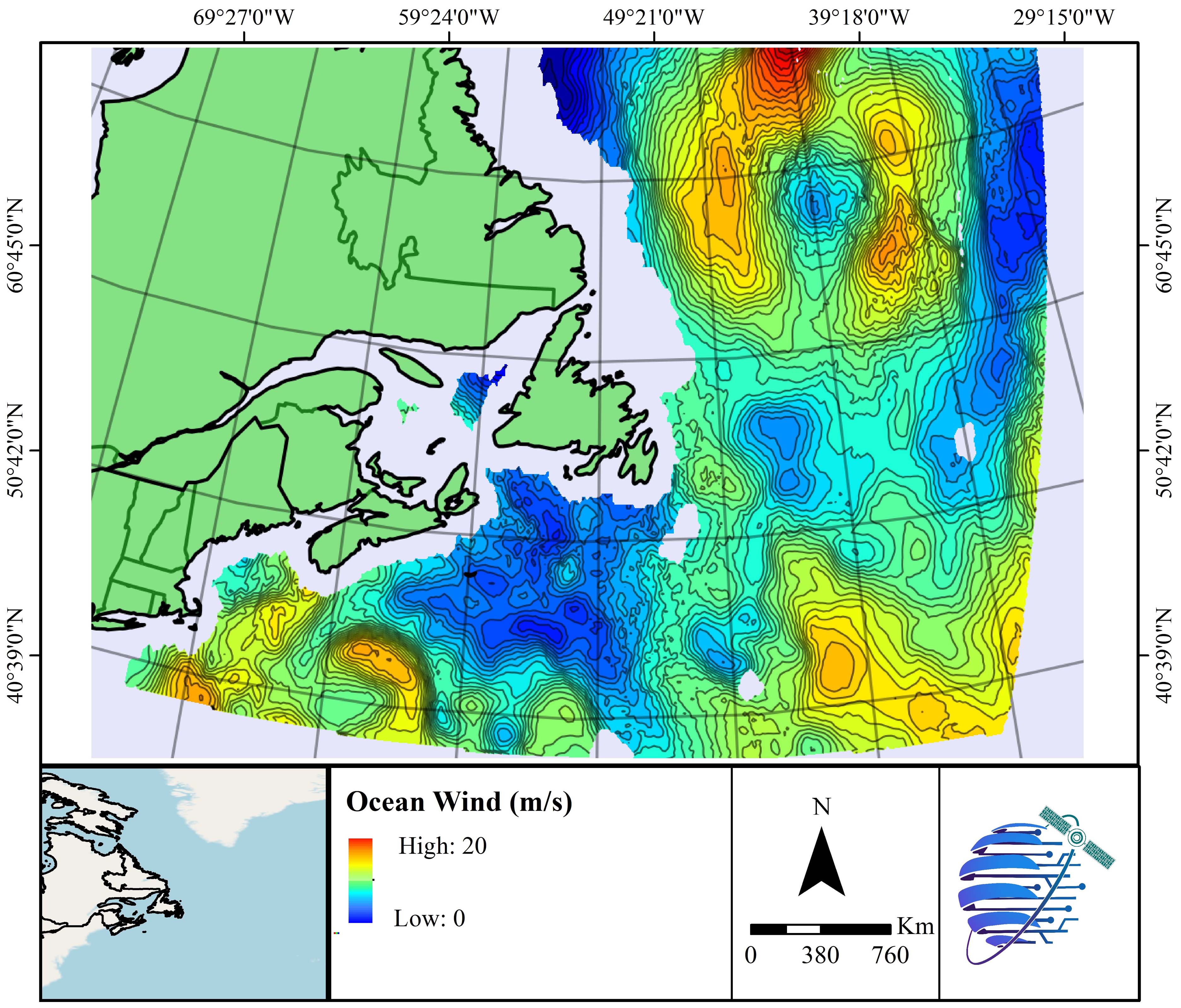
Ocean Wind

Oil Spill
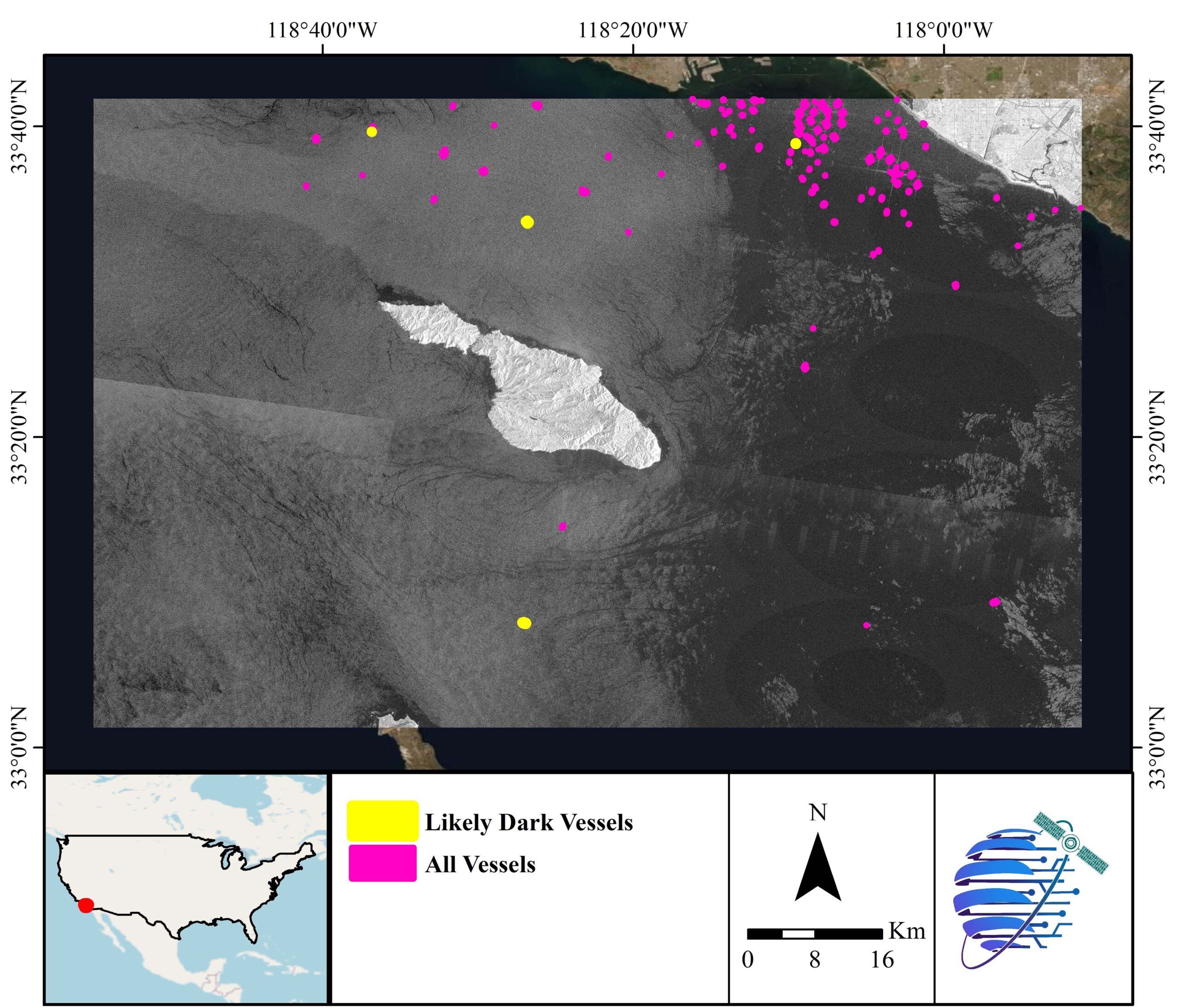
Dark Vessels
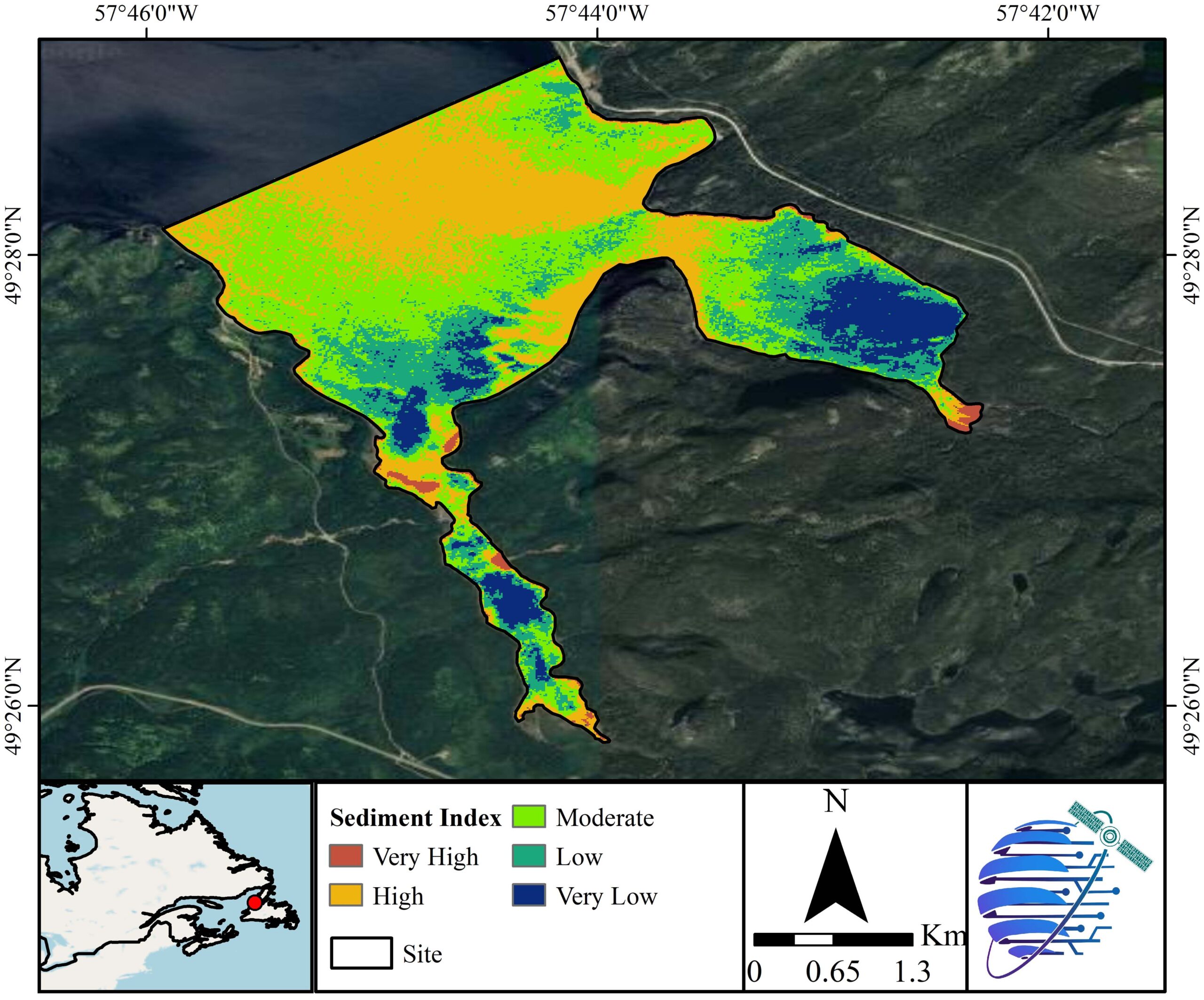
Sediment
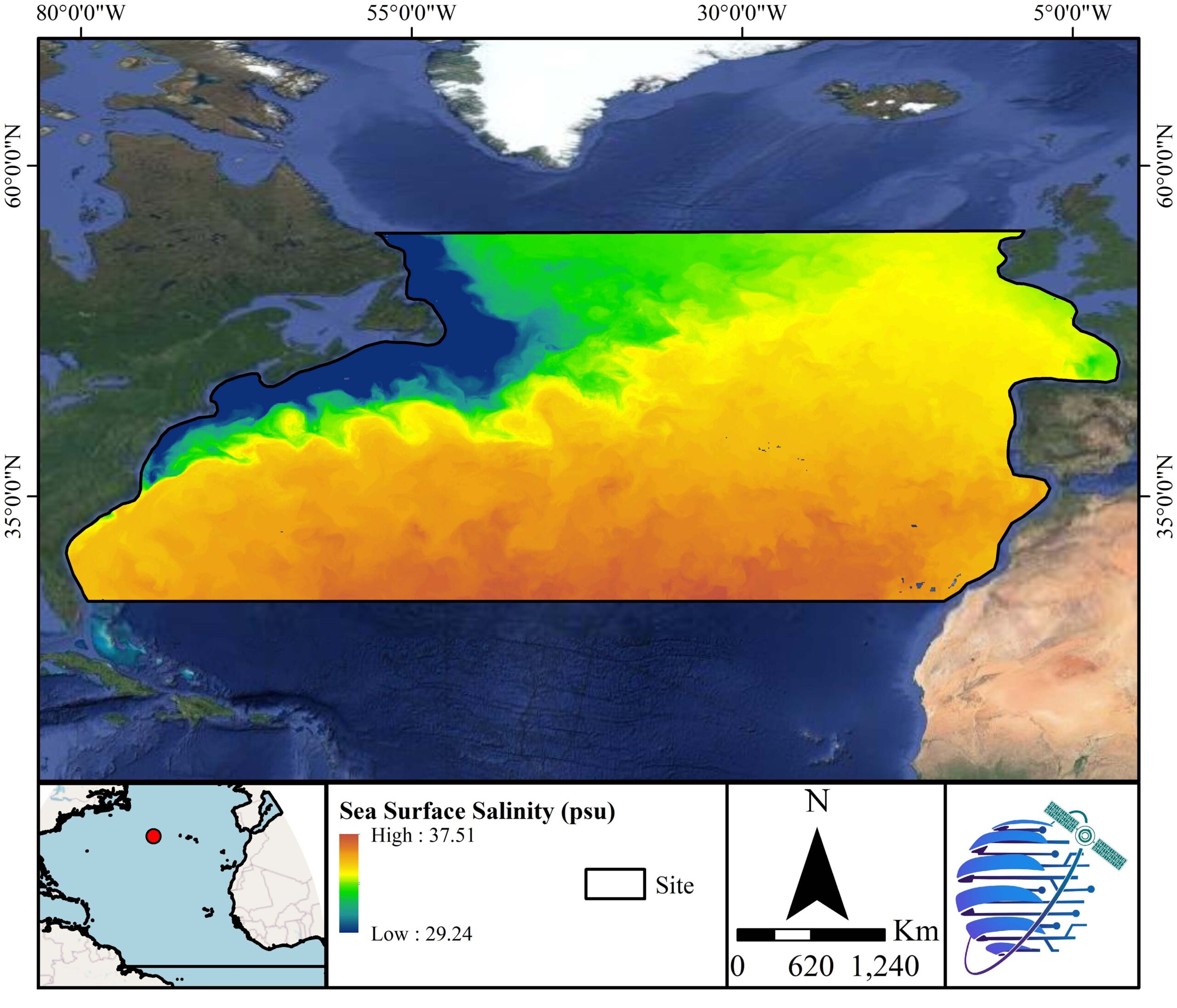
Sea Surface Salinity
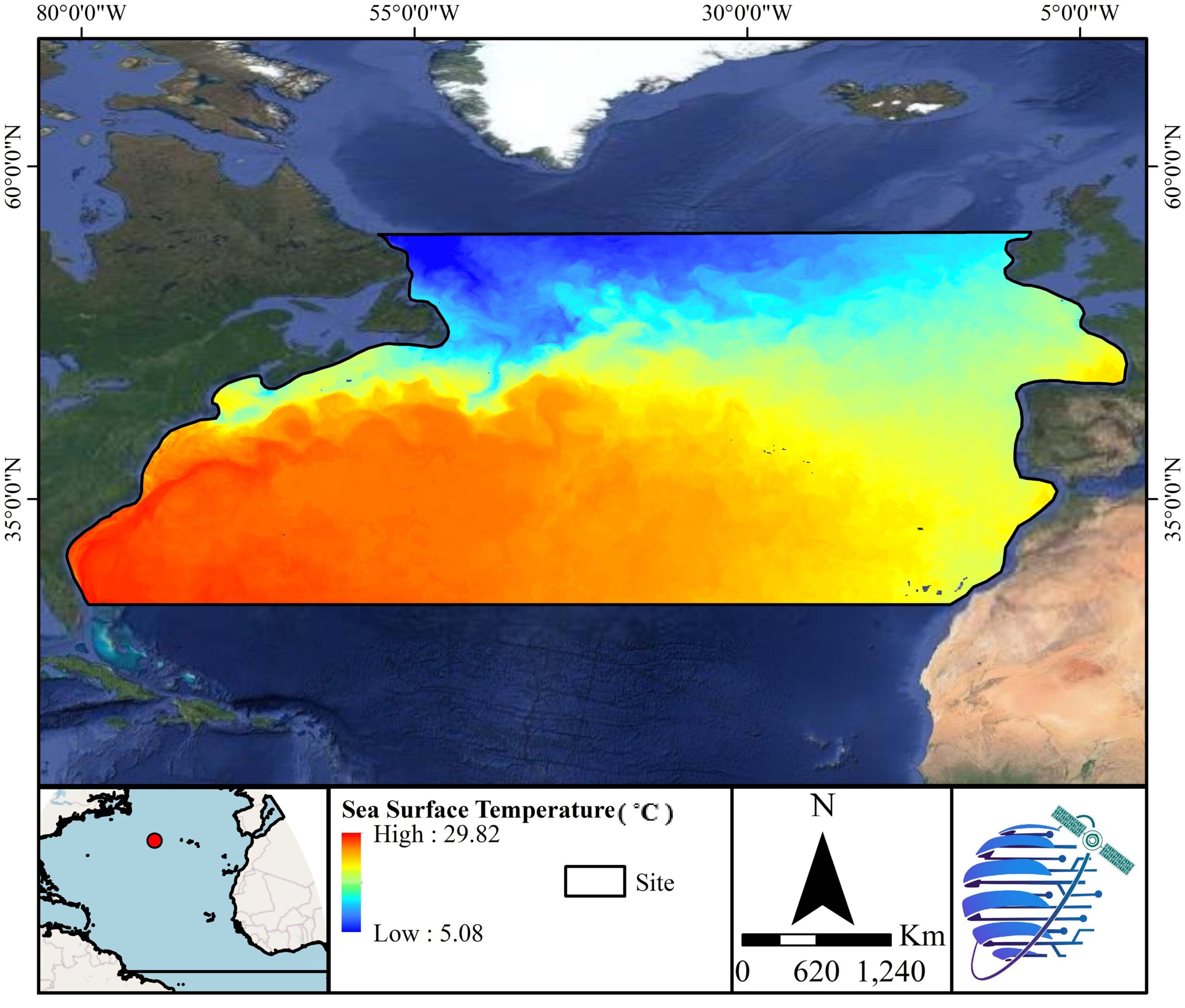
Sea Surface Temperature
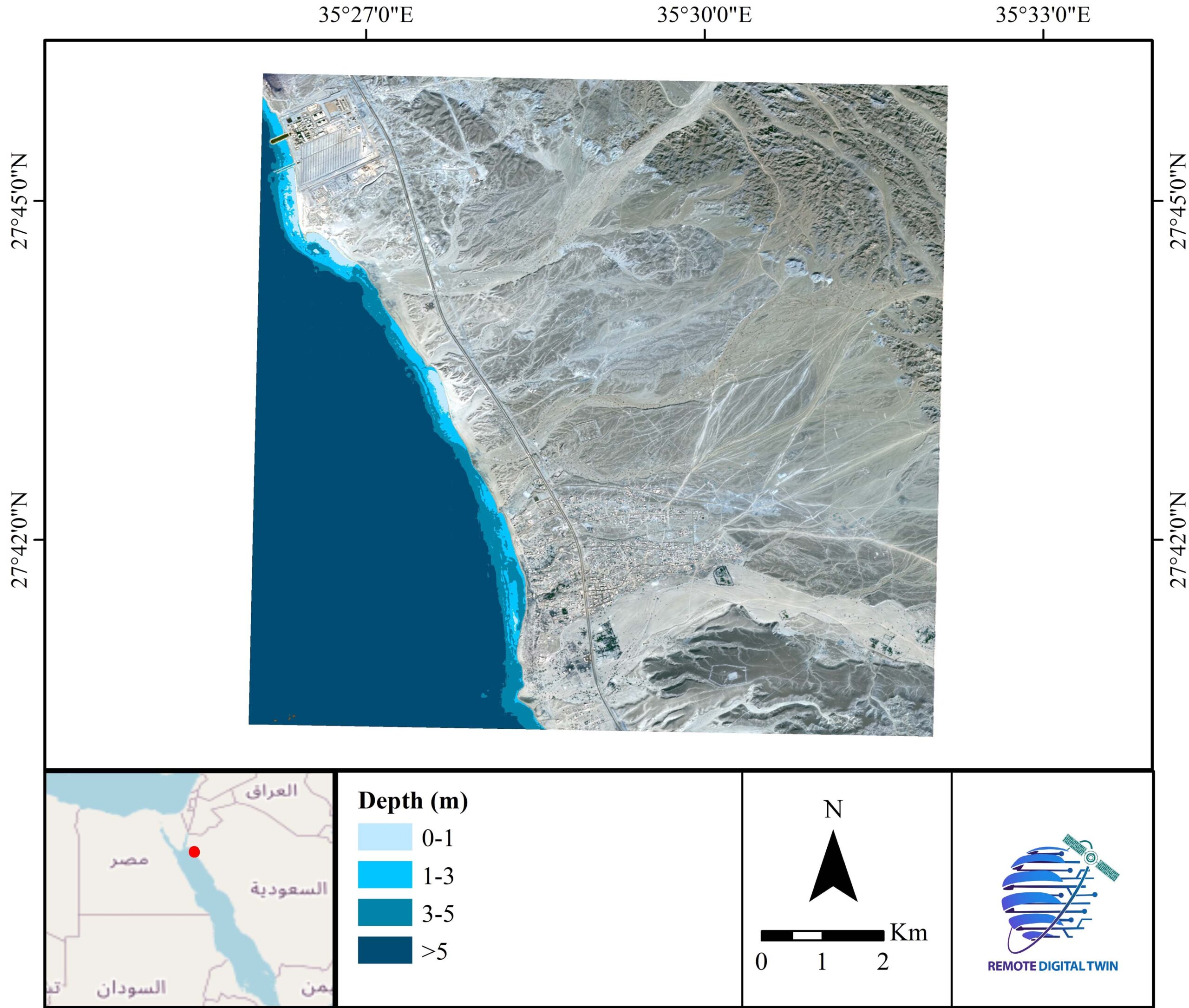
Bathymetry
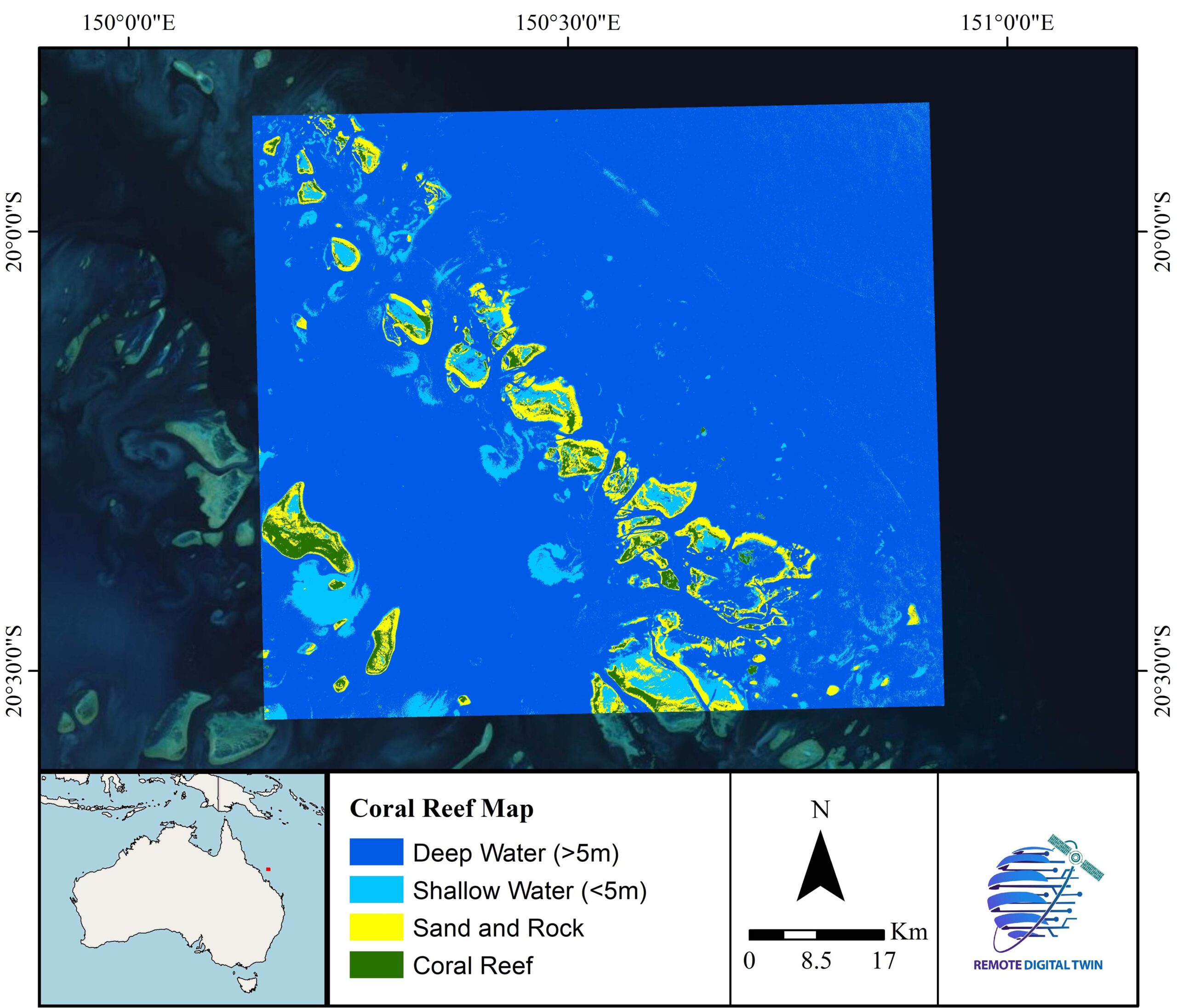
Coral Reefs
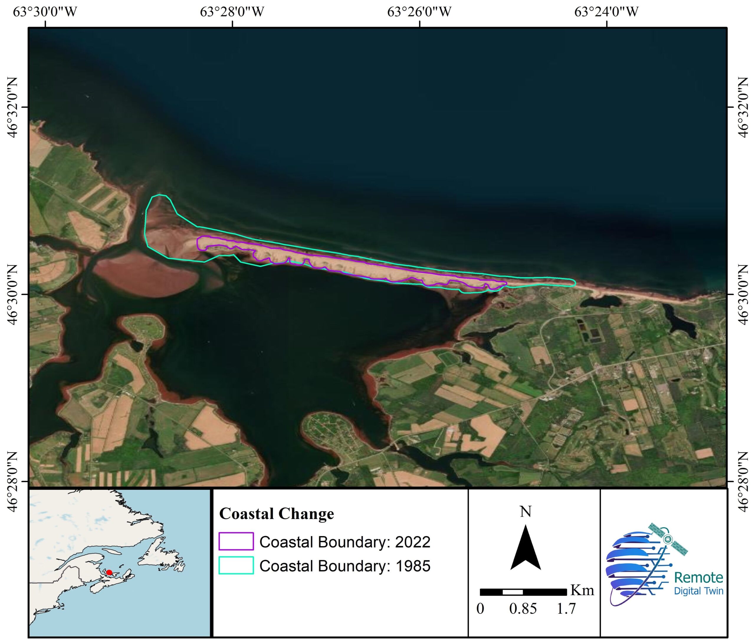
Coastal Erosion
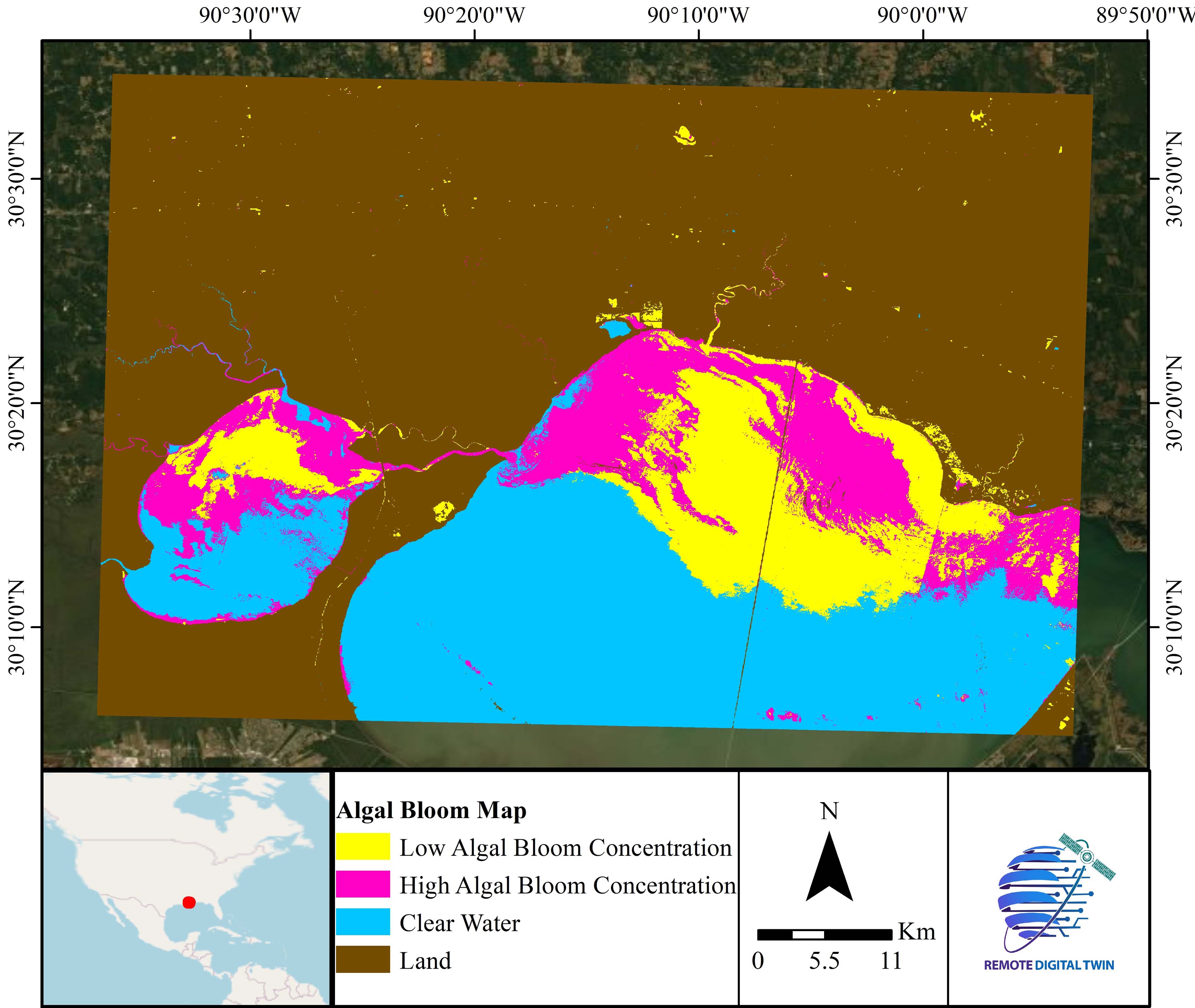
Algal Bloom
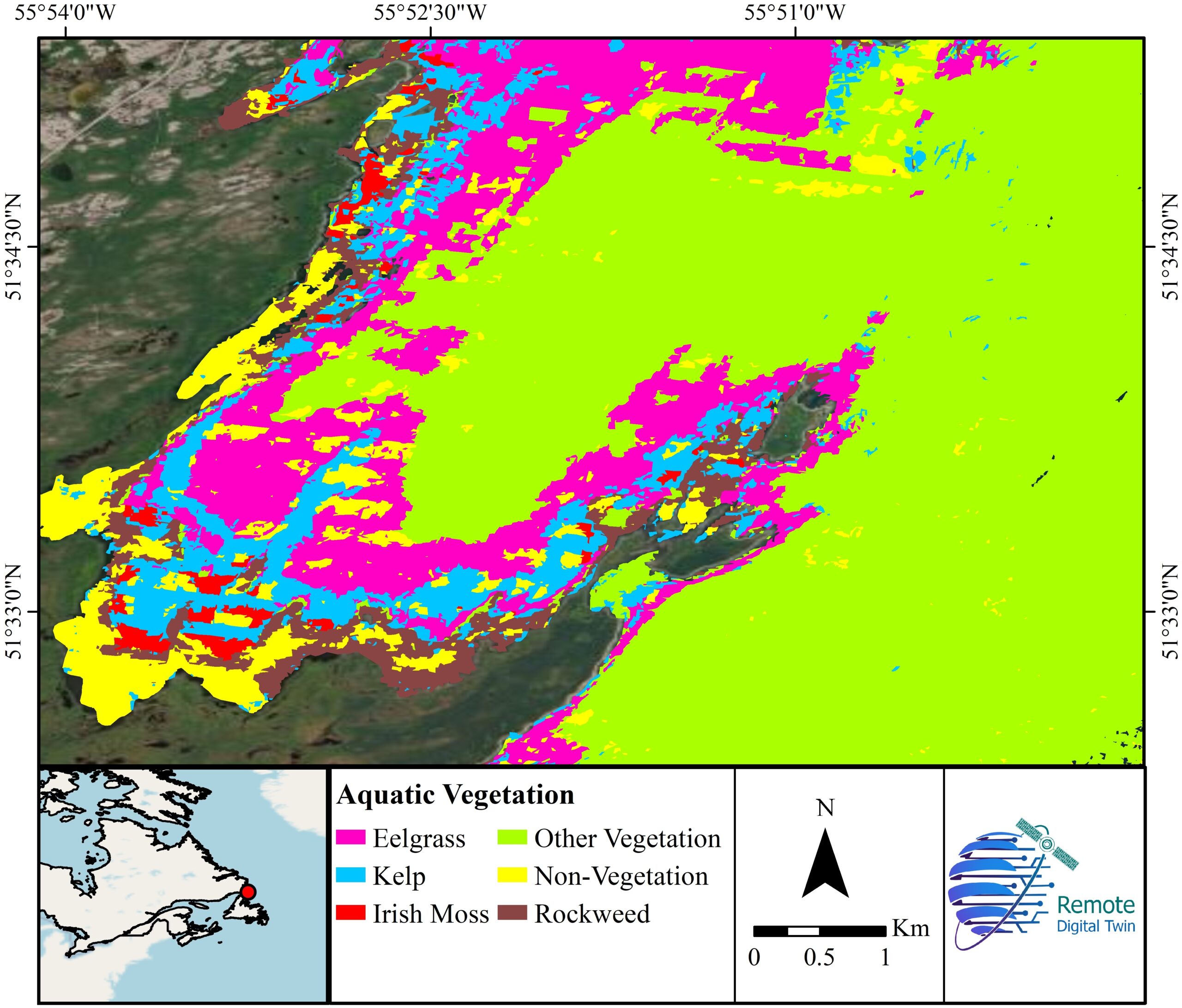
Aquatic Vegetation